- Jolly Grant Airport
-
Jolly Grant Airport.
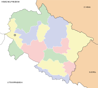
Dehradun Airport.IATA: DED – ICAO: VIDN Location of airport in Uttarakhand Summary Airport type Public Operator Airports Authority of India Location Dehradun Elevation AMSL 1,831 ft / 558 m Coordinates 30°11′23″N 078°10′49″E / 30.18972°N 78.18028°E Runways Direction Length Surface ft m 08/26 7,000 2,140 Concrete Jolly Grant Airport (IATA: DED, ICAO: VIDN), also known as Dehradun Airport, is an airport serving Dehradun, Uttarakhand, India.
Overview
The airport is located about 25 km (16 mi) southeast of the city of Dehradun. Nestled in the foothills of the Himalayas, the airport, after a runway extension to accommodate larger aircraft, resumed commercial operations on 30 March 2008. Located close to the holy city of Rishikesh, the gateway to the Himalayas, the airport allows tourists to fly in instead of travelling by rail or road. It is a 20 minutes drive to the town of Rishikesh and around 45 minutes to Haridwar.
Airlines and destinations
Airlines Destinations Air India Delhi Jet Airways Delhi Kingfisher Airlines Delhi External links
- Jolly Grant Airport (official Airports Authority of India web site)
- Airport information for VIDN at World Aero Data. Data current as of October 2006.
Categories:- Dehradun
- Airports in Uttarakhand
Wikimedia Foundation. 2010.


