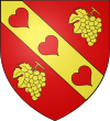
- Contrecœur, Quebec
-
Contrecœur, Quebec — City — 
SealMotto: À cœur vaillant tout est possible Location within Lajemmerais Regional County Municipality. Coordinates (5000, route Marie-Victorin [1]): 45°51′26″N 73°14′21″W / 45.85722°N 73.23917°W Country  Canada
Province  Quebec
Region Montérégie (16) RCM Lajemmerais Settled 1681 Established January 01, 1976 Incorporated May 03, 1997 Electoral Districts
Federal
Verchères—Les PatriotesProvincial Verchères Government[1][2][3] – Mayor Suzanne Dansereau – Federal MP(s) Luc Malo (BQ) – Quebec MNA(s) Stephane Bergeron (PQ) Area[4] – Land 61.19 km2 (23.6 sq mi) Population (2006)[4] – Total 5,678 – Density 92.8/km2 (240.4/sq mi) – Change (2001-06)  8.7%
8.7%– Dwellings 2,519 Time zone EST (UTC−5) – Summer (DST) EDT (UTC−4) Postal code(s) J0L Area code(s) 450 Access Routes[5]
 A-30
A-30
 Route 132
 Route 137
Website www.ville.contrecoeur.qc.ca Contrecœur is a city in southwestern Quebec, Canada on the south shore of the St. Lawrence River. The population as of the Canada 2006 Census was 5,678. Contrecœur is approximately 45 kilometres (28 mi) northeast of Montreal and is accessible via Autoroute 30, the main road from the southwest, which continues on to Sorel-Tracy.
Contents
History
 Plaque honouring pioneers of the town of Contrecœur.
In 1672, Antoine Pécaudy de Contrecœur, a soldier of the Carignan-Salières Regiment, was granted a seigneury by King Louis XIV. He and 68 other pioneers founded the town in 1681, and it his named in his honor. A migratory bird sanctuary is located near the town on Contrecœur Island.
Demographics
Population
Population trend[6]
Census Population Change (%) 2006 5,678  8.7%
8.7%2001 5,222  2.0%
2.0%1996 5,331  3.1%
3.1%1991 5,501 N/A Language
Mother tongue language (2006)[4]
Language Population Pct (%) French only 5,415 97.04% English only 35 0.63% Both English and French 40 0.72% Other languages 90 1.61% See also
References
- ^ a b Ministère des Affaires Municipales et Régions: Contrecœur
- ^ Parliament of Canada Federal Riding History: VERCHÈRES—LES PATRIOTES (Quebec)
- ^ Chief Electoral Officer of Quebec - 40th General Election Riding Results: VERCHÈRES
- ^ a b c 2006 Statistics Canada Community Profile: Contrecœur, Quebec
- ^ Official Transport Quebec Road Map
- ^ Statistics Canada: 1996, 2001, 2006 census
External links

Saint Lawrence River / Lavaltrie Saint Lawrence River / Lanoraie Sorel-Tracy 
Saint Lawrence River / Saint-Sulpice 
Saint-Roch-de-Richelieu  Contrecœur

Verchères Calixa Lavallée Saint-Antoine-sur-Richelieu  Administrative divisions of Montérégie (Region 16)
Regional county municipalities
and equivalent territoriesBrome-Missisquoi · La Haute-Yamaska · Acton · Pierre-De Saurel · Les Maskoutains · Rouville · Le Haut-Richelieu · La Vallée-du-Richelieu · Longueuil · Marguerite-d'Youville · Roussillon · Les Jardins-de-Napierville · Le Haut-Saint-Laurent · Beauharnois-Salaberry · Vaudreuil-Soulanges
Municipalities Cowansville · Granby · Sorel-Tracy · Saint-Hyacinthe · Saint-Jean-sur-Richelieu · Chambly · Saint-Basile-le-Grand · Mont-Saint-Hilaire · Belœil · Brossard · Saint-Lambert · Boucherville · Saint-Bruno-de-Montarville · Longueuil · Sainte-Julie · Varennes · La Prairie · Candiac · Sainte-Catherine · Saint-Constant · Mercier · Châteauguay · Beauharnois · Salaberry-de-Valleyfield · Pincourt · Vaudreuil-Dorion · Saint-Lazare
Categories:- Cities and towns in Quebec
- Incorporated places in Montérégie
- Populated places on the Saint Lawrence River
- Greater Montreal
Wikimedia Foundation. 2010.

