- Mount Phillips (New Mexico)
-
Mount Phillips 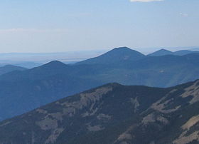
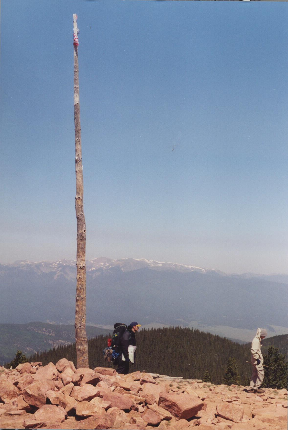
Mount Phillips (tallest mountain, at center) seen from Baldy MountainElevation 11,741 ft (3,579 m) Prominence 2,921 ft (890 m) [1] Location Location Colfax County, New Mexico, USA Range Cimarron Range, Sangre de Cristo Mountains Coordinates 36°28′41″N 105°09′35″W / 36.47806°N 105.15972°W[2] Topo map USGS Garcia Peak (NM) Mount Phillips, formerly called Clear Creek Mountain was renamed in 1960 in honor of the then living Waite Phillips, who donated the area to the Boy Scouts of America. It is located in Colfax County about 11 mi (17 km) south of Baldy Mountain in the Cimarron Range, a subrange of the Sangre de Cristo Mountains of New Mexico. It is the second highest peak in Boy Scouts of America's Philmont Scout Ranch in the central country on the western perimeter. It is an easy hike from Comanche Peak, but it is a much steeper ascent from Clear Creek to its 11,741 ft summit[2]. There are four close trial camps in the area of the summit, but none have water. These are Mount Phillips, Comanche Peak, Thunder Ridge and Red Hills Camps, which are all dry. The staff camp of Clear Creek is the closest camp with water.
The mountain is mostly made up of the metamorphic rock, pink gneiss[3], which is quite evident as small boulders on the trail. The the true summit is marked with a flagpole toward the northside. A few crosses have sprung up in this area, having great meaning to the groups that have erected them. It is scarce of trees and gives great views to the north, east and west. This is not true for the south, due to the gentle incline of the terrain in this direction. From the southern false summit, a good view of Angel Fire Ski Area is quite visible.
-
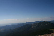
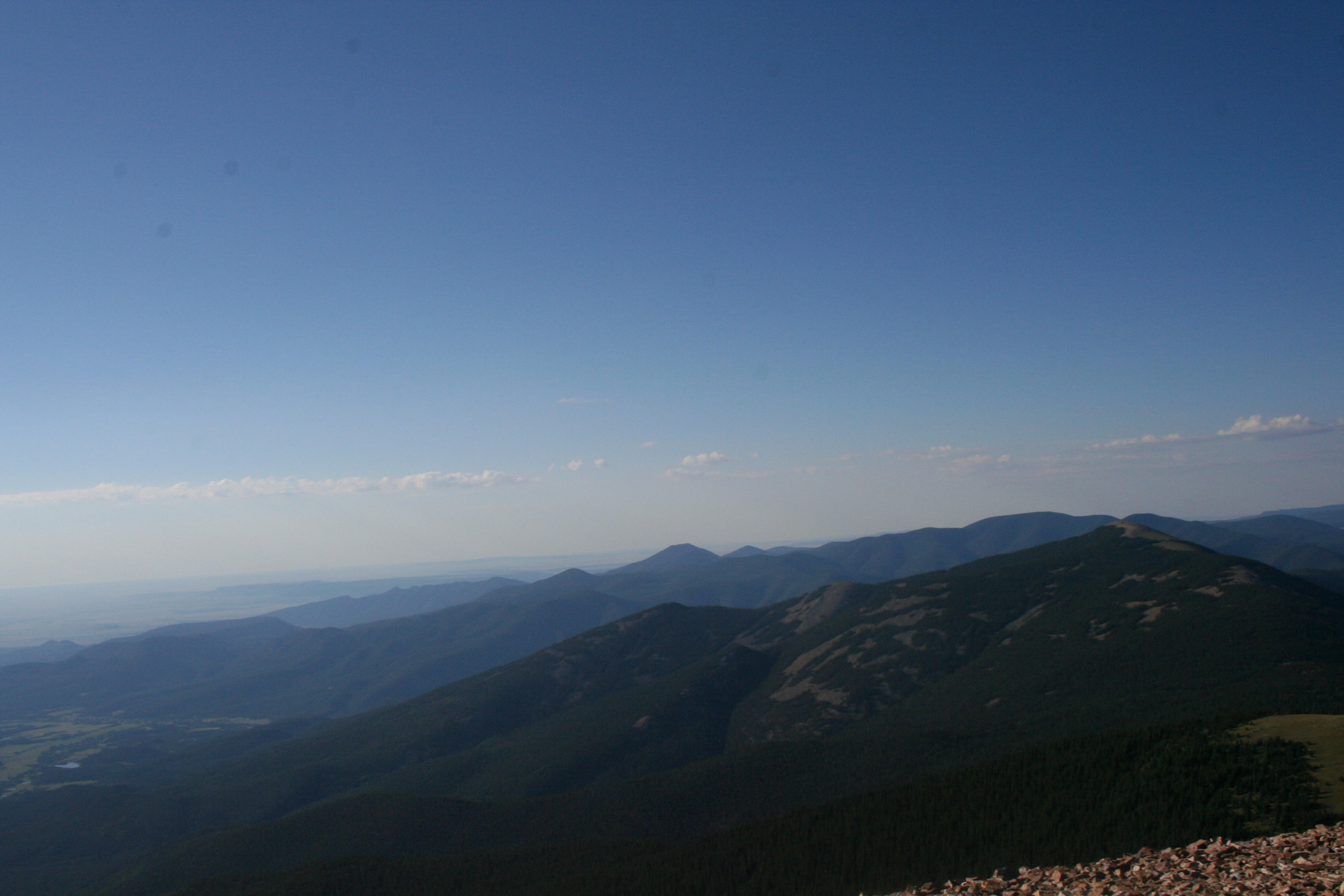
Mount Phillips in the distance (center with flattop) looking south from the summit of Baldy Mountain past Touch-Me-Not Mountain
-
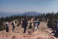
Mount Phillips Summit Trail looking north toward Touch-Me-Not and Baldy Mountains
-
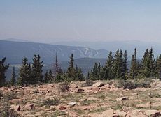
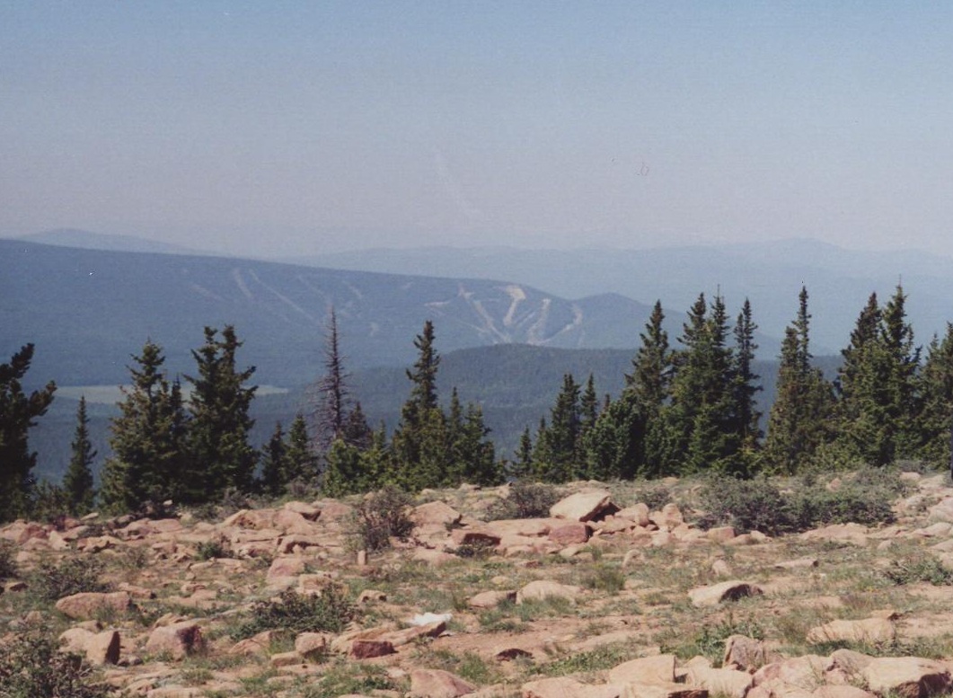
Mount Phillips view south from the southern false summit to Angel Fire Ski Area
-
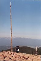
Mount Phillips summit flagpole
See also
- 4000 meter peaks of the United States
- Cimarron Range
- Culebra Range
- List of U.S. states by elevation
- Mountain peaks of North America
- Mountain peaks of the Rocky Mountains
- Mountain peaks of the United States
- Sangre de Cristo Mountains
- Southern Rocky Mountains
References
- ^ New Mexico High-prominence peaks at listsofjohn.com
- ^ a b Mount Phillips on TopoQuest
- ^ Mary Stuever and Daniel Shaw, Philmont Fieldguide, Boy Scouts of America, 1995
 State of New Mexico
Topics Delegations · Geography · Government · History · Landmarks · Military · Natural history · New Mexicans · Settlements · Transportation · Tribes · Visitor attractions
Society Culture · Demographics · Economy · Education · Politics
Regions Cities Alamogordo · Albuquerque · Artesia · Carlsbad · Clovis · Corrales · Deming · Española · Farmington · Gallup · Grants · Hobbs · Las Cruces · Las Vegas · Los Alamos · Los Lunas · Lovington · Portales · Raton · Rio Rancho · Roswell · Ruidoso · Santa Fe · Silver City · Socorro · Sunland Park · Taos · Tucumcari
Counties Bernalillo · Catron · Chaves · Cibola · Colfax · Curry · De Baca · Doña Ana · Eddy · Grant · Guadalupe · Harding · Hidalgo · Lea · Lincoln · Los Alamos · Luna · McKinley · Mora · Otero · Quay · Rio Arriba · Roosevelt · Sandoval · San Juan · San Miguel · Santa Fe · Sierra · Socorro · Taos · Torrance · Union · Valencia
Categories:- Landforms of Colfax County, New Mexico
- Mountains of New Mexico
- Philmont Scout Ranch
- New Mexico geography stubs
-


Wikimedia Foundation. 2010.