- National Register of Historic Places listings in Racine County, Wisconsin
-
Buildings, sites, structures, districts, and objects in Racine County listed on the National Register of Historic Places
-
- This National Park Service list is complete through NPS recent listings posted November 10, 2011.[1]
Current listings
[2] Landmark name Image Date listed Location City or town Summary 1 Badger Building December 3, 1980 610 Main St.
42°43′36″N 87°46′58″W / 42.726667°N 87.782778°WRacine 2 Elam Beardsley Farmhouse March 1, 1982 5601 Northwest Hwy.
42°47′28″N 88°15′45″W / 42.791111°N 88.2625°WWaterford 3 Burlington Downtown Historic District June 2, 2000 Roughly bounded by E. Jefferson, N. Pine, E. Washington, E. Chestnut, N. Dodge, Commerce, Mill, and W. Chestnut Sts.
42°40′49″N 88°16′37″W / 42.680278°N 88.276944°WBurlington 4 John Collins House November 20, 1974 6409 Nicholson Rd.
42°48′20″N 87°53′40″W / 42.805556°N 87.894444°WCaledonia 5 Eli R. Cooley House April 11, 1973 1135 S. Main St.
42°43′09″N 87°46′55″W / 42.719167°N 87.781944°WRacine 6 Thomas Driver and Sons Manufacturing Company July 14, 2004 134 S. Main St., 214 State St.
42°43′55″N 87°47′03″W / 42.731944°N 87.784167°WRacine 7 First Presbyterian Church March 20, 1973 716 College Ave.
42°43′32″N 87°47′07″W / 42.725556°N 87.785278°WRacine 8 Chauncey Hall Building October 10, 1980 338-340 Main St.
42°43′46″N 87°47′00″W / 42.729444°N 87.783333°WRacine Designed by E. Townsend Mix 9 Chauncey Hall House January 2, 1976 1235 S. Main St.
42°43′04″N 87°46′55″W / 42.717778°N 87.781944°WRacine 10 Hansen House June 6, 1979 1221 N. Main St.
42°44′10″N 87°47′04″W / 42.736111°N 87.784444°WRacine 11 Thomas P. Hardy House December 3, 1974 1319 S. Main St.
42°42′59″N 87°46′55″W / 42.716389°N 87.781944°WRacine 12 Franklyn Hazelo House December 30, 1974 34108 Oak Knoll Rd.
42°44′01″N 88°17′23″W / 42.733611°N 88.289722°WBurlington 13 Historic Sixth Street Business District 
March 24, 1988 Roughly bounded by Water St. and Fifth St., Main Seventh St., and Grand Ave.
42°43′36″N 87°47′07″W / 42.726667°N 87.785278°WRacine 14 Herbert F. Johnson House 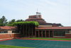
January 8, 1975 33 E. Four Mile Rd.
42°46′49″N 87°46′16″W / 42.780278°N 87.771111°WWind Point 15 Peter Johnson House January 6, 1986 1601 State St.
42°43′54″N 87°48′00″W / 42.731667°N 87.8°WRacine 16 S. C. Johnson and Son Administration Building and Research Tower 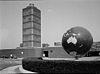
December 27, 1974 1525 Howe St.
42°42′49″N 87°47′27″W / 42.713611°N 87.790833°WRacine 17 Karel Jonas House March 1, 1982 1337 N. Erie St.
42°44′17″N 87°47′13″W / 42.738056°N 87.786944°WRacine 18 Kaiser's November 25, 1980 218 6th St.
42°43′37″N 87°47′01″W / 42.726944°N 87.783611°WRacine 19 KATE KELLY (Shipwreck) November 21, 2007 L. Michigan, 2 mi. E of Wind Pt.
42°46′48″N 87°43′31″W / 42.78°N 87.725278°WWind Point 20 Mitchell Lewis Building April 20, 2005 815 Eighth St.
42°43′26″N 87°47′25″W / 42.723889°N 87.790278°WRacine 21 Lincoln School August 19, 1994 1800 State St.
42°44′06″N 87°48′14″W / 42.735°N 87.803889°WRacine 22 McClurg Building 
July 13, 1977 245 Main St.
42°43′51″N 87°47′00″W / 42.730833°N 87.783333°WRacine 23 Melvin Avenue Residential Historic District November 2, 2011 Merlin Ave. generally bounded by Erie & N. Main Sts.
42°45′20″N 87°47′07″W / 42.755556°N 87.785278°WRacine 24 Memorial Hall April 10, 1980 72 7th St.
42°43′33″N 87°46′51″W / 42.725833°N 87.780833°WRacine 25 George Murray House June 6, 1979 2219 Washington Ave.
42°42′49″N 87°48′22″W / 42.713611°N 87.806111°WRacine 26 No. 4 Engine House June 27, 1979 1339 Lincoln St.
42°44′16″N 87°47′20″W / 42.737778°N 87.788889°WRacine 27 Northside Historic District of Cream Brick Workers' Cottages March 16, 1994 Roughly bounded by Goold, Erie, English, Main, Yout and Chatham Sts. and Lakeview Community Center
42°44′46″N 87°47′08″W / 42.746111°N 87.785556°WRacine 28 Norwegian Buildings at Heg Park July 17, 1980 NE of Waterford on Heg Park Rd.
42°48′16″N 88°10′22″W / 42.804444°N 88.172778°WWaterford 29 Old Main Street Historic District 
August 11, 1987 Roughly bounded by Second St., Lake Ave., Fifth St., and Wisconsin Ave.
42°43′46″N 87°47′00″W / 42.729444°N 87.783333°WRacine 30 Racine College 
December 12, 1976 600 21st St.
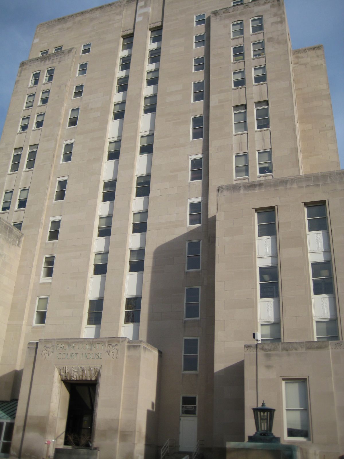
42°42′22″N 87°47′10″W / 42.706111°N 87.786111°WRacine 31 Racine County Courthouse 
July 28, 1980 730 Wisconsin Ave.
42°43′30″N 87°47′03″W / 42.725°N 87.784167°WRacine 32 Racine Depot October 10, 1980 1402 Liberty St.
42°43′50″N 87°47′52″W / 42.730556°N 87.797778°WRacine 33 Racine Elks Club, Lodge No. 252 September 7, 1984 601 Lake Ave.
42°43′37″N 87°46′52″W / 42.726944°N 87.781111°WRacine 34 Racine Harbor Lighthouse and Life Saving Station September 9, 1975 Racine Harbor North Pier
42°44′03″N 87°46′43″W / 42.734167°N 87.778611°WRacine 35 Racine Public Library 
March 20, 1981 701 S. Main St.
42°43′33″N 87°46′56″W / 42.725833°N 87.782222°WRacine 36 Racine Rubber Company Homes Historic District September 27, 2006 Roughly bounded by Victory Ave., Republic Ave., Cleveland Ave. and West Boulevard
42°42′44″N 87°49′10″W / 42.712222°N 87.819444°WRacine 37 Rickeman Grocery Building 
March 1, 1982 415 6th St.
42°43′35″N 87°47′08″W / 42.726389°N 87.785556°WRacine 38 Shoop Building 
April 26, 1978 215 State St.
42°43′53″N 87°47′04″W / 42.731389°N 87.784444°WRacine 39 Southern Wisconsin Home Historic District September 27, 1991 21425 Spring St.
42°41′36″N 88°04′52″W / 42.693333°N 88.081111°WDover 40 Southside Historic District October 18, 1977 Roughly bounded by Lake Michigan, DeKoven Ave., Villa and Eighth Sts.
42°42′51″N 87°46′57″W / 42.714167°N 87.7825°WRacine 41 St. Luke's Episcopal Church, Chapel, Guildhall, and Rectory 
July 27, 1979 614 S. Main St.
42°43′35″N 87°46′59″W / 42.726389°N 87.783056°WRacine 42 St. Patrick's Roman Catholic Church July 5, 1979 1100 Erie St.
42°44′04″N 87°47′15″W / 42.734444°N 87.7875°WRacine 43 United Laymen Bible Student Tabernacle December 8, 1983 924 Center St.
42°43′19″N 87°47′23″W / 42.721944°N 87.789722°WRacine 44 Uptown Theater March 1, 1982 1426-1430 Washington Ave.
42°42′57″N 87°47′54″W / 42.715833°N 87.798333°WRacine 45 US Post Office-Racine Main 
May 8, 1985 603 Main St.
42°43′37″N 87°46′56″W / 42.726944°N 87.782222°WRacine 46 Whitman-Belden House January 17, 1980 108 N. State St.
42°44′31″N 88°13′37″W / 42.741944°N 88.226944°WRochester 47 Wilmanor Apartments June 24, 1994 1419-1429 W. Sixth St. and 253-255 N. Memorial Dr.
42°43′32″N 87°47′55″W / 42.725556°N 87.798611°WRacine 48 Windpoint Light Station 
July 19, 1984 Windridge Dr. at Lake Michigan
42°46′51″N 87°45′30″W / 42.780833°N 87.758333°WRacine 49 Yorkville #4 School August 4, 2011 17640 Old Yorkville Rd.
42°44′31″N 88°01′37″W / 42.741944°N 88.026944°WYorkville 50 Young Men's Christian Association Building 
March 1, 1982 314-320 6th St.
42°43′36″N 87°47′05″W / 42.726667°N 87.784722°WRacine See also
- List of National Historic Landmarks in Wisconsin
- National Register of Historic Places listings in Wisconsin
References
- ^ "National Register of Historic Places: Weekly List Actions". National Park Service, United States Department of the Interior. Retrieved on November 10, 2011.
- ^ Numbers represent an ordering by significant words. Various colorings, defined here, differentiate National Historic Landmark sites and National Register of Historic Places Districts from other NRHP buildings, structures, sites or objects.
U.S. National Register of Historic Places Topics Lists by states Alabama • Alaska • Arizona • Arkansas • California • Colorado • Connecticut • Delaware • Florida • Georgia • Hawaii • Idaho • Illinois • Indiana • Iowa • Kansas • Kentucky • Louisiana • Maine • Maryland • Massachusetts • Michigan • Minnesota • Mississippi • Missouri • Montana • Nebraska • Nevada • New Hampshire • New Jersey • New Mexico • New York • North Carolina • North Dakota • Ohio • Oklahoma • Oregon • Pennsylvania • Rhode Island • South Carolina • South Dakota • Tennessee • Texas • Utah • Vermont • Virginia • Washington • West Virginia • Wisconsin • WyomingLists by territories Lists by associated states Other Municipalities and communities of Racine County, Wisconsin Cities Burlington‡ | Racine

Villages Caledonia | Elmwood Park | Mount Pleasant | North Bay | Rochester | Sturtevant | Union Grove | Waterford | Wind Point
Towns CDPs Bohners Lake | Browns Lake | Eagle Lake | Tichigan | Wind Lake
Unincorporated
communitiesKansasville | North Cape | Union Church
Footnotes ‡This populated place also has portions in an adjacent county or counties
Categories:- Racine County, Wisconsin
- Lists of historic places in Wisconsin
-


Wikimedia Foundation. 2010.