- Masindi District
-
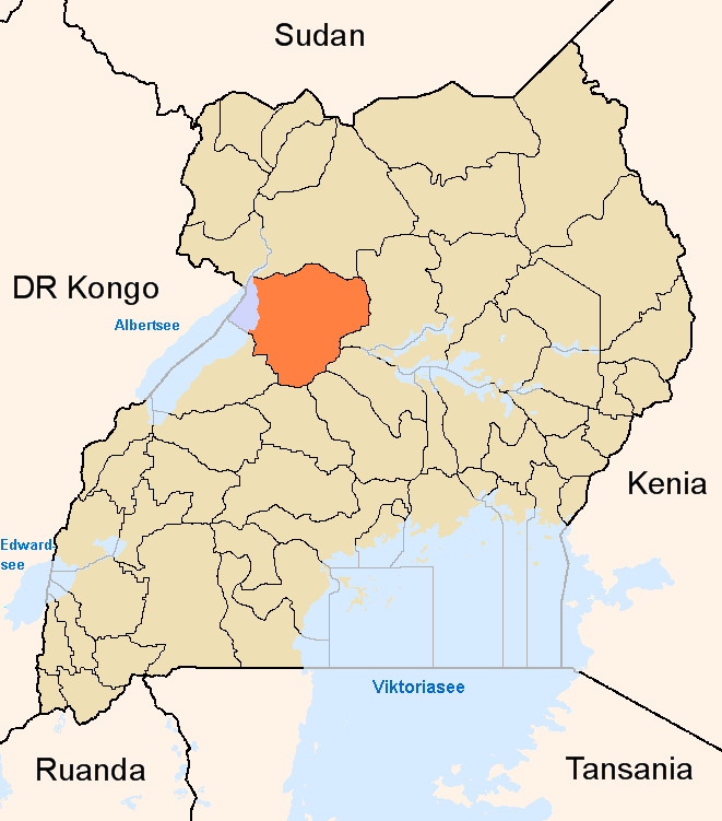
Masindi District — District — District location in Uganda
Coordinates: 01°41′N 31°44′E / 1.683°N 31.733°E Country  Uganda
Region Western Uganda Sub-region Bunyoro sub-region Capital Masindi Population (2010 Estimate) - Total 285,200 Time zone EAT (UTC+3) Website Homepage Masindi District is a district in Western Uganda. Like many other Ugandan districts, it is named after its 'chief town' of Masindi, the location of the district headquarters. The region of the country in which the district is located is comparatively dry, but is fertile enough to support a predominantly agriculturalist population. Most of the district residents are both poor and rural.
Contents
Location
Masindi District is bordered by Nwoya District to the north, Kiryandongo District to the east, Nakasongola District and Nakaseke District to the southeast, Kyankwanzi District to the south, Hoima District to the southwest and Bulisa District to the northwest.[1] Masindi, the 'chief town' of the district is located approximately 214 kilometres (133 mi), by road, west of Uganda's capital Kampala.[2] The coordinates of the district are: 01 41N, 31 44E.
Overview
Masindi District comprises a total area of 9,326 square kilometres (3,601 sq mi), of which 8,087 square kilometres (3,122 sq mi) (86.7%) is land, 2,843 square kilometres (1,098 sq mi) (30.5%) national wild reserve area, 1,031 square kilometres (398 sq mi) (11.1%) is national forest reserve and 799.6 square kilometres (308.7 sq mi) is open water.[3] Approximately 196.3 square kilometres (75.8 sq mi) (2.1%) of the district are wetlands.[4]
Population
The district, as configured after July 2010, had population of 208,420, back in 2002, according to the national census conducted that year.[5] At that time, 50.1% of the population were males and 49.9% were females. The annual population growth rate in the district at that time was 5.1%.[6] It is estimated that in 2010, the population of the district was approximately 285,200. See table below:
Masindi District Population Trends Year Estimated Population 2002 208,420 2003 216,800 2004 225,400 2005 234,400 2006 243,800 2007 253,600 2008 263,700 2009 274,300 2010 285,200 Masindi District has a diverse ethnic composition of 55 tribes, with the dominant tribes, the Banyoro and the Bagungu, forming about 59.9% of the population. The Alur, the Jonam and the Aringa form 5.3%. The Baruli form 4.5%. People from Rwanda, Kenya, Southern Sudan and the Democratic Republic of the Congo have also settled permanently in the district. The average household size is about 4.86 persons, lower than the regional average of 5.2. The population is predominantly rural, with only 5.43% of the residents living in urban areas.[7]
Economic activities
Agriculture is the main economic activity in the district. Crops grown include:
Fishing is practiced in the rivers and on Lake Albert. Fish farming is an important economic activity with over 250 ponds in the district. Bee keeping for honey production is an increasing practice in the district. Tourism is also increasing with a steady stream of visitors to Murchison Falls National Park (formerly Kabalega Falls National Park).
73.1% of the population in the district are engaged in smallholder agricultural activities. About 6.2% of the total farmland is under large scale commercial farming. The district is the leading producer of maize in the region. In Uganda, only Iganga District and Kapchorwa District produce more maize than Masindi District.[8]
Landmarks
The landmarks in Masindi District include:
- Murchison Falls National Park - More than 50% of the park is located in Masindi District, south of the Victoria Nile
- Murchison Falls - On the Victoria Nile, are also located in Masindi District, inside the national park.
- Butiaba Port - Located 54.5 kilometres (33.9 mi), by road, west of Masindi, on the shores of Lake Albert.
- Bugungu Wildlife Reserve, near Butiaba Port
- Budongo Forest Reserve - About 40 kilometres (25 mi), by road, west of Masindi on the Masindi-Butiaba Road
- Omukama’s Palace - One of the palaces of the Omukama of Bunyoro
See also
- Masindi
- Bunyoro Kingdom
- Bunyoro sub-region
- Murchison Falls National Park
- Murchison Falls
References
- ^ Uganda District Map
- ^ Distance Between Kampala and Masindi with Map
- ^ Geography of Masindi District
- ^ 2.1% of Masindi District are wetlands
- ^ 2002 Uganda Population Map By District
- ^ Population Dynamics of Masindi District In 2002
- ^ The People of Masindi District
- ^ Economic Activities in Masindi District
 Regions and Districts of Uganda
Central Eastern Amuria · Budaka · Bududa · Bugiri · Bukedea · Bukwa · Bulambuli · Busia · Butaleja · Buyende · Iganga · Jinja · Kaberamaido · Kaliro · Kamuli · Kapchorwa · Katakwi · Kibuku · Kumi · Kween · Luuka · Manafwa · Mayuge · Mbale · Namayingo · Namutumba · Ngora · Pallisa · Serere · Sironko · Soroti · TororoNorthern Western Categories:- Masindi District
- Districts of Uganda
- Western Region, Uganda
- Lake Albert (Africa)
Wikimedia Foundation. 2010.