- Mubende District
-
"Mubende District" redirects here. For City of Mubende, see Mubende.
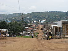 Mubende in August 2007
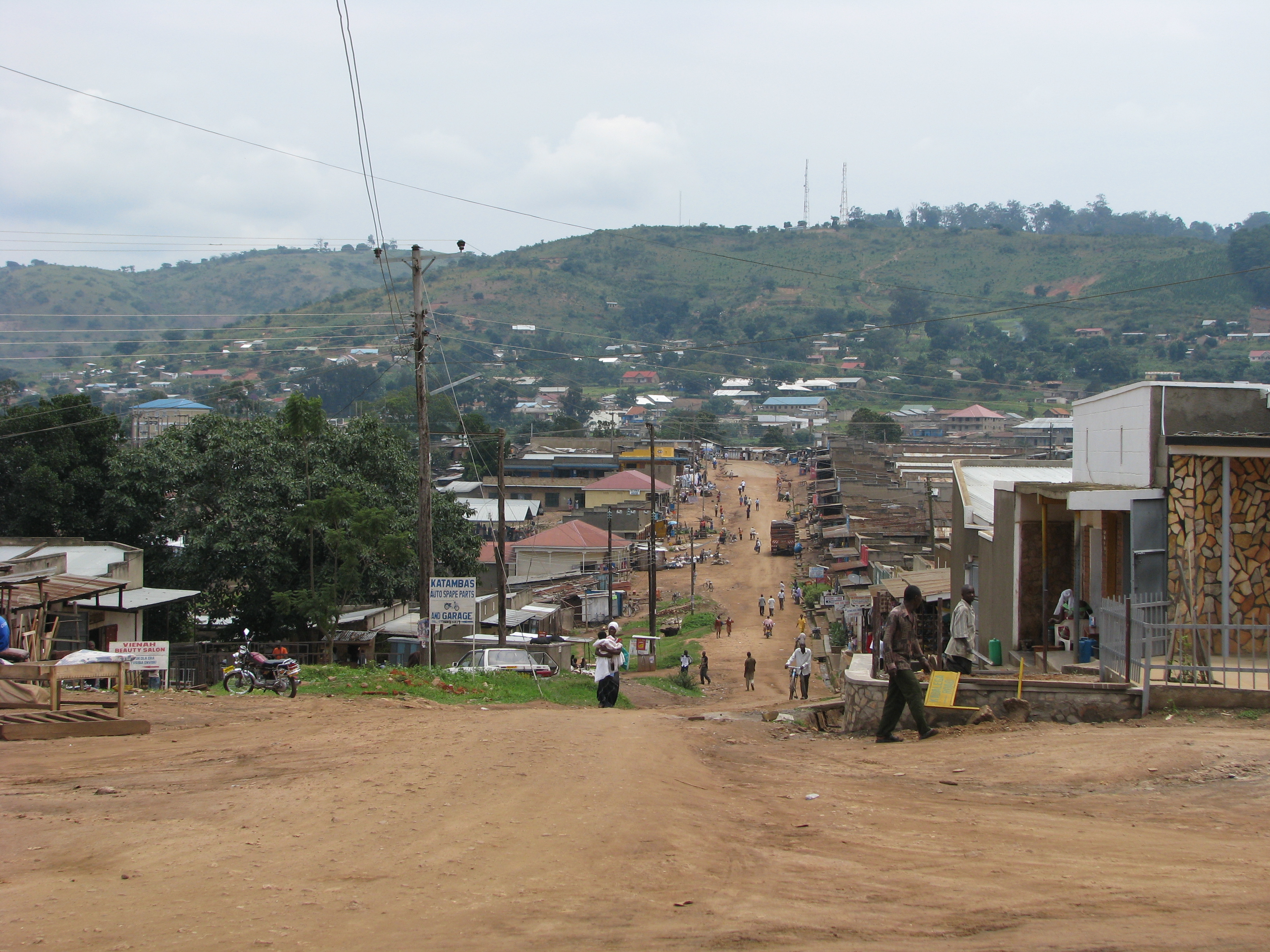
Mubende District — District — District location in Uganda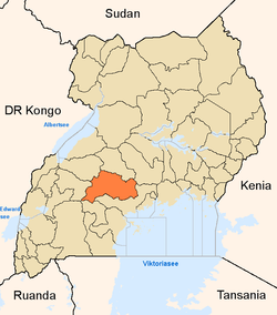
Coordinates: 00°36′N 31°24′E / 0.6°N 31.4°E Country  Uganda
Region Central Uganda Capital Mubende Area - District 4,645 km2 (1,793.4 sq mi) Elevation 1,300 m (4,265 ft) Population (2010 Estimate) - District 579,200 - Density 124.7/km2 (323/sq mi) - Metro 22,200 Time zone EAT (UTC+3) Website Homepage Mubende is a district in Central Uganda. Like most other Ugandan districts, it is named after its 'chief town', Mubende. Mubende District was reduced in size in July 2005 with the creation of Mityana District.
Contents
Location
Mubende District is bordered by Kyankwanzi District to the north, Kiboga District to the northeast and Mityana District to the east. Gomba District and Sembabule District lie to the south, Kyegegwa District to the southwest and Kibaale District to the northwest of Mubende District.[1] Mubende, the district headquarters, is located approximately 172 kilometres (107 mi), by road, west of Kampala, the capital of Uganda, and the largest city in that country.[2] The coordinates of Mubende District are:00 36N, 31 24E.
Overview
The district covers an area of approximately 4,645 square kilometres (1,793 sq mi). It has fifteen (15) lower Local Governments which include:[3]
- Bagezza Local Council
- Bukuya Local Council
- Butoloogo Local Council
- Kalwaana Local Council
- Kasambya Local Council
- Kassanda Local Council
- Kiganda Local Council
- Kigando Local Council
- Kitenga Local Council
- Kitumbi Local Council
- Kiyuuni Local Council
- Maduudu Local Council
- Mubende Town Council
- Mwezi Local Council
- Nabingoola Local Council
Population
In 2002 the national census estimated the population of the district to be about 436,500 people of whom 219,460 (50.3%) were males and 217,033 (59.7%) were female, with an annual population growth rate of 3.6%.[4] It is estimated that in 2010, the population of the district was about 579,200. See table below:
Mubende District Population Trends Year Estimated Population 2002 436,500 2003 452,200 2004 468,500 2005 485,400 2006 502,800 2007 520,900 2008 539,700 2009 559,100 2010 579,200 Economic activity
The major economic activity in Mubende District is agriculture with emphasis on food crops like:
- Sweet potatoes
- Beans
- Cassava
- Maize
- Bananas
- Groundnuts
- Onions
- Cabbage
- Tomatoes
Cash crops grown in the district include:
External links
See also
- Mubende
- Central Region, Uganda
- Buganda
- Districts of Uganda
References
 Regions and Districts of Uganda
Central Eastern Amuria · Budaka · Bududa · Bugiri · Bukedea · Bukwa · Bulambuli · Busia · Butaleja · Buyende · Iganga · Jinja · Kaberamaido · Kaliro · Kamuli · Kapchorwa · Katakwi · Kibuku · Kumi · Kween · Luuka · Manafwa · Mayuge · Mbale · Namayingo · Namutumba · Ngora · Pallisa · Serere · Sironko · Soroti · TororoNorthern Western Categories:- Mubende District
- Districts of Uganda
- Central Region, Uganda

Wikimedia Foundation. 2010.