- Nakasongola District
-
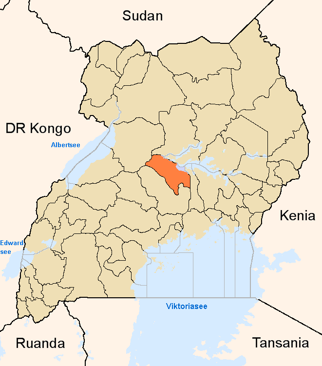
Nakasongola District — District — District location in Uganda
Coordinates: 01°18′N 32°30′E / 1.3°N 32.5°E Country  Uganda
Region Central Uganda Capital Nakasongola Area - Total 4,909 km2 (1,895.4 sq mi) - Land 4,683.2 km2 (1,808.2 sq mi) - Water 225.8 km2 (87.2 sq mi) Elevation 1,160 m (3,806 ft) Population (2010 Estimate) - Total 163,600 - Density 34.9/km2 (90.4/sq mi) Time zone EAT (UTC+3) Website Homepage Nakasongola District is a district in Central Uganda. The district is named after its 'chief town' of Nakasongola.
Contents
Location
Nakasongola District is bordered by Apac District to the northwest, Amolatar District to the northeast, Kayunga District to the east, Luweero District to the south, Nakaseke District to the southwest and Masindi District to the northwest.[1] Nakasongola, the main municipal, administrative and commercial center of the district, is located approximately 139 kilometres (86 mi), by road, north of Kampala, the capital of Uganda and the largest city in the country.[2] The coordinates of the district are:01 18N, 32 30E.
Overview
Nakasongola District was created in 1997. Prior to that it was part of Luweero District. The commission of inquiry into the local government system in 1987 recognized that Nakasongola was too far away from the administrative center of Luweero to be administered directly from there. Nakasongola suffered from relative neglect due to the distance from the then district headquarters. This became the basis for the creation of Nakasongola District in 1997. [3] The district covers 4,909 square kilometres (1,895 sq mi) of which 4.6% is permanent wetland.[4] The district comprises three counties, namely:[5]
- Kyabujingo County - Kakooge, Kalongo and Kalungi sub-counties
- Buluuli County - Lwampanga, Wabinyonyi sub-counties and Nakasongola Town Council
- Budyebo County - Nakitoma, Nabiswera and Lwabiyata sub-counties
Population
The 2002 national census estimated the population of the district at 127,100 people, of whom 62,312 (49.7%) were females and 62,985 (50.3%) were males. The growth rate of the population in Uganda has averaged 3.2% during the first decade of the 2000s.[6] Given those statistics, it is estimated that the population of Nakasongola District in 2010, was approximately 163,600. See table below:
Nakasongola District Population Trends Year Estimated Population 2002 127,100 2003 131,200 2004 135,400 2005 139,700 2006 144,200 2007 148,800 2008 153,600 2009 158,500 2010 163,600 Language
The main languages spoken in the district are Luganda and Luluuri. English is spoken in the major urban centers.
Economic activities
Agriculture is one of the major activities with emphasis on food crops, including:
- Cassava
- Maize
- Sweet potatoes
- Sorghum
- Bananas
- Millet
Cash crops include:
External links
- Nakasongola District Creates New Counties
- Nakasongola District Portal
- Tourism Potential of Nakasongola District
See also
- Nakasongola
- Central Region, Uganda
- Districts of Uganda
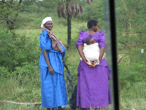
Photos
References
 Regions and Districts of Uganda
Central Eastern Amuria · Budaka · Bududa · Bugiri · Bukedea · Bukwa · Bulambuli · Busia · Butaleja · Buyende · Iganga · Jinja · Kaberamaido · Kaliro · Kamuli · Kapchorwa · Katakwi · Kibuku · Kumi · Kween · Luuka · Manafwa · Mayuge · Mbale · Namayingo · Namutumba · Ngora · Pallisa · Serere · Sironko · Soroti · TororoNorthern Western Categories:- Nakasongola District
- Districts of Uganda
- Central Region, Uganda
- Lake Kyoga
Wikimedia Foundation. 2010.