- Mayuge District
-
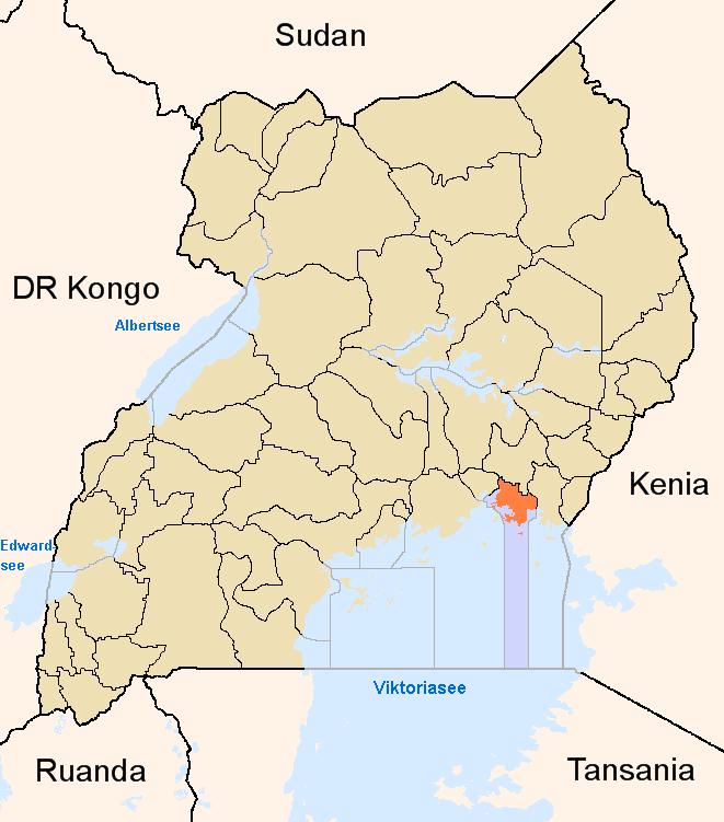
Mayuge District — District — District location in Uganda
Coordinates: 00°20′N 33°30′E / 0.333°N 33.5°E Country  Uganda
Region Eastern Uganda Sub-region Busoga sub-region Capital Mayuge Area - Total 9,948.6 km2 (3,841.2 sq mi) - Land 2,288.2 km2 (883.5 sq mi) - Water 7,660.4 km2 (2,957.7 sq mi) Elevation 1,350 m (4,429 ft) Population (2010 Estimate) - Total 407,300 - Density 178/km2 (461/sq mi) Time zone EAT (UTC+3) Website Homepage Mayuge District is a district in Eastern Uganda. Like many other Ugandan districts, it is named after its 'chief town', Mayuge, where the district headquarters are located.
Contents
Location
Mayuge District is bordered by Iganga District to the north, Bugiri District to the northeast and east, Namayingo District to the east, the Republic of Tanzania to the south, and Jinja District to the west. The coordinates of the district are:00 20N, 33 30E. The district headquarters are located at Mayuge, approximately 38 kilometres (24 mi), by road, east of Jinja, Uganda's sixth largest city.[1]
Overview
Prior to 2000, Mayuge District was known as Bunya County and was part of Iganga District. Present day Mayuge District, Iganga District, Kamuli District, Jinja District, Kaliro District and Bugiri District, constitute the Busoga Kingdom.
7,660.4 square kilometres (2,957.7 sq mi) of the district surface area is open water of Lake Victoria. It is estimated that this represents 77% of the total surface area in the district. Another 10% of the district is protected national forest reserve.[2]
The district has many Islands which are currently occupied by permanent and migratory fishermen. These include the Islands of Seguti, Dagusi, Vumba, Kaza, Nambuga and Simu. The Islands are all easily accessible by motor boat or canoe.
Population
The 2002 national census estimated the population of the district to be about 326,600 people, of whom 51.2% were female and 48.8% were male.[3] It is estimated that the population of the district in 2010 was approximately 407,300. See table below:
Mayuge District Population Trends Year Estimated Population 2002 326,600 2003 335,700 2004 345,100 2005 354,800 2006 364,700 2007 374,900 2008 385,400 2009 396,200 2010 407,300 Economic activities
Due to fertile soils and favorable climate, Mayuge District has great agricultural potential. However, the fact that open water and natural forest reserves occupy an estimated 87% of the surface area of the district, significant pressure has been exerted on the natural environment from the increasing population numbers. Most of the agriculture in the district is on the subsistence level. The crops grown include: [4]
- Maize
- Cassava
- Groundnuts
- Cocoa
- Cotton
- Coffee
- Beans
- Sweet potatos
- Millet
- Simsim
- Sunflower
- Tomatos
- Passion fruit
- Onions
- Cabbage
Fishing is another high-value activity practiced in the district. This activity is the largest income earner in the district, accounting for 63% and 52% of the district revenue in 2002 and 2003 respectively. In 2004, an estimated 2,600 people were engaged in commercial fishing in Mayuge District.[5]
The fish caught from Lake Victoria include:
- Nile Perch
- Tilapia
- Rargentae (Mukene)
- Clarias (Cat fish)
- Protopterus (Lung fish)
In recent times, bee keeping for production of honey, is becoming an accepted and practiced method of earning an income in the district.
External links
See also
- Mayuge
- Busoga sub-region
- Districts of Uganda
References
 Regions and Districts of Uganda
Central Eastern Amuria · Budaka · Bududa · Bugiri · Bukedea · Bukwa · Bulambuli · Busia · Butaleja · Buyende · Iganga · Jinja · Kaberamaido · Kaliro · Kamuli · Kapchorwa · Katakwi · Kibuku · Kumi · Kween · Luuka · Manafwa · Mayuge · Mbale · Namayingo · Namutumba · Ngora · Pallisa · Serere · Sironko · Soroti · TororoNorthern Western Categories:- Mayuge District
- Districts of Uganda
- Eastern Region, Uganda
Wikimedia Foundation. 2010.