- Mayuge
-
Mayuge Location in Uganda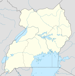
 Mayuge
Coordinates: 00°19′52″N 33°31′48″E / 0.33111°N 33.53°E Country  Uganda
Region Eastern Uganda Sub-region Busoga sub-region District Mayuge District Government – Mayor Elevation 3,904 ft (1,190 m) Population (2011 Estimate) – Total 11,900 Mayuge is a town in Eastern Uganda. It is the 'chief town' of Mayuge District and is the location of the district headquarters. The district is named after the town.
Contents
Location
Mayuge is located approximately 38 kilometres (24 mi), by road, east of the city of Jinja. The coordinates of the town are:00 19 52N, 33 31 48E (Latitude:0.3310; Longitude:33.5300). Neighboring communities include: Bugadi, Bukanya, Bugoto, Wandegeya, Bemba, Namalege, Musita and Ikulwe.
Overview
Mayuge is a small rural settlement that is in the process of becoming an urban center. The headquarters of Mayuge District are located here. Mayuge is the only municipality in Mayuge District.[1]
Population
In 2002, the national census estimated Mayuge's population at 8,715. In 2008, the Uganda Bureau of Statistics (UBOS), estimated the population of the town at 10,700.[2] In 2011, UBOS estimated the population of Mayuge at approximately 11,900.[3]
Economic activity
The economic activity in the town revolves mainly around subsistence agriculture, poultry farming and animal husbandry.[4]
External links
See also
- Mayuge District
- Busoga sub-region
- Eastern Region, Uganda
References
 Mayuge DistrictCapital: Mayuge
Towns and
villagesMayugeGeography Notable people Lukia Isanga Nakadama · Henry BagiireCategories:- Populated places in Uganda
- Cities in the Great Rift Valley
- Populated places on Lake Victoria
- Mayuge District
- Eastern Region, Uganda

Wikimedia Foundation. 2010.