- Masindi Airport
-
Masindi Airport IATA: KCU – ICAO: HUMI Location of Masindi Airport in Uganda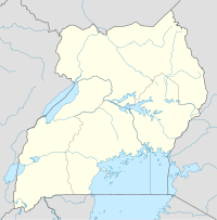
 HUMI
HUMI
Placement on map is apprroximateSummary Airport type Public Owner Civil Aviation Authority of Uganda Serves Masindi, Location Masindi,  Uganda
Elevation AMSL 3,850 ft / 1,173 m Coordinates 1°45′18″N 31°44′12″E / 1.755000°N 31.736667°ECoordinates: 1°45′18″N 31°44′12″E / 1.755000°N 31.736667°E Runways Direction Length Surface m ft 01/19 2,042 6,700 Unpaved Masindi Airport (IATA: KCU, ICAO: HUMI) is an airport in Uganda.
Contents
Location
Masindi Airport is located in a suburrb called Kyema, in the town of Masindi, Masindi District, Bunyoro sub-region, in Western Uganda. Its location is approximately 199 kilometres (124 mi), by air, northwest of Entebbe International Airport, the country’s largest civilian and military airport.[1] This location lies approximately 10 kilometres (6 mi), by road, directly north of the central business district of the town.[2] The geographic coordinates of this airport are 1°45′18″N 31°44′12″E / 1.755°N 31.73667°E.
Overview
The airport is one of the thirteen (13) upcountry airports that are administered by the Uganda Civil Aviation Authority.[3] It is one of the forty-six (46) airports in the country.[4] Situated at 3,850 feet (1,173 m) above sea level, the airport has a single unpaved runway measuring 6,700 feet (2,042 m) long.[5]
Scheduled airlines and destinations
At this time, there is no regular, scheduled airline service at Masindi Airport.
External links
- Location of Masindi Airport At Google Maps
- Website of Uganda Civil Aviation Authority
- Accident history for KCU at Aviation Safety Network
- Airport information for HUMI at Great Circle Mapper.
See also
- Masindi
- Masindi District
- Bunyoro sub-region
- Western Region, Uganda
- Civil Aviation Authority of Uganda
- List of airports in Uganda
References
- ^ "Flight Distance Between Entebbe Airport And Masindi Airport With Map". Distance Calculator. Globefeed.com. http://distancecalculator.globefeed.com/Uganda_Distance_Result.asp?fromplace=Entebbe%20Airport%20()%20&toplace=Masindi%20(Masindi)&fromlat=0.042386&tolat=1.6744444&fromlng=32.443503&tolng=31.715. Retrieved 2 August 2011. "198.72 km"
- ^ Map Showing Masindi And Kyema With Distance Marker
- ^ "Aerodromes". Civil Aviation Authority of Uganda. http://www.caa.co.ug/index1.php?pageid=77&pageSection=Aerodromes. Retrieved 9 March 2010.[dead link]
- ^ "Uganda". CIA World Factbook. https://www.cia.gov/library/publications/the-world-factbook/geos/ug.html. "Airports: 46 (2010)"
- ^ Elevation & Length of Masindi Airport Runway
 Masindi District
Capital: Masindi Towns and villages Economy Barclays Bank · Centenary Bank · Stanbic Bank · Kinyara Sugar Works · Kinyara Power StationNotable landmarks Masindi Airport · Murchison Falls National Park · Budongo Forest Reserve · Bugungu Wildlife Reserve · Butiaba Port · Omukama's Masindi Palace · Masindi Hotel · Masindi HospitalEducation Kigumba Institute of Petroleum StudiesNotable people Kabakumba MasikoCategories:- Airports in Uganda
- Masindi District
- Bunyoro sub-region
- Western Region, Uganda

Wikimedia Foundation. 2010.