- Moroto Airport
-
Moroto Airport IATA: none – ICAO: HUMO Location of Moroto Airport in Uganda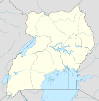
 Moroto
Summary Airport type Public, Civilian Owner Uganda Civil Aviation Authority Serves Moroto, Uganda Location Moroto,  Uganda
Elevation AMSL 4,100 ft / 1,260 m Coordinates 02°30′00″N 34°36′00″E / 2.5°N 34.6°E Runways Direction Length Surface ft m 4,900 1,500 Unpaved Moroto Airport (ICAO: HUMO) is an airport in Uganda. It is one of the forty-six (46) airports in the country.[1]
Contents
Location
Moroto Airport is in the town of Moroto, in northeastern Uganda, approximately 368 kilometres (229 mi), by air. The airport has a single unpaved runway measuring 4,900 feet (1,500 m).[2] It lies northeast of Entebbe International Airport, the country’s largest civilian and military airport.[3]
The geographic coordinates of this airport are 02°30′00″N 34°36′00″E / 2.5°N 34.6°ECoordinates: 02°30′00″N 34°36′00″E / 2.5°N 34.6°E. It is about 8 kilometres (5.0 mi), by road, west of downtown Moroto. Moroto Airport is 1,260 metres (4,130 ft) above sea level.
Overview
Moroto Airport is a small civilian airport that serves the town of Moroto. It is one of the 13 upcountry airports that are administered by the Uganda Civil Aviation Authority (CAA).[4] The complete list of Ugandan upcountry airports under the administration of the CAA includes:[5]
- Arua Airport
- Gulu Airport
- Jinja Airport
- Kasese Airport
- Kidepo Airport
- Kisoro Airport
- Lira Airport
- Masindi Airport
- Mbarara Airport
- Moroto Airport
- Pakuba Airport
- Soroti Airport
- Tororo Airport
External links
See also
References
- ^ "Uganda". CIA World Factbook. https://www.cia.gov/library/publications/the-world-factbook/geos/ug.html. "Airports: 46 (2010)"
- ^ Location of Moroto Airport
- ^ Nautical Distance Between Entebbe and Moroto with Map
- ^ Moroto Airport Administered by Uganda's CAA
- ^ Upcountry Airports Administered By the Uganda Civil Aviation Authority in 2009
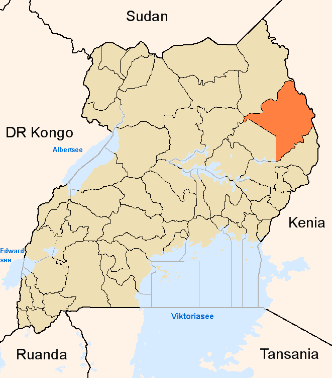
 Moroto District
Capital: Moroto Counties and
sub-countiesBokora County · Matheniko County · Moroto Municipality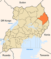
Towns and
villagesEconomy Stanbic BankNotable
landmarksMoroto Regional Referral Hospital · St. Kizito Matany Hospital · Mount Moroto · Moroto Airport · Roman Catholic Diocese of MorotoCategories:- Airports in Uganda
- Moroto District

Wikimedia Foundation. 2010.