- Arua Airport
-
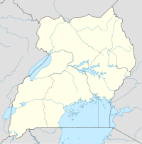
Arua Airport IATA: RUA – ICAO: HUAR Location of Arua Airport in Uganda
Placement on map is approximateSummary Airport type Public, Civilian Owner Uganda Civil Aviation Authority Serves Arua, Uganda Location Arua,  Uganda
Elevation AMSL 3,951 ft / 1,204 m Coordinates 03°02′50″N 30°54′44″E / 3.04722°N 30.91222°E Runways Direction Length Surface ft m 17/35 5,600 1,700 Unpaved Arua Airport (IATA: RUA, ICAO: HUAR) is a civilian airport in the town of Arua, Uganda. It is one of the forty-six (46) airports in the country.[1]
Contents
Location
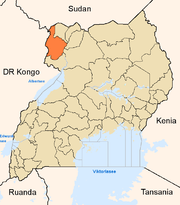
The airport is located in the town of Arua, Arua District, West Nile Sub-Region, in Northern Uganda, close to the International borders with the Democratic Republic of the Congo and withh South Sudan.
Its location is approximately 371 kilometres (231 mi), by air, northwest of Entebbe International Airport, Uganda's largest airport.[2] Arua Airport is located only 12 miles (19 km) from Uganda's border with the Democratic Republic of the Congo and about 20 miles (32 km) from the border between Uganda and South Sudan. The coordinates of this airport are 3°2′50″N 30°54′44″E / 3.04722°N 30.91222°ECoordinates: 3°2′50″N 30°54′44″E / 3.04722°N 30.91222°E.[3]
Overview
Arua Airport is the second-busiest airport in Uganda, behind Entebbe International Airport. It is situated at an elevation of 3,951 feet (1,204 m) above sea level.[4] The airport's single unpaved runway measures 5,600 feet (1,700 m).[5] Its strategic location makes Arua Airport an important center for both commercial and passenger air traffic between Uganda and her two neighbors, Democratic Republic of the Congo and South Sudan.
Airlines and destinations
Airlines Destinations Eagle Air Entebbe, Juba, Yei, Moyo Planned Improvements
On July 9, 2009, the Civil Aviation Authority of Uganda which owns and operates Arua Airport publicly announced that it had started to upgrade the airport to International standards. A modern airport terminal with a capacity for 200 passengers will be constructed. In addition to tarmacking the surface, the runway will be widened from 30 metres (98 ft) to 45 metres (148 ft). It will also be lengthened from 1.8 kilometres (5,900 ft) to 2.5 kilometres (8,200 ft).[6] These improvements are part of the efforts to improve Arua Airport, Gulu Airport and Kasese Airport to International standards. When these improvements are complete, the total number of International airports in Uganda will increase to four (4), including the only International Airport at Entebbe, as of July 2009.[7]
As of December 2009, Arua Airport was one of the thirteen (13) upcountry airports under the administration of the Uganda Civil Aviation Authority. It is also one of the five (5) upcountry airports that are authorized to handle cross-border air traffic from member countries of the East African Community, as part of efforts to promote tourism within Eastern Africa.[8]
External link
- Location of Arua Airport At Google Maps]
- Website of Uganda Civil Aviation Authority
- Website of Eagle Air Uganda
- Airport information for HUAR at Great Circle Mapper.
See also
- Arua
- Arua District
- West Nile sub-region
- Northern Region, Uganda
- Civil Aviation Authority of Uganda
- List of airports in Uganda
References
 Arua District
Capital: Arua Counties and sub-counties Vurra County · Madi-Okollo County · Ayivu County
Towns and villages Economy Bank of Africa · Barclays Bank · Centenary Bank · Crane Bank · Diamond Trust Bank · Bank of Africa · Housing Finance Bank · Kenya Commercial Bank · PostBank Uganda · DFCU Bank · Stanbic Bank · Pride Microfinance Limited · West Nile Distilleries · Arua Foam Mattresses Limited · Toyota Uganda LimitedNotable landmarks Arua Airport · Arua Regional Referral Hospital · Roman Catholic Diocese of AruaEducation Notable people Simon EjuaCategories:- Airports in Uganda
- Arua District
- West Nile sub-region
- Northern Region, Uganda
Wikimedia Foundation. 2010.

