- National Park, New Jersey
-
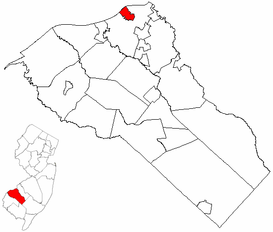
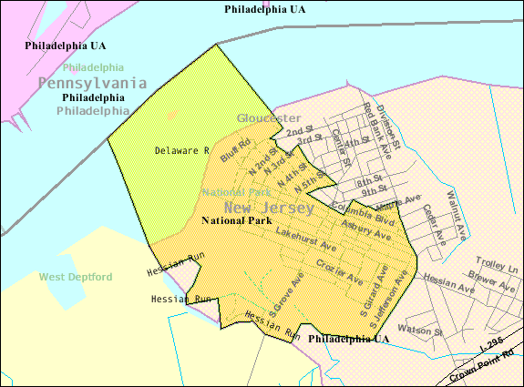
National Park, New Jersey — Borough — National Park highlighted in Gloucester County. Inset map: Gloucester County highlighted in the State of New Jersey.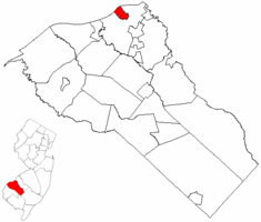 Census Bureau map of National Park, New Jersey
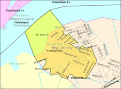
Coordinates: 39°52′05″N 75°11′09″W / 39.86806°N 75.18583°WCoordinates: 39°52′05″N 75°11′09″W / 39.86806°N 75.18583°W Country United States State New Jersey County Gloucester Incorporated April 15, 1902 Government – Type Borough (New Jersey) – Mayor Patricia M. Rossiter Area – Total 1.4 sq mi (3.7 km2) – Land 1.0 sq mi (2.6 km2) – Water 0.4 sq mi (1.1 km2) Elevation[1] 20 ft (6 m) Population (2006)[2] – Total 3,215 – Density 3,219.0/sq mi (1,242.9/km2) Time zone Eastern (EST) (UTC-5) – Summer (DST) EDT (UTC-4) ZIP code 08063 Area code(s) 856 FIPS code 34-49680[3][4] GNIS feature ID 0885314[5] Website http://www.nationalparkboro.com National Park is a Borough in Gloucester County, New Jersey, United States. As of the United States 2000 Census, there were 3,205 residents. Despite its name, National Park is neither a national park nor associated with one.
Contents
History
In 1777, during the American Revolutionary War, the Continental Army under command of George Washington constructed two forts on the Delaware River to block the approach to Philadelphia: Fort Mifflin on the Pennsylvania side and Fort Mercer on the New Jersey side in what is now National Park. The fort was named in honor of Brigadier General Hugh Mercer who had died earlier that year at the Battle of Princeton. A park, monument, and museum commemorate the fort on its original site.
On October 22 of that year, in what is known as the Battle of Red Bank, an attack by 900 Hessian troops, serving under British Major General William Howe, who then occupied Philadelphia, was repelled, with heavy losses on the Hessian side (including the death of their commander, Colonel Carl Emil Kurt von Donop) by the 600 Continental defenders under Colonel Christopher Greene. After the loss of Fort Mifflin, Fort Mercer was abandoned without a fight when Lord Charles Cornwallis landed 2,000 British troops nearby on November 18.
Beginning in 1895, the area was commercially developed as National Park on the Delaware, a religious resort/retreat for members of the Methodist Episcopal Church.
National Park was formed as a borough by an Act of the New Jersey Legislature on April 15, 1902, from portions of West Deptford Township.[6]
Geography
National Park is located at 39°52′02″N 75°10′49″W / 39.867158°N 75.180201°W (39.867158, -75.180201).[7]
According to the United States Census Bureau, the borough has a total area of 1.4 square miles (3.6 km2), of which, 1.0 square mile (2.6 km2) of it is land and 0.4 square miles (1.0 km2) of it (30.56%) is water.
National Park borders West Deptford Township and the Delaware River.
The Delaware River shore faces the southern end of Philadelphia, approximately across from the mouth of the Schuylkill River and the site of Fort Mifflin.
Demographics
Historical populations Census Pop. %± 1930 1,828 — 1940 1,977 8.2% 1950 2,419 22.4% 1960 3,380 39.7% 1970 3,730 10.4% 1980 3,552 −4.8% 1990 3,413 −3.9% 2000 3,205 −6.1% Est. 2006 3,215 [2] 0.3% Population 1930 - 1990.[8] As of the census[3] of 2000, there were 3,205 people, 1,111 households, and 865 families residing in the borough. The population density was 3,219.0 people per square mile (1,237.5/km2). There were 1,165 housing units at an average density of 1,170.1 per square mile (449.8/km2). The racial makeup of the borough was 98.35% White, 0.09% Black, 0.25% Native American, 0.25% Asian, 0.03% Pacific Islander, 0.53% from other races, and 0.50% from two or more races. Hispanic or Latino of any race were 1.44% of the population.
There were 1,111 households out of which 37.3% had children under the age of 18 living with them, 58.2% were married couples living together, 14.0% had a female householder with no husband present, and 22.1% were non-families. 18.6% of all households were made up of individuals and 8.6% had someone living alone who was 65 years of age or older. The average household size was 2.86 and the average family size was 3.24.
In the borough the population was spread out with 26.4% under the age of 18, 9.3% from 18 to 24, 29.7% from 25 to 44, 22.2% from 45 to 64, and 12.5% who were 65 years of age or older. The median age was 37 years. For every 100 females there were 99.2 males. For every 100 females age 18 and over, there were 93.8 males.
The median income for a household in the borough was $48,534, and the median income for a family was $51,535. Males had a median income of $35,102 versus $27,398 for females. The per capita income for the borough was $18,048. About 6.5% of families and 7.6% of the population were below the poverty line, including 6.7% of those under age 18 and 7.9% of those age 65 or over.
Government
Local government
National Park is governed under the borough form of New Jersey municipal government and consists of a Mayor and a Borough Council of six council members, with all positions elected at large. A mayor is directly elected by the voters to a four-year term. The six-member Borough Council are elected to staggered three-year terms, two seats coming up for election each year.[9]
As of 2011[update], the Mayor of National Park is Patricia M. Koloski. Members of the Borough Council Borough Council are Council President Dennis Mehaffey Sr., Mark Cooper, Michael Duer, Anne Marie Henry, Harry Schaeffer and Michael Szatkowski.[10]
Federal, state and county representation
National Park is in the 1st Congressional district. New Jersey's First Congressional District is represented by Rob Andrews (D, Haddon Heights). New Jersey is represented in the United States Senate by Frank Lautenberg (D, Cliffside Park) and Bob Menendez (D, Hoboken).
National Park is in the 3rd legislative district of the New Jersey Legislature, which is represented in the New Jersey Senate by Stephen M. Sweeney (D, West Deptford Township) and in the New Jersey General Assembly by John J. Burzichelli (D, Paulsboro) and Celeste Riley (D, Bridgeton).[11]
Gloucester County is governed by a Board of Chosen Freeholders, whose seven members are elected at-large to three-year terms of office on a staggered basis, with two or three seats coming up for election each year. Each year, the Board selects a Freeholder Director and Deputy Director from among its members. As of 2011, Gloucester County's Freeholders are Freeholder Director Robert M. Damminger (D, West Deptford Township, 2012), Deputy Freeholder Director Dr. Warren S. Wallace (D, Washington Township, 2011), Giuseppe "Joe" Chila (D, Woolwich Township, 2012), Frank J. DiMarco (D, Deptford Township, 2011), Vincent H. Nestore, Jr. (R, Deptford Township, 2013), Heather Simmons (D, Glassboro Borough, 2011), Larry Wallace (R, Woolwich Township, 2013).[12]
Education
The National Park School District serves public school students in Preschool through sixth grade. As of the 2005-06 school year, National Park Elementary School served 315 students.[13]
Seventh through twelfth grade public school students attend Gateway Regional High School, which serves students from the boroughs of National Park, Wenonah, Westville and Woodbury Heights as part of the Gateway Regional High School District.[14]
Site of Fort Mercer
Main article: Fort MercerReferences
- ^ U.S. Geological Survey Geographic Names Information System: Borough of National Park, Geographic Names Information System, accessed January 4, 2008.
- ^ a b "National Park borough, New Jersey". American FactFinder. United States Census Bureau. http://factfinder.census.gov/servlet/SAFFPopulation?_event=Search&geo_id=06000US3401547250&_geoContext=01000US%257C04000US34%257C05000US34015%257C06000US3401547250&_street=&_county=national+park&_cityTown=national+park&_state=04000US34&_zip=&_lang=en&_sse=on&ActiveGeoDiv=geoSelect&_useEV=&pctxt=fph&pgsl=060&_submenuId=population_0&ds_name=null&_ci_nbr=null&qr_name=null®=null%253Anull&_keyword=&_industry=. Retrieved 2010-08-16.
- ^ a b "American FactFinder". United States Census Bureau. http://factfinder.census.gov. Retrieved 2008-01-31.
- ^ A Cure for the Common Codes: New Jersey, Missouri Census Data Center. Accessed July 14, 2008.
- ^ "US Board on Geographic Names". United States Geological Survey. 2007-10-25. http://geonames.usgs.gov. Retrieved 2008-01-31.
- ^ "The Story of New Jersey's Civil Boundaries: 1606-1968", John P. Snyder, Bureau of Geology and Topography; Trenton, New Jersey; 1969. p. 140.
- ^ "US Gazetteer files: 2010, 2000, and 1990". United States Census Bureau. 2011-02-12. http://www.census.gov/geo/www/gazetteer/gazette.html. Retrieved 2011-04-23.
- ^ New Jersey Resident Population by Municipality: 1930 - 1990, Workforce New Jersey Public Information Network. Accessed March 1, 2007.
- ^ 2005 New Jersey Legislative District Data Book, Rutgers University Edward J. Bloustein School of Planning and Public Policy, April 2005, p. 19.
- ^ "Council". National Park Borough web site. www.nationalparkboro.com. http://www.nationalparkboro.com/council.htm. Retrieved 20111-02-07.
- ^ "Legislative Roster: 2010-2011 Session". New Jersey Legislature. http://www.njleg.state.nj.us/members/roster.asp. Retrieved 2010-02-08.
- ^ Gloucester County Board of Chosen Freeholders, Gloucester County, New Jersey. Accessed May 27, 2011.
- ^ Data for National Park Elementary School, National Center for Education Statistics. Accessed February 28, 2008.
- ^ Gateway Regional High School District 2007 School Report Card, New Jersey Department of Education. Accessed February 28, 2008. "Gateway Regional High School District is comprised of one 7th-12th-grade school located in Woodbury Heights, NJ. It serves the secondary students from the municipalities of National Park, Wenonah, Westville, and Woodbury Heights."
External links
- Borough of National Park website
- National Park Elementary School
- National Park Elementary School's 2009–10 School Report Card from the New Jersey Department of Education
- Data for National Park Elementary School, National Center for Education Statistics
- National Park Fire Dept
- National Park forum
Municipalities and communities of Gloucester County, New Jersey City 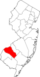
Boroughs Clayton | Glassboro | National Park | Newfield | Paulsboro | Pitman | Swedesboro | Wenonah | Westville | Woodbury Heights
Townships Deptford | East Greenwich | Elk | Franklin | Greenwich | Harrison | Logan | Mantua | Monroe | South Harrison | Washington | West Deptford | Woolwich
CDPs Communities Almonesson | Bridgeport | Clarksboro | Cooper | Cross Keys | Ferrell | Franklinville | Greenfields Village | Harrisonville | Hurffville | Malaga | Mickleton | Monroeville | Mount Royal | New Brooklyn | Red Bank | Repaupo | Richwood | Sewell | Thorofare
Categories:- Boroughs in Gloucester County, New Jersey

Wikimedia Foundation. 2010.