- Newfield, New Jersey
-
Newfield, New Jersey — Borough — Newfield highlighted in Gloucester County. Inset map: Gloucester County highlighted in the State of New Jersey. Census Bureau map of Newfield, New Jersey
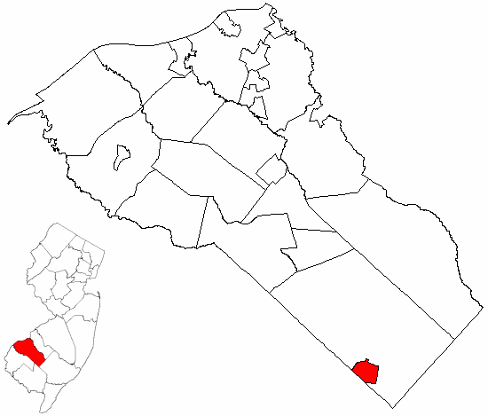
Coordinates: 39°32′58″N 75°01′06″W / 39.54944°N 75.01833°WCoordinates: 39°32′58″N 75°01′06″W / 39.54944°N 75.01833°W Country United States State New Jersey County Gloucester Incorporated March 8, 1924 Government[1] – Type Borough (New Jersey) – Mayor Joseph Curcio, III Area – Total 1.7 sq mi (4.4 km2) – Land 1.7 sq mi (4.4 km2) – Water 0.0 sq mi (0.0 km2) Elevation[2] 121 ft (37 m) Population (2006)[3] – Total 1,664 – Density 951.1/sq mi (367.2/km2) Time zone Eastern (EST) (UTC-5) – Summer (DST) EDT (UTC-4) ZIP code 08344 Area code(s) 856 FIPS code 34-51390[4][5] GNIS feature ID 0885319[6] Website http://www.newfieldboro.org Newfield is a Borough in Gloucester County, New Jersey, United States. As of the United States 2000 Census, the borough population was 1,616.
Newfield was formed as a borough by an Act of the New Jersey Legislature on March 8, 1924, from portions of Franklin Township, based on the results of a referendum held on April 1, 1924.[7]
Contents
Geography
Newfield is located at 39°32′56″N 75°01′19″W / 39.548986°N 75.022057°W (39.548986, -75.022057).[8]
According to the United States Census Bureau, the borough has a total area of 1.7 square miles (4.4 km2), all of it land.
Newfield borders Franklin Township and Cumberland County.
Demographics
Historical populations Census Pop. %± 1930 880 — 1940 889 1.0% 1950 1,010 13.6% 1960 1,299 28.6% 1970 1,487 14.5% 1980 1,563 5.1% 1990 1,592 1.9% 2000 1,616 1.5% Est. 2006 1,664 [3] 3.0% historical data source:[9] As of the census[4] of 2000, there were 1,616 people, 596 households, and 470 families residing in the borough. The population density was 951.1 people per square mile (367.0/km2). There were 620 housing units at an average density of 364.7 per square mile (140.8/km2). The racial makeup of the borough was 95.11% White, 1.30% African American, 0.68% Native American, 0.56% Asian, 1.05% from other races, and 1.30% from two or more races. Hispanic or Latino of any race were 3.84% of the population.
There were 596 households out of which 33.6% had children under the age of 18 living with them, 64.9% were married couples living together, 9.9% had a female householder with no husband present, and 21.0% were non-families. 17.6% of all households were made up of individuals and 9.1% had someone living alone who was 65 years of age or older. The average household size was 2.71 and the average family size was 3.04.
In the borough the population was spread out with 24.4% under the age of 18, 7.2% from 18 to 24, 28.9% from 25 to 44, 25.3% from 45 to 64, and 14.2% who were 65 years of age or older. The median age was 39 years. For every 100 females there were 85.3 males. For every 100 females age 18 and over, there were 83.8 males.
The median income for a household in the borough was $51,875, and the median income for a family was $59,934. Males had a median income of $39,926 versus $28,750 for females. The per capita income for the borough was $21,063. About 5.5% of families and 6.5% of the population were below the poverty line, including 9.8% of those under age 18 and 6.1% of those age 65 or over.
Government
Local government
Newfield is governed under the Borough form of New Jersey municipal government. The government consists of a Mayor and a Borough Council comprising six council members, with all positions elected at large. A Mayor is elected directly by the voters to a four-year term of office. The Borough Council consists of six members elected to serve three-year terms on a staggered basis, with two seats coming up for election each year.[1]
The Mayor of Newfield Borough is Joseph Curcio, III. Members of the Newfield Borough Council are:[10]
- Charles Grova, Jr. - Chairman Public Safety
- Frank Martinelli - Chairman Telecommunications, Grants
- Donald Sullivan - Chairman Water Department
- Michael Carrow - Chairman Finance Committee
- Everett Marshall - Chairman Public Works, Trash & Recycling
- Harold Down - Chairman License & Inspections
Federal, state and county representation
Newfield is in the 2nd Congressional district. New Jersey's Second Congressional District is represented by Frank LoBiondo (R, Ventnor City). New Jersey is represented in the United States Senate by Frank Lautenberg (D, Cliffside Park) and Bob Menendez (D, Hoboken).
Newfield is in the 4th district of the New Jersey Legislature, which is represented in the New Jersey Senate by Fred H. Madden (D, Washington Township) and in the New Jersey General Assembly by Domenick DiCicco (R, Franklin Township) and Paul Moriarty (D, Washington Township).[11]
Gloucester County is governed by a Board of Chosen Freeholders, whose seven members are elected at-large to three-year terms of office on a staggered basis, with two or three seats coming up for election each year. Each year, the Board selects a Freeholder Director and Deputy Director from among its members. As of 2011, Gloucester County's Freeholders are Freeholder Director Robert M. Damminger (D, West Deptford Township, 2012), Deputy Freeholder Director Dr. Warren S. Wallace (D, Washington Township, 2011), Giuseppe "Joe" Chila (D, Woolwich Township, 2012), Frank J. DiMarco (D, Deptford Township, 2011), Vincent H. Nestore, Jr. (R, Deptford Township, 2013), Heather Simmons (D, Glassboro Borough, 2011), Larry Wallace (R, Woolwich Township, 2013).[12]
Education
Newfield is a non-operating school district.[13] Public school students in Newfield attend the schools of the Buena Regional School District as part of a sending/receiving relationship. The district serves students from Buena and Buena Vista Township. Students are sent to the district's high school for grades 9 - 12 from both Estell Manor City and Weymouth Township as part of sending/receiving relationships with the respective school districts.[14]
Students attend Edgarton Elementary School for grades K - 5, Dr. J. P. Cleary Middle School for grades 6 - 8 and Buena Regional High School for grades 9 - 12.
References
- ^ a b 2005 New Jersey Legislative District Data Book, Rutgers University Edward J. Bloustein School of Planning and Public Policy, April 2005, p. 24.
- ^ U.S. Geological Survey Geographic Names Information System: Borough of Newfield, Geographic Names Information System. Accessed June 13, 2008.
- ^ a b Census data for Newfield borough, United States Census Bureau. Accessed March 14, 2008.
- ^ a b "American FactFinder". United States Census Bureau. http://factfinder.census.gov. Retrieved 2008-01-31.
- ^ "A Cure for the Common Codes: New Jersey". Missouri Census Data Center. http://mcdc2.missouri.edu/webrepts/commoncodes/ccc_nj.html. Retrieved 2008-07-14.
- ^ "US Board on Geographic Names". United States Geological Survey. 2007-10-25. http://geonames.usgs.gov. Retrieved 2008-01-31.
- ^ "The Story of New Jersey's Civil Boundaries: 1606-1968", John P. Snyder, Bureau of Geology and Topography; Trenton, New Jersey; 1969. p. 140.
- ^ "US Gazetteer files: 2010, 2000, and 1990". United States Census Bureau. 2011-02-12. http://www.census.gov/geo/www/gazetteer/gazette.html. Retrieved 2011-04-23.
- ^ New Jersey Resident Population by Municipality: 1930 - 1990, Workforce New Jersey Public Information Network. Accessed March 1, 2007.
- ^ Borough of Newfield Municipal Offices, accessed July 13, 2007. Does not reflect recent appointment as of date accessed.
- ^ "Legislative Roster: 2010-2011 Session". New Jersey Legislature. http://www.njleg.state.nj.us/members/roster.asp. Retrieved 2010-02-08.
- ^ Gloucester County Board of Chosen Freeholders, Gloucester County, New Jersey. Accessed May 27, 2011.
- ^ 13 Non-Operating School Districts Eliminated, New Jersey Department of Education press release dated July 1, 2009. Accessed December 26, 2009.
- ^ Buena Regional School District 2007 Report Card Narrative, New Jersey Department of Education. Accessed March 14, 2008. "Students from Weymouth and Estell Manor join students from Buena Vista Township, Buena Borough, and Newfield at the high school."
External links
- Newfield Borough website
- Buena Regional School District
- Buena Regional School District's 2009–10 School Report Card from the New Jersey Department of Education
- Data for the Buena Regional School District, National Center for Education Statistics
Municipalities and communities of Gloucester County, New Jersey City 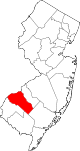
Boroughs Clayton | Glassboro | National Park | Newfield | Paulsboro | Pitman | Swedesboro | Wenonah | Westville | Woodbury Heights
Townships Deptford | East Greenwich | Elk | Franklin | Greenwich | Harrison | Logan | Mantua | Monroe | South Harrison | Washington | West Deptford | Woolwich
CDPs Communities Almonesson | Bridgeport | Clarksboro | Cooper | Cross Keys | Ferrell | Franklinville | Greenfields Village | Harrisonville | Hurffville | Malaga | Mickleton | Monroeville | Mount Royal | New Brooklyn | Red Bank | Repaupo | Richwood | Sewell | Thorofare
Categories:- Boroughs in Gloucester County, New Jersey
- New Jersey District Factor Group none


Wikimedia Foundation. 2010.