- Woodbury Heights, New Jersey
Infobox Settlement
official_name = Woodbury Heights, New Jersey
settlement_type = Borough
nickname =
motto =
imagesize =
image_caption =
image_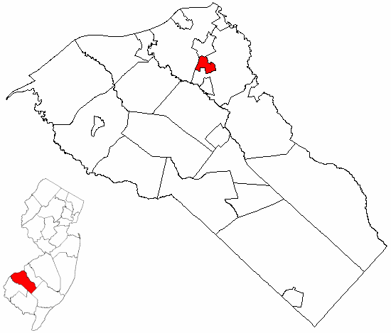
mapsize = 250x200px
map_caption = Woodbury Heights highlighted in Gloucester County. Inset
mapsize1 = 250x200px
map_caption1 = Census Bureau map of Woodbury Heights, New Jerseysubdivision_type = Country
subdivision_name =United States
subdivision_type1 = State
subdivision_name1 =New Jersey
subdivision_type2 = County
subdivision_name2 = Gloucester
government_footnotes =
government_type =Borough (New Jersey)
leader_title =Mayor
leader_name = Harry W. Elton, Jr.
leader_title1 =
leader_name1 =
established_title = Incorporated
established_date =April 27 ,1915 unit_pref = Imperial
area_footnotes =
area_magnitude =
area_total_km2 = 3.2
area_land_km2 = 3.2
area_water_km2 = 0.0
area_total_sq_mi = 1.2
area_land_sq_mi = 1.2
area_water_sq_mi = 0.0population_as_of = 2006
population_footnotes =
population_total = 3030
population_density_km2 = 941.0
population_density_sq_mi = 2437.2timezone = Eastern (EST)
utc_offset = -5
timezone_DST = EDT
utc_offset_DST = -4
elevation_footnotes = [Gnis|885448|Borough of Woodbury Heights,Geographic Names Information System . AccessedJune 13 ,2008 .]
elevation_m = 13
elevation_ft = 43
latd = 39 |latm = 48 |lats = 59 |latNS = N
longd = 75 |longm = 09 |longs = 03 |longEW = Wpostal_code_type =
ZIP code
postal_code = 08097
area_code = 856
blank_name = FIPS code
blank_info = 34-82180GR|2 [ [http://mcdc2.missouri.edu/webrepts/commoncodes/ccc_nj.html A Cure for the Common Codes: New Jersey] , Missouri Census Data Center. AccessedJuly 14 ,2008 .]
blank1_name = GNIS feature ID
blank1_info = 0885448GR|3
website = http://www.bwhnj.com
footnotes =Woodbury Heights is a Borough located in Gloucester County,
New Jersey ,United States . As of the 2000 census, the borough had a total population of 2,988.Woodbury Heights was formed as a borough by an Act of the
New Jersey Legislature onApril 6 ,1915 , from portions of Deptford Township, based on the results of a referendum held onApril 27 ,1915 . Portions were exchanged with Woodbury in 1925, and portions of the city were annexed onMarch 22 ,1938 . Portions were exchanged with Deptford Township in 1956 and other portions were annexed from the township in 1965."The Story of New Jersey's Civil Boundaries: 1606-1968", John P. Snyder, Bureau of Geology and Topography; Trenton, New Jersey; 1969. p. 142.]Geography
Woodbury Heights is located at 39°49'1" North, 75°9'12" West (39.817013, -75.153379)GR|1.
According to the
United States Census Bureau , the borough has a total area of 1.2 square miles (3.2 km²). 1.2 square miles (3.2 km²) of it is land. Glen Lake, although no longer open for swimming, is available for fishing and non-motorized boating. [http://www.sjnewsco.com/woodbury_heights.htm]Woodbury Heights borders Deptford Township, West Deptford Township, and Woodbury.
Demographics
USCensusPop
1930= 997
1940= 1137
1950= 1373
1960= 1723
1970= 3621
1980= 3460
1990= 3392
2000= 2988
estimate= 3030
estyear=2006
estref= [http://factfinder.census.gov/servlet/SAFFPopulation?_event=ChangeGeoContext&geo_id=16000US3482180&_geoContext=01000US%7C04000US34%7C16000US3480120&_street=&_county=woodbury&_cityTown=woodbury&_state=04000US34&_zip=&_lang=en&_sse=on&ActiveGeoDiv=geoSelect&_useEV=&pctxt=fph&pgsl=010&_submenuId=population_0&ds_name=null&_ci_nbr=null&qr_name=null®=null%3Anull&_keyword=&_industry= Census data for Woodbury Heights borough] ,United States Census Bureau . AccessedSeptember 18 ,2007 .]
footnote=Population 1930 - 1990. [ [http://www.wnjpin.net/OneStopCareerCenter/LaborMarketInformation/lmi01/poptrd6.htm New Jersey Resident Population by Municipality: 1930 - 1990] , Workforce New Jersey Public Information Network. AccessedMarch 1 ,2007 .] As of thecensus GR|2 of 2000, there are 2,988 people, 1,027 households, and 825 families residing in the borough. Thepopulation density is 2,437.2 people per square mile (937.9/km²). There are 1,045 housing units at an average density of 852.4/sq mi (328.0/km²). The racial makeup of the borough is 96.35% White, 1.54%African American orBlack , 0.27% Native American, 1.00% Asian, 0.00% Pacific Islander, 0.47% from other races, and 0.37% from two or more races. 1.24% of the population areHispanic orLatino of any race.There are 1,027 households out of which 38.2% have children under the age of 18 living with them, 66.4% are married couples living together, 9.6% have a female householder with no husband present, and 19.6% are non-families. 16.7% of all households are made up of individuals and 8.1% have someone living alone who is 65 years of age or older. The average household size is 2.89 and the average family size is 3.24.
In the borough the population is spread out with 26.1% under the age of 18, 6.7% from 18 to 24, 29.2% from 25 to 44, 24.7% from 45 to 64, and 13.3% who are 65 years of age or older. The median age is 38 years. For every 100 females there are 92.6 males. For every 100 females age 18 and over, there are 90.8 males.
The median income for a household in the borough is $63,266, and the median income for a family is $70,167. Males have a median income of $51,342 versus $33,220 for females. The
per capita income for the borough is $24,001. 4.1% of the population and 2.4% of families are below the poverty line. Out of the total people living in poverty, 3.7% are under the age of 18 and 2.8% are 65 or older.Government
Local government
Woodbury Heights is governed under the Borough form of New Jersey municipal government. The government consists of a Mayor and a Borough Council comprising six council members, with all positions elected at large. A Mayor is elected directly by the voters to a four-year term of office. The Borough Council consists of six members elected to serve three-year terms on a staggered basis, with two seats coming up for election each year. ["2005 New Jersey Legislative District Data Book",
Rutgers University Edward J. Bloustein School of Planning and Public Policy , April 2005, p. 28.]The Mayor of Woodbury Heights is Harry W. Elton, Jr. Borough Council members are Council President Eshia “Jake” Jacob, Susan S. Degnen, Duane Pheasant, Harold “Hap” Pye, Brett D. Scull and Joseph Smith. [ [http://www.bwhnj.com/viewpage.php?id=13 Woodbury Heights Mayor / Council] , Borough of Woodbury Heights. Accessed
June 20 ,2008 .]Federal, state and county representation
Woodbury is in the First Congressional District and is part of New Jersey's 5th Legislative District. [ [http://www.lwvnj.org/pubs/CG06.pdf 2006 New Jersey Citizen's Guide to Government] , New Jersey
League of Women Voters , p. 66. AccessedAugust 30 ,2006 .]Education
The
Woodbury Heights School District serves public school students in preschool through sixth grade. Woodbury Heights Elementary School served an enrollment of 240 students as of the 2005-06 school year. [ [http://nces.ed.gov/ccd/schoolsearch/school_list.asp?Search=1&DistrictID=3418180 Data for the Woodbury Heights Elementary School] ,National Center for Education Statistics . AccessedFebruary 28 ,2008 .]For seventh through twelfth grade, public school students attend Gateway Regional High School, a regional public high school serving students from the boroughs of National Park, Wenonah, Westville and Woodbury Heights, as part of the Gateway Regional High School District. [ [http://education.state.nj.us/rc/rc07/narrative/15/1715/15-1715-000.html Gateway Regional High School District 2007 School Report Card] ,
New Jersey Department of Education . AccessedFebruary 28 ,2008 . "Gateway Regional High School District is comprised of one 7th-12th-grade school located in Woodbury Heights, NJ. It serves the secondary students from the municipalities of National Park, Wenonah, Westville, and Woodbury Heights."]St. Margaret Regional School, a K-8
Catholic school , is located in Woodbury Heights as well.References
External links
* [http://www.bwhnj.com/ Borough of Woodbury Heights]
* [http://www.woodburyhtselem.com/ Woodbury Heights Elementary School]
*NJReportCard|15|5870|0|Woodbury Heights Elementary School
* [http://nces.ed.gov/ccd/schoolsearch/school_list.asp?Search=1&DistrictID=3418180 Data for the Woodbury Heights Elementary School] ,National Center for Education Statistics
* [http://www.nj.com/forums/woodburyheights/ Woodbury Heights forum]

Wikimedia Foundation. 2010.