- Monroeville, New Jersey
-
Monroeville is an unincorporated area located within portions of Elk Township in Gloucester County and Upper Pittsgrove Township in Salem County, New Jersey, United States. The area is served as United States Postal Service ZIP Code 08343. The Area is used as the mailing address for its residents. Most of the residents attend Upper Pittsgrove School if they are on the Upper Pittsgrove Township portion, although some attend Olivett Elementary in Pittsgrove Township. The Area Code is 856. Monroeville is mostly filled with wooded areas and farms, it is not densely populated although it is a friendly place to live. It is mainly considered a region of Upper Pittsgrove Township, differentiated by the postal zip code (08343).
As of the United States 2000 Census, the population for ZIP Code Tabulation Area 08343 was 4,596.[1]
Geography
Monroeville is located at 39°37′44″N 75°09′34″W / 39.62889°N 75.15944°W.[2]
References
- ^ Census 2000 Fact Sheet for Zip Code Tabulation Area 08343, United States Census Bureau. Accessed June 18, 2008.
- ^ U.S. Geological Survey Geographic Names Information System: Monroeville, Geographic Names Information System. Accessed June 18, 2008.
External links
Municipalities and communities of Gloucester County, New Jersey County seat: Woodbury City 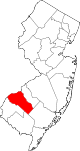
Boroughs Clayton | Glassboro | National Park | Newfield | Paulsboro | Pitman | Swedesboro | Wenonah | Westville | Woodbury Heights
Townships Deptford | East Greenwich | Elk | Franklin | Greenwich | Harrison | Logan | Mantua | Monroe | South Harrison | Washington | West Deptford | Woolwich
CDPs Communities Almonesson | Bridgeport | Clarksboro | Cooper | Cross Keys | Ferrell | Franklinville | Greenfields Village | Harrisonville | Hurffville | Malaga | Mickleton | Monroeville | Mount Royal | New Brooklyn | Red Bank | Repaupo | Richwood | Sewell | Thorofare
Municipalities and communities of Salem County, New Jersey County seat: Salem City 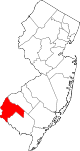
Boroughs Townships Alloway | Carneys Point | Elsinboro | Lower Alloways Creek | Mannington | Oldmans | Pennsville | Pilesgrove | Pittsgrove | Quinton | Upper Pittsgrove
CDPs Alloway | Carneys Point | Pennsville | Olivet
Communities Auburn | Brotmanville | Centerton | Deepwater | Hancock's Bridge | Monroeville | Pedricktown
Categories:- Populated places in Gloucester County, New Jersey
- Populated places in Salem County, New Jersey
- Unincorporated communities in New Jersey
- New Jersey geography stubs


Wikimedia Foundation. 2010.