- Mullica Hill, New Jersey
-
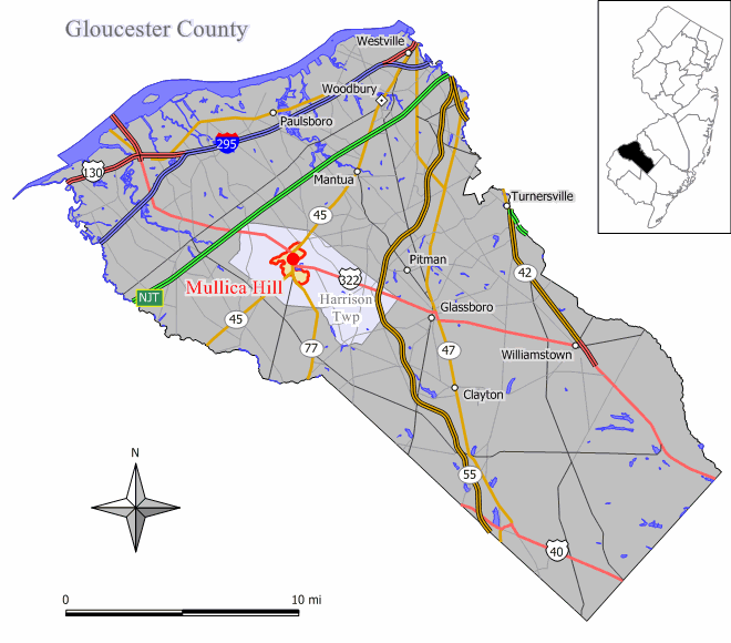
Mullica Hill, New Jersey — CDP — 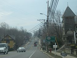 Map of Mullica Hill CDP in Gloucester County
Coordinates: 39°44′16″N 75°13′23″W / 39.73778°N 75.22306°WCoordinates: 39°44′16″N 75°13′23″W / 39.73778°N 75.22306°W Country United States State New Jersey County Gloucester Area – Total 1.2 sq mi (3.1 km2) – Land 1.2 sq mi (3.1 km2) – Water 0.0 sq mi (0.0 km2) Elevation 69 ft (21 m) Population (2000) – Total 1,658 – Density 1,382.0/sq mi (533.6/km2) Time zone Eastern (EST) (UTC-5) – Summer (DST) EDT (UTC-4) ZIP code 08062 Area code(s) 856 FIPS code 34-49440[1] GNIS feature ID 0878657[2] Mullica Hill is a census-designated place (CDP) and unincorporated area located within Harrison Township, in Gloucester County, New Jersey. As of the United States 2000 Census, Mullica Hill population was 1,658.
Contents
History
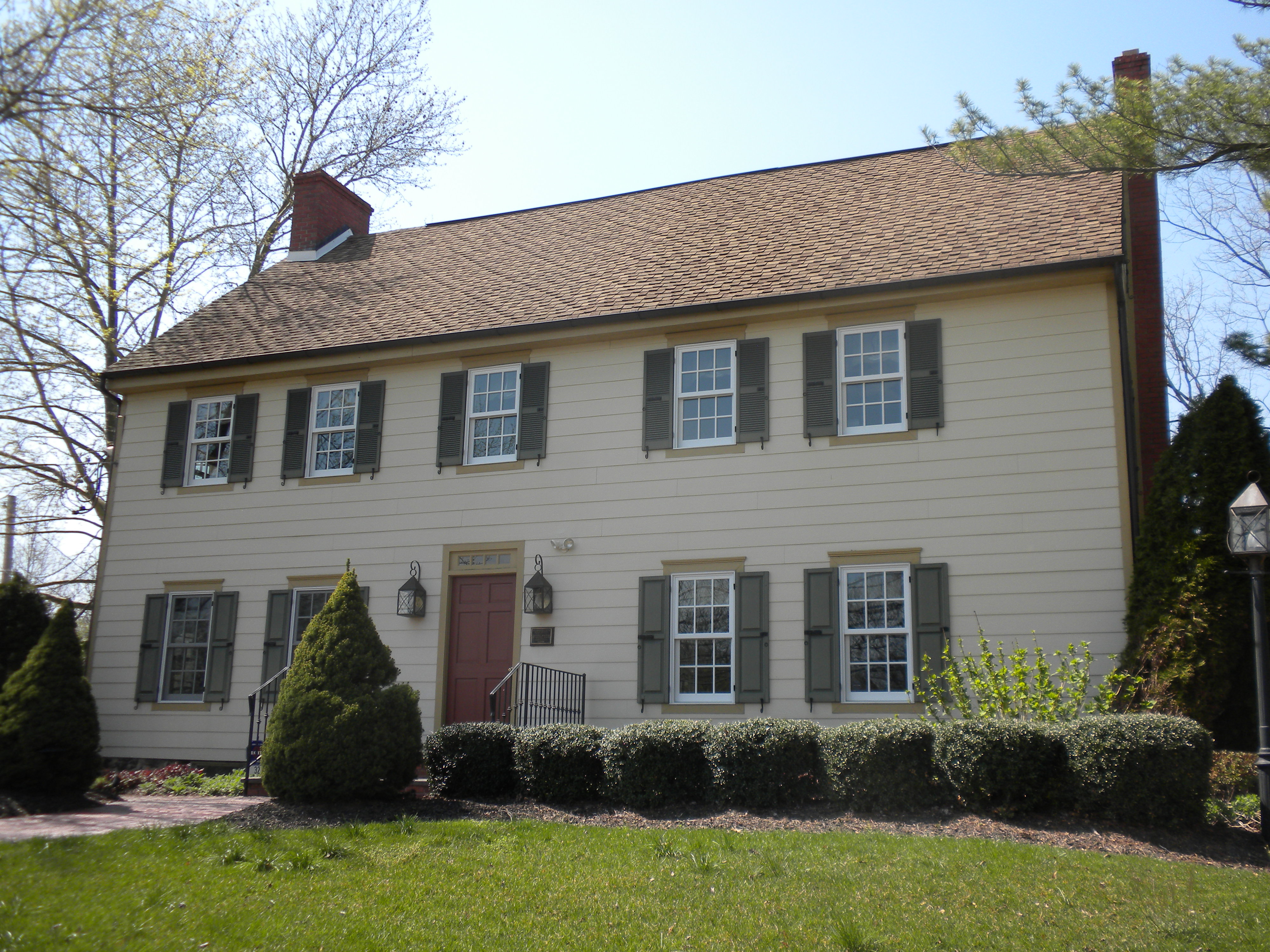
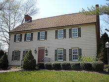 William Mullica House
Spicerville was the name of a village on the south bank of Raccoon Creek, named after prominent landowner Jacob Spicer. Mullica Hill originally referred to the village on the north bank of Raccoon Creek, named after Eric Pålsson Mullica, an early settler who began purchasing land here in 1704. Eventually, both villages became known as just Mullica Hill. Most of Mullica Hill's historic buildings were built following the Civil War. In 1991, the entire village was placed on the National Register of Historic Places.[3]
Geography
Mullica Hill is located at 39°44′16″N 75°13′23″W / 39.737760°N 75.223081°W (39.737760, -75.223081).[4]
According to the United States Census Bureau, Mullica Hill has a total area of 3.1 km2 (1.2 mi2), all land.
Demographics
Historical populations Census Pop. %± 1990 1,117 — 2000 1,658 48.4% source: [5] As of the census[1] of 2000, there were 1,658 people, 697 households, and 432 families residing in the CDP. The population density was 533.5/km2 (1,382.0/mi2). There were 737 housing units at an average density of 237.1/km2 (614.3/mi2). The racial makeup of the CDP was 91.07% White, 6.88% African American, 0.06% Native American, 0.72% Asian, 0.84% from other races, and 0.42% from two or more races. Hispanic or Latino of any race were 2.05% of the population.
There were 697 households out of which 34.6% had children under the age of 18 living with them, 45.8% were married couples living together, 13.2% had a female householder with no husband present, and 37.9% were non-families. 33.9% of all households were made up of individuals and 11.5% had someone living alone who was 65 years of age or older. The average household size was 2.37 and the average family size was 3.09.
The population is spread out with 28.3% under the age of 18, 6.1% from 18 to 24, 33.7% from 25 to 44, 20.9% from 45 to 64, and 11.0% who were 65 years of age or older. The median age was 36 years. For every 100 females there were 82.4 males. For every 100 females age 18 and over, there were 73.3 males.
The median income for a household in the CDP was $38,628, and the median income for a family was $62,321. Males had a median income of $48,295 versus $35,250 for females. The per capita income for the CDP was $22,503. About 6.4% of families and 8.1% of the population were below the poverty line, including 5.4% of those under age 18 and 20.7% of those age 65 or over.
Education
Mullica Hill hosts Harrison Township Elementary School which serves students in grades K - 3 from Harrison Township as part of the Harrison Township School District. It also hosts South Harrison Elementary School which serves grades K-6.
Public school students from Mullica Hill also attend Pleasant Valley School (grades 4 - 6), Clearview Regional Middle School (grades 7 & 8), and Clearview Regional High School (grades 9-12). All are located in Mullica Hill. Students that live in South Harrison in Mullica Hill also attend Kingsway Regional Middle School (grades 7 and 8) and Kingsway Regional High School (grades 9-12).
Friends School Mullica Hill is a private, nonsectarian, coeducational day school located in the Mullica Hill section, serving 273 students in pre-kindergarten through eighth grade.33
Notable residents
See also: Category: People from Gloucester County, New Jersey- Jay Accorsi (born 1963), college football coach at Rowan University.
- John W. Hazelton (1814-1878), represented New Jersey's 1st congressional district from 1871-1875.[6]
- Nathan T. Stratton (1813-1887), represented New Jersey's 1st congressional district in the United States House of Representatives from 1851 to 1855.[7]
References
- ^ a b "American FactFinder". United States Census Bureau. http://factfinder.census.gov. Retrieved 2008-01-31.
- ^ "US Board on Geographic Names". United States Geological Survey. 2007-10-25. http://geonames.usgs.gov. Retrieved 2008-01-31.
- ^ Eric Mullica and his descendants: A Swedish pioneer in New Jersey (Charles J. Werner, New Gretna, NJ: 1930)
- ^ "US Gazetteer files: 2010, 2000, and 1990". United States Census Bureau. 2011-02-12. http://www.census.gov/geo/www/gazetteer/gazette.html. Retrieved 2011-04-23.
- ^ "Population Finder: Mullica Hill CDP, New Jersey". U.S. Census Bureau. http://factfinder.census.gov/servlet/SAFFPopulation?_event=Search&geo_id=16000US3447895&_geoContext=01000US%7C04000US34%7C16000US3447895&_street=&_county=Mullica+Hill&_cityTown=Mullica+Hill&_state=04000US34&_zip=&_lang=en&_sse=on&ActiveGeoDiv=geoSelect&_useEV=&pctxt=fph&pgsl=160&_submenuId=population_0&ds_name=null&_ci_nbr=null&qr_name=null®=null%3Anull&_keyword=&_industry=. Retrieved 2007-03-19.
- ^ John Wright Hazelton, Biographical Directory of the United States Congress. Accessed August 16, 2007.
- ^ Nathan Taylor Stratton. Biographical Directory of the United States Congress. Accessed August 25, 2007.
External links
Municipalities and communities of Gloucester County, New Jersey City 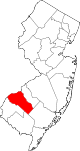
Boroughs Clayton | Glassboro | National Park | Newfield | Paulsboro | Pitman | Swedesboro | Wenonah | Westville | Woodbury Heights
Townships Deptford | East Greenwich | Elk | Franklin | Greenwich | Harrison | Logan | Mantua | Monroe | South Harrison | Washington | West Deptford | Woolwich
CDPs Beckett | Gibbstown | Mullica Hill | Oak Valley | Turnersville | Victory Lakes | Williamstown
Communities Almonesson | Bridgeport | Clarksboro | Cooper | Cross Keys | Ferrell | Franklinville | Greenfields Village | Harrisonville | Hurffville | Malaga | Mickleton | Monroeville | Mount Royal | New Brooklyn | Red Bank | Repaupo | Richwood | Sewell | Thorofare
Categories:- Census-designated places in New Jersey
- Populated places in Gloucester County, New Jersey


Wikimedia Foundation. 2010.