- Pilesgrove Township, New Jersey
Infobox Settlement
official_name = Pilesgrove Township, New Jersey
settlement_type = Township
nickname =
motto =
imagesize =
image_caption =
image_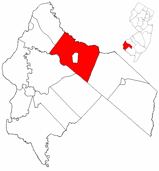
mapsize = 250x200px
map_caption = Pilesgrove Township highlighted in Salem County. Inset
mapsize1 = 250x200px
map_caption1 = Census Bureau map of Pilesgrove Township, New Jerseysubdivision_type = Country
subdivision_name =United States
subdivision_type1 = State
subdivision_name1 =New Jersey
subdivision_type2 = County
subdivision_name2 = Salem
government_footnotes =
government_type =Township (New Jersey)
leader_title =Mayor
leader_name = Ernest A. Bickford
leader_title1 =
leader_name1 =
established_title = Incorporated
established_date =February 21 ,1798 unit_pref = Imperial
area_footnotes =
area_magnitude =
area_total_km2 = 90.8
area_land_km2 = 90.4
area_water_km2 = 0.4
area_total_sq_mi = 35.1
area_land_sq_mi = 34.9
area_water_sq_mi = 0.1population_as_of = 2006
population_footnotes =
population_total = 4534
population_density_km2 = 43.4
population_density_sq_mi = 112.4timezone = Eastern (EST)
utc_offset = -5
timezone_DST = EDT
utc_offset_DST = -4
elevation_footnotes = [Gnis|882132|Township of Pilesgrove,Geographic Names Information System . AccessedJanuary 4 ,2008 .]
elevation_m = 23
elevation_ft = 75
latd = 39 |latm = 39 |lats = 3 |latNS = N
longd = 75 |longm = 18 |longs = 58 |longEW = Wpostal_code_type =
ZIP code
postal_code = 08098
area_code = 856
blank_name = FIPS code
blank_info = 34-58530GR|2 [ [http://mcdc2.missouri.edu/webrepts/commoncodes/ccc_nj.html A Cure for the Common Codes: New Jersey] , Missouri Census Data Center. AccessedJuly 14 ,2008 .]
blank1_name = GNIS feature ID
blank1_info = 0882132GR|3
website = http://www.pilesgrovenj.org
footnotes =Pilesgrove Township is a Township in Salem County,
New Jersey ,United States . As of theUnited States 2000 Census , the township population was 3,923."Pile's Grove" was first mentioned in a deed dated
April 15 ,1701 , through the date of the township's original corporation is unknown. Pilesgrove was incorporated as one of New Jersey's original group of 104 Townships onFebruary 21 ,1798 . Portions of the township were taken onDecember 6 ,1769 to form Pittsgrove Township and onJuly 26 ,1882 to form Woodstown."The Story of New Jersey's Civil Boundaries: 1606-1968", John P. Snyder, Bureau of Geology and Topography; Trenton, New Jersey; 1969. p. 216.]Geography
According to the
United States Census Bureau , the township has a total area of 35.0square mile s (90.8km² ), of which, 34.9 square miles (90.4 km²) of it is land and 0.1 square miles (0.4 km²) of it (0.40%) is water. TheSalem River flows through the township. [DeLorme (2005). "New Jersey Atlas & Gazetteer". Yarmouth, Maine: DeLorme. ISBN 0-89933-324-9.]Pilesgrove Township borders Oldmans Township, Carneys Point Township, Mannington Township, Alloway Township, Upper Pittsgrove Township. The Borough of Woodstown is an independent municipality within the boundaries of Pilesgrove Township.
Pilesgrove Township also borders Gloucester County.
Demographics
USCensusPop
1850=2962
1860=3359
1870=3385
1880=3007
1890=1796
1900=1744
1910=1606
1920=1770
1930=1815
1940=1614
1950=1942
1960=2519
1970=2706
1980=2810
1990=3250
2000=3923
estimate= 4534
estyear=2006
estref= [http://factfinder.census.gov/servlet/SAFFPopulation?_event=Search&geo_id=06000US3402745360&_geoContext=01000US%7C04000US34%7C05000US34027%7C06000US3402745360&_street=&_county=pilesgrove&_cityTown=pilesgrove&_state=04000US34&_zip=&_lang=en&_sse=on&ActiveGeoDiv=geoSelect&_useEV=&pctxt=fph&pgsl=060&_submenuId=population_0&ds_name=null&_ci_nbr=null&qr_name=null®=null%3Anull&_keyword=&_industry= Census data for Pilesgrove township] ,United States Census Bureau . AccessedAugust 14 ,2007 .]
footnote=Population 1930 - 1990. [ [http://www.wnjpin.net/OneStopCareerCenter/LaborMarketInformation/lmi01/poptrd6.htm New Jersey Resident Population by Municipality: 1930 - 1990] , Workforce New Jersey Public Information Network. AccessedMarch 1 ,2007 .] [cite web
url=http://www.census.gov/prod/www/abs/decennial/index.htm
title=U.S. Census Historical Data 1790-2000
accessdate=2007-03-16] [Data for 1790-1840 not available] As of thecensus GR|2 of 2000, there were 3,923 people, 1,216 households, and 994 families residing in the township. Thepopulation density was 112.4 people per square mile (43.4/km²). There were 1,261 housing units at an average density of 36.1/sq mi (13.9/km²). The racial makeup of the township was 84.63% White, 12.18% African American, 0.28% Native American, 0.92% Asian, 0.05% Pacific Islander, 1.07% from other races, and 0.87% from two or more races. Hispanic or Latino of any race were 2.98% of the population.There were 1,216 households out of which 35.4% had children under the age of 18 living with them, 71.1% were married couples living together, 7.0% had a female householder with no husband present, and 18.2% were non-families. 14.9% of all households were made up of individuals and 6.8% had someone living alone who was 65 years of age or older. The average household size was 2.91 and the average family size was 3.24.
In the township the population was spread out with 23.8% under the age of 18, 8.4% from 18 to 24, 27.2% from 25 to 44, 26.2% from 45 to 64, and 14.4% who were 65 years of age or older. The median age was 40 years. For every 100 females there were 107.1 males. For every 100 females age 18 and over, there were 107.9 males.
The median income for a household in the township was $66,042, and the median income for a family was $71,629. Males had a median income of $50,833 versus $31,806 for females. The
per capita income for the township was $27,400. About 2.3% of families and 3.4% of the population were below thepoverty line , including 2.8% of those under age 18 and 2.8% of those age 65 or over.Government
Local government
Pilesgrove is governed under the Township form of New Jersey municipal government. The government consists of three members elected at large in partisan elections to serve three-year terms on a staggered basis, with one seat coming up for election each year. ["2005 New Jersey Legislative District Data Book",
Rutgers University Edward J. Bloustein School of Planning and Public Policy , April 2005, p. 19.] At an annual reorganization meeting, the council selects one of its members to serves as mayor and another as deputy mayor.Pilesgrove Township is governed by a three-member Township Committee. Members of the Pilesgrove Township Committee are
Mayor Ernest A. Bickford,Deputy Mayor Edward J. Kille and William Miller. [ [http://www.pilesgrovenj.org/committee.htm Township Committee] , Pilesgrove Township. AccessedMay 14 ,2008 .]Federal, state and county representation
Pilesgrove Township is in the Second Congressional District and is part of New Jersey's 3rd Legislative District. [ [http://www.lwvnj.org/pubs/CG06.pdf 2006 New Jersey Citizen's Guide to Government] , New Jersey
League of Women Voters , p. 62. AccessedAugust 30 ,2006 .]Education
The
Woodstown-Pilesgrove Regional School District serves nearly 1,700 students public school students from Woodstown and Pilesgrove Township in three schools. Schools in the district (with 2005-06 enrollment data from theNational Center for Education Statistics [ [http://nces.ed.gov/ccd/schoolsearch/school_list.asp?Search=1&DistrictID=3418330 Data for the Woodstown-Pilesgrove Regional School District] ,National Center for Education Statistics . AccessedMay 13 ,2008 .] ) are [http://woodstown.org/mss.html Mary S. Shoemaker Elementary School] for grades preK-4 (514 students), [http://woodstown.org/wms.html Woodstown Middle School] for grades 5-8 (447) andWoodstown High School for grades 9-12 (696). Students from neighboring Alloway Township, Oldmans Township and Upper Pittsgrove Township attend the high school as part ofsending/receiving relationship s. [ [http://education.state.nj.us/rc/rc07/narrative/33/5910/33-5910-000.html Woodstown-Pilesgrove Regional School District 2007 Report Card Narrative] ,New Jersey Department of Education . AccessedMay 14 ,2008 . "...a comprehensive review of our school district's offerings to the Woodstown-Pilesgrove community as well as in the high school sending districts of Alloway, Oldmans, and Upper Pittsgrove."]Notable residents
Notable current and former residents of Pilesgrove Township include:
*Nathan T. Stratton (1813-1887), representedNew Jersey's 1st congressional district in theUnited States House of Representatives from 1851 to 1855. [ [http://bioguide.congress.gov/scripts/biodisplay.pl?index=S000996 Nathan Taylor Stratton] . "Biographical Directory of the United States Congress ". AccessedAugust 25 ,2007 .]References
External links
* [http://www.pilesgrovenj.org/ Pilesgrove Township's website]
* [http://www.salemcountynj.gov/fedstatelocal/pilesgrove.html Pilesgrove Township page on Salem County website]
* [http://www.woodstown.org/ Woodstown-Pilesgrove Regional School District]
*NJReportCard|33|5910|0|Woodstown-Pilesgrove Regional School District
* [http://nces.ed.gov/ccd/schoolsearch/school_list.asp?Search=1&DistrictID=3418330 Data for the Woodstown-Pilesgrove Regional School District] ,National Center for Education Statistics

Wikimedia Foundation. 2010.