- Beed
-
This article is about the municipality in Maharashtra, India. For its namesake district, see Beed district.
Beed
बीड · بیڑ
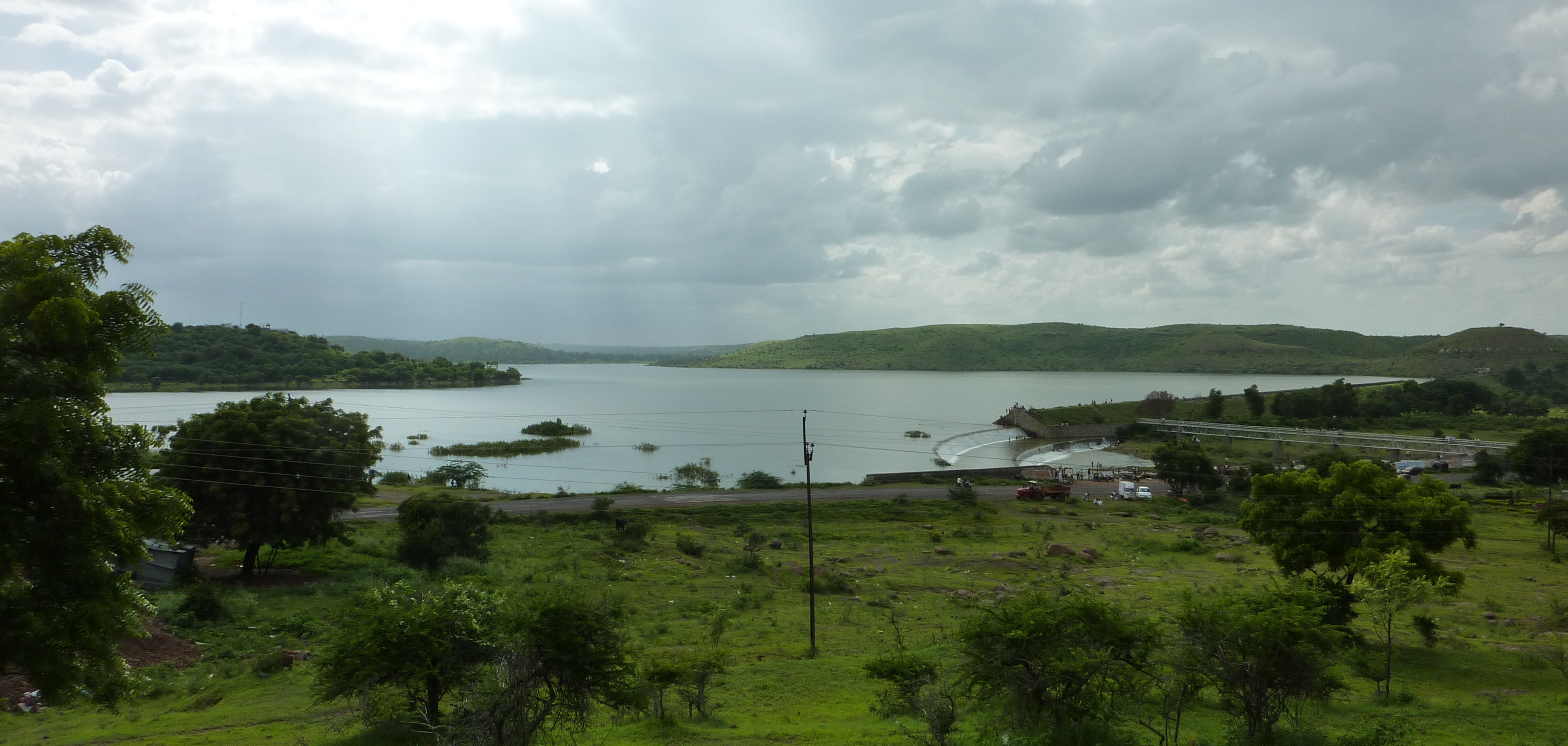
— town — Scenic Bendsura Project on a cloudy evening, viewed from nearby Balaghat hills.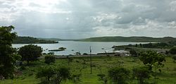
Coordinates 18°59′N 75°46′E / 18.99°N 75.76°ECoordinates: 18°59′N 75°46′E / 18.99°N 75.76°E Country India Region Marathwada State Maharashtra District(s) Beed Settled Possibly 13th century CE President of Municipal Council Bharat Bhushan Kshirsagar Population
• Density
138,091 (295th) (2001[update])
• 1,997 /km2 (5,172 /sq mi)
Sex ratio 923.54 ♂/♀ Literacy 72.26%% Official languages Marathi, Urdu Time zone IST (UTC+05:30) Area
69.15 km2 (27 sq mi)[1]
• 515 metres (1,690 ft)
Climate
• Precipitation
Temperature
• Summer
• WinterBSh (Köppen)
• 666 mm (26.2 in)
• 45 °C (113 °F)
• 15 °C (59 °F)Distance(s)-
• From Mumbai • 402 kilometres (250 mi) E (land) • From Hyderabad • 424 kilometres (263 mi) NW (land) • From Aurangabad, Maharashtra • 130 kilometres (81 mi) SE (land)
Footnotes-
- ^ "Gazetteers Department - Bhir". maharashtra.gov.in (Government of Maharashtra). http://www.maharashtra.gov.in/english/gazetteer/Beed/places_bhir_town.html. Retrieved 2007-02-27.
Website [http://beed.nic.in Peoples beed.nic.in Peoples]
Beed (Marathi: बीड Beed, Urdu: بیڑ Bīr) is a town and administrative headquarters of the district of the same name located in central Maharashtra state of India. According to 2001 census, it is the largest urban area in the district with a population of 138,091.[1] Calculated population of 2010 is 161,604.[2] It ranks 295th in population in India.[3] Nearly 36% of the district’s urban population lives in the town alone. It has witnessed roughly 23% population growth during 1991–2001 decade.
Its official name is Beed, though; Bhir, Bir, Bīr, Bid or Bīd can also be seen sometimes in official and unofficial documents and seals. Some references like Encyclopædia Britannica refer it as Bhir, Encyclopedia Encarta as Bīr and Google Maps as Bir while it is found at World Gazetteer as Bīd. In 1990s during the government of right wing Hindu party Shiv Sena in Maharashtra, Beed town was proposed to be renamed as Champavatinagar, which is said to be its old name.
Beed's early history is obscure. Historians speculate based on archaeological remains that the town might have been founded by the Yadava rulers (1173–1317) of Devagiri (now Daulatabad). Beed town was a part of the State of Hyderabad (Asaf Jahi Kingdom) of Nizams. After independence the state was annexed to India in September 1948 following a military action. Beed remained in Hyderabad state until 1956 when it was included in Bombay Presidency. On May 1, 1960 Maharashtra state was created on linguistic basis and Marathi dominant Beed town became part of Maharashtra.[4][1]
There are several historical buildings located in the town of which Kankaleshwar temple is the most famous. There are remains of citadel wall which protect a part of the old town from rare but violent floods of Bendsura river. As district headquarters, the town has several district and local administrative offices including district and municipal councils, district and session courts and offices of district collector and superintendent of police. Hospitals, schools and colleges including professional training colleges are also located in the town.
Topography and Climate


Panoramic view of a part of Beed town from the eastern hills on a rainy day. Beed is situated on the Deccan Plateau 18°59′N 75°46′E / 18.99°N 75.76°E, on the banks of Bendsura river (also called Bindusara) which is a sub-tributary of Godavari river. Bendsura originates in the hills of Balaghat range, 30 km south-west of the town near the village of Waghira. The river divides the town into smaller eastern and larger western parts. Balaghat Range stretches very close, up to 10 km south of the town making terrain; mainly in the eastern part, undulating. Soil is coarse and rocky largely consisting of basalt. Thin layers of fertile black soil are also seen in the northern part and in the south at the western bank of Bendsura. The town has Semi-arid, hot and dry climate consisting of mainly three seasons. Summers are long, ranging almost five months from mid February to June. Temperatures in summer fall between 31 °C (87.8 °F) - 40 °C (104 °F) (1997 average). However, it may reach higher than 40 °C in searching summer. May is the hottest month of a year with an average day temperature of 42 °C (107.6 °F) in the district. Winters are short with temperatures ranging within 12 °C (53.6 °F) - 20 °C (68 °F). December is the coldest month in a year. Occasionally, due to northern cold waves temperature may fall as low as 3 °C (37.4 °F) or 4 °C (39.2 °F). Relative humidity in winter is the lowest and December is the driest month in a year with the relative humidity as low as 30%. Rains are scarce and occur only during the Monsoon from mid June to September. Annual average rainfall is 66.6 cm (26.22 inches).[1] The average rain fall has got a drop of 9.6 cm from the averages recorded during 1900s.[5] Average number of rainy days in a year is 41. September gets the maximum rainfall in a year while July has the maximum rainy days. Highest rainfall recorded in 24 hours (19.18 cm) occurred on August 17, 1887.[6]
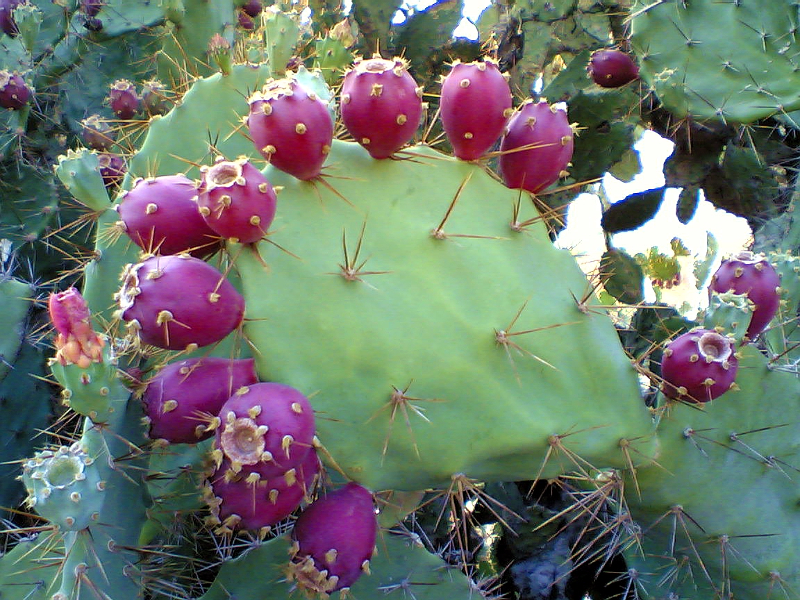
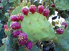 Prickly Pear Cactus — a kind of common vegetation found in the hills of Balaghat Range
.
Bendsura is a rapid and seasonal river. Aiming irrigation and drinking water supply to the town, a reservoir Bendsura Project (capacity 7.106 mm3) was constructed on the river in 1955 near the village Pāli, about 10 km south of the town.[7] At some places in the town, the river is narrow and looks like a stream. The lack of vegetation and rocky and undulating terrain contributes to violent floods in heavy rains. These have repeatedly caused substantial loss of property and life in the history of the town, most recently on July 23, 1989 when a massive flooding of three habitations in the town caused a number of dead or missing and property losses of millions of rupees.[8] Beed falls under Seismic Hazard Zone-III in India according to the new seismic hazard map updated in the year 2000 by the Bureau of Indian Standards. Before this update, the town was under Zone-I.[9]
History
Beed is a historical town of possibly medieval origin, in Maharashtra, India. Few historians have mentioned it as it never became a place of importance. Rulers, almost always, ignored it perhaps because of its unimportant location.
Historical Accounts
The first historical mention of the town came in the Tārīkh-e-Firishta (original name Gulshan-e-Ibrahimi) compiled by Muhammad Qasim Firishta (1560–1620), a 17th century Persian-Indian historian. Famous English translation of this book History of The Rise of Mahomedan Power in India by John Briggs has been published several times in India and abroad. Firishta has given little but valuable information about the town of his time. He has also mentioned the famous Kankaleshwar temple in detail. In 1317 AH (1898), Qazi Muhammad Qutbullah, a resident and Qazi of Beed wrote a detailed history of Beed town (Tārīkh-e-Bīr) in Urdu based on the accounts available at that time. Copy of this book, now can only be found in the State Archives, Library of Salar Jang Museum and Library of Osmania University; all in Hyderabad. However, first detailed history of the town Riyāz-ul-Abrār (Garden of the Virtuous) was written by Qazi Muhammad Fakhruddin in 1152 AH (1739). Unfortunately this book is not available in the libraries for reference. However, Qutbullah has quoted this book in his Tārīkh-e-Bīr (History of Beed) and also has referred for the accounts. In 1361 AH (1942) Syed Basit Ali, a resident of Beed, who was a student of intermediate in the City College of Hyderabad, wrote a brief history Tārīkh-e-Bīr in Urdu. Its copies can be found in the library of Osmania University. In recent times Abdul Hamīd Nathapuri wrote Zila Bīr Kī Tārīkh (history of Beed district) in Urdu which is published in 1998 from Mumbai. His book gives accounts of mainly Beed town and is largely based on Qutbullah’s accounts and oral traditions. Some historical accounts can also be found in the gazette of Beed district published in 1969 by the Gazetteers Department of Beed district. This Gazette is now out of print but available online at the government of Maharashtra website. The Imperial Gazetteer of India, compiled during the British rule also gives some important details of the town and the district.
Foundation and name
The history of the foundation of the town is unknown. According to legend, Beed was an inhabited place in the period of Pandavas and Kurus as Durgavati. Its name was subsequently changed to Balni. Champavati, who was sister of Vikramaditya, after capturing it renamed as Champavatinagar. After that the town fell to Calukya (Chalukya), Rashtrkuta and Yadava dynasties before felling to the Muslim rule. However, some scholars say that it was possibly founded by the Yadava rulers of Devagiri (now Daulatabad). Tārīkh-e-Bīr (history of Beed) mentions that Muhammad bin Tughluq named it Bir (Arabic ‘Well’) after building a fort and several wells in and around the town.[4][8][10] Until recent times, wells were abundant in the town. Because of modern facilities of water supply they became less important and subsequently most of them were filled. It is unclear that as to how the present name Beed came into use. There are at least two different traditions. The first tradition says that since the district is situated at the foot of Balaghat Range as if it is in a hole, it was named as Bil (Marathi for hole) which in course of time corrupted to Bid. According to the second tradition a Yavana ruler of ancient India, named it Bhir (Persian for Water) after finding water at a very low depth [4] and Bhir might have become Beed in course of time. The first tradition seems to be untrue, because with no angle, the entire district can be called a ‘hole’. Only north eastern part of the district is at lower heights and a vast area of 10,615 km² can not be called a ‘hole’ just because of slight depression. Furthermore, Bil (hole) in Marathi is spoken for a deep and narrow hole not for a slight depression. The second tradition though, have some distortion, appears to be true and in accord with Tārīkh-e-Bīr of Quazi Muhammad Qutbullah (1898). The word ‘Yavana’ in early Indian literature meant a Greek or any foreigner. At a much later date it was frequently applied to the Muslim invaders of India.[11] It is quite possible that Muhammad bin Tughluq may have been referred in this tradition as Yavana ruler. Muslims invaded and ruled the Deccan for centuries and almost all Muslim rulers had Persian as their court language. It seems that Arabic 'Bir' was eventually pronounced ‘Bhir’ in the Indian languages and the people mistakenly took this Arabic word as Persian for the court language of the rulers was Persian. Until recent times after independence, the town was called ‘Bir’ and ‘Bhir’ in the official documents. Beed District having Taluka: 1.Ashti 2.Beed 3.Kaij 4.Ambajogae 5.Gevrai 6.Majalgaon
Historical events
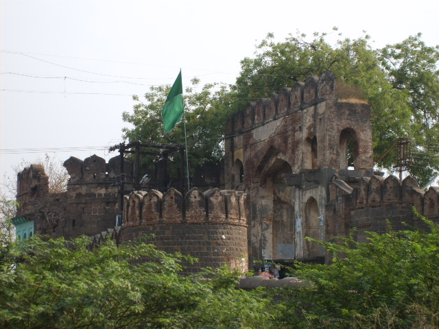
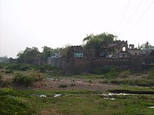 Degenerating wall of ancient citadel and its Burjs — An unfortunate shield for the violent floods of Bendsura for the fortunate dwellers of the town.
According to legend, when Ravana, demon king of Lanka (Sri Lanka), abducted Sita (wife of Hindu deity Rama) and was taking her to Lanka, Jatayu (eagle) tried to stop him. Ravana cut its wings and wounded Jatayu fell on the ground. When Rama reached there in search of his beloved wife, Jatayu told him the whole story and died. The place where he died is said to be in Beed town and Jatashankar temple is standing at the place, which is; according to scholars, possibly built by Yadavas of Devagiri.[4] Another legend also narrates that Beed was called Durgavati in the period of Pandavas and Kurus who fought a devastating war of Mahabharata.
Early history
Early history of the town is obscure until it came under Tughluq rule. If the town was founded in Yadava era then possibly it happened in king Singhana's (1210–47) period, when Yadava dynasty reached its height. He may have built the town and Kankaleshwar temple as well. Beed came under Muslim rule for the first time in 1317 when Qutb-ud-Din Mubarak Shah (1316–20), the last Khilji, captured Devagiri and Yadava dynasty was annexed to Khilji dynasty. Beed remained under Khiljis until 1320 when Ghiyas-ud-Din Tughluq (1320–25) took over. In 1327 Muhammad bin Tughluq (1325–51) made Daulatabad his capital. Tughluq and his army camped in the town in 1341 (AH 742 Islamic calendar) while on the journey back to Daulatabad from Warangal. The emperor lost one of his teeth here, which he ordered to be buried with much ceremony and a tomb was constructed at the place.[12] The tomb is still present in very poor condition near the village Karjani about 13 km south of the town. Juna Khan one of the governors of Tughluq empire is said to have resided in Beed for quite some time and introduced many reforms for the welfare of the ruled. He diverted the course of Bendsura from west to east by constructing a protection wall around the town. Before his time there was no such protection for the town and it was situated on the eastern bank of the river. After that the population was largely shifted to the western part.[10] In 1347 Beed came under Bahmanid rule when Hasan Gangu (1347–58), founder of Bahmanid Sultanate, rebelled against Tughluq rule and ascended throne of Daulatabad as Ala-ud-Din Bahman Shah. Muhammad Tughluq acted vigorously and came to Deccan to subdue the rebels. He recaptured the province of Daulatabad, of which, Beed was a part. Hasan Gangu and other insurgents fled to Bidar and Gulbarga. Before the matter is fully settled a rebel broke in Gujarat and the sultan approached to Gujarat appointing Imad-ul-Mulk as governor in Deccan. Meanwhile Hasan Gangu attacked Daulatabad and marched towards Beed and captured it. After that the town remained under Bahmanid rule and is said to be flourished under Firuz Shah Bahmani's (1397–1422) rule. During the reign of Humayun Shah Bahmani (1451–61), famous as Zālim (cruel), his brother Hasan Shah rebelled and came to Beed. A Jagirdar (feudatory) of Beed, Habibullah Shah was his supporter. Humayun Shah sent an army and after a fierce fighting in the grounds of Kankaleshwar temple, the rebellion armies defeated Humayun's army. Humayun became furious and sent another force to defeat the rebels. This time rebels were defeated, Habibullah Shah was killed and captured Hasan Shah was taken to the capital and was put before a hungry lion.[8]
1600 CE to 1858 CE
After the decline of Bahmanid Sultanate the town fell to Nizam Shahi rulers of Ahmadnagar. Several wars were fought in Beed between Nizam Shahi and Adil Shahi rulers of Bijapur to take the control of Beed. In 1598 Mughals captured Beed from Chand Bibi of Ahmadnagar. A year later Nihang Khan retook it but soon it fell again to Mughals. Mughal army camped here for some time. During the reign of Jahangir (1569–1627), Jan Sipar Khan was administering Beed town. He constructed Jama Masjid of Beed in 1036 AH (1627). Aurangzeb (1658–1707), appointed Haji Sadar Shah in Beed as Naib-e-Subadar (assistant of governor). Sadar Shah did some good changes and constructions in the town. He built Eid Gah (place of Eid prayer) in 1702 and a new habitation on the heights in the eastern part as Ghazi Pura (now Islam Pura) in 1703. The remains of it are still visible. He also constructed a small citadel (1703) inside the old large citadel which was worn out after standing for several hundred years, from Tughluq period. A stone plate in Persian script at the main entry of Jama Masjid sets the year of construction of citadel by Haji Sadar Shah in the year 1115 AH (1703). In his period economy of the town also flourished. Chhagal (water container made of leather), Gupti (hidden sword in wooden stick) etc. made in Beed were popular in the region.[10]
 This main entrance of Shahinshah Wali tomb was constructed by Amīr Nawāz Jang in 1830.
Beed was quite a beautiful town during Bahmanids and Mughals. Tārīkh-e-Bīr mentions many gardens and amenities of these periods. Until 1960s there were two well maintained gardens in the town. In 1724 Nizam-ul-Mulk Asaf Jah founded Asaf Jahi kingdom, seizing Deccan against the rule of Mughal emperor Muhammad Shah (1719–48). In Nizams' era no major addition or construction was done to the citadel because the old building was serving the purpose and the citadels were losing importance with the advent of modern fighting techniques. Maratha ruler of Gwalior, Mahadji Scindia (1761–94) was defeated and severely injured and was missing in the third war of Panipat in 1761. His wife, who is said to be from Beed, went to a Muslim Sufi of Beed Mansur Shah and told him to prey for the return of Mahadji. After return to Gwalior Mahadji called Mansur Shah to Gwalior but he refused and sent his son Habib Shah instead. Mahadji remained thankful to Mansur Shah for all his life. His tomb is in eastern Beed. Reign of sixth Nizam Mir Mahbub Ali Khan (1869–1911) proved eventful in the history of Beed. Rebels, great famine and floods happened in his reign. Jagirdars were replaced by Awwal Taluqdars (Collectors) in his father's reign and Jivanji Ratanji came as the first collector of Beed in 1865. Districts were created and Beed district was formally settled in 1883.[5] He constructed one habitation and market Mahbub Gunj (now Hiralal Chowk) on the eastern bank of Bendsura, remains of that can still be seen. After a very scarce rainfall in three successive years 1897-99, great famine occurred in Beed in 1900. Thousands of cattle and Hundreds of humans died of starvation and thousands migrated to the neighbouring parts of the country. The census in 1901 reported remarkable decrease of 150,464 in the population of Beed district.[5] Mir Osman Ali Khan (1911–48) came after his father's death. Kotwalis, Police Stations, Schools, Hospitals and Dispensaries were built during his period.[13] Nizams were allies of the British Empire in India. During the countrywide movement for independence, in 19th and 20th centuries they tried to suppress the feelings of nationalism which were spreading due to nationwide efforts of the freedom fighters. Nationalists in the state of Hyderabad did not like Nizam's friendship with the oppressor British Empire. Beed was the first place in Marathwada region where freedom struggle started in 1818.[14] In 1818 during the rule of Nizam Sikandar Jah (1803–29) first rebel broke out in Beed under the leadership of Dharmaji Pratap Rao. Nizam sent the Risala of Navab Murtaza Yar Jang under the command of British Lieutenant John Sutherland. The rebel leader and his bother were captured and a long run rebellion movement in Beed came to an end.[14][15]
1858 CE to Present

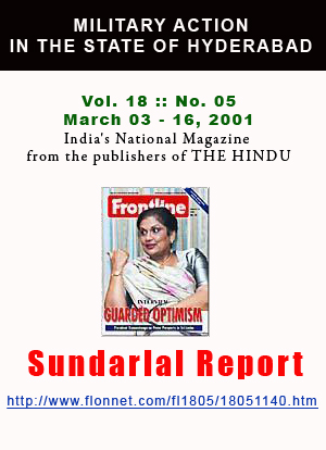
Another rebel broke in 1858 and all the rebels were captured. After that many small incidents of defiance happened against British rule but all were suppressed by force. A major rebel broke under the leadership of Baba Sahab alias Rao Sahab in 1898. The important leaders of this movement were Brahmins of Beed and the Brahmin officials in police and judiciary also supported the movement. They were dreaming of Brahmin rule and started collecting money for arms by looting and donations in different parts of the district. But after a short fight the rebels were captured and the movement came to an end. But the feelings of defiance could not be suppressed and different movements under the leadership of Swami Ramanand Teerth and Govind Bhai Shroff continued in Marathwada and the state. After independence, Mir Osman Ali Khan was reluctant to join the Indian Union. Finally, on September 12, 1948 a military action Operation Polo was launched and the state was easily captured within six days as Nizam's army resisted little. Although Operation Polo caused relatively few casualties, the following communal carnage was all the more terrible. Beed was one of the eight worst hit districts in the state. After calm down, a team visited the town on behalf of Indian government and sent a report to the centre. According to official, Sundarlal Report, 27,000-40,000 Muslims were killed throughout the state. Horrible crimes of abduction and rape of women and girls, loot, arson, desecration of mosques, forcible conversions and seizure of houses and lands were mentioned in the report.[16] Some unofficial reports, however, puts the figure of killings up to 50,000 and some even to a few hundred thousand.[17] A plebiscite was held shortly after the military action in which the population voted overwhelmingly in favour of joining the Indian Union. Many Muslims during and after 1948 migrated to Pakistan. The town has witnessed communal strife several times in modern India. In 1949 Bendsura Project was launched to provide drinking and irrigation water supply to the town and nearby villages. The project was completed in 1956. In 1952 Beed Nagar Pālika (Municipal Council) was established under the undivided Hyderabad State. In 1962, a year after the creation of Maharashtra State, Beed Zila Parīshad (District Council) came into being after dissolving all the local bodies.[4]
Chronology
- 13th Century (possibly) - Beed town was founded.
- 13th/14th Century (possibly) - Kankaleshwar temple was built.
- 1317 - Beed falls to the Khiljis as Qutb-ud-Din Mubarak Shah captures Devagiri.
- 1327 - Beed came under Tughluqs.
- 1341 - Emperor Muhammad Tughluq came to the town. On his order the citadel was built, the flow of Bendsura was turned to the south, several wells were dug in and around the town and the town was named Bir.
- 1347 - Beed comes under Bahmanid rule as Ala-ud-Din Bahman Shah founds Bahmani Sultanate.
- 1455(roughly)- a fierce war was fought between Humayun Shah Zālim and Hasan Shah in the grounds of Kankaleshwar temple. Ruler Humayun was defeated. Humayun sent another army and the rebel was captured.
- 1499 - Beed was annexed to the Nizam Shahi dynasty of Ahmadnagar after the capture of Daulatabad.
- 1583 - Khazana Well constructed.
- 1598 - Mughal captures Beed from Chand Bibi of Ahmadnagar.
- 1627 - Jama Masjid was constructed by Jan Sipar Khan.
- 1702 - Eid Gah (place of Eid prayer) was built.
- 1703 - New citadel inside the old fort and a new habitation on the eastern heights were built during the rule of Aurangzeb.
- 1724 - Beed became part of Asaf Jahi kingdom (Hyderabad state) as Nizam-ul-Mulk Asaf Jah-I seize Deccan.
- 1739 - Qazi Muhammad Fakhruddin writes a detailed history of Beed town by the name 'Riyāz-ul-Abrār' (Garden of the Virtuous) in Urdu.
- 1818 - Rebel brakes under the leadership of Dharmaji Pratap Rao. British Lieutenant John Sutherland comes with army and captures the rebel.
- 1835 - Massive flood hits the town. Kotwali Gate and adjacent wall was constructed as a protection from frequent violent floods.
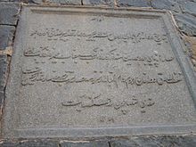 Katba — A stone plate carved in Persian at the Kotwali gate states the date of flood and construction of protection wall as 1251 AH (1835).
- 1858 - A small rebel breaks but all the rebels were captured.
- 1865 - Jivanji Ratanji became the first collector of Beed as the feudatory system was abolished by Nizams.
- 1883 - Beed district was formally settled.
- 1898 - A rebel broke under the leadership of Baba Sahab alias Rao Sahab. The rebels were captured.
- 1898 - Qazi Muhammad Qutbullah, a resident and Qazi of Beed wrote a detailed history of Beed town (Tārīkh-e-Bīr) in Urdu.
- 1898 - 1900 - Great famine occurs in Beed. Hundreds of humans and thousands of cattle die.
- 1942 - Syed Basit Ali wrote a brief history of Beed town in Urdu.
- 1947 - India gains independence.
- 1948 - Operation Polo was launched to take the Hyderabad State in the Indian Union on September 12. During the operation communal strife breaks and thousands killed in the carnage.
- 1949 - Bendsura project was launched.
- 1952 - Beed Nagar Pālika (Municipal Council) established.
- 1956 - Bendsura project completed.
- 1962 - Beed Zila Parīshad (District Council) came into being.
- 1969 - First Gazette of Beed district under the modern India was published.
- 1982 - Television transmission station was constructed.
- 1982 - Area of 43 villages from Beed district was given to a newly created Latur district.
- 1989 - Massive flood wipes out three habitations in the town. Several died or missing, properties of worth millions of rupees destroyed.
- 1994 - Beed came in headlines world wide after the breakout of Bubonic Plague.
- 1998 - Abdul Hamīd Nathapuri wrote a history of Beed district (Zila Bīr Kī Tārīkh) in Urdu.
- 2002 - 23rd National junior Kho-Kho championship was held.
- 2004 - First mobile phone service started in the town.
Historical buildings
Kankaleshwar Temple
It is perhaps the oldest and the most beautiful building in the town. Historians are not sure about the construction period of this temple. The architectural style suggests that it might have been constructed during Yadava period.,[4] most probably during the reign of Singhana (1210–47), who also founded Devagiri (Daulatabad). The design of this temple has some close similarities to the temples at the famous caves of Ellora. Situated in the middle of a small lake in the eastern part of the town, the temple is built with black stone and is carved with excellent human and divine figures. A fair is held in the grounds of temple during Mahashivratri.
Jama Masjid (Mosque)
Built during the period of Mughal emperor Jahangir (1605–27) by his official in Beed Jān Sipār Khan in 1036 AH (1627), it is one of the largest mosques in Beed. Situated in the centre of the town at Quila (citadel) it has three huge domes and four minarets.[8]
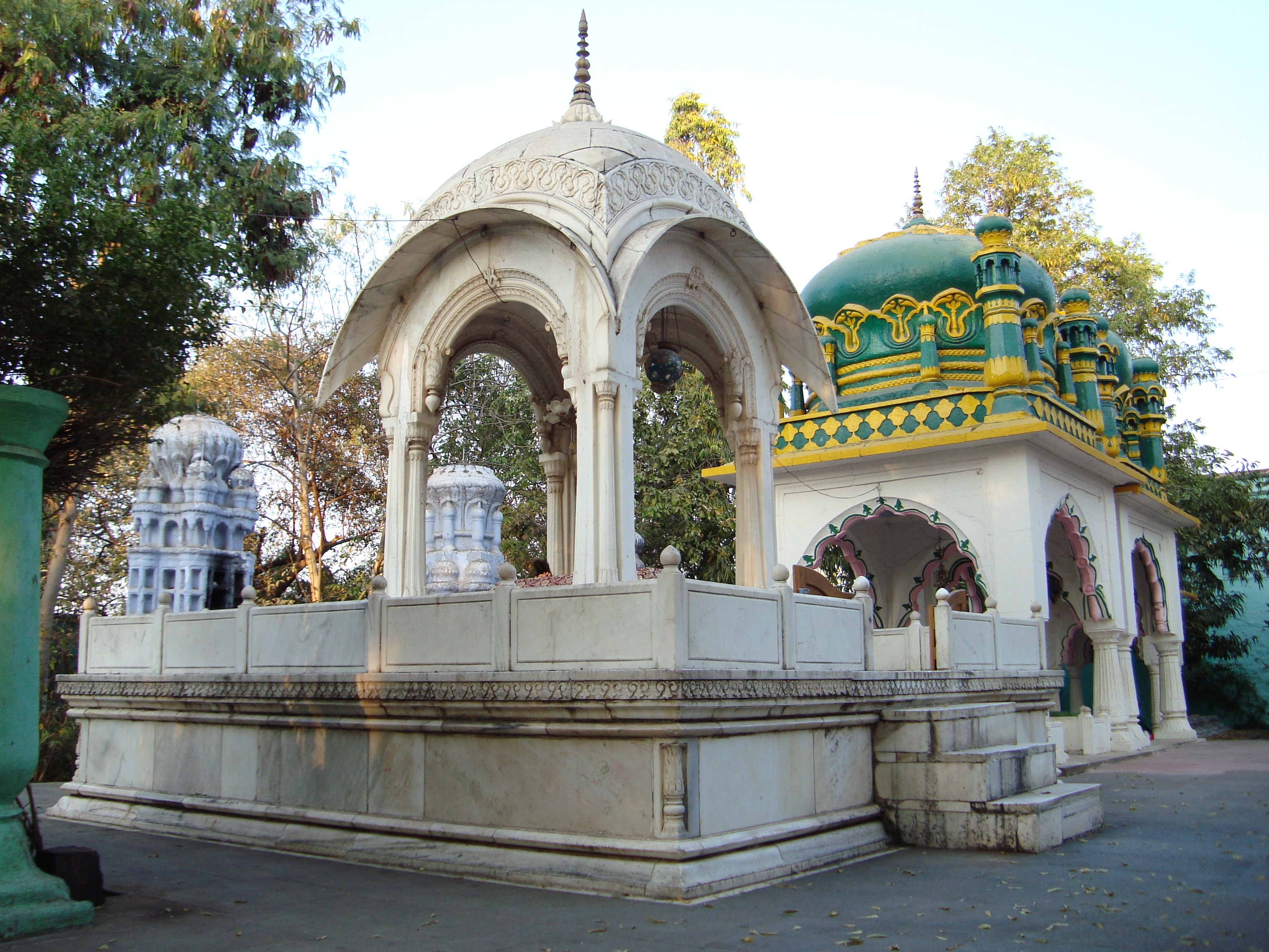
Shahinshah Wali tomb
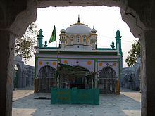 Shahinshah Wali tomb — dome on the grave of Sufi Shahinshah wali.
Shahinshah Wali was a Sufi of 14th century. He came to Beed during the rule of Muhammad Tughluq. His tomb and surrounding areas were built in different periods from 1385–1840. The details can be seen in the history of Beed. It is situated on the eastern elevations. Each year an Urs (fair) is held here on 2nd day of Rabi’ Al-Awwal, third month of Islamic calendar.[8]
Khandoba Temple
It is situated on the eastern hills. Built in Hemadpanti style, it is often regarded as the symbol of town. Two symmetrical, octagonal dīpmal (tower of light) rising 21.33 meters (70 ft) are standing in front of the temple. Towers have carved figures of humans and animals, now most of them defaced. There are two stories about the construction of this temple. One says that it was built by Sultanji Nimbalkar a Jagirdar of Nizam era. The other says that it was built by Mahadji Scindia. Tārīkh-e-Bīr (History of Beed) mentions it with Nimbalkar.[10]
Mansur Shah tomb
Mansur Shah was 18th century Sufi of Suharwardy clan of Sufis. He is said to be a Dharma Guru (spiritual teacher) of Mahadji Scindia. His tomb is in the eastern part of Beed near Khandeshwari temple. Dome of the shrine is made of marble.[8]
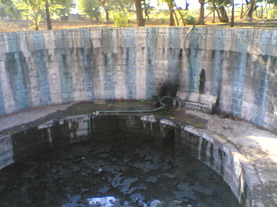
Khazana Well
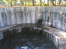 Khazana well — once famous and maintained, now is full of dirty water.
This historic and famous well is situated about 6 km south of the town. It was constructed in 991 AH (1583) by Salābat Khan, a Jagirdar of Beed in the period of Murtaza Nizam Shah of Ahmadnagar. It is said that the water level in this well remains unchanged even in droughts.[8] Three currents of water start from the well and irrigate the land of Barg o Zār (meaning 'Leaves and Flowers', pronounced in colloquial as Balguzār) around the town. During droughts municipality of the town take water from this well and supply it to some parts of the town and surrounding villages. Salābat Khan also constructed Kāranja (fountains) and a garden in the centre of the town. Tower of Kāranja is still standing in the middle of the town in a very bad condition.
Historic Gates
 Bāb-uz-Zafar (Gate of success) — now known as Kotwali Ves (Kotwali gate) was built in 1835 on the western bank of Bendsura. The gate is now in poor condition and the adjacent Fatah Burj on left is almost gone.
The town had several gates and a small fort in the past.[8] Now only four are remaining and are in poor condition. Only one out of several were built in the eastern part in Mahbub Gunj (now Hiralal Chowk). Kotwali gate (known as Kotwali Ves) is situated at the western bank of river Bendsura. This has got its name because a police station (Kotwali) was situated adjacent to the gate. Another gate, which is also in a bad condition, is found at Quila near Milliya campus. Fourth gate is in Bashīr Gunj area and perhaps is in a little better condition than the other gates, most probably due to the grave on its Burj which is said to be of some Sufi Buland Shah.
Historical buildings
Kankaleshwar Temple
It is perhaps the oldest and the most beautiful building in the town. Historians are not sure about the construction period of this temple. The architectural style suggests that it might have been constructed during Yadava period.,[4] most probably during the reign of Singhana (1210–47), who also founded Devagiri (Daulatabad). The design of this temple has some close similarities to the temples at the famous caves of Ellora. Situated in the middle of a small lake in the eastern part of the town, the temple is built with black stone and is carved with excellent human and divine figures. A fair is held in the grounds of temple during Mahashivratri.
Jama Masjid (Mosque)
Built during the period of Mughal emperor Jahangir (1605–27) by his official in Beed Jān Sipār Khan in 1036 AH (1627), it is one of the largest mosques in Beed. Situated in the centre of the town at Quila (citadel) it has three huge domes and four minarets.[8]
Shahinshah Wali tomb
Shahinshah Wali tomb — dome on the grave of Sufi Shahinshah wali.Shahinshah Wali was a Sufi of 14th century. He came to Beed during the rule of Muhammad Tughluq. His tomb and surrounding areas were built in different periods from 1385–1840. The details can be seen in the history of Beed. It is situated on the eastern elevations. Each year an Urs (fair) is held here on 2nd day of Rabi’ Al-Awwal, third month of Islamic calendar.[8]
Khandoba Temple
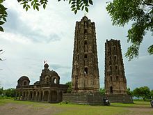 Khandoba Temple often regarded as the symbol of the town stand in a bad condition on the eastern hills in Beed town.
It is situated on the eastern hills. Built in Hemadpanti style, it is often regarded as the symbol of town. Two symmetrical, octagonal dīpmal (tower of light) rising 21.33 meters (70 ft) are standing in front of the temple. Towers have carved figures of humans and animals, now most of them defaced. There are two stories about the construction of this temple. One says that it was built by Sultanji Nimbalkar a Jagirdar of Nizam era. The other says that it was built by Mahadji Scindia. Tārīkh-e-Bīr (History of Beed) mentions it with Nimbalkar.[10]
Mansur Shah tomb
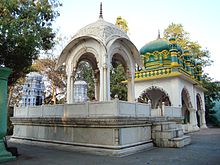 Mansur Shah tomb in the eastern part of Beed town.
Mansur Shah was 18th century Sufi of Suharwardy clan of Sufis. He is said to be a Dharma Guru (spiritual teacher) of Mahadji Scindia. His tomb is in the eastern part of Beed near Khandeshwari temple. Dome of the shrine is made of marble.[8]
Khazana Well
Khazana well — once famous and maintained, now is full of dirty water.This historic and famous well is situated about 6 km south of the town. It was constructed in 991 AH (1583) by Salābat Khan, a Jagirdar of Beed in the period of Murtaza Nizam Shah of Ahmadnagar. It is said that the water level in this well remains unchanged even in droughts.[8] Three currents of water start from the well and irrigate the land of Barg o Zār (meaning 'Leaves and Flowers', pronounced in colloquial as Balguzār) around the town. During droughts municipality of the town take water from this well and supply it to some parts of the town and surrounding villages. Salābat Khan also constructed Kāranja (fountains) and a garden in the centre of the town. Tower of Kāranja is still standing in the middle of the town in a very bad condition.
Historic Gates
Bāb-uz-Zafar (Gate of success) — now known as Kotwali Ves (Kotwali gate) was built in 1835 on the western bank of Bendsura. The gate is now in poor condition and the adjacent Fatah Burj on left is almost gone.The town had several gates and a small fort in the past.[8] Now only four are remaining and are in poor condition. Only one out of several were built in the eastern part in Mahbub Gunj (now Hiralal Chowk). Kotwali gate (known as Kotwali Ves) is situated at the western bank of river Bendsura. This has got its name because a police station (Kotwali) was situated adjacent to the gate. Another gate, which is also in a bad condition, is found at Quila near Milliya campus. Fourth gate is in Bashīr Gunj area and perhaps is in a little better condition than the other gates, most probably due to the grave on its Burj which is said to be of some Sufi Buland Shah.
Demographics
As of 2001[update] India census,[18] Beed town had a population of 138,091. Male population is 71,790 and females constitute 66,301. There are 923.54 females per thousand males in the town. Birth rate is 15.9 which is lower than the national average of 22. Death rate is 3 which is lower than the national average of 8.2. Infant mortality rate is 71 per thousand live births which is much higher than the national average of 54.6 deaths for thousand live births. Maternal mortality rate however, is 1 which is extremely lower than the national average of 540.[19] Beed district has got the lowest sex ratio in Maharashtra State. Beed has the lowest male-female sex ratio in the age group of 0–6 years (801 as against 1000 male children) as per the 2011 census. Maharashtra's sex ratio in the age group of 0–6 years is 883 girls as against 1000 boys.[20]
Even this small town is an evidence of India’s religious and cultural diversity. 69.15 km² of land is home for Hindu, Muslim, Buddhist, Jain, Christian and Sikh communities. A calculated Hindu population in the town comprises around 40% - 41%. 12,307 Hindus were living in the town in 1901, which was 69.64% of the then population.[5] This proportion was reduced after a mass conversion of Dalits to Buddhism and Christianity. Moreover, Jain population was also considered as Hindu at that time. Nearly 25% of population in Beed comprises Muslims.[21][22] 4,993 Muslims were living in the town in 1901 which was 28.25% of the then population.[5] Calculated Muslim population in Beed as per 2001 census reaches 34522. Percentage of Dalit (Scheduled Casts & Scheduled Tribes) population in the district is 14.13% (SC 13.01% - ST 1.12%) in the 2001 census.[1] Calculated Dalit population in the town as per 2001 census is 19512. By religion, nearly all Dalits are Buddhist; however, some still follow Hindu customs. A Buddhist temple is located at Mali Chowk area. According to Crusade Watch there were 662 Christians living in the town in the year 2000 which was 0.5% of the then population.[23] In 1901 only 68 Christians were living in the town and most of them were native.[5] Protestant (Assemblies of God) and Roman Catholic (Saint Ann’s) churches are located in the town. A missionary Saint Ann’s school has a reputation of elite with excellent infrastructure. Jain community (both Svetambar and Digambar Jain) also has presence with the temples of both communities. Digambar Jain temple is located in Juna Bazar, almost entirely Muslim area. Sikhs are perhaps the smallest religious entity in the town but have their Gurdwara which is said to be built in 1895.[8] Urdu (Deccani accent) is the mother tongue for Muslims. Hindus and Dalits speak Marathi. Other communities use Marathi and Hindi as a mode of communication. Officially Marathi, Hindi and English languages are in use.
Administration
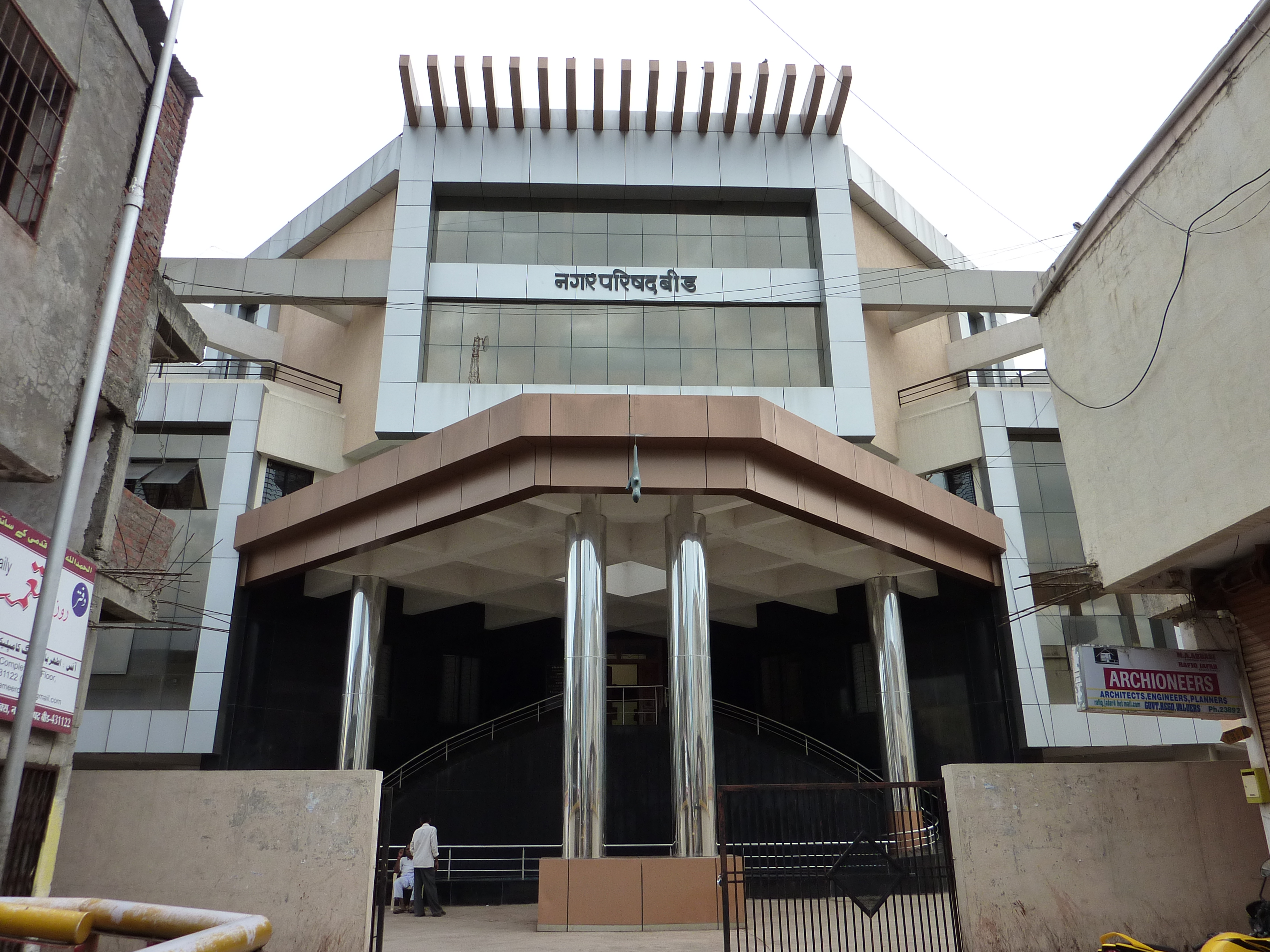
 New building of Municipal Council at Basheer Gunj
The municipal council (established in 1952) is the administrative body for the town which is directly responsible for the affairs within the town limits which is 69.15 square kilometers presently. The town has been divided into 40 Wards, each ward has its elected representative called 'Councilor'. The councilors elect the 'President' of the council which is always from the party which has majority in the council. The municipal elections are held after every five years. The district has Superintendent of police who's office is in the town. Two police stations covering eastern and western parts of the town are operational under the superintendent of police.
Culture
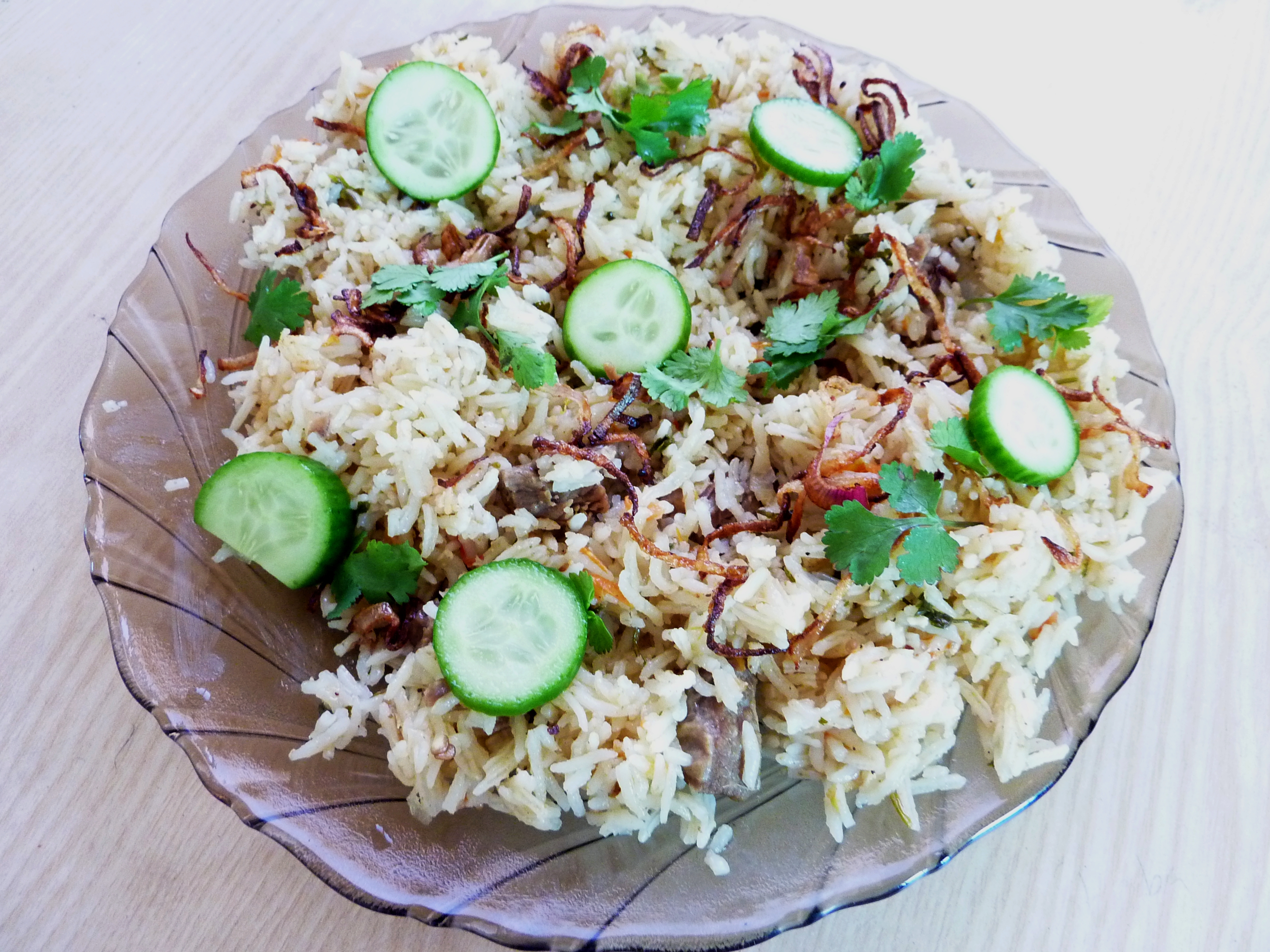
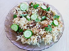 Tahari — one of the most common non-vegetarian dish.
Culture, though not typical, is predominantly Maharashtrian. Customs are followed religiously in marriages and other functions. Family, customs and religion still holds importance in the society. Food is largely vegetarian, but spicy non-vegetarian food is also popular. Several restaurants, Dhabas and roadside food shops offer non-vegetarian food. Chicken is perhaps the most popular non-vegetarian food in all sects of society. Achār (pickle), pāpad (poppadom) and spices are part of a common high chilli diet.
New generation; especially males, wear western outfits. Shalwar Khamis is popular in young girls. Married women wear Saris (a long piece of colourful fabric) and bodice. Traditional outfits are popular, if any, only in elderly. Diwali, Holi, Dasehra, Eid-ul-Fitr, Eid-ul-Adha and Buddha Jayanti are major festivals. New housing constructions are mainly concrete based, but in poor, mud-and-mortar houses with metal sheet roofs are common. There are no amenities in the town except cinema halls and a small, little maintained garden. Few years back there were seven cinema halls, now four are remaining; of which ‘Ashoka’ is the oldest. Two parks were maintained until 1969 by the municipal council.[4] One small but well maintained garden including a small zoo was situated at the eastern bank of Bendsura. A massive flood on July 23, 1989 wiped it off leaving no traces. A small garden cum zoo is recently been constructed in Khas Bagh area but it needs much improvements.
Transport
The town is accessible only by road. National Highway 211, linking Dhulia to Solapur passes through the town. Maharashtra State Road Transport Corporation (MSRTC) a state owned transport company provides bus access to the major towns in Maharashtra and neighbouring states. Some private travel agencies also have services to the major cities of the state. Nearest domestic airport is Aurangabad (133 km); nearest international airports are Mumbai (418 km), Hyderabad (428 km) and Pune (250 km). Nearest railway stations are Jalna (110 km), Parli (120 km), Aurangabad (133 km) and Ahmadnagar (145 km). Auto rickshaw is the only mode of public transport inside town. Roads inside the town are of average width and below average quality. Railway line access is probably the most awaited thing for the people of town.
Economy
Beed has a backward economy with a negligible growth. In 1997 Sarma committee has listed Beed as one of the 100 most backward districts in India.[19] After this listing the government of India and the government of Maharashtra specified Beed town as 'D' zone and declared tax holiday and concessions to lure the investors in the district.[24] Without proper arrangement of water supply and transport facility, this declaration resulted nothing. Economic backwardness is attributed to the lack of natural resources, frequent droughts, lack of good transport facilities and corruption.[21] Economy entirely depends on monsoon dependent agriculture, service sector and small businesses. Beed is one of the poorest districts of Maharashtra with Per capita GDP of Rs 15,303 (about $380) which is lower than the Maharashtra State average GDP Rs 17,079 (about $427).[21][25] There are some small scale industries of ginning, PVC and plastic pipes, wood cutting and local based soft drink. Business sector comprises small and medium scale retail and wholesale businesses of daily needs, textile and automobiles. Small business includes roadside shops and vendors of vegetables, spices, food and snacks, cloths and toys etc. Beed has a good wholesale market of cloths and small vendors from neighbouring towns and districts approach here for purchase.
Education
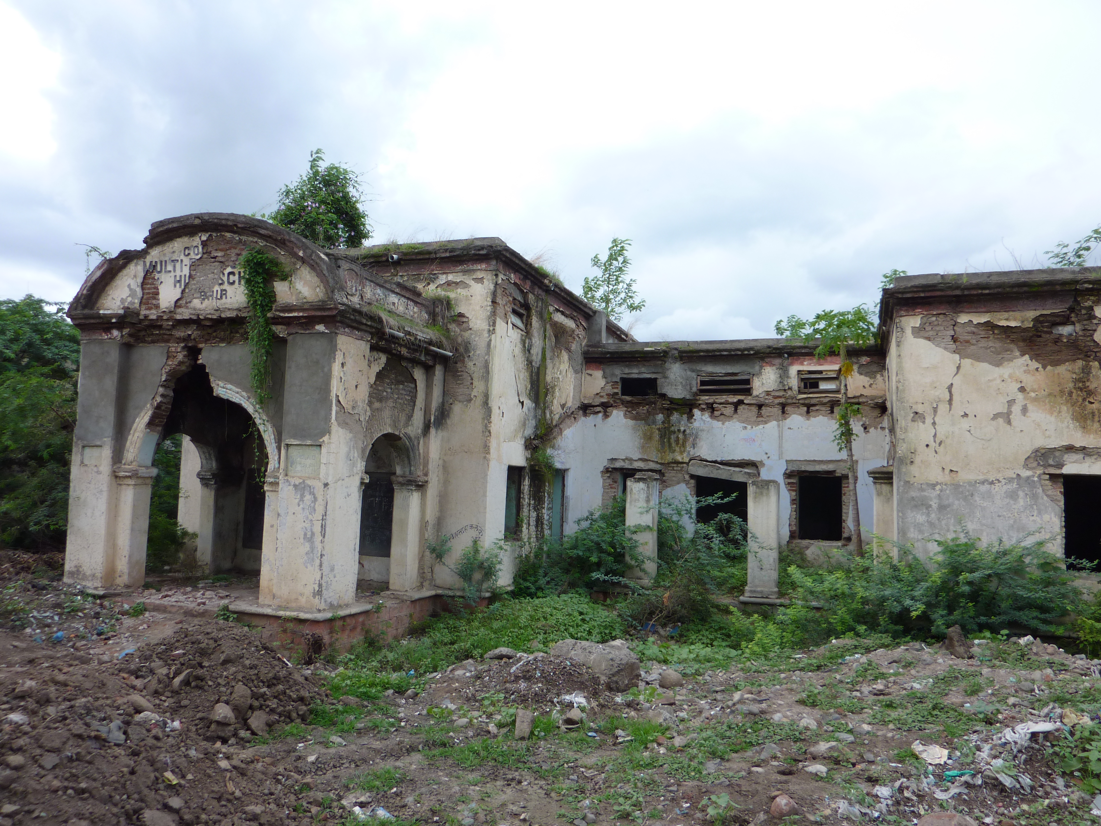
 Milliya campus — a minority education center and one of the largest campuses of the town was founded in 1959 by Mir Raunaque Ali.
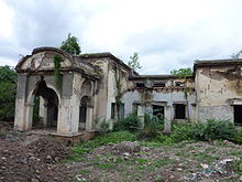 Multipurpose High School — established in 1921 by Nizam Mir Osman Ali Khan; is the oldest high school in Beed, now a garbage dump.
English, Marathi and Urdu are the mediums of education. Many schools and colleges have very good infrastructure and facilities. Primary education is managed by the Zila Parishad (district council), headquarters in Beed. All the secondary schools and junior colleges are affiliated to Maharashtra State Board of Secondary and Higher Secondary Education in Pune. One Engineering College, one Agricultural Engineering college, one Dairy Technology college, one Dental College, one Ayurvedic Medical College, two diploma Engineering Colleges (one is state run), one Homoeopathic Medical College, one Diploma Pharmacy College and one Industrial Training Institute are offering professional education in the town. Other colleges offer arts, science, commerce and vocational faculties up to post graduation level. All the colleges are affiliated to Dr. Babasaheb Ambedkar Marathwada University in Aurangabad.
Beed town has the highest literacy rate in the urban areas of the district.[1]
Health
Under its health policy, the state government runs a 300 bed hospital (District Hospital) in the town with some modern facilities like Computed Tomography Scan (CT scan). Hospital receives average 18000 patients and performs 250 HIV tests monthly.[26] Various private clinics and hospitals and a state run veterinary hospital are also providing services. Prominent among them is Vithai Hospital, which is the Largest Charitable Multi speciality hospital in district having 200 beds.
One Homoeopathic hospital is running with ‘Sonajirao Kshirsagar Homoeopathic Medical College’. No facilities are available in super specialities like Neurology, Oncology etc. Beed was in headlines throughout the world in August 1994 for the outbreak of Bubonic Plague. To some researchers, though, the disease detected here resembled Plague but could not be substantiated as per WHO criteria.[27]
Sports
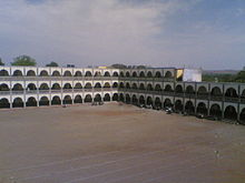
Cricket is undisputedly, the most popular game in the town. There are many small clubs playing cricket. State level soccer competitions held in the recent times have also fuelled love for soccer and few Soccer clubs have also been emerged. There is a medium size District Stadium in the town with a good shopping complex but poor sports facilities. 23rd National junior Kho-Kho championship was held in the stadium in 2002. State level volleyball and Kabaddi competitions were also held in late 90s. Sports Like Taekwondo are gaining popularity. The district also held the 22nd State Taekwondo Championship in 2008.
Media and communication
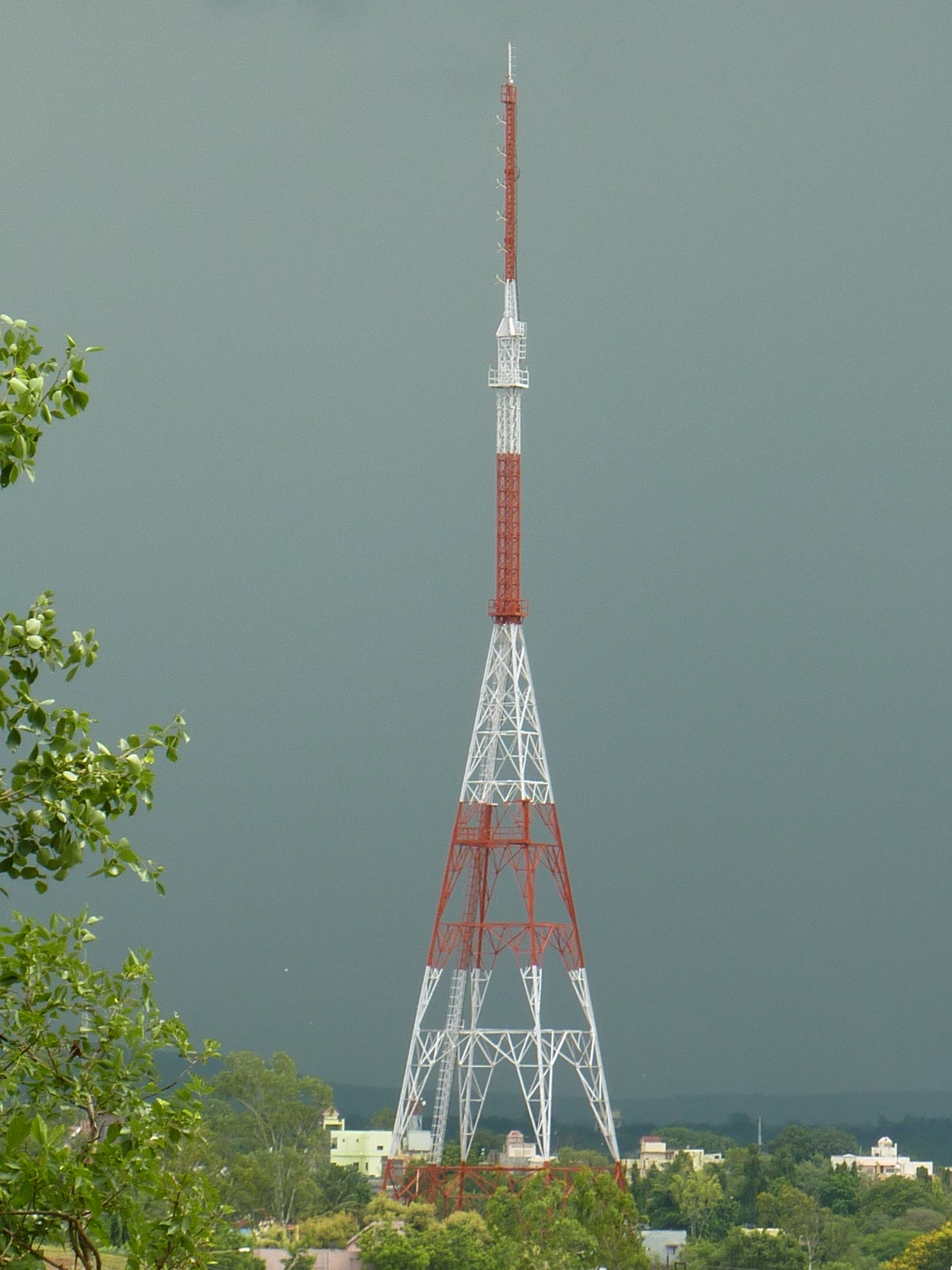
 Radio transmission tower of Akashwani Beed in the industrial area (MIDC).
More than a dozen Marathi and two Urdu dailys are published from the town. Zunjar Neta, Lok Prashn, Champavati Patr, Parshv Bhumi, Lokasha and Beed Reporter are major Marathi dailies. Local and regional news, crime stories and articles on local issues and politics are common features of the dailies. Marathi, Urdu, Hindi and English dailies including national dailies publishing from different cities of India also have penetration. No magazines are published in the town, but all the major national magazines do have readers. In 1961 there were only 51 working telephone connections in Beed exchange. Today Bharat Sanchar Nigam Limited (BSNL), a state owned telephone service provider, has more than 15,000 customers. It has also introduced broadband internet lines. In 2004 district’s first mobile phone service was started in the town by ‘Idea’. After that BSNL, Airtel, Vodafone, BPL, Tata Indicom and Reliance also jumped in the growing market. In 1982 the then Prime Minister Indira Gandhi put the foundation stone of terrestrial television relay centre, situated on eastern hills. Only Doordarshan was available until 1990s when satellite channels and cable operators started the business. Some enthusiasts have started a local cable channel ‘Beed News’. It provides local news coverage and plays movies rest of the time. All India Radio Beed, at FM 102.9 MHz,[28] broadcasts news, film and folk music, programmes of Vividh Bharti and programmes based on agriculture and health education.
Issues and challenges in the 21st century
Beed district as a whole —
- Population below poverty line = 32.4%
- Literacy = 68.48%
- Literate females = 55.38%
- Estimated coverage of safe drinking water (habitations) = 66.1%
- Villages not connected by paved roads = 52.82% [29]
Beed town —
- Female literacy = 65.26%
- Sex Ratio = 923.54 females per thousand males As of 2001[update] India census,[18]
Beed has a long history as a neglected and backward area. Industrial and economic backwardness, lack of good transport facility, electricity and literacy were the issues in 1960s and they are the same even today.[21][30] Many elections have been fought with the issue of railway line facility. In the recent times the list of issues has gone up with shortage of drinking water supply and electricity, frequent droughts, failing crops and suicide of farmers, unemployment, corruption and increasing crimes.[21] Beed also records highest power theft in Maharashtra. Nearly 60% power supplied to the district is stolen before it can reach to the consumers who pay for it. Further, unpaid electricity bills runs to almost Rupees 4540 million (about $113 M) .[31]
Social and environmental issues are no different than that of the whole country. Human rights (especially women’s and children’s), child labor, poverty, rising HIV infections, religious strife, human trafficking and sexual abuse are some major social issues of concern in Beed. Sex Ratio in the town is also on decline as is the case of the whole country due to foeticide of female babies.
The district ranks 143rd in literacy in India based on IndianNgos.com research and analysis of 586 districts throughout India.[32][33] On Human Development Index (HDI), using UNDP method, Beed ranks 18th out of 30 districts in the State of Maharashtra, with 0.47 HDI. It is 7th poorest district in the state with Human Poverty Index (HPI) of 21.21.[25] Deforestation, desertification, frequent droughts, shrinking water reservoirs and extreme shortages of drinking water, especially in rural areas are major issues which needs urgent attention. Beed district, according to the official statistics, has only 2.47% forest area, that too of lower quality.[1]
Further reading
- Qazi, M. Q. Bīri (1898): Tārīkh-e-Bīr (History of Beed in Urdu).
- Nathapuri, Abdul Hamīd (1998): Zila Bīr Kī Tarīkh (History of Beed District in Urdu). Asian Printing Press, Gulshan Colony, Jogeshwari (W) Mumbai.
- Gazette of Beed district (1969) Gazetteers department–Bhir (Beed). Out of print but available online at the government of Maharashtra web site.
- Official website of Beed district
- The Imperial Gazetteer of India. New edition, published under the authority of His Majesty's secretary of state for India in council. Oxford, Clarendon Press, 1908-1931. Editors - Hunter, William Wilson, Sir, 1840-1900 /Cotton, James Sutherland, 1847-1918 ed./Burn, Richard, Sir, 1871-1947 joint ed./Meyer, William Stevenson, Sir, 1860-1922. joint ed.
- From the Sundarlal Report Frontline, Volume 18, Issue 05, March 3–16, 2001
- Noorani, A. G. Of a Massacre Untold. Frontline, Volume 18, Issue 05, March 3–16, 2001
References
- ^ a b c d e f "New Page 4". beed.nic.in. http://beed.nic.in/htmldocs/socioeco.htm. Retrieved 2007-03-04.
- ^ "World Gazetteer: Bīd - profile of geographical entity including name variants". world-gazetter.com. http://world-gazetteer.com/wg.php?x=&men=gpro&lng=en&des=wg&srt=npan&col=abcdefghinoq&msz=1500&geo=392389576. Retrieved 2008-07-10.
- ^ Samuel, O. P. (2007). "India's top 300 cities/towns". Manorama Year Book 2007. Malayala Manorama (ISSN 0542-5778). p. 712.
- ^ a b c d e f g h "Gazetteers Department - Bhir". maharashtra.gov.in (Government of Maharashtra). http://www.maharashtra.gov.in/english/gazetteer/Beed/places_bhir_town.html. Retrieved 2007-02-27.
- ^ a b c d e f Hunter, William Wilson, Sir the school (1908-19-31). "Bir". The Imperial Gazetteer of India. Oxford, Clarendon Press. pp. 114–117 (volume 8). http://dsal.uchicago.edu/reference/gazetteer. Retrieved 2007-04-26.
- ^ "Gazetteers Department - Bhir". maharashtra.gov.in (Government of Maharashtra). http://www.maharashtra.gov.in/english/gazetteer/Beed/gen_climate.html. Retrieved 2007-02-27.
- ^ "Gazetteers Department - Bhir". maharashtra.gov.in (Government of Maharashtra). http://maharashtra.gov.in/english/gazetteer/Beed/agri_irrigations.html. Retrieved 2007-02-27.
- ^ a b c d e f g h i j k l m n Nathapuri, Abdul Hamīd (1998) (in Urdu). Zilla Bīr Kī Tārīkh (History of Beed District). Asian Printing Press, Gulshan Colony, Jogeshwari (W) Mumbai.
- ^ "Amateur Seismic Centre - Pune". Amateur Seismic Centre - Pune. http://www.asc-india.org/seismi/seis-maharashtra.htm. Retrieved 2007-03-04.
- ^ a b c d e Quazi M. Q. Bīri (1898) (in Urdu). Tārīkh e Bīr (History of Beed). Quazi M. Q. Bīri. p. 90.
- ^ Encyclopædia Britannica contributor (2007). "Yavana". Encyclopædia Britannica 2007 Ultimate Reference Suite DVD. Encyclopædia Britannica Inc.
- ^ Firishta, Muhammad Qasim (1829). History of The Rise of The Mahomedan Power in India. Longman, London. Volume I, Page 424.
- ^ "Gazetteers Department - Bhir". maharashtra.gov.in (Government of Maharashtra). http://www.maharashtra.gov.in/english/gazetteer/Beed/medical_history.html. Retrieved 2007-02-27.
- ^ a b Rizvi, S. M. Jawwād (1992) (in Urdu). Riyāsat e Hyderābād mein Jadd o Jahd e Āzādi 1800 - 1900 (Freedom struggle in the state of Hyderabad 1800 - 1900). Bureau for Promotion of Urdu Language, Ministry of Human Resource Development, India.. p. 79.
- ^ "Gazetteers Department - Bhir". maharashtra.gov.in (Government of Maharashtra). http://www.maharashtra.gov.in/english/gazetteer/Beed/his_modern_period.html. Retrieved 2007-02-27.
- ^ "From the Sundarlal Report". Frontline. March 3–16, 2001. http://www.flonnet.com/fl1805/18051140.htm. Retrieved 2007-03-07.
- ^ Noorani, A. G. (March 3–16, 2001). "Of a massacre untold". Frontline. http://www.flonnet.com/fl1805/18051130.htm. Retrieved 2007-03-07.
- ^ a b "Census of India 2001: Data from the 2001 Census, including cities, villages and towns (Provisional)". Census Commission of India. Archived from the original on 2004-06-16. http://web.archive.org/web/20040616075334/http://www.censusindia.net/results/town.php?stad=A&state5=999. Retrieved 2008-11-01.
- ^ a b "Empower Poor.Com". Empower Poor.Com. http://www.empowerpoor.com/districtdetail.asp?district=46. Retrieved 2007-04-20.
- ^ "Mah govt worried over skewed sex ratio in Beed; meet on May 20, IBN Live News". IBN Live. http://ibnlive.in.com/generalnewsfeed/news/mah-govt-worried-over-skewed-sex-ratio-in-beed-meet-on-may-20/687466.html. Retrieved 2011-05-18.
- ^ a b c d e Srinivasan, S.. "Marathwada Profile". Rediff.com. http://www.rediff.com/election/2004/oct/06maha1.htm. Retrieved 2007-02-26.
- ^ Justice Sachar, Rajinder (November 2006). Social, Economic, and Educational status of the Muslim community of India, A Report. Prime Minister’s High Level Committee, Cabinet Secretariat, Government of India.
- ^ "Crusade Watch". Crusade Watch. http://www.crusadewatch.org/index.php?option=com_content&task=view&id=568&Itemid=27. Retrieved 2007-02-26.
- ^ "www.mah.nic.in/beed_district/dicothe.html". Government of Maharashtra. http://www.mah.nic.in/beed_district/dicothe.html. Retrieved 2007-11-17.
- ^ a b Kamdar, S. and Basak, A.. "Beyond the Human Development Index, Preliminary Notes on Deprivation and Inequality" (PDF). Mumbai University. http://www.mu.ac.in/economics/File60_Sangitawp1.pdf. Retrieved 2007-02-27.[dead link]
- ^ "Hospitals Under CIVIL SURGEON BEED". beed.nic.in. http://beed.nic.in/htmldocs/health.htm. Retrieved 2007-03-04.
- ^ Deodhar/ Yemul/ Banerjee (1998). Plague that never was: A review of the alleged Plague outbreaks in India in 1994. Journal of Public Health Policy, Vol. 19, No. 2.
- ^ Alan G. Davies. "Radio Stations in Maharashtra – India". Asiawaves. http://www.asiawaves.net/india/maharashtra-radio.htm. Retrieved 2007-03-04.
- ^ "Empower Poor.Com". Empower Poor.Com. http://www.empowerpoor.org/backgrounder.asp?report=19. Retrieved 2007-02-27.
- ^ "Gazetteers Department of Beed district". maharashtra.gov.in (Government of Maharashtra). http://www.maharashtra.gov.in/english/gazetteer/Beed/ind_intro.html. Retrieved 2007-02-27.
- ^ "Beed Records Highest Power Theft". Ramachandran, Anupama (NDTV.com). 2006-03-06. http://www.ndtv.com/morenews/showmorestory.asp?category=National&id=101803. Retrieved 2006-03-09.
- ^ "IndianNGOs.com". IndianNGOs.com. http://www.indianngos.com/districts.beed_about.htm. Retrieved 2007-03-01.[dead link]
- ^ "IndianNGOs.com". IndianNGOs.com. Archived from the original on 2007-03-09. http://web.archive.org/web/20070309005616/http://www.indianngos.com/issue/education/districts/beed.htm. Retrieved 2007-03-01.
External links
Categories:- Cities and towns in Beed district
- Talukas in Maharashtra
-


Wikimedia Foundation. 2010.