- Colstrip, Montana
-
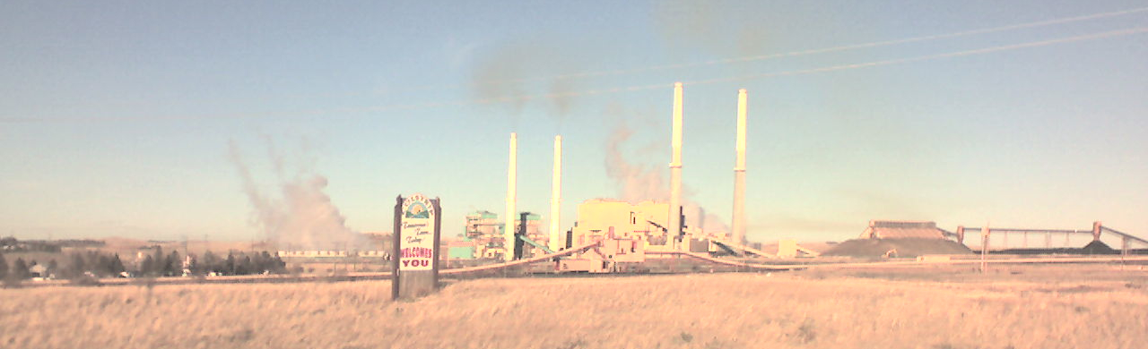
Colstrip, Montana — City — Sign upon entering Colstrip
SealMotto: Tomorrow's Town Today Location of Colstrip, Montana
Coordinates: 45°53′32″N 106°37′44″W / 45.89222°N 106.62889°WCoordinates: 45°53′32″N 106°37′44″W / 45.89222°N 106.62889°W Country United States State Montana County Rosebud Incorporated (city) 1998 Government – Type Mayor-Council – Mayor John Williams Area – Total 4.5 sq mi (11.6 km2) – Land 4.5 sq mi (11.6 km2) – Water 0.0 sq mi (0.0 km2) Elevation 3,222 ft (982 m) Population (2000) – Total 2,346 – Density 522.6/sq mi (201.8/km2) Time zone Mountain (MST) (UTC-7) – Summer (DST) MDT (UTC-6) ZIP code 59323 Area code(s) 406 FIPS code 30-16525 GNIS feature ID 0770042 Website http://www.cityofcolstrip.com/ Colstrip is a city in Rosebud County, Montana, United States. The population was 2,346 at the 2000 census. Established in 1924 and incorporated as a city in 1998, Colstrip is the largest city in Rosebud County with 25% of the total population. Colstrip's primary industries are coal mining and electricity production. For the Sports Illustrated Magazine's 50th anniversary, it named Colstrip the top sports town in Montana. The entire community celebrates Colstrip Days annually on the weekend prior to the 4th of July. The primary way to travel to Colstrip is by driving. See the video Coal Strip Tease for a driving tour of Colstrip.
Contents
History
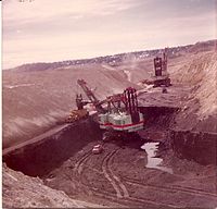 Open pit strip mining with Draglines at Colstrip's Rosebud Mine
Colstrip was established by the Northern Pacific Railway in 1924 as a company town to provide coal for their steam locomotives. The mining is open pit strip mining, where draglines remove soil above the layer of bituminous coal from the Fort Union Formation.[1]
During World War II, the Colstrip mine was identified as strategically important because it supplied coal for the Northern Pacific Railway steam locomotives hauling military equipment for the war effort. The mine was guarded from sabotage, and the employees were not allowed to quit their jobs.[2]
In 1958 the railroad switched to using diesel locomotives and the Colstrip mine was shut down. In 1959 Montana Power Company purchased the rights to the mine and the town, and resumed mining operations in the 1970s with plans to build coal-fired electrical plants.[3]
 Colstrip Power Plants 1-4 from right to left
The power plants were built in the 1970s and 1980s by a collection of contractors including Bechtel. During this construction period Colstrip was a boomtown, with a large increase in population. Plants 1 & 2 were operational in 1975 and 1976, and plants 3 & 4 were operational in 1984 and 1986.
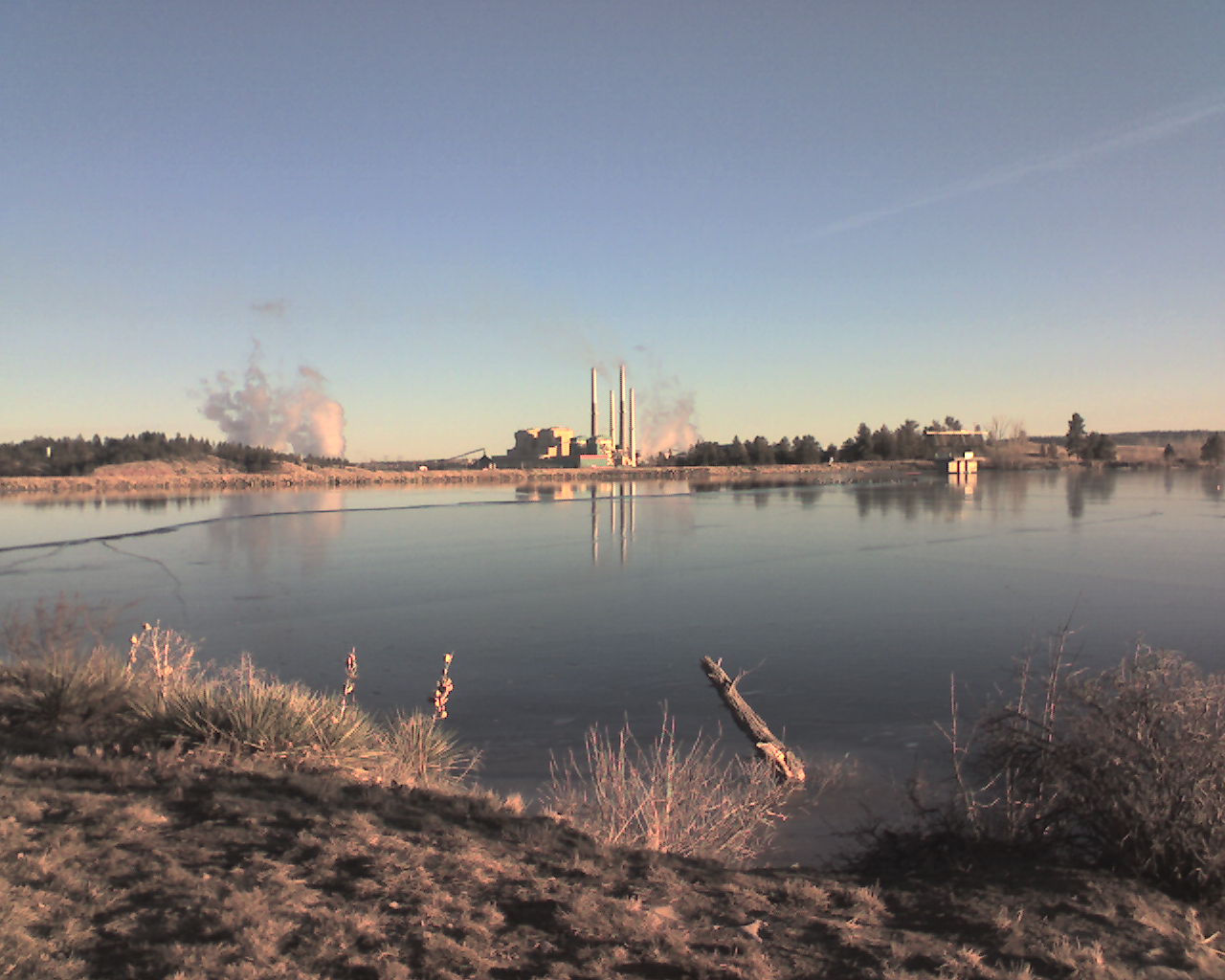
 Castle Rock Lake near Colstrip
In 1974 construction of Colstrip's 150-acre (0.61 km2) Castle Rock Lake (formerly named surge pond) was completed. The Colstrip plants produce electricity from coal using steam. The water for the steam is pumped in an underground pipe 30 miles (48 km) from the Yellowstone River and stored in the lake. The lake is stocked with fish and the home for a wide variety of wildlife.
In 1990 the Colstrip Energy Limited Project started commercial operations. Located six miles (10 km) north of Colstrip, this experimental electricity production facility is owned by Rosebud Energy Corp., a partnership that at one point included Enron. The plant uses high sulfur waste coal from the Rosebud Coal Mine's topmost one foot layer of coal.[4]
In 1998 plants 1-4 were sold to PPL Corporation (PPL),[5] and the Rosebud Coal Mine was sold to Westmoreland Mining LLC.[6] [7] In this same year the City of Colstrip was incorporated.
Education
The highest level of education in Colstrip is the Colstrip High School. The nearest college is Chief Dull Knife College in Lame Deer. Colstrip is about 20 miles (32 km) north of the Northern Cheyenne Indian Reservation. Many Cheyenne students from the reservation attend school at the high school, making up about one third of the students.[8]
Geography
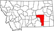
Colstrip is located at 45°52′50.03″N 106°37′47.65″W / 45.8805639°N 106.6299028°W (45.880563, -106.629903)[9].
According to the United States Census Bureau, the city has a total area of 4.5 square miles (12 km2), all of it land.
Demographics
Historical populations Year Pop. ±% 1924 300 — 1968 100 −66.7% 1980 1,503 +1403.0% 1982 7,500 +399.0% 1990 3,035 −59.5% 2000 2,346 −22.7% 2006 2,342 −0.2% 2007 2,375 +1.4% 2010 2,214 −6.8% The historical population of Colstrip has varied largely since it was established in 1924. Prior to incorporation in 1998 it was a census-designated place.[10]
As of the census[11] of 2000, there were 2,346 people, 825 households, and 674 families residing in the city. The population density was 522.6 people per square mile (201.7/km²). There were 936 housing units at an average density of 208.5 per square mile (80.5/km²). The racial makeup of the city was 83.93% White, 0.68% African American, 11.30% Native American, 0.13% Asian, 0.51% from other races, and 3.45% from two or more races. Hispanic or Latino of any race were 3.15% of the population.
There were 825 households out of which 48.2% had children under the age of 18 living with them, 66.8% were married couples living together, 9.6% had a female householder with no husband present, and 18.3% were non-families. 16.7% of all households were made up of individuals and 2.5% had someone living alone who was 65 years of age or older. The average household size was 2.84 and the average family size was 3.18.
In the city the population was spread out with 34.4% under the age of 18, 6.1% from 18 to 24, 28.7% from 25 to 44, 27.7% from 45 to 64, and 3.1% who were 65 years of age or older. The median age was 35 years. For every 100 females there were 106.0 males. For every 100 females age 18 and over, there were 100.9 males.
The median income for a household in the city was $55,650, and the median income for a family was $60,352. Males had a median income of $54,241 versus $25,234 for females. The per capita income for the city was $20,336. About 5.9% of families and 7.0% of the population were below the poverty line, including 10.7% of those under age 18 and none of those age 65 or over.
Notable natives
- Wally McRae — Cowboy poet who earned the 1990 National Endowment for the Arts' National Heritage Award
- George Armstrong Custer — one of his final encampments before Battle of the Little Bighorn was 10 miles (16 km) south of Colstrip
- Tuff Harris — safety for the Pittsburgh Steelers, moved from Lodge Grass to play football at Colstrip High School as a sophomore
References
- ^ "Rosebud Mine Tour Fact Sheet 2007". Westmoreland Mining LLC. http://leg.mt.gov/content/committees/interim/2007_2008/energy_telecom/meeting_documents/ETICWesternEnergypresent.pdf. Retrieved 2008-07-18.
- ^ McRae, Wallace (2009). Stick Horses and Other Stories of Ranch Life. Gibbs Smith. p. 106. ISBN 978-1423605911.
- ^ "City of Colstrip History". Colstrip City Government. http://www.cityofcolstrip.com/history.htm. Retrieved 2008-07-11.
- ^ "SEC Info - Rosebud Energy Corp.". Securities & Exchange Commission. http://www.secinfo.com/dsVsj.48x.d.htm. Retrieved 2008-07-26.
- ^ http://www.pplmontana.com/producing+power/power+plants/Colstrip.htm
- ^ http://www.westmoreland.com/coal.asp?topic=westmoreland_mining#rosebud
- ^ "Montana Power Company - Generations of Power". The Missoulian Newspaper. http://www.missoulian.com/specials/power/power1.html. Retrieved 2008-07-11.
- ^ Page 107 We, the Northern Cheyenne People: our land, our history, our culture (2008), Ambler, Marjane; Little Bear, Richard E; Wilson, Dave; Tall Bull, Linwood; Hantz, Joan; Ward, Carol; Wertman, Bill; Chief Dull Knife College, Lame Deer, Montana
- ^ "US Gazetteer files: 2010, 2000, and 1990". United States Census Bureau. 2011-02-12. http://www.census.gov/geo/www/gazetteer/gazette.html. Retrieved 2011-04-23.
- ^ "Colstrip Comprehensive Growth Plan". Colstrip City Government. http://www.cityofcolstrip.com/documents/Growth%20Plan/Colstrip%20Comprehensive%20Growth%20Plan%2008%20for%20website.pdf. Retrieved 2008-07-11.
- ^ "American FactFinder". United States Census Bureau. http://factfinder.census.gov. Retrieved 2008-01-31.
External links
Municipalities and communities of Rosebud County, Montana Cities Colstrip | Forsyth
CDPs Unincorporated
communitiesIndian reservation Footnotes ‡This populated place also has portions in an adjacent county or counties
 State of Montana
Topics - Index
- History
- Governors
- People
- Geography
- State Government
- Delegations
- Visitor Attractions
Society - Crime
- Demographics
- Economy
- Education
- Politics
Regions - The Flathead
- Glacier National Park
- Regional designations of Montana
- Western Montana
- Yellowstone
Largest cities Counties - Beaverhead
- Big Horn
- Blaine
- Broadwater
- Carbon
- Carter
- Cascade
- Chouteau
- Custer
- Daniels
- Dawson
- Deer Lodge
- Fallon
- Fergus
- Flathead
- Gallatin
- Garfield
- Glacier
- Golden Valley
- Granite
- Hill
- Jefferson
- Judith Basin
- Lake
- Lewis and Clark
- Liberty
- Lincoln
- Madison
- McCone
- Meagher
- Mineral
- Missoula
- Musselshell
- Park
- Petroleum
- Phillips
- Pondera
- Powder River
- Powell
- Prairie
- Ravalli
- Richland
- Roosevelt
- Rosebud
- Sanders
- Sheridan
- Silver Bow
- Stillwater
- Sweet Grass
- Teton
- Toole
- Treasure
- Valley
- Wheatland
- Wibaux
- Yellowstone
Categories:- Populated places established in 1924
- Towns in Montana
- Company towns in the United States
- Northern Pacific Railway
- Populated places in Rosebud County, Montana
- Mining communities in Montana


Wikimedia Foundation. 2010.