- Lame Deer, Montana
Infobox Settlement
official_name = Lame Deer, Montana
settlement_type = CDP
nickname =
motto =
imagesize =
image_caption =
image_
imagesize =
image_caption =
image_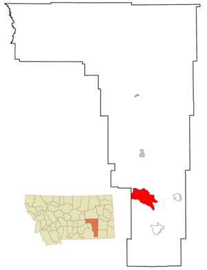
mapsize = 250px
map_caption = Location of Lame Deer, Montana
mapsize1 =
map_caption1 =subdivision_type = Country
subdivision_name =United States
subdivision_type1 = State
subdivision_name1 =Montana
subdivision_type2 = County
subdivision_name2 = Rosebud
government_footnotes =
government_type =
leader_title =
leader_name =
leader_title1 =
leader_name1 =
established_title =
established_date =unit_pref = Imperial
area_footnotes =area_magnitude =
area_total_km2 = 143.9
area_land_km2 = 143.9
area_water_km2 = 0.0
area_total_sq_mi = 55.6
area_land_sq_mi = 55.6
area_water_sq_mi = 0.0population_as_of = 2000
population_footnotes =
population_total = 2018
population_density_km2 = 14.0
population_density_sq_mi = 36.3timezone = Mountain (MST)
utc_offset = -7
timezone_DST = MDT
utc_offset_DST = -6
elevation_footnotes =
elevation_m = 1014
elevation_ft = 3327
latd = 45 |latm = 37 |lats = 19 |latNS = N
longd = 106 |longm = 39 |longs = 29 |longEW = Wpostal_code_type =
ZIP code
postal_code = 59043
area_code = 406
blank_name = FIPS code
blank_info = 30-42250
blank1_name = GNIS feature ID
blank1_info = 0773196
website =
footnotes =Lame Deer (Mea-véˀhoˀeno in Cheyenne) is a
census-designated place (CDP) in Rosebud County,Montana ,United States . The population was 2,018 at the 2000 census. Lame Deer is part of theNorthern Cheyenne Indian Reservation , and the home of the ChiefDull Knife College.Geography
Lame Deer is located at coor dms|45|37|19|N|106|39|29|W|city (45.621819, -106.658079).GR|1
According to the
United States Census Bureau , the CDP has a total area of 55.6square mile s (144.0km² ), all land.Demographics
As of the
census GR|2 of 2000, there were 2,018 people, 526 households, and 401 families residing in the CDP. Thepopulation density was 36.3 people per square mile (14.0/km²). There are 573 housing units at an average density of 10.3/sq mi (4.0/km²). The racial makeup of the CDP was 5.80% White, 0.05% African American, 92.47% Native American, 0.05% Asian, 0.15% from other races, and 1.49% from two or more races. Hispanic or Latino of any race were 2.18% of the population. 67.9% spoke English, 28.9% Cheyenne and 2.7% Crow as their first language.There were 526 households out of which 44.1% had children under the age of 18 living with them, 39.9% were married couples living together, 27.8% had a female householder with no husband present, and 23.6% were non-families. 21.1% of all households were made up of individuals and 6.1% had someone living alone who was 65 years of age or older. The average household size was 3.77 and the average family size was 4.42.
In the CDP the population was spread out with 43.7% under the age of 18, 9.6% from 18 to 24, 25.4% from 25 to 44, 16.3% from 45 to 64, and 5.1% who were 65 years of age or older. The median age was 22 years. For every 100 females there were 93.7 males. For every 100 females age 18 and over, there were 95.2 males.
The median income for a household in the CDP was $19,828, and the median income for a family was $19,821. Males had a median income of $26,484 compared with $23,500 for females. The
per capita income for the CDP was $7,247. About 46.9% of families and 50.4% of the population were below thepoverty line , including 59.4% of those under the age of 18 and 49.0% of those 65 and older.References
External links
*
* [http://www.cheyennenation.com/ Northern Cheyenne Tribe]
Wikimedia Foundation. 2010.