- Ogmore-by-Sea
-
For other places, see Ogmore (disambiguation).
Coordinates: 51°27′52″N 3°38′07″W / 51.46435°N 3.63526°W
Ogmore-by-Sea Welsh: Aberogwr 
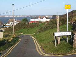
Ogmore by Sea
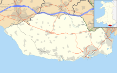
 Ogmore-by-Sea shown within the Vale of Glamorgan
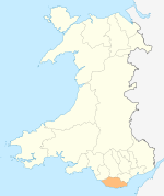
Principal area Vale of Glamorgan Ceremonial county South Glamorgan Country Wales Sovereign state United Kingdom Postcode district CF Police South Wales Fire South Wales Ambulance Welsh EU Parliament Wales UK Parliament Vale of Glamorgan Welsh Assembly Vale of Glamorgan List of places: UK • Wales • Vale of Glamorgan Ogmore-by-Sea (Welsh: Aberogwr - Aber Mouth + Ogwr River Ogmore) is a seaside village in the Vale of Glamorgan, Wales. It lies on the western limit of the Glamorgan Heritage Coastline of south Wales.
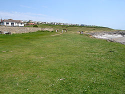
Approximately 3 miles from Bridgend and about 20 miles west of Cardiff the village lies in the Vale of Glamorgan. The beaches look out on Tusker Rock, has sand at low-tide, and sharp rocks at high-tide. The River Ogmore estuary is flanked by Ogmore beach on one side and the dunes of Merthyr Mawr on the other. The estuary makes bathing unsafe from most of the beach. The rocky shoreline is well-known as a rock climbing location. It is an interesting place geologically with a variety of fossils clearly visible. Many people use the car-park by the estuary to the River Ogmore, which is just as you enter the village, others move on to Southerndown.
Just like its counterparts in Cornwall, Ireland and Brittany, the west-facing beach and coast was notorious as a graveyard for ships during strong on-shore winds (i.e south-westerly winds from the Atlantic). Many ships in particular were destroyed on Tusker Rock, a brutal reef slightly out to sea that is totally covered at high tide. Also prevalent at Ogmore (and all across the Vale of Glamorgan coastline) was organised shipwrecking; similar to tales in Cornwall where lanterns would be tied to a bull/cow at night resting onto top of a cliff; passing ships would mistake a flickering light as a lighthouse and be lured to destruction. This also happened further down the coast at Southerndown
Ogmore centre was built for the benefit of children from all over South Wales shortly before WW2. It was closed in the mid 90s but reopened in 1998 as a Trust, but following problems with the lease, it closed again in 2007.
External links
- Map sources for Ogmore-by-Sea
- St Brides Major Southerndown and Ogmore-by-sea community website
- www.geograph.co.uk : photos of Ogmore-by-Sea and surrounding area
Coordinates: 51°27′52″N 3°38′07″W / 51.46435°N 3.63526°W
Categories:- Villages in the Vale of Glamorgan
Wikimedia Foundation. 2010.


