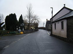
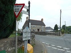
- Clawdd Coch
-
- Not to be confused with Y Clawdd Coch, a mountain in North Wales
Coordinates: 51°29′24″N 3°21′42″W / 51.49°N 3.361667°W
Clawdd Coch 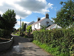
 Clawdd Coch
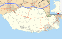
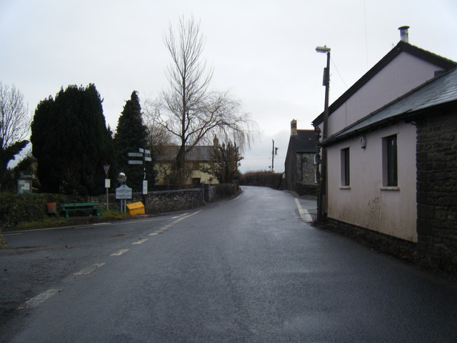
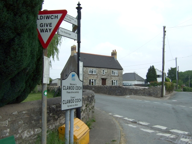
Clawdd Coch shown within the Vale of GlamorganOS grid reference SJ2519 Principal area Vale of Glamorgan Ceremonial county South Glamorgan Country Wales Sovereign state United Kingdom Postcode district CF Police South Wales Fire South Wales Ambulance Welsh EU Parliament Wales UK Parliament Vale of Glamorgan Welsh Assembly Vale of Glamorgan List of places: UK • Wales • Vale of Glamorgan Clawdd Coch (also Clawdd-coch or Clawddcoch) is a hamlet in the Vale of Glamorgan. It lies to the northeast of Tredodridge in the parish of Pendoylan. It is located near the edge of the Vale of Glamorgan Golf Club and Hensol Castle.
Etymology
It translates as "Red Ridge", coch being the Welsh language word for "red".[1]
History
Clawdd Coch is documented as having some degree of importance as a Roman settlement and it is believed to be the final resting place of Ostorius.[2][3] One of the roads leading into the hamlet was built by the Romans, known as Via Media.[2] A notable smelting operation of lead and copper took place in the vicinity at what was known as "Dol-y-felin-blwm".[2]
In the mid 19th century, the hamlet was known to be owned by a Mr. Asterley who farmed the land here.[3] Presumably he lived in what is Clawdd Coch guest house, a long farmhouse which was built in the 1650s. It was a favourite of Ivor Novello, who would often spend relaxing weekends here, to gain inspiration for his works.[4] It underwent renovation in 1988.

References
- ^ England (1822). An account of the principal pleasure tours in England and Wales. Baldwin, Cradock, and Joy. p. 214. http://books.google.com/books?id=_QgHAAAAQAAJ&pg=PA214. Retrieved 27 January 2011.
- ^ a b c Collections historical and archeological relating to montgomeryshire and its borders.. London. 1884. pp. 37–48. http://books.google.com/books?id=3PMHAAAAQAAJ. Retrieved 27 January 2011.
- ^ a b Cambrian Archaeological Association (1851). Archaeologia cambrensis. W. Pickering. p. 144. http://books.google.com/books?id=Aro1AAAAMAAJ&pg=PA144. Retrieved 27 January 2011.
- ^ "Clawdd Coch Guest House - A History". Clawdd Coch guest house. http://www.clawddcoch-guesthouse.co.uk/guest-house-history. Retrieved 27 January, 2011.
Categories:- Villages in the Vale of Glamorgan
- Glamorgan geography stubs


Wikimedia Foundation. 2010.