- Morden Hall Park
-
Morden Hall Park 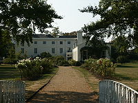
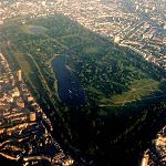
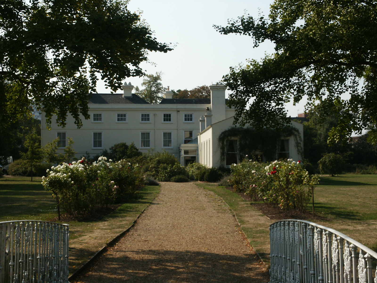
Morden HallType Park Proprietor National Trust Managed by Hall is a private restaurant Size 125 acres (0.5 km2) Main feature Historic parkland Other features Snuff Mill (education centre) Public access Yes, not house Museum No Exhibition No Region Greater London Address Morden Hall Road Postcode SM4 Refreshments Yes Parking Yes Shop Yes 51°24′4″N 0°11′15″W / 51.40111°N 0.1875°WCoordinates: 51°24′4″N 0°11′15″W / 51.40111°N 0.1875°W Morden Hall Park is a National Trust park located on the banks of the River Wandle in Morden, south London. It covers over 50ha (125 acres) of parkland with the River Wandle meandering through it spanned by numerous foot bridges. The estate contains Morden Hall itself, Morden Cottage, an old Snuff Mill, and many old farm buildings, some of which are now a garden centre and a city farm. The rose garden has over 2000 roses.
Contents
History
The estate land was originally owned by Westminster Abbey. There is evidence of an earlier manor-house, but the Hall dates back to the 1770s and contains a variety of natural landscapes, including the parkland of the "Deer Park", meadow and marshland. A number of historic buildings are located in the park, including the Hall itself and preserved watermills where tobacco was once ground into snuff.
The Hall was owned and occupied by the Garth family for generations. It was occupied, as a school, for young gentlemen about 1840, until it was sold by Sir Richard Garth to a tobacco merchant Gilliat Hatfeild (1827–1906) in the 1870s.
The Hall was a military hospital during the First World War.
Gilliat Hatfeild's son, Gilliat Edward Hatfeild (1864–9 February 1941), left the core of the estate (including the house) to the National Trust, when he died. The Hall is now empty, after Whitbread plc decided that the building/location did not fit in with the business plan they had for their Beefeater chain. They still own the lease and continue to pay rent, according to the original lease contract. At least two attempts to sub-lease the property have failed, after limited success.
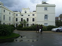 Morden Hall Park House
Gilliat Edward Hatfeild lived at the nearby Morden Cottage which he considered better suited to his life as a bachelor. The formal garden of the cottage is surrounded by an unusual collection of ornamental trees, including one of the oldest yews in England.
Outside of the main park, the remainder of the estate has been swallowed up in housing developments stretching between Morden, South Wimbledon and Collier's Wood and an industrial estate at Deer Park Road.
Access
The main entrance to the park is a short walk from Morden town centre, and car parking is available at the main entrance. The Snuff Mill and Riverside Café are adjacent to the main entrance.[1]
The Tramlink light rail line from Wimbledon to Croydon runs through the northern part of the park, and Phipps Bridge and Morden Road tram stops give access to the park. Both tram stops are a 0.5 mi (0.80 km) walk through the park to the Snuff Mill and Riverside Café. Morden tube station and Morden South railway station are respectively 0.25 mi (0.40 km) and 0.5 mi (0.80 km) walk through the town centre from the main entrance.[1]
References
- ^ a b "Morden Hall Park - Getting there". National Trust. http://www.nationaltrust.org.uk/main/w-vh/w-visits/w-findaplace/w-mordenhallpark-2/w-mordenhallpark-gettingthere-2.htm. Retrieved 2008-09-02.
- aboutbritain.com Morden Hall Park. accessed April 2008
- 'Parishes: Morden', A History of the County of Surrey: Volume 4 (1912), pp. 235–237. Date accessed: 12 April 2008.
- British Pathe News Archive 1948 Newsreel of film industry party held at Morden Hall (download - select low resolution free preview)
External links
 Media related to Morden Hall Park at Wikimedia Commons
- National Trust, Morden Hall Park
Parks and open spaces in London Royal parks Bushy · Green · Greenwich · Hyde · Kensington · Regent's · Richmond · St James's
Large urban parks Alexandra · Battersea · Blackheath · Burgess · Crystal Palace · Finsbury · Hampstead Heath · Parliament Hill · Southwark · Victoria · Wimbledon
Country parks Bayhurst Wood · Belhus Woods · Eastbrookend · Fairlop Waters · Fryent · Hainault Forest · Havering · High Elms · Hornchurch · Lee Valley · South Norwood · Stanmore · Stockley · Trent
Commons Barnes · Bromley · Cannon Hill · Clapham · Eel Brook · East Sheen · Ham · Hayes · Kenley · Mitcham · Old Oak · Peckham Rye · Plumstead · Putney · Putney Lower · Stanmore · Stoke Newington · Streatham · Tooting · Tylers · Wandsworth · Wimbledon · Winn's
Marshes Aveley · Crayford · Erith · Hackney · Hornchurch · Ingrebourne · Leyton · Rainham · Tottenham · Walthamstow · Wennington
Woodland Bostall · Coldfall · Dulwich · Epping Forest · Grangewood Park · Highgate · Lesnes Abbey · Oxleas · Queen's · Russia Dock · Sydenham Hill
House gardens Belair Park · Boston Manor House · Cannizaro Park · Danson Park · Grovelands Park · Grove Park · Hampton Court Park · Kenwood House · Langtons · Morden Hall Park · Osterley Park · Syon House
Entry-fee charging Community gardens Phoenix Garden · Calthorpe Project
Parks and open spaces by London borough Barking and Dagenham · Barnet · Bexley · Brent · Bromley · Camden · Croydon · Ealing · Enfield · Greenwich · Hackney · Hammersmith and Fulham · Haringey · Harrow · Havering · Hillingdon · Hounslow · Islington · Kensington and Chelsea · Kingston · Lambeth · Lewisham · Merton · Newham · Redbridge · Richmond · Southwark · Sutton · Tower Hamlets · Waltham Forest · Wandsworth · Westminster
Categories:- National Trust properties in London
- Parks and open spaces in Merton
- 1770s architecture

Wikimedia Foundation. 2010.