- Clissold Park
-
Coordinates: 51°33′40″N 0°5′17″W / 51.56111°N 0.08806°W
 The popular Clissold Park Café, is housed in a former 1790s mansion house. The spire of St Mary's Church, Stoke Newington, is in the background.
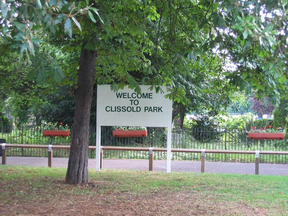
 A sign welcoming people to the park, near the most southern entrance
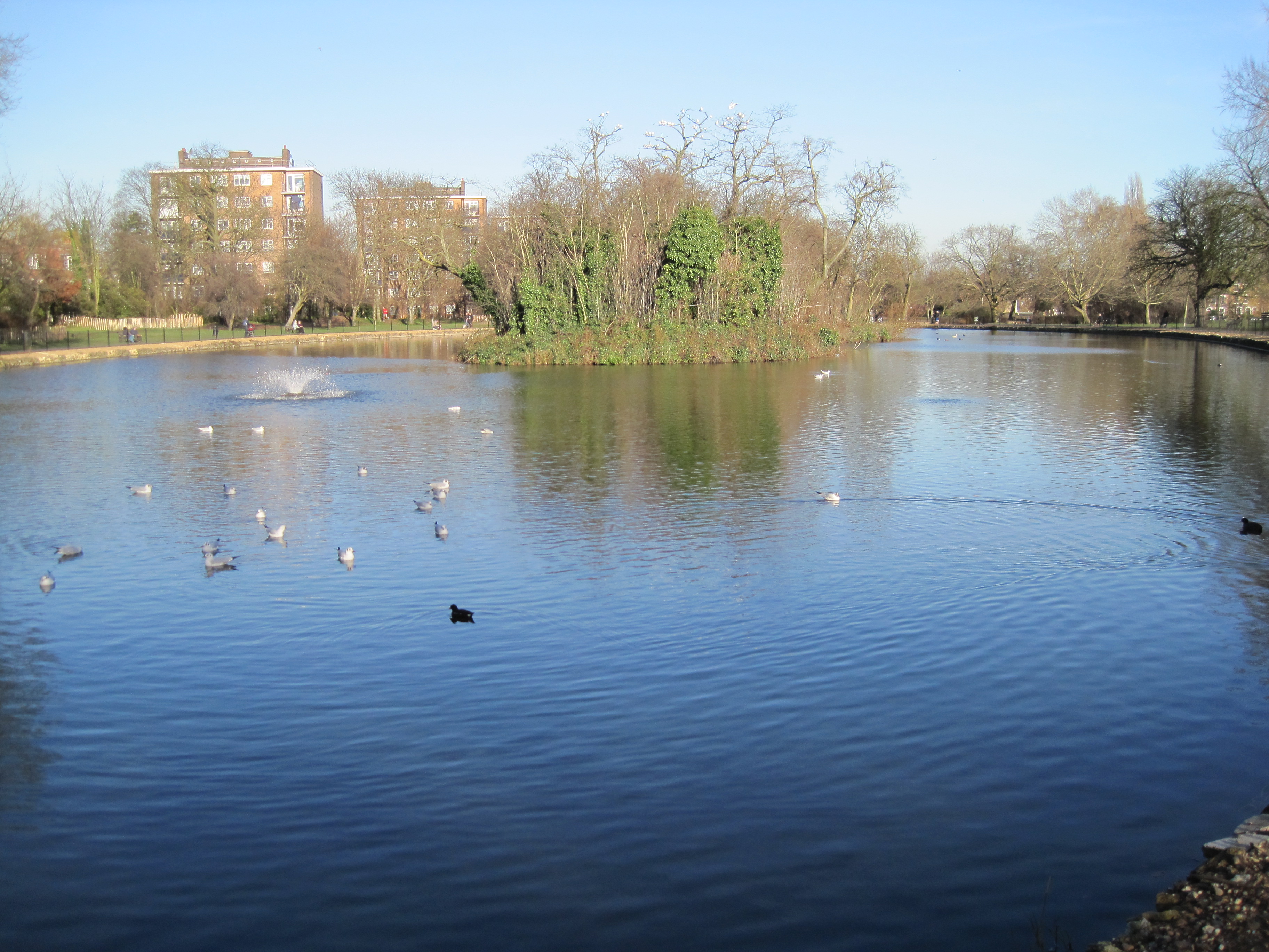
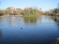 Lake in Clissold Park
Clissold Park is a 22 hectares (54 acres)[1] community park in Stoke Newington within the London Borough of Hackney. Facilities include a children's playground, sports fields, a bowling green, tennis courts, a cafe and some animal attractions including terrapins in its lakes. The park also hosts remains of the New River.
The Capital Ring has some of its paths running through a small section of the park.
Contents
History
Clissold House, the park’s Grade II-listed building, was built for Jonathan Hoare[2], a Quaker merchant and anti-slavery campaigner, in the 1790s. (His brother Samuel Hoare Jr was one of the founders of the Society for Effecting the Abolition of the Slave Trade.) The park was his front lawn, and the stretch of water that winds around the house was once part of the New River, a canal that supplied London with clean water from Hertfordshire.[3]
The estate eventually fell to Reverend Clissold; when he died in 1882, developers closed in, but activists John Runtz and Joseph Beck convinced the authorities to open it as a public space in 1889. A fountain was erected in 1890 commemorating these heroes; later, the park’s two wildlife ponds were named after them too.[3]
Restoration
Clissold House, the former mansion within the park, is a Grade II* listed building; and is currently used as refreshment rooms.[4] In 2007, Clissold Park was voted the Heart of Hackney, in an I Love Hackney poll organised by Hackney Council. On March 30, 2007 the Heritage Lottery Fund announced the award of a development grant to put forward a bid for a full £4.5 million park restoration grant.[5] The work will restore the park and house to its original 19th century design.
Work on the Clissold Park and House Restoration project commenced in January 2010, and over the next 2 years an estimated £8.9 million pounds[6] is to be spent upgrading the historic Clissold Mansion and surrounding park. Funding was received from the Heritage Lottery Fund, the Big Lottery Fund, and Hackney Council.
Plans[7] for the park include:
Restoring the Grade II listed Clissold House
Restoring a section of the New River (England)
Extensive maintenance to the two park lakes
Renovating the current animal enclosures
Creating a new play and wheels park areaKey Phases
Contractor site setup Jan 2010
Setting up of site compounds and hoarding; protection of trees in work areas; and construction of haul routes. New temporary contractor site access from Church St.Lakes and Northern Boundary Feb – May 2010
Draining, wildlife relocation, de-silting of lakes, repair of lake edges and new planting.Closure of redgra sport pitch Feb 2010 – Feb 2011
Construction of drainage and barriers to contain silt from lakes which will be used for landscaping.Animal Enclosures Feb – July 2010
Construction of new aviary, butterfly dome, pathways and animal shelters.Bowling green and pavilion Feb – June 2010
Refurbishment of bowling pavilion including new public toilets and landscaping of surrounding areas.New River (England) and Central Lawns May – Nov 2010
Draining, de-silting, excavation New River extension and construction of new bridge and pond dipping platform. Installation of new pumping and water circulation equipment.Sport and Play Sept 2010 – Feb 2011
Construction of new Multi-use Games Area and Wheels Park; landscaping and extension of play area.Park-wide work Feb 2010 – Jan 2011
Other site-wide works including repairs to foot paths, restoration of the old pump house, tree works and landscaping.A full timetable of works, and current progress may be found on the Hackney Council [3] website.
Clissold Park received a Green Flag award in July 2008.[8]
Transport
There are no nearby London Underground stations, but within one mile are Manor House, Finsbury Park and Arsenal.
The nearest railway stations are Canonbury and Stoke Newington.
In popular culture
The park, and its pond, feature in the Hank Wangford song, 'Jogging with Jesus'.
The album Ham by London band the Chap features a song with the title 'Clissold Park'.
The London based 'Astrophonica' record label features a song by label owners Fracture & Neptune, titled "Clissold" named after the park.
References
- ^ Clissold Park: A Short History (Clissold Park User Group) accessed 20 Sept 2009
- ^ Quaker history page
- ^ a b http://www.timeout.com/london/features/5576/2.html
- ^ Details from listed building database (423697) . Images of England. English Heritage. accessed 22 January 2009
- ^ BBC News 16 April 2007 accessed 17 April 2007
- ^ [1] Clissold Park User Group accessed 07 April 2010
- ^ [2] Hackney Council Clissold Restoration Project accessed 07 April 2010
- ^ Hackney Today 188 21 July 2008
External links
- Open Gym Sundays 11AM
- Clissold Park User Group
- Guide to Clissold Park
- [4]
- Clissold Park Café
- The Reservoirs Nature Society (TeRNS)
Parks and open spaces by London borough Barking and Dagenham · Barnet · Bexley · Brent · Bromley · Camden · Croydon · Ealing · Enfield · Greenwich · Hackney · Hammersmith and Fulham · Haringey · Harrow · Havering · Hillingdon · Hounslow · Islington · Kensington and Chelsea · Kingston · Lambeth · Lewisham · Merton · Newham · Redbridge · Richmond · Southwark · Sutton · Tower Hamlets · Waltham Forest · Wandsworth · Westminster
Categories:- Parks and open spaces in Hackney
- Grade II listed buildings in London
- Bowling greens in England
Wikimedia Foundation. 2010.