- Mount Baldy (Arizona)
-
Mount Baldy 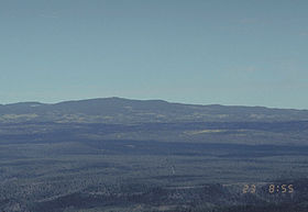
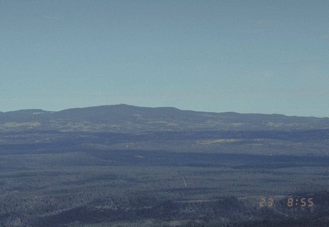
Mount Baldy from a US Forest Service webcamElevation 11,420 ft (3,481 m) Prominence 4,720 ft (1,439 m) Location Location Apache County, Arizona, USA Range White Mountains Coordinates 33°54′22″N 109°33′46″W / 33.90611°N 109.56278°WCoordinates: 33°54′22″N 109°33′46″W / 33.90611°N 109.56278°W Topo map USGS Mount Baldy (AZ) Mount Baldy (Western Apache: Dził Łigai White Mountain[1][2]) is a mountain in northeastern Arizona in the United States. It is the highest point in the White Mountains, making it the highest point in Apache County. It is the second highest point in the state after the six summits of the San Francisco Peaks near Flagstaff. With a summit 11,420 feet (3,480 meters) above sea level, the peak of Mount Baldy rises above the tree line and is left largely bare of vegetation, lending the mountain its current name.[3]
The summit of Mount Baldy is within the Fort Apache Indian Reservation and is off-limits to hikers without permission. An unnamed sub-peak with an elevation of 11,400 ft (3,474 m) exists approximately 0.5 miles (0.8 kilometers) to the north of the summit that is off reservation and accessible to the public via maintained trail.[4]
Mount Baldy is one of the most sacred mountains to the Apache of Arizona. The Western Apache of Arizona inhabited the areas within their most four sacred mountain ranges: the White Mountains of Eastern Arizona, the Pinaleno Mountains near the town of Safford in southeastern Arizona, the Four Peaks near the City of Phoenix and the San Francisco Peaks near Flagstaff.
When Captain George M. Wheeler visited the mountaintop in 1873, he described the view as "The most magnificent and effective of any among the large number that have come under my observation". Wheeler named the mountain Mount Thomas after General Lorenzo Thomas, who fought in the Mexican–American War. It later became Mount Baldy.[5]
Mount Baldy also contains the headwaters of the Salt River and produces the most abundant trout fishing streams in Arizona. No other mountain in Arizona produces as much rivers and streams.Along its slope it contains numerous manmade lakes. The area around Mount Baldy also averages the most abundant precipitation in Arizona. Mount Baldy also contains abundant wildlife including the recently introduced Mexican Grey Wolf.
While looking northeast from Historic Fort Apache (elevation 5,290 ft) Mount Baldy rises 6,130 ft in elevation.
See also
References
- ^ Green, Stewart M. (2003) Scenic Driving Arizona Globe Pequot Press, Old Saybrook, Connecticut, page 133, ISBN 0-7627-2701-2
- ^ McNamee, George (2000) "In High Spirits" Backpacker 2000(December): pp. 136, 126, page 136
- ^ Deforest, Lisa. "Sheep Crossing Trail". The Arizona Republic. http://www.azcentral.com/travel/hiking/articles/baldy.html.
- ^ "West Baldy Trail". White Mountains Online. http://www.wmonline.com/attract/trails/wbaldy.htm.
- ^ Byrd H. Granger (1960). Arizona Place Names. University of Arizona Press. p. 3. http://books.google.com/books?id=I7r_ZwEACAAJ. Retrieved 20 November 2011.
External links
- "Mount Baldy, Arizona". Peakbagger.com. http://www.peakbagger.com/peak.aspx?pid=3963.
 State of Arizona
Topics - Index
- Climate
- Delegations
- Geography
- History
- Museums
- Music
- People
- Transportation
- Visitor Attractions
Society - Culture
- Demographics
- Economy
- Education
- Politics
Regions - Arizona Strip
- Arizona Sun Corridor
- Coconino Plateau
- Colorado Plateau
- Grand Canyon
- Kaibab Plateau
- Mogollon Plateau
- Mogollon Rim
- Mojave Desert
- Monument Valley
- North Central Arizona
- Northeast Arizona
- Northern Arizona
- Oak Creek Canyon
- Phoenix Metropolitan Area
- Safford area
- San Francisco Volcanic Field
- Sonoran Desert
- Southern Arizona
- Verde Valley
- White Mountains
Counties Cities Categories:- White Mountains (Arizona)
- Landforms of Apache County, Arizona
- Mountains of Arizona
- Arizona geography stubs
Wikimedia Foundation. 2010.