- Merton Park
-
Coordinates: 51°24′38″N 0°12′06″W / 51.4106°N 0.2017°W
Merton Park 
 Merton Park
Merton Park shown within Greater LondonOS grid reference TQ250695 London borough Merton Ceremonial county Greater London Region London Country England Sovereign state United Kingdom Post town LONDON Postcode district SW19 Dialling code 020 Police Metropolitan Fire London Ambulance London EU Parliament London UK Parliament Wimbledon London Assembly Merton and Wandsworth List of places: UK • England • London Merton Park is a place in the London Borough of Merton. It is a quiet and leafy suburb situated between Wimbledon, Morden, South Wimbledon and Wimbledon Chase. It is 7.3 miles (11.7 km) south-west of Charing Cross. The area is part of the historic parish of Merton.
The approximate boundaries of the Merton Park area can be considered to be Kingston Road (A238) to the north, Dorset Road (B285) and Morden Road (A24) to the east, Martin Way to the south and Aylward Road to the west. Additionally, the area north of Kingston Road between Merton Hall Road, Avebury Road and Kingswood Road is often included. Note that this definition of the area does not correspond directly with the Local Government ward of the same name which for administrative convenience includes areas as far south as Morden South railway station.
The area contains two state schools - Merton Park Primary and Rutlish School (boys) and is almost entirely residential in character without shops or pubs except a bar at the Old Rutlishians ('Old Ruts') playing field pavilion in Poplar Road. The area is centred around the historic parish church, St. Mary's. The church was founded in the 12th century by the Augustinian order of the nearby Merton Priory of which only the Western Gate remains.
A notable feature of the Merton Park Ward is that it regularly returns Independents to Merton Council on which the three Merton Park councillors currently hold the balance of power. Three MPWRA have also been Deputy Mayor of Merton: Peter Southgate in 2005/06, Krysia Williams in 2008/09 and Karin Forbes in 2009/10.
The John Innes Society is a charity that promotes good design and area embellishment in Merton Park.
History
- For earlier history see Merton.
Until the last quarter of the 19th century, the parish of Merton was mainly rural. The area now known as Merton Park was farm land owned by City merchant John Innes who was the local "lord of the manor". The rapid development of Wimbledon to the north, encouraged Innes to develop his land for housing. He took as his model, the garden suburbs (particularly Bedford Park in Chiswick) and developed the tree-lined roads of detached and semi-detached houses for which the area is known.
The northern section of Merton Park each side of Kingston Road is now a conservation area. The southern section, roughly from Circle Gardens southwards, was developed in the 1920s and 1930s, stimulated by the opening of the London Underground station at Morden. Housing here was developed on a smaller scale and is not as distinguished, nor is the area designated for conservation.
See also
External links
London Borough of Merton Districts Colliers Wood · Lower Morden · Merton Park · Mitcham · Morden · Morden Park · Motspur Park · Raynes Park · St Helier · South Wimbledon · West Barnes · Wimbledon · Wimbledon Park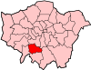
Attractions Constituencies Other topics People · Public art · SchoolsParks and open spaces in Merton University of the Arts London Colleges and
subdivisions
University CampusCamberwell · Charing Cross Road · Clerkenwell · Elephant and Castle · Hackney · High Holborn · Holborn · Merton Park · Millbank · Oxford Street · WimbledonPeopleAcademics · Alumni · Chairman: Sir John Tusa · Rector: Nigel CarringtonOtherAffiliates London Centre for Arts and Cultural Exchange · Universities UK
 Category ·
  CommonsCategories:
- Districts of London


Wikimedia Foundation. 2010.