- Red Ruthenia
-
Red Ruthenia
Ruś czerwona← 
1340–1772  →
→
 →
→

Flag Coat of arms Areas of the Kingdom of Poland. The area was part of the Polish-Lithuanian Commonwealth from 1569
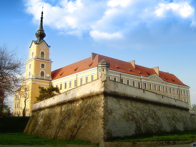
Capital Volodymyr, Halych, Lviv Language(s) Old East Slavic, Latin, Middle High German Religion Eastern Orthodox Christianity, Catholic Church Government Ruthenian Voivodeship History - Established 1340 - Disestablished 1772  Ducal seal "Ladislaus Dei Gracia Dux Opoliensis Wieloniensis et Terre Russie Domin et Heres" (ca. 1387)

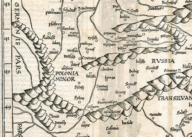
 Palace of Lubomirski family in Rzeszów.
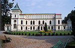 Palace of Rey family in Przecław.
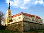
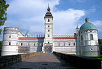 Palace of Krasicki family in Krasiczyn.
 Potocki Palace, Lviv.
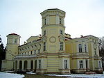 Lubomirski Palace, Przemyśl.
Red Ruthenia (Latin: Ruthenia Rubra or Russia Rubra, Ukrainian: Червона Русь, Chervona Rus, Polish: Ruś Czerwona, Russian: Червоная Русь, Chervonaya Rus) is the name used since medieval times to refer to the area known as Eastern Galicia prior to World War I; first mentioned in Polish historic chronicles in the 1321, as Ruthenia Rubra or Ruthenian Voivodeship (1366-1772).
Ethnographers explain that the term was applied from the old-Slavonic use of colours for the cardinal points on the compass. The ancient totem-god Svitovyd had four faces. The northern face of this totem was white (hence White Ruthenia or Belarus), the western face red (Red Ruthenia), the southern black (Black Ruthenia), and the eastern green (Green Ruthenia). This makes the placement of Black Ruthenia problematic.
Red Ruthenia, which is the historical name of the greater part of Eastern Galicia, already belonged to Poland in the Xth. century, and within the last ten centuries, belonged only for 75 years to the Ruthenian Princes of Kiev. Red Ruthenia is a rather vague term from the geographical point of view, meaning different things at different periods. The territory so called never formed a very definite whole either geographically or politically. In 981, in the era of the united Kievan Rus, Vladimir the Great 'took the forts of Czerwierń from the Lachs'. After 1340, the biggest landowner in Red Ruthenia was the king of Poland. Unlike the territory of Poland, the king's demesne consisted of enormous and homogenous areas.
The historic Red Ruthenia, reaching on its south-west to Przemyśl and Sanok, has been inhabited for nearly the last ten centuries mostly by the Ruthenian population.
The traditional population of Red Ruthenia was Lendians,[2] Boykos, Lemkos and of a Silesian-German group of so-called sylvan Germans (Walddeutsche) between the Dunajec and the San rivers, denationalized back in the 16th to 18th centuries, and among several other people.[3]
Marcin Bielski claimed that Bolesław I Chrobry had settled some Germans in the region to defend the borders against Hungary and Kievan Rus', however, they turned to farming. Maciej Stryjkowski mentioned Germans peasants near Przeworsk, Przemyśl, Sanok, and Jarosław, describing them as good farmers. While evaluating the size of the population of late medieval Poland, one should take into account the development of internal colonisation and the migration of Polish people to Red Ruthenia, Zips, Orava and Podlasia,[4] whom Ukrainians called the "Mazury", poor peasant migrants, chiefly from Mazowsze.[5]
It was in the second half of the 14th century that a new wave of settlers ie the Vallachians, came from the South-eastern Carpathians and quickly spread all over Red Ruthenia. From the 15th century, however, the Ruthenian element began to prevail. Nevertheless, it was not until the 16th century that the Vallachian population in the Bieszczady Mountains and the Lower Beskid was completely Ruthenized.[6]
Between the 14th and the 16th c. the area in question underwent a rapid urbanization process, resulting in the founding of over 200 new towns built in the so-called German model (iure Theuthonico), which had been virtually unknown in Red Ruthenia when it was an independent state (Duchy of Halicz, before 1340).[7]
Contents
History
See also: Principality of Halych and Principality of TerebovliaOriginally it was related to a certain territory between Bug and Wieprz rivers. Its name derived from Cherven ("Cherv" means "red" in Slavic languages), a gord that existed there, possibly in the present village of Czermno.[8] From the mid-950s onward, the Lendians were politically anchored in the Bohemian sphere of influence. Cosmas of Prague relates that the land of Krakow was controlled by the Přemyslids of Bohemia until 999.[9] His report is buttressed by the foundation charter of the Archdiocese of Prague (1086), which traces the eastern border of the archdiocese, as established in 973, along the Bug and Styr (or Stryi rivers.[10]
Abraham ben Jacob, who travelled in Eastern Europe in 965, remarks that Boleslaus II of Bohemia ruled the country "stretching from the city of Prague to the city of Krakow".[11] At one point in the 970s, the region seems to have been taken over by Mieszko I of Poland. This may be inferred from the Primary Chronicle which reports that Vladimir I of Kiev conquered the "Cherven towns" from the Poles in 981 (actually, in 979).[12][13]
In 1018, it was retook by Poland,[14] in 1031 annexed to Rus. The Rus'ian expedition against Poland (1030-1031) had as their object not only the recovery of territories previously lost (1018); they were also designated as a powerful blow at the Polish Metropolis of Slavonic rite.[15] In 1031 Harald and his men reached the land of the Kievan Rus, where they served the armies of Yaroslav I the Wise, the Grand Prince of the Rus, whose wife Ingigerd was a distant relative of Harald. In the spring 1031, where he became chief of Yaroslav's bodyguard jointly with Eilifr, son of that Rognvaldr who had originally come to Novgorod with Ingigerd. Harald served a military apprenticeship, fighting in the Polish campaign of 1031, and against to Leasir people.[16]
It came under Polish control in 1340, when Casimir III of Poland recovered it[17][18] Since these times the name Ruś Czerwona is recorded, translated as "Red Ruthenia", applied to a territory extended up to the Dniester River, with priority gradually transferred to Przemyśl (Peremyshl). Since the times of Władysław Jagiełło, the Przemyśl Voivodeship was called the Ruthenian Voivodeship ("województwo ruskie"), with the priority eventually transferred to Lwów (Lviv). It consisted of five lands: Lwów , Sanok, Halicz (Halych), Przemyśl (Peremyshl), and Chełm (Kholm). The city of Halych gave the name to Galicia.
In October 1372 Władysław Opolczyk was unexpectedly deprived from the office of Count palatine. Although he retained most of his castles and goods in Hungary, his political influence was significantly decreased. As a compensation, was made Governor of the Hungarian Galicia–Volhynia. In this new position, the Duke of Opole successfully contributing to the economic development of the territories entrusted to him. Władysław mainly resided in Lwów, but at the end of his rule he spent more time in Halicz. The only serious conflict during his time as Governor was related to his approaching to the Russian Orthodox Church, which caused the angry of the local boyards, who were strongly Catholics. Probably following Władysław's advices, in 1374 King Louis I published an earthly privilege for the nobility in Koszyce, which ensured the succession of the King's daughters after his death.
Under Polish rule, 325 towns were founded between the 14th and the second half of the 17th century, most in the 15th and 16th centuries (96 and 153 respectively).[19]
Red Ruthenia was acquired by the Austrian Empire in 1772 and remained a part of it until 1918.[20]
Between World War I and World War II this land belonged to the Second Polish Republic. Presently, this area is split. The Western part is the area of Eastern Poland around Przemyśl, the Eastern part (around Lviv) is a part of Western Ukraine.
 Ducal seal Boleslaw-Yuri II (ca. 1338) regis Russiae
Also, during his reign (1333–1370), Casimir the Great founded on Magdeburg rights several cities, urbanizing hitherto rural province.[21] Among major Ruthenian's cities founded by the King, there are:
item. City cities founded Current voivodeship 1.  Sanok
Sanok1339 Subcarpathian Voivodeship 2.  Krosno
1342 Subcarpathian Voivodeship 3.  Łańcut
1349 Subcarpathian Voivodeship 4.  Przemyśl
1350 Subcarpathian Voivodeship 5.  Rzeszów
1354 Subcarpathian Voivodeship 6.  Lwów
Lwów1356 7.  Brzozów
1359 Subcarpathian Voivodeship 8.  Halicz
1367 Administrative division (14th century-1772)
In the 1340s, the Rurikid dynasty died out, and the area passed to King Casimir III of Poland. But the sister state of Volhynia, together with Kiev fell under Lithuanian control.
Thereafter, the region comprised a Polish possession divided into a number of voivodeships. This began an era of German eastward migration and Polish settlement among the Ruthenian population.Armenian and Jewish immigration to the region also occurred in large numbers. Numerous castles were built during this time and some new cities were founded: Stanisławów (Stanyslaviv in Ukrainian, now Ivano-Frankivsk) and Krystynopol (now Chervonohrad).
Ruthenia was many times subjected to incursions by Tartars and Ottoman Turkey in the 16th and 17th centuries, however they were driven out, devastated during the Khmelnytsky Uprising (1648–1654), the Russo-Polish War (1654–1667), and inconvenienced by Swedish invasions during The Deluge (1655–1660), and the Swedes returned during the Great Northern War of the early 18th century.
Historically Red Ruthenia consisted of three governorships: 1) the Ruthenian whose capital was Lviv, and part of which were the provinces of Lviv, Halych, Sanok, Przemyśl, and Chełm; 2) Bełz, which separated the provinces of Lviv and Przemyśl from the rest of Lviv governorship; and 3) the Podolian with its capital in Kamieniec Podolski.
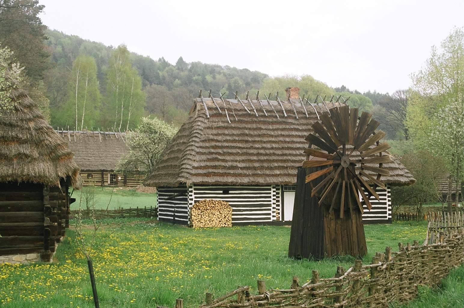
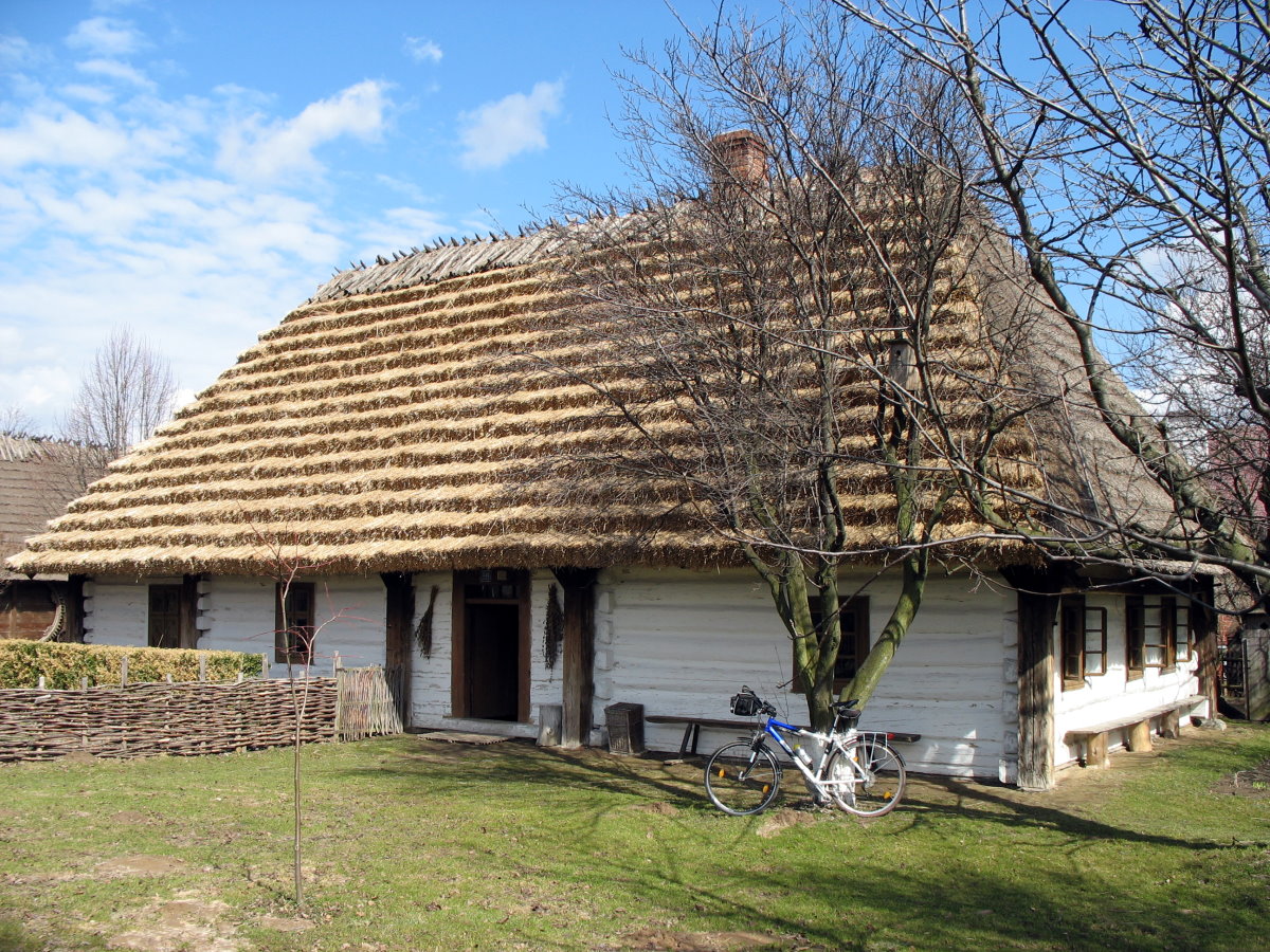
 Skansen in Sanok.
Ruthenian Voivodeship
- Chełm Land (Ziemia Chełmska), Chełm
- Chełm County, (Powiat Chełmski), Chełm
- Powiat of Krasnystaw, (Powiat Krasnystawski), Krasnystaw
- Powiat of Ratno, (Powiat Ratneński), Ratno
- Halicz Land (Ziemia Halicka), Halicz
- Powiat of Halicz, (Powiat Halicki), Halicz
- Kolomyja County, (Powiat Kołomyjski), Kołomyja
- Trembowla County, (Powiat Trembowelski), Trembowla
- Lwów Land (Ziemia Lwowska), Lwów
- Powiat of Lwów, (Powiat Lwowski), Lwów
- Powiat of Żydaczów, (Powiat Żydaczowski), Żydaczów
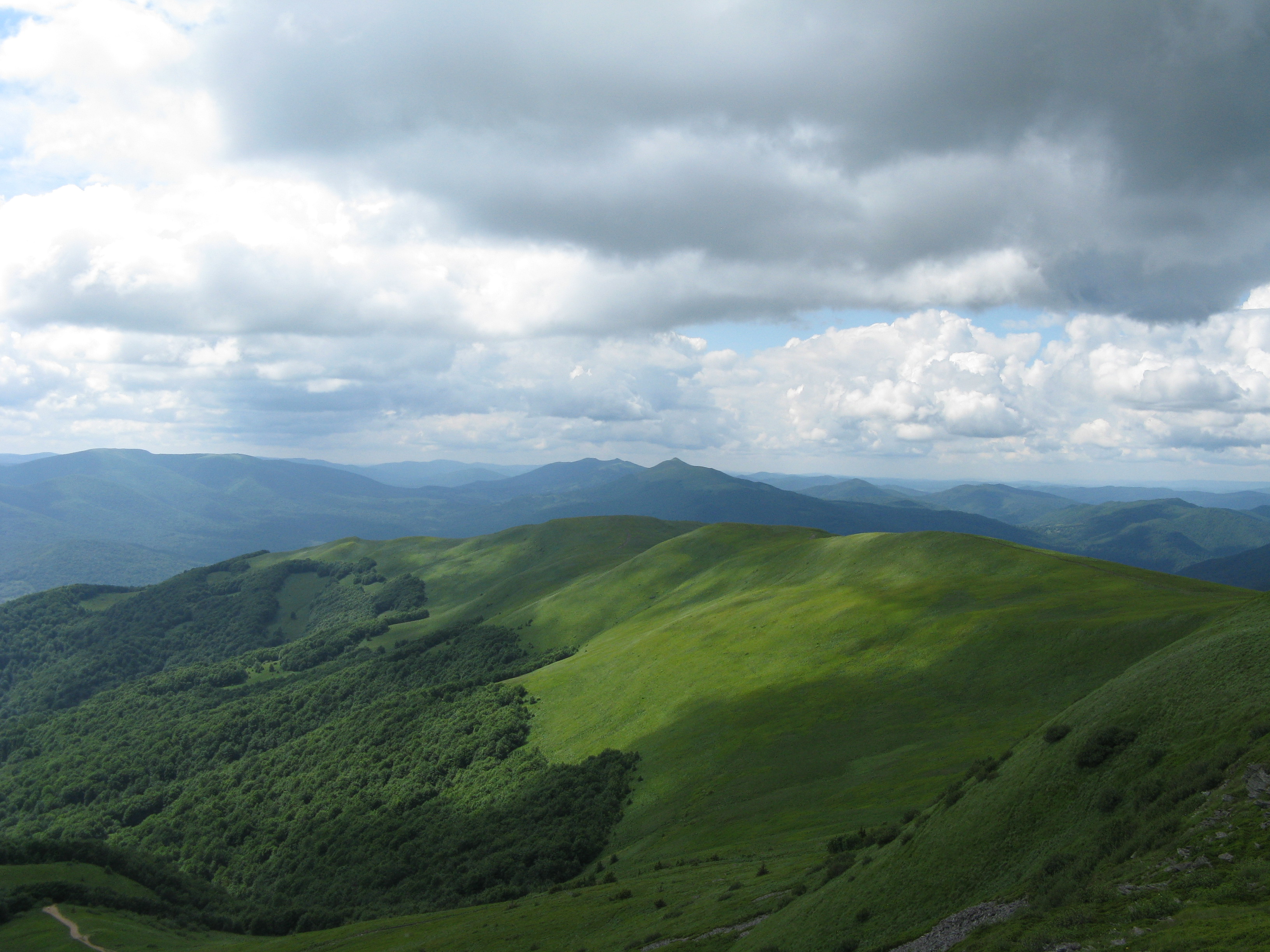
 Szeroki Wierch seen from Tarnica.
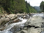 Bieszczady.
- Przemyśl Land (Ziemia Przemyska), Przemyśl; Its area was 12,000 sq. km. and in the 17th century it was divided five smaller regions (county, powiaty).
- Sanok Land (Ziemia Sanocka), Sanok
- Sanok County (Powiat Sanocki), Sanok. Actually the intensive development of human settlements in the region took place during 13th — 15th centuries. The settlements were located according to the German Law within an area flanked by Wisłok, San and Wisłoka rivers. The historic Red Ruthenia, reaching on its south-west to Przemyśl and Sanok, has been inhabited for nearly the last ten centuries mostly by the Ruthenian population. The Wallachians engaged mainly in mountain pasturage, were probably also familiar with some forms of agriculture. Moving to the West, the Vallachians founded numerous villages in the Przemysl and Sanok regions in the 15th century. In the Sanok Province there were 6 Israelite communities with synagogues and kahal organizations. Jewish Communities of the 16th and 17th centuries had legislative autonomy also in the sphere of criminal law. Social ethnic background, using various law systems (German, Ruthenian and Wallachian). Peasants occupied themselves mainly with farming and sheep breeding. What was characteristic of the Sanok region was that many subjects of Hungarian lords participated in the brigandage activities there while peasants living in poland took part in robberies in Hungary. At the head of the list comes the land of Sanok which, in the matter of rural population even surpassed in density the neighbouring Palatinate of Cracow. Last in rank comes the land of Halicz, the most eastward, which was perpetually threatened with Tatar and Wallachian invasions.
Bełz Voivodeship
-
- Belz County, (Powiat Bełzski), Bełz
- Grabowiec County, (Powiat Grabowiecki), Grabowiec[disambiguation needed
 ]
] - Horodło County, (Powiat Horodelski), Horodło
- Lubaczów County, (Powiat Lubaczowski), Lubaczów
- Busk Land, (Ziemia Buska), Busk
 Ruthenia CoA[23]
First World War and Polish-Ukrainian conflict
During the First World War, Galicia (Red Ruthenia) saw heavy fighting between the forces of Russia and the Central Powers. The Russian forces overran most of the region in 1914 after defeating the Austro-Hungarian army in a chaotic frontier battle in the opening months of the war. This gave Russia the opportunity to invade Germany from the south. In 1918, Western Ruthenia became a part of the restored Republic of Poland, while the local Ukrainian population briefly declared the independence of Eastern Galicia as the West Ukrainian People's Republic. These competing claims lead to the Polish-Ukrainian War. In the western part of Red Ruthenia, Rusyn Lemkos formed the Lemko-Rusyn Republic in 1918, initially attempting to unite with Russia, instead of Ukraine. As this was impossible, they later attempted to unite with Rusyns from the area south of the Carpathians, in an attempt to join Czechoslovakia as a third ethnic entity. This effort was suppressed by the Polish government in 1920, and the area was incorporated into Poland. The leaders of the republic were tried by the Polish government, but were acquitted.
Second World War and Distrikt Galizien
In 1939 the Supreme Command of the Wehrmacht approved a plan Fall Weiß (1939) with details of future attack on Poland. In the plan, military brigades from Galicia played the role of a Fifth column, to attack and demoralize the Polish Army in the rear, if resistance from Polish troops were stronger than expected.[24] After September 17, 1939, all territory east of the San, Bug and Neman rivers, approximating the former territory of East Galicia (Red Ruthenia), was annexed into the USSR. This territory was divided into four administrative districts (oblasts): Lviv, Stanislav, Drohobych and Ternopil (the latter including parts of Volhynia) of the Soviet Republic of Ukraine. In 1940–1941, the Soviet authorities conducted four mass deportations from the eastern part of the Second Polish Republic, inhabited by Ukrainians, Belarusians, Jews, Lithuanians, Russians, Germans, Czechs, and Armenians, along with Poles. Approximately 335,000 Polish citizens were carried out and deported to Siberia, Kazakhstan, and the north-east of European Russia, by the NKVD. According to general Vasily Khristoforov, the director of the FSB archives in Moscow, exactly 297,280 Polish citizens were deported in 1940.[25]
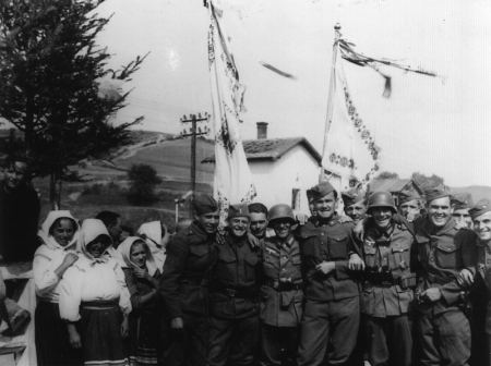
 Cheerful German and Slovak soldiers posing with Ukrainian civilians in Komańcza Red Ruthenia, Poland 1939. (see Slovak invasion of Poland (1939).
After June 22, 1941, the period of Sovietisation came to an end when Germany occupied East Ruthenia during Operation Barbarossa. This was a period of massacres. Evacuating Soviets decided instantly to kill the mass of people waiting in the prisons for deportation to the Gulag even if their fault was petty crimes or no fault at all.
Conflicts in Ruthenia and Volhynia between Poles and Ukrainians also intensified during this time, with skirmishes between the Polish Home Army (AK), Ukrainian Insurgent Army (UPA), German Wehrmacht, and Soviet partisans. These conflicts included the massacres of Poles in Volhynia, and within Ruthenia, revenge attacks on Ukrainians and Operation Vistula. Despite these warring factions, and despite Ukrainian Galicians joining the UPA and supporting its anti-Soviet, anti-Polish, and anti-German policies, some also joined Germany in its fight against the USSR, forming the 14th Waffen Grenadier Division of the SS Galizien (1st Ukrainian). The Division SS "Galizien" was commanded by German and Austrian officers (Walter Schimana, Fritz Freitag) who were delegated to the division.
Post-war
The new Poland/USSR border, with majority Polish-speaking areas to the west, and Ukrainians (Ruthenes) to the east was recognized by the western Allies as part of the Yalta Conference with the Soviet Union. There were however large minority populations on either side of the new frontier and the end of the Second World War saw the forcible population transfer of over 500,000 people by the Communist authorities, Ukrainians moving to the east and Poles to the west in the Operation Vistula.
See also
- Lędzianie
- History of Ukraine
- History of Poland
- Ruthenia
- White Ruthenia
- Black Ruthenia
- Ivano-Frankivsk Oblast
- Stanislawow Voivodeship
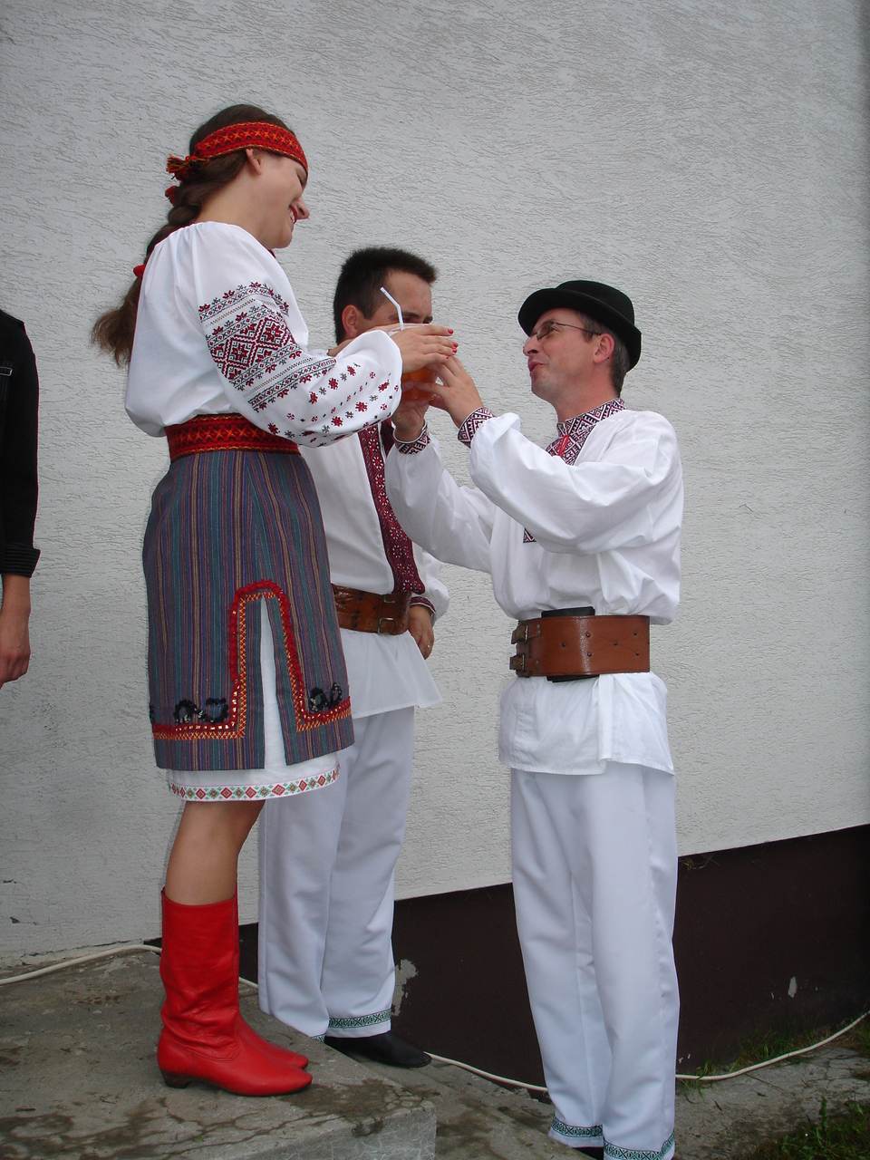
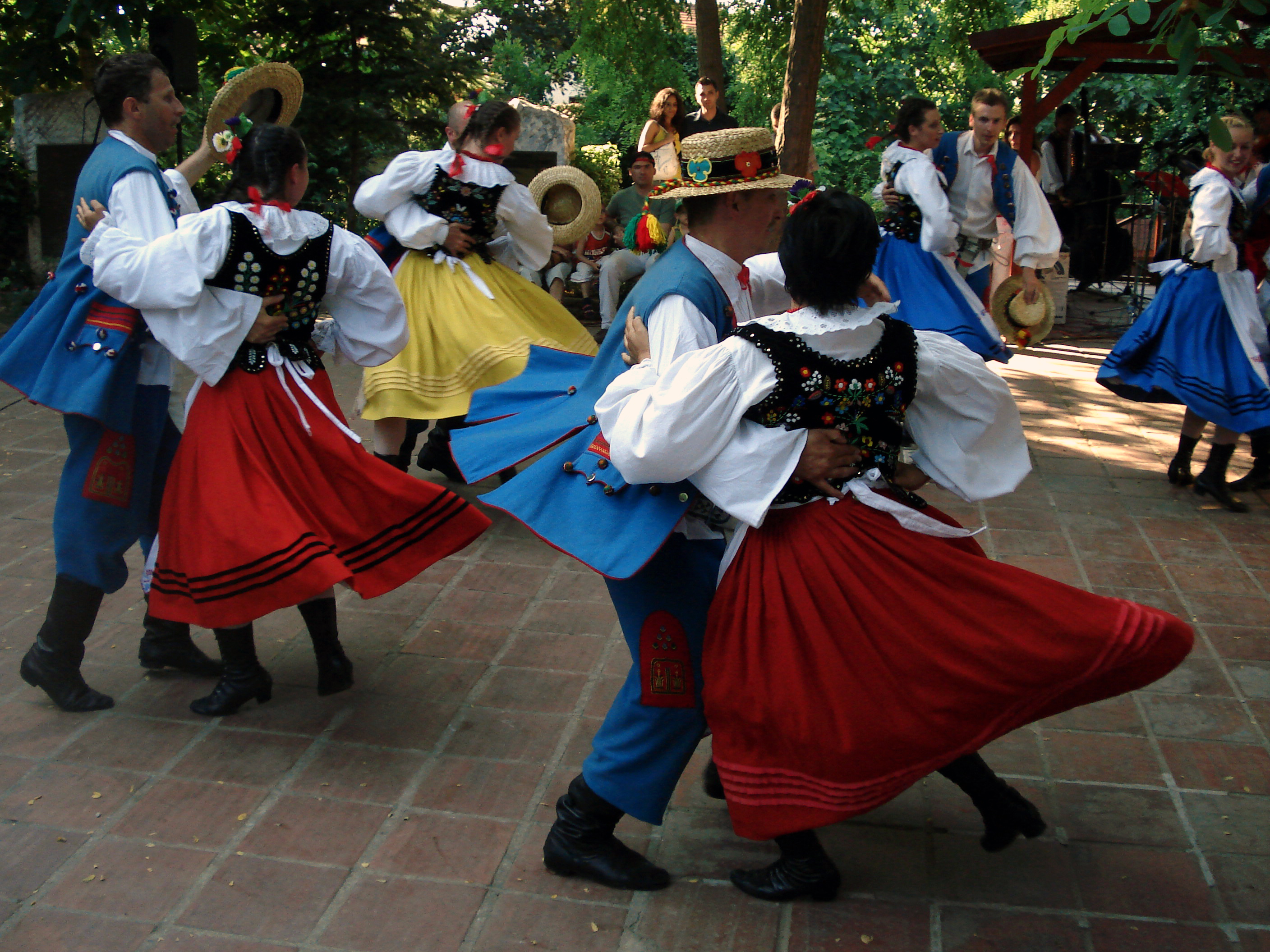
 Polish folk-costumes Pogórzanie.
Sources
- "Monumenta Poloniae Historica"
- Akta grodzkie i ziemskie z archiwum ziemskiego. Lauda sejmikowe. Tom XXIII, XXIV, XXV.
- Słownik geograficzny Królestwa Polskiego (Digital edition)
- Lustracja województwa ruskiego, podolskiego i bełskiego, 1564-1565 Warszawa, (I) edition 2001, pages 289. ISBN 83-7181-193-4
- Lustracje dóbr królewskich XVI-XVIII wieku. Lustracja województwa ruskiego 1661—1665. Część III ziemie halicka i chełmska. Polska Akademia Nauk - Instytut Historii. 1976
- Lustracje województw ruskiego, podolskiego i bełskiego 1564 - 1565, wyd. K. Chłapowski, H. Żytkowicz, cz. 1, Warszawa - Łódź 1992
- Lustracja województwa ruskiego 1661-1665, cz. 1: Ziemia przemyska i sanocka, wyd. K. Arłamowski i W. Kaput, Wrocław-Warszawa-Kraków. 1970
- Aleksander Jabłonowski. Polska wieku XVI, t. VII, Ruś Czerwona, Warszawa 1901 i 1903.
References
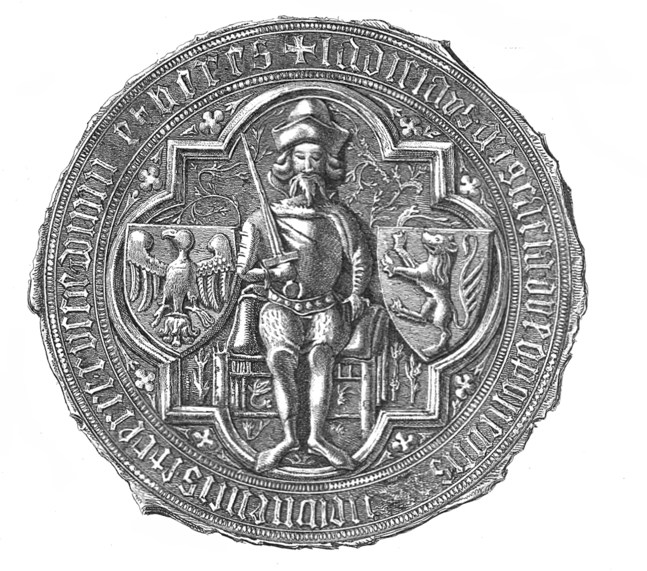
- ^ „Karte von Germania, Kleinpolen, Hungary, Walachai u. Siebenbuergen nebst Theilen der angraenzenden Laender“ von des „Claudii Ptolemaei geographicae enarrationis libri octo“, 1525, Strassburg
- ^ The cultural unity of the area had been disturbed, if we look at it from the perspective of the whole Smaller Poland, after the basin of upper and middle Bug and of upper Wieprz rivers had been taken over in 981 (or 979) by Ruthenia, with its rich culture of urban character, the fact that can be seen in such places as Czermno, Chełm, or Gródek on Bug . This way a new boundary had divided the former community of Lendians living in the basins of rivers San, upper Bug, Styr and probably upper Dniester, who subsequently were absorbed in majority by the eastern Slavic element. In: A. Rozwałka , "Pobuże region as an object of research and protection of the archaeological heritage from the period of Early Middle Ages", Our Bug. Creating conditions for development of the border areas of Poland, Ukraine and Belarus through enhancement and preservation of natural and cultural heritage, Lublin, 2008, p. 109 [1]
- ^ "were mainly Germans, Poles, Armenians and Jews, but also Karaims, Tatars, Greeks or Wallachians [in:] "Kwartalnik historii kultury materialnej: t. 47, PAN. 1999. p. 146
- ^ Vierteljahrschrift für Sozial- und Wirtschaftsgeschichte, 1992
- ^ M. H. Marunchak. The Ukrainian Canadians, 1982
- ^ Czajkowski, 1992; Parczewski, 1992; Reinfuss, 1948, 1987, 1990
- ^ Kwartalnik historii kultury materialnej: t. 47, PAN. 1999. p. 146
- ^ (Ukrainian) Въ лЂто 6478 [970] - 6494 [986]. Лаврентіївський літопис
- ^ Die Chronik der Böhmen des Cosmas von Prag. Berlin, 1923 (MGH SS rer. Germ. NS, 2). I, 33–34. Page 60.
- ^ The entire vicinity of Krakow was to be administered from Prague: "...ad orientem hos fluvios habet terminos: Bug scilicet et Ztir cum Cracouua civitate provintiaque cui Uuag nomen est cum omnibus regionibus ad predictam urbem pertinentibus, que Cracouua est".
- ^ Relacja Ibrahima Ibn Ja'kuba z podróży do krajów słowiańskich w przekazie Al-Bekriego. Krakow, 1946 (MPH NS. 1). Page 50.
- ^ S. Plokhy. "The origins of the Slavic nations: premodern identities in Russia, Ukraine, Belarus". Cambridge University Press. 2006. p. 57.
- ^ The later Halych-Volhynian Chronicle, when describing King Danylo's expedition to Kalisz in 1227, remarks that "no other prince had entered so far into Poland, apart from Vladimir the Great, who had christened that land".
- ^ A. Buko. "The archaeology of early medieval Poland". Brill. 2008. p. 307
- ^ Paszkiewicz. The making of the Russian nation, 1977 p. 104
- ^ Äfven i ett annat slaviskt lånord år ja substitueradt med æ, nåmligen læsir = Ijach, n. pi. Ijasi 'Polack, [in:] s. Axel Olrik i Festskrift til Vilh. Thomsen, 126 f.; [in:] trans. Arkiv för nordisk filologi: t. 19-20. page 280
- ^ H. H. Fisher, "America and the New Poland (1928)", Read Books, 2007, p. 15
- ^ N. Davies, God's playground: a history of Poland in two volumes, Oxford University Press, 2005, pp. 71, 135 [2]
- ^ A. Janeczek, Town and country in the Polish Commonwealth, 1350-1650, in: S. R. Epstein, Town and Country in Europe, 1300-1800, Cambridge University Press, 2004, p. 164
- ^ K. Kocsis, E. K. Hodosi, Ethnic Geography of the Hungarian Minorities in the Carpathian Basin, Simon Publications, 1988, p. 84
- ^ Anna Beredecka, NOWE LOKACJE MIAST KRÓLEWSKICH W MA¸OPOLSCE W LATACH 1333–1370
- ^ Franciszek Kotula. Pochodzenie domów przysłupowych w Rzeszowskiem. "Kwartalnik Historii Kultury Materialnej" Jahr. V., Nr. 3/4, 1957, S. 557
- ^ "Lew wspięty w koronie, herb najważniejszego nabytku terytorialnego Kazimierza Wielkiego — Rusi Czerwonej, wywodzi się od poświadczonego już w drugiej dekadzie XIV w. godła napieczętnego książąt halicko-włodzimierskich Andrzeja i Lwa." [in:] Polskie herby ziemskie: geneza, treści, funkcje. 1 93. p. 14
- ^ Sergei Berets. Ukrainian Legion - allies of Nazis, rivals of Bendera.. BBC World Service - Russian Service, 02/09/2009.
- ^ Instytut Pamięci Narodowej :: FSB, Moskwa 2004
Ukrainian historical regions Kievan Rus' Principalities Medieval epoch Red Ruthenia · Galicia–Volhynia · Bełz Voivodeship · Bracław Voivodeship · Czernihów Voivodeship · Kijów Voivodeship · Podole Voivodeship · Ruthenian VoivodeshipCossack epoch Cossack Hetmanate · Right-bank Ukraine · Left-bank Ukraine · Sloboda Ukraine · Zaporozhian Sich · Dnieper Ukraine · Little RussiaRussian Imperial guberniyas Austro-Hungarian provinces 20th century Ukrainian SSR · Moldavian ASSR · Drohobych Oblast · Izmail Oblast · Crimean Oblast · Lviv Voivodeship · Ternopil Voivodeship · Volhynian Voivodeship · Stanyslaviv Voivodeship · Carpatho-Ukraine · Reichskommissariat Ukraine · Distrikt GalizienGeographical Nadbuzhia · Budzhak · Black Sea Ukraine · Donbas · Dniester Ukraine · Podolia · Pokuttya · Pryazovya · New Russia · Polissya · Podniprovya · Porossia · Prydunavya · Prykarpattia · Porizhia Ukraine · Volhynia · ArtaniyaEthno-Ukrainian regions abroad Categories:- Former countries in Europe
- States and territories disestablished in 1772
- Rus
- History of Galicia (Eastern Europe)
- Historical regions in Poland
- Historical regions in Ukraine
- East Slavic history
- Ukrainian population groups
- Podkarpackie Voivodeship
- Chełm Land (Ziemia Chełmska), Chełm


Wikimedia Foundation. 2010.