- Sanok County
Infobox Settlement
name = Sanok County
native_name = Powiat sanocki
settlement_type =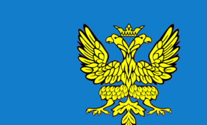
image_shield = POL powiat sanocki COA.svg
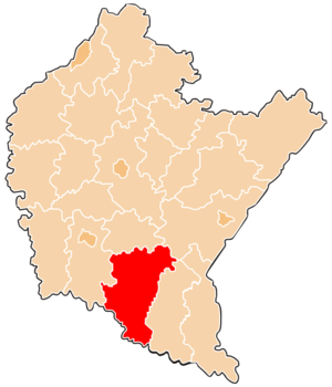
map_caption = Location within the voivodeship
subdivision_type = Country
subdivision_name = POL
subdivision_type1 = Voivodeship
subdivision_name1 = Subcarpathian
area_total_km2 = 1225.12
population_total = 94740
population_as_of = 2006
population_density_km2 = auto
population_urban = 44471
population_blank1_title = Rural
population_blank1 = 50269
coor_type = Sanok
latd = 49
latm = 33
lats =
latNS = N
longd = 22
longm = 13
longs =
longEW = E
seat =Sanok
parts_type =Gmina s
parts = Total 8 (incl. 1 urban)
p1 =Sanok
p2 =Gmina Besko
p3 =Gmina Bukowsko
p4 =Gmina Komańcza
p5 =Gmina Sanok
p6 =Gmina Tyrawa Wołoska
p7 =Gmina Zagórz
p8 =Gmina Zarszyn
blank_name = Car plates
blank_info = RSA
website = http://www.powiat-sanok.pl __NOTOC__Sanok County ( _pl. powiat sanocki) is a unit of territorial administration and local government (powiat ) inSubcarpathian Voivodeship , south-easternPoland , on the Slovak border. It was created onJanuary 1 ,1999 as a result of the Local Government Reorganization Act of 1998. Its administrative seat and largest town isSanok , which lies convert|56|km|mi|0 south of the regional capitalRzeszów . The only other town in the county isZagórz , lying convert|6|km|mi|0|abbr=on south-east of Sanok.The county covers an area of convert|1225.12|km2|sqmi|1. As of 2006 its total population is 94,740, out of which the population of Sanok is 39,481, that of Zagórz is 4,990, and the rural population is 50,269.
Neighbouring counties
Sanok County is bordered by
Krosno County to the west,Brzozów County to the north,Przemyśl County to the north-east andLesko County to the east. It also bordersSlovakia to the south.Administrative division
The county is subdivided into eight
gmina s (one urban, one urban-rural and six rural). These are listed in the following table, in descending order of population.Food
About 60% of the land surface of County is given over to agricultural use. However, very little of this is arable land; the vast majority consists of permanent grass pasture or rough grazing for herd animals such as sheep and cows. Although both beef and dairy cattle are raised widely, especially in Odrzechowa, County is more well-known for its sheep farming, and thus lamb is the meat traditionally associated with Polish cooking.
Literature
* Prof.
Adam Fastnacht . Slownik Historyczno-Geograficzny Ziemi Sanockiej w Średniowieczu (Historic-Geographic Dictionary of the Sanok District in the Middle Ages), Kraków, 2002, ISBN 83-88385-14-3.References
* [http://www.stat.gov.pl/gus/45_655_PLK_HTML.htm Polish official population figures 2006]
Rural landscape picture


Wikimedia Foundation. 2010.