- Poltava Governorate
Infobox Former Subdivision
native_name = Полтавская губернiя
conventional_long_name = Poltava Governorate
common_name = Poltava
subdivision = Governorate
nation = Russian Empire
year_start = 1802
date_start = February 27
year_end = 1925
date_end = August 01
p1 = Malorossiya Governorate
flag_p1 =
s1 = Poltava Oblast
flag_s1 = Flag of Poltava Oblast.svg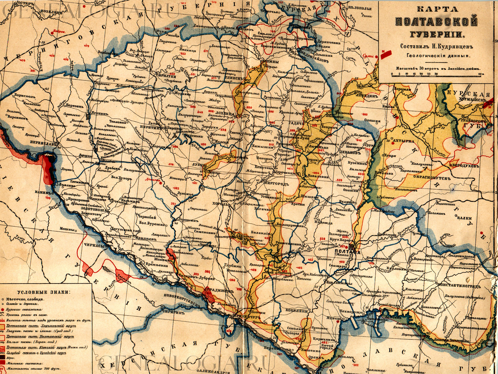
image_map_caption = An old map showing the Poltava Governorate.
capital = Poltava
political_subdiv =uezd s: 15 (1803)
stat_pop1 = 2778151
stat_area1 = 49365
stat_year1 = (1897)The Poltava Governorate ( _ru. Полтавская губернiя; translit.: "Poltavskaya guberniya", _ua. Полтавська Губернія) or Government of Poltava was a
guberniya in the historicalLeft-bank Ukraine region of theRussian Empire , which was officially created in 1802 from the disbandedMalorossiya Governorate with an administrative center ofPoltava . It was administered by 15uezd s:*
Gadyach - Гадячь (Hadiach )
*Zenkov - Зеньковъ (Zinkiv )
*Zolotonosha - Золотоноша
*Kobeliaky - Кобеляки
*Konstantinograd - Константиноградъ (modernKrasnohrad )
*Kremenchug - Кременчугъ (Kremenchuk )
*Lokhvitsa - Лохвица (Lokhvytsia )
*Lubny - Лубны
*Mirgorod - Миргородъ (Myrhorod )
*Pereyaslav - Переяславъ (modernPereyaslav-Khmelnytskyi )
*Piryatin - Пирятинъ (Pyriatyn )
*Poltava - Полтава
*Priluki - Прилуки (Pryluky )
*Romny - Ромны
*Khorol - ХорольMost of these ended up in the modern
Poltava Oblast ofUkraine , although some: Zolotonosha, Konstantinograd, Pereyaslav and Romny are now part of Cherkasy, Kharkiv, Kiev andSumy Oblast s respectfully.The Poltava Governorate covered a total area of 49,365 km², and had a population of 2,778,151 according to the 1897 Russian Empire census. In 1914, the population was 2,794,727. After the formation of the
Ukrainian SSR , the territory was wholly included into the new Soviet Republic. Initially the governorate system was retained although variations included theKremenchug Governorate which was temporarily formed on its territory (August 1920 - December 1922), and the passing of the Pereyaslav uezd to theKiev Governorate .However on Third of June 1925 the guberniya was liquidated and replaced by seven okrugs (which it was already subdivided into as of seventh of March 1923): Zolotoninsky, Krasnohradsky, Kremenchutsky, Lubensky, Poltavsky, Prylutsky and Romensky.External links
* [http://whp057.narod.ru/polta.htm whp] - Information
* [http://gatchina3000.ru/brockhaus-and-efron-encyclopedic-dictionary/081/81355.htm Poltava Guberniya] - Article inBrockhaus and Efron Encyclopedic Dictionary ru icon
* [http://patent.net.ua/symbol/regions/pl/ua.html Poltava Governorate] - Historical coat of arms uk icon/en icon
* [http://www.encyclopediaofukraine.com/display.asp?linkpath=pagesCHChernihivgubernia.htm Chernihiv gubernia] - Article in the [http://www.encyclopediaofukraine.com/ Encyclopedia of Ukraine]
Wikimedia Foundation. 2010.