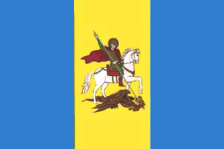
- Kiev Oblast
Infobox Ukrainian oblast
Name = Kiev Oblast (also spelled Kyiv Oblast)
UkrainianName = Київська область
TransliteratedName = Kyivs’ka oblast’
Nickname = Київщинаspaces|2(Ukrainian) "Kyivshchyna"spaces|2(transliteration )

Ukraine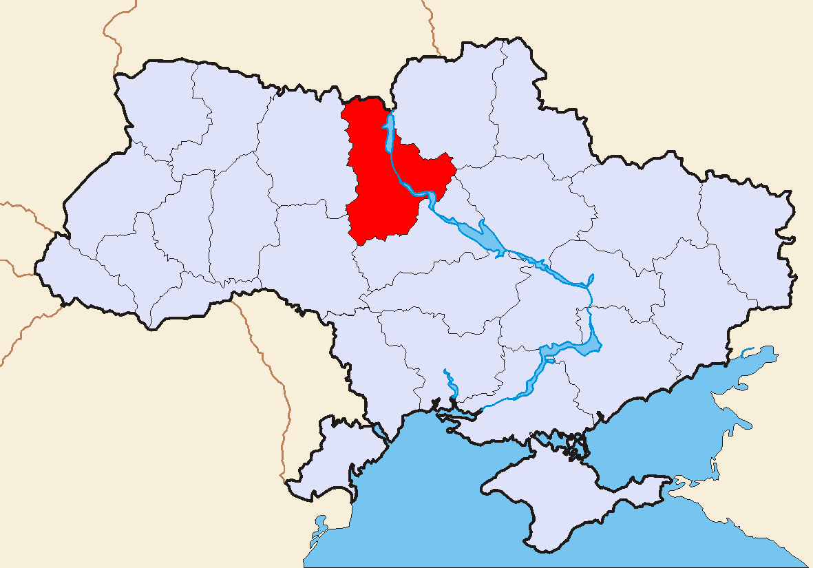
Administrative_center =Kiev
GovernorName = Vira Ulianchenko
GovernorParty = ?
ChairmanName = Yevhen Zhovtiak
ChairmanParty = PMU
CouncilSeats = ?
Raions = 25
CityRaions = 11
Cities = 25
CMTs = 30
Villages = 1,129
AreaRank = 8th
TotalArea = 28,131
LandArea = ?
WaterArea = ?
PercentWater = ?
PopulationYear = 2006
Population_rank = 10th
Population = 1,755,497
Density = 63.01
Population_Growth = ?
SalaryYear = 2006
Salary_rank = 5th
Salary = 1023
Salary_Growth = ?
PostalAbbreviation = 07-09
PostalCodePrefix =List of postal codes#U-Z
ISOCode =
FIPSRegionCode =
PhoneCode = +380-44
Website = www.kyiv-obl.gov.uaKiev Oblast, also written as Kyiv Oblast ( _uk. Київська область, translit. "Kyivs’ka oblast’"; also referred to as Kyivshchyna — _uk. Київщина) is an
oblast (province) in centralUkraine .The administrative center of the oblast is the city of
Kiev ( _uk. Київ, "Kyiv"), also being the capital of Ukraine. Despite being located in the center of the Kiev Oblast, and hosting the governing bodies of the oblast, Kiev itself is a self-governing city with special status and not under oblast jurisdiction.The current Head of the Kiev Oblast State Administration is
Vira Ulianchenko .Geography
Kiev Oblast has a total area of 28,100 km² (approximately 35 times the area of Kiev city) and is located in north-central Ukraine. On the west it borders the
Zhytomyr Oblast , on the Southwest —Vinnytsia Oblast , on the South —Cherkasy Oblast , on the Southeast -Poltava Oblast , on the East and Northeast —Chernihiv Oblast , and on the North — Homyel Voblasts ofBelarus .The oblast is equally split between the both banks of
Dnieper River ("Dnipro") north and south of Kiev. Other significant rivers in the oblast are the Dnieper's tributaries: Pripyat ("Prypiat") (R), Desna (L), Teteriv (R), Irpin' (R), Ros' (R) andTrubizh (L).The length of the Dnipro River within the boundaries of the oblast totals 246 km. The oblast has a total number of 177 rivers intersecting the region; 13 reservoirs (the most notable ones being
Kiev Reservoir and theKaniv Reservoir ), over 2000 ponds, and approximately 750 small lakes.Climate
The climate of Kiev Oblast is characteristic of the
Polesia area and other neighboring forested areas. The oblast has a moderatelycontinental climate with relatively mild Winters and warm Summers. The temperatures range from -6.1 °C in January to 19.2 °C degrees in July.Vegetation
Kiev Oblast has small mountains and slopes on the right bank of the Dnieper River. This entire area is surrounded by a continuous belt by greenery and forests. The oblast's "green area" covers 436 square kilometers, characterized by 250 different sorts of trees and bushes.
History
Kiev Oblast was officially created as part of the
Ukrainian Soviet Socialist Republic onFebruary 27 ,1932 .The current borders of the oblast were last set following the
Chernobyl accident in 1986. Administrative oversight of the new city ofSlavutych , which was constructed as part of theChernihiv Oblast , was then transferred to the Kiev Oblast ("see Chornobyl zone below").Earlier historical administrative units that later became the territory of the oblast include the
Kijów Voivodeship under thePolish-Lithuanian Commonwealth andGrand Duchy of Lithuania , and the Kiev Governorate under theRussian Empire . The northern part of the oblast belongs to the historical region ofPolesia ("Polissia").Points of Interest
The following historic-cultural sites were nominated for the
Seven Wonders of Ukraine .
*Pereyaslav (Natianal preserve)
*Liutych platzdarm
*Ivan Kozlovsky villa
*Dobranychivka settlement
*Saint Pokrov Church (Parkhomivka)
*Museum-villa of Ekaterina Bilokur
*Landscape garden Oleksandria Administrative divisions
The oblast is subdivided into 25
raions ("administrative districts"). It consists of 25 cities, 30 towns, and more than 1,000 villages.The following data incorporates the number of each type of administrative divisions of Kiev Oblast:
* Administrative Center - 1 (
Kiev )
*Raions — 25;
* City raions — 0;
* Settlements — 1184, including:
**Villages — 1129;
** Cities/Towns — 55, including:
***Urban-type settlement — 30;
*** Cities — 25, including:
**** Cities of oblast' subordinance — 11;
**** Cities of raion subordinance — 14;
*Selsovet s — 606.[

raion s and administrative centers.]The local administration of the oblast' is controlled by the Kiev Oblast Rada. The governor of the oblast' is the Kiev Oblast Rada speaker, appointed by the
President of Ukraine .The "exclaves"
The municipality of
Slavutych is located within the borders of the neighboringChernihiv Oblast on the eastern bank of theDnieper river and the municipality has no common border with the Kiev Oblast. Still, Slavutych is administrated by the Kiev Oblast authorities (being a kind of administrativeexclave ).Similarly, the town of
Kotsiubynske , which is located within the borders of Kiev city (which is itself surrounded by the Kiev Oblast), officially belongs to the Kiev Oblast.Chornobyl zone
The north-western end of the oblast is a part of the
zone of alienation due to theradioactive contamination caused by the Chernobyl ("Chornobyl") nuclear reactor accident. The largest cities within zone areChornobyl and Prypiat, which are now abandoned ("seeghost town s"). The city ofSlavutych was built outside of the zone to host evacuated residents of Prypyat and personnel of the zone installations.Important cities and towns
Important cities and towns of Kiev Oblast include:
Demographics
Kiev Oblast's largest nationality group are
Ukrainians (1,684,800 people, or 92.5%), followed byRussians ,Jew s,Belarusians ,Poles , and others. The current estimated population (excluding Kiev) is around 1.8 million (as of 2006). The population density is 63.01/km².The urban population, according to the 2001 Ukrainian Census data, accounted for 1,053,500 people, or 57.6%, and the rural population — for 774,400 people, or 42.4%. [ [http://www.ukrcensus.gov.ua/eng/regions/reg_Kyiv/ Ukrcensus.gov.ua - Kyiv region] URL accessed on November 26, 2006]
According to the data, the number of men accounted for 845,900 people, or 46.3%, that of women — 982,000 people, or 53.7%.
Economy
Industry
Kiev Oblast's main industry's include: power production, food, chemical and petrochemical industries, mechanical engineering and metal-working. The national share of tire production for
automobile s constitutes — 63%,excavator s — 53%, paper and cardboard — 40%, hoisting cranes — 39%. In general, the oblast has a total of 330 licenced industrial enterprises and 742 smaller industrial enterprises. [http://www.kmu.gov.ua/control/en/publish/article?art_id=301241&cat_id=32596 Cabinet of Ministers of Ukraine - Kyiv Region] URL accessed on November 26, 2006]Agriculture
In addition to industry, the oblast also has a developed agriculture production. In 1999, the gross grain yield in the region was about 1,118,600 tons, sugar-beets — 1,570,900 tons, sunflower seeds — 18,1 thousand tons, potatoes — 669,200 tons. The region also produced 156,900 tons of meat, 738,500 tons of milk and 855,2 million eggs. At the beginning of 1999, there were 1,130 registered farms within the oblast. [http://www.kmu.gov.ua/control/en/publish/article?art_id=301241&cat_id=32596 Cabinet of Ministers of Ukraine - Kyiv Region] URL accessed on November 26, 2006]
Transportation
Kiev Oblast has a highly-developed rail transport system. The total length of the oblast's working rairoad lines is 88 km (as of 1985). Through the territory of the oblast pass the:
Moscow —Kiev—Lviv , Kiev—Dnipropetrovsk —Donetsk and other railroad routes. In addition to inter-Ukraine and international rail routes, local Elektrychka lines also pass through the oblast: Kiev—Fastiv—Koziatyn, Kiev—Fastiv—Myronivka, Kiev—Teteriv, Kiev—Nizhyn, and Kiev—Yahotyn.The length of the oblast's automobile roads totals 7,760 km, including 7,489 km of paved roads. The main roads passing thorough the oblast include:
*Saint Petersburg —Kiev—Odessa (M-01/M-05 route)
*Kiev-Kovel -Lublin (M-07 route)
*Voronezh —Kharkiv -Kiev-Lviv -Krakov (E-40, M-06/M03 route)
*Luhansk -Dnipropetrovsk -Kiev (M-04 route) [Київська область: Карта автошляхів. - К.: ДНВП "Картографія", 2006] [Україна: Карта автомобільних шляхів. - К.: Укрегеодезкартографія, 1993.]The oblast's main airports include two international airports: the
Boryspil Airport and the Gostomel (Antonov) Cargo Airport. Ukrainian military airbases are located in the cities ofBila Tserkva andUzyn .Strategic gas-pipelines located in the oblast include
Urengoy —Pomary—Uzhhorod , and Shebelynka—Poltava —Kiev.Education
Kiev Oblast has 795 state-run schools of general education, 219 (27.5%) of which are situated in urban areas and 576 (72.5%) of which — in rural areas. [http://www.kyiv-obl.gov.ua/eng/viewpage.php3?t=4&p=94 Kiev Oblast Administration - Secondary and Higher Education] URL accessed on December 15, 2006] These schools are attended by 232,260 students, 141,416 (60.6%) which attend urban schools, and 98,944 (39.4%) which attend rural area schools. [http://www.kyiv-obl.gov.ua/eng/viewpage.php3?t=4&p=94 Kiev Oblast Administration - Secondary and Higher Education] URL accessed on December 15, 2006] In addition, there are 12 evening schools with an enrollment of over 6,000 students, 15 private institutions containing about 7,000 students, 23 vocational schools containing over 14,300 students, 22 higher schools with an enrollment of over 34,900 students), and 52 home-school institutions containing over 48,700 children. [http://www.kyiv-obl.gov.ua/eng/viewpage.php3?t=4&p=94 Kiev Oblast Administration - Secondary and Higher Education] URL accessed on December 15, 2006] There are also 756 institutions of pre-school education attended by a total of 44,400 children, 52 home-school institutions, 22 vocational institutions, having an enrollment of with 17,300 students. [http://www.kyiv-obl.gov.ua/eng/viewpage.php3?t=4&p=94 Kiev Oblast Administration - Secondary and Higher Education] URL accessed on December 15, 2006]
Also, educational institutions for orphans, physically and mentally disabled children represent an important component of Kiev Oblast's educational system.
In addition to general education schools, the oblast has educational institutions specifically for gifted children, including:
* Fastiv Regional Natural and Mathematic School
* Kyiv Regional Lyceum of Physical Education and Sports
* Stritiv Higher Pedagogical School ofKobza Music
* Brovary Higher School of Physical Education (breeding ground for several world- and Olympic champions).Nomenclature
:"See also: Kiev or Kyiv"
Most of Ukraine's oblasts are named after their
capital cities, officially referred to as "oblast centers". The name of each oblast is arelative adjective , formed by adding a femininesuffix to the name of respective center city: Kiev ("Kyiv") is the center of the "Kyivs’ka oblast"' (Kiev Oblast). Most oblasts are also sometimes referred to in a feminine noun form, following the convention of traditional regional place names, ending with the suffix "-shchyna", as is the case with the Kiev Oblast, "Kyivshchyna".Kiev is the traditional English name for the administrative center of the Kiev Oblast, but the Ukrainianized versions (transliterated from the Ukrainian language) "Kyiv" and "Kyiv Oblast" are sometimes also used.
ee also
*
Subdivisions of Ukraine References
* [http://www.kmu.gov.ua/control/en/publish/article?art_id=301241&cat_id=32596 Information Card of the Region] - Official site of the Cabinet of Ministers of Ukraine
External links
* [http://www.kyiv-obl.gov.ua/eng/ kyiv-obl.gov.ua] - Official website of Kiev Oblast Administration uk icon/ru icon/en icon
* [http://patent.net.ua/symbol/regions/kv/ua.html patent.net.ua] - Symbols of Kiev Oblast
* [http://www.chernobyl.in.ua/ Wormwood Forest] - a "commercial" site, however, containing free-access Chernobyl-related maps and photogallery en icon/uk icon
* [http://www.catalogue.biz.ua/eng/guides/guide_index/1/11/ catalogue.biz.ua] Post codes directory of Kiev Oblast uk icon/ru icon/en icon
* [http://baryshivka.org.ua/ Baryshivka site in the Kyiv Oblast] uk icon
Wikimedia Foundation. 2010.