- Cherkasy Oblast
-
Cherkasy Oblast
Черкаська область
Cherkas’ka oblast’— Oblast — 
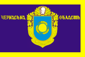
Flag
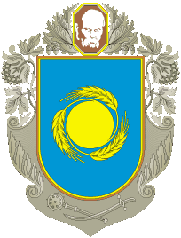
Coat of armsNickname(s): Черкащина (Cherkashchyna) Location of Cherkasy Oblast (red) within Ukraine (blue)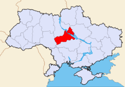
Country  Ukraine
Established January 7, 1954 Admin. center Cherkasy Largest cities Cherkasy, Uman, Smila, Zolotonosha Government – Governor Serhiy Tulub[1] (Party of Regions[1]) – Oblast council 76 seats – Chairperson Volodymyr Hres (BUT) Area – Total 20,900 km2 (8,069.5 sq mi) Area rank Ranked 18th Population (2006) – Total 1,335,064 – Rank Ranked 15th – Density 63.9/km2 (165.4/sq mi) Demographics – Official language(s) Ukrainian – Average salary UAH 817 (2006) Time zone EET (UTC+2) – Summer (DST) EEST (UTC+3) Postal code 18-20xxx Area code +380 47 ISO 3166 code UA-71 Raions 20 Cities of oblast subordinance 6 Cities (total) 25 Towns 34 Villages 838 FIPS 10-4 UP01 Website www.oda.ck.ua
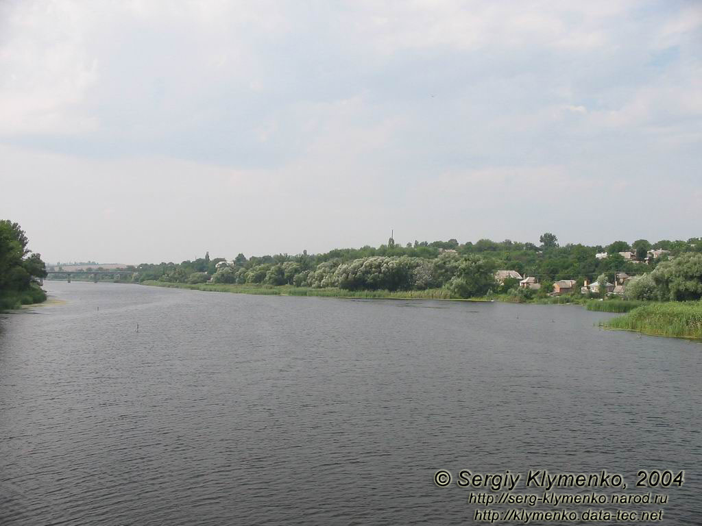
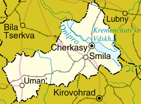
www.rada.gov.uaCherkasy Oblast (Ukrainian: Черкаська область, translit. Cherkas’ka oblast’; also referred to as Черкащина, Cherkashchyna) is an oblast (province) of central Ukraine located along the Dnieper River. The administrative center of the oblast is the city of Cherkasy).
Contents
Geography
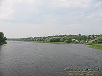
With 20,900 km², the Cherkasy oblast is the 18th largest oblast of Ukraine, comprising about 3.5% of the area of the country. The south flowing Dnieper River with the hilly western bank and the plain eastern bank divides the oblast into two unequal parts. The larger western part belongs to the Dnieper Upland. The low-lying eastern part of the oblast used to be subject to the frequent Dnieper flooding before the flow of the river became controlled by multiple dams of Hydroelectric Power Plants constructed along the river in the 20th century.
The oblast extends for 245 km from south-west to north-east, and for 150 km from north to south. The northern-most point of the oblast is located is near the village of Kononivka in the Drabivskyi Raion (district), the southern-most point near the village of Kolodyste in the Talnivskyi Raion, the western-most point near the village of Korytnya in the Zhashkivskyi Raion, and the eastern-most point near the village of Stetsivka in the Chyhyrynsky Raion. The geometric centre of the oblast is located near the village Zhuravky of the Horodyshchenskyi Raion. The oblast borders the Kiev Oblast to the north, the Kirovohrad Oblast to the south, the Poltava Oblast to the east, and the Vinnytsya Oblast to the west.
History
Main article: History of Cherkasy OblastThe Cherkasy Oblast was created as part of the Ukrainian Soviet Socialist Republic on January 7, 1954. The oblast's territory was the major cities of Cherkasy, Smila and Uman, their corresponding raions (districts), as well as 30 former raions of the Vinnytsia, Kiev, Kirovohrad and Poltava Oblasts.
Archaeological discoveries, have shown that people have inhabited the valley of the Dnieper (Dnipro) River since the times immemorial. The oldest objects excavated on the territory of the region date back to the Stone Age – the Palaeolithic period.
Administrative divisions
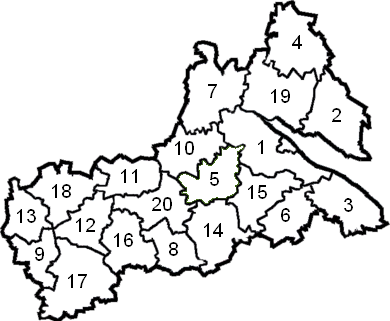
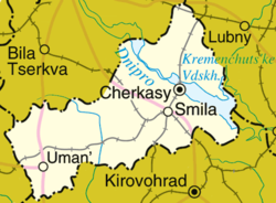 Map of Cherkasy Oblast.
Cherkasy Oblast is administratively subdivided into 20 raions (districts), as well as 6 cities (municipalities) which are directly subordinate to the oblast government: Vatutine, Zolotonosha, Kaniv, Smila, and the administrative center of the oblast, Cherkasy. There are a total of 25 cities, 34 towns, and 838 villages.
The following data incorporates the number of each type of administrative divisions of Cherkasy Oblast:
- Administrative Center—1 (Cherkasy);
- Raions—20;
- City raions—2;
- Settlements—855, including:
- Villages—824;
- Cities/Towns—31, including:
- Urban-type settlements—15;
- Cities—16, including:
- Cities of oblast subordinance—6;
- Cities of raion subordinance—10;
- Selsovets—525.
The local administration of the oblast is controlled by the Cherkasy Oblast Rada. The governor of the oblast is the Cherkasy Oblast Rada speaker, appointed by the President of Ukraine.
Raions
There are 20 raions (districts) in the oblast:
- Cherkasy Raion
- Chornobay Raion
- Chyhyryn Raion
- Drabiv Raion
- Horodyshche Raion
- Kamyanka Raion
- Kaniv Raion
- Katerynopil Raion
- Khrystynivka Raion
- Korsun-Shevchenkivskyi Raion
- Lysianka Raion
- Mankivka Raion
- Monastyryshche Raion
- Shpola Raion
- Smila Raion
- Talne Raion
- Uman Raion
- Zhashkiv Raion
- Zolotonosha Raion
- Zvenyhorodka Raion
Demographics

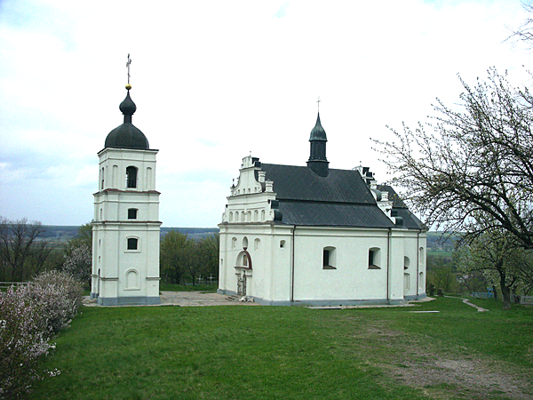
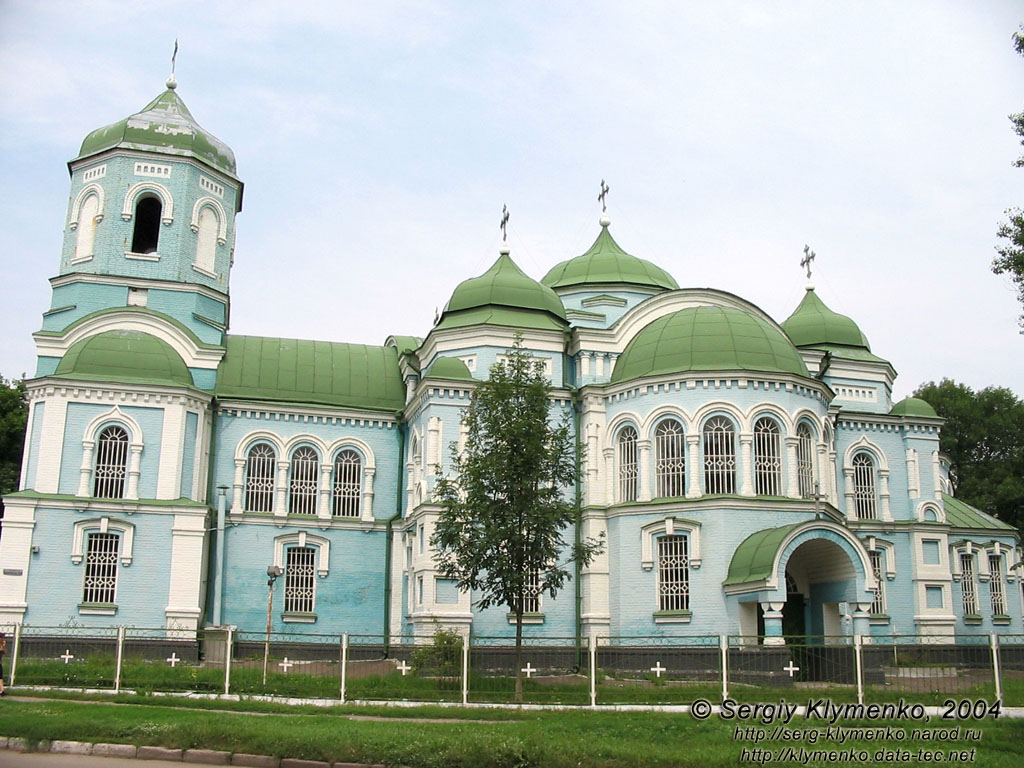
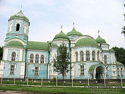 The Sviato-Uspenskyi Cathedral in Zolotonosha.
The current estimated population is 1,335,064 (as of 2006).
According to the 2001 Ukrainian census, the oblast's population is almost equally divided between the urban and rural areas (53.7% and 46.3%, respectively).[2] The demographic situation in this largely agricultural territory is somewhat complicated by population ageing.[3]
By ethnic composition, Ukrainians represent the overwhelming majority of the oblast's population (93.6%).[4] Ethnic Russians are the distant second group of population (5.4%), and are concentrated mainly in the city of Cherkasy.
The oblast is primarily Ukrainophone.
Economy
The economy of the Cherkasy Oblast is largely dominated by agriculture. While the winter wheat and sugar beets are the main products grown in the oblast, barley, corn, tobacco and hemp are also grown. Cattle breeding is also important.
The industry is mainly concentrated in Cherkasy, the oblast's capital and the largest city. A chemical industry was developed in the city in late 1960s in addition to machine building, furniture making and agricultural processing.
Attractions
- Sofiivka
- Fatherland of Taras Shevchenko
- Trypillian culture
- Shevchenko National preserve
Nomenclature
Most of Ukraine's oblasts are named after their capital cities, officially referred to as "oblast centers" (Ukrainian: обласний центр, translit. oblasnyi tsentr). The name of each oblast is a relative adjective, formed by adding a feminine suffix to the name of respective center city: Cherkasy is the center of the Cherkas’ka oblast’ (Cherkasy Oblast). Most oblasts are also sometimes referred to in a feminine noun form, following the convention of traditional regional place names, ending with the suffix "-shchyna", as is the case with the Cherkasy Oblast, Cherkashchyna.
See also: Romanization of UkrainianSee also
- Administrative divisions of Ukraine
- Right and Left-bank Ukraine, historical region
References
- ^ a b Yanukovych appoints governors of Kirovohrad, Sumy, Vinnytsia, Cherkasy and Ternopil regions, Kyiv Post (April 7, 2010)
- ^ "General results of the census / Urban and rural population / Cherkasy region". 2001 Ukrainian Census. http://www.ukrcensus.gov.ua/eng/results/general/urban-rural/Cherkasy/. Retrieved 2007-06-03.
- ^ "General results of the census / Age composition of population / Cherkasy region". 2001 Ukrainian Census. http://www.ukrcensus.gov.ua/eng/results/general/age/Cherkasy/. Retrieved 2007-06-03.
- ^ "General results of the census / National composition of population / Cherkasy region". 2001 Ukrainian Census. http://www.ukrcensus.gov.ua/eng/results/general/nationality/Cherkasy/. Retrieved 2007-06-03.
- "Cherkasy Region". Cabinet of Ministers of Ukraine. http://www.kmu.gov.ua/control/en/publish/article?art_id=116717&cat_id=32596. Retrieved 2007-06-01.
- (1972) Icтopia мicт i ciл Укpaїнcькoї CCP - Черкаськa область (History of Towns and Villages of the Ukrainian SSR - Cherkasy Oblast), Kiev. (Ukrainian)
External links
- oda.ck.ua—Official website of Cherkasy Oblast Administration (Ukrainian)/(Russian)/(English)
- ukrainebiz.com—Cherkasy oblast: facts and figures
Administrative divisions of Cherkasy Oblast, Ukraine Raions 

Cities Cherkasy · Chyhyryn · Horodysche · Kamianka · Kaniv · Khrystynivka · Korsun-Shevchenkivskyi · Monastyrysche · Shpola · Smila · Talne · Uman · Vatutine · Zhashkiv · Zolotonosha · ZvenyhorodkaUrban-type
settlementsVillages Administrative divisions of UkraineOblasts Cherkasy · Chernihiv · Chernivtsi · Dnipropetrovsk · Donetsk · Ivano-Frankivsk · Kharkiv · Kherson · Khmelnytskyi · Kiev · Kirovohrad · Luhansk · Lviv · Mykolaiv · Odessa · Poltava · Rivne · Sumy · Ternopil · Vinnytsia · Volyn · Zakarpattia · Zaporizhia · ZhytomyrCities with special status Autonomous Republic Administrative centers Cherkasy · Chernihiv · Chernivtsi · Dnipropetrovsk · Donetsk · Ivano-Frankivsk · Kharkiv · Kherson · Khmelnytskyi · Kiev · Kirovohrad · Luhansk · Lutsk · Lviv · Mykolaiv · Odessa · Poltava · Rivne · Sevastopol · Simferopol · Sumy · Ternopil · Uzhhorod · Vinnytsia · Zaporizhia · ZhytomyrCategories:- Cherkasy Oblast
- Oblasts of Ukraine
- States and territories established in 1954

Wikimedia Foundation. 2010.