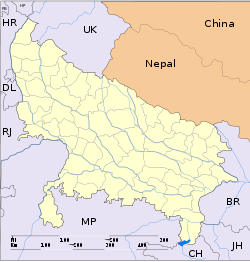
- Nagina
-
Nagina — city — Coordinates 29°27′N 78°27′E / 29.45°N 78.45°ECoordinates: 29°27′N 78°27′E / 29.45°N 78.45°E Country India State Uttar Pradesh District(s) Bijnor Population 71,310 (2001[update]) Time zone IST (UTC+05:30) Area
• 282 metres (925 ft)
Codes-
• Pincode • 246762 • Vehicle • UK 12,UP 20
Nagina is a town and a municipal board in Bijnor district in the Indian state of Uttar Pradesh.
Contents
History
The Ain-e-Akbari mentions the city as the headquarter of Nagina mahal or pargana.[1] During British period, it remained the headquarter of Nagina Tahsil, Bijnor district, in the United Province; and from 1817–1824, it was the headquarter of newly formed Northern Moradabad district.[1] In 1901, the Nagina Tehsil had 464 villages and two towns: Nagina, with a population of 21,412, and Afzalgarh, with a population of 6,474.[1]
Rise of Rohilla power in the area was marked by an 18th century fort, which was later used as tahsili or tehsil offices. In 1805, the city was sacked by the Pashtuns under Muhammad Amir Khan.[1]
As a part of the Indian Rebellion of 1857, Nagina was the site of battle between the Nawab of Najibabad and the British, ending in the defeat of the Nawab on April 21, 1858,[2] following which British established their authority in Bijnor, and later, in 1886, Nagina became a municipality.[2]
A famous poet Khurrum Shahzad Noor was born here.
Nagina Lok Sabha constituency is one of the 80 Lok Sabha (parliamentary) constituencies in Uttar Pradesh state in northern India. This constituency came into existence in 2008, as a part of delimitation of parliamentary constituencies based on the recommendations of the Delimitation Commission of India constituted in 2002.
Agriculture Center (Krishi Vigyan Kendra, Nagina)
It was established in 1995 to help farmers in crop production, Animal Husbandary, Fisheries,etc. They train the farmers and demonstrate new technologies to raise crops.The mandate of KVK is spreading knowledge and teaching skills to improve the productivity and profitability of the farming.
Geography
Nagina is located at 29°27′N 78°27′E / 29.45°N 78.45°E.[3] It has an average elevation of 222 metres (728 ft).
Handicrafts
Nagina is famous for its wooden handicrafts, especially ebony work.That is why it is also known as 'Wood Craft City'. A neighborhood called Luhari Sarai is famous for its wooden items and world-known artisans.
Demographics
According to Census of India in 2001 ,[4] Nagina had a population of 71,310. Males constitute 53% of the population and females 47%. Nagina has an average literacy rate of 69%, higher than the national average of 59.5%; Male literacy is 73%, and female literacy is 54%. In Nagina, 14% of the population is under 6 years of age.
Education
1. S.T.Mary's School, Nagina.
2. M.M.Inter College, Nagina.
3. Dayanand Vaidik Kanya Inter College, Nagina
4. Hindu Inter College, Nagina.
5. Krishna Gopal Mahavidyalya, Nagina.
6. City Degree College, Nagina.
7. Iqbal Memorial Inter College, Nagina.
8. Indian Public Junior High School, Nagina.
9. Gandhi Inter College, Nagina.
10.Radha Sarswati Vidya Mandir, Nagina.
11. Tigri Manka Wala Medical College, Nagina
12. Nehru Junior High School Lal Sarai, Nagina
References
- ^ a b c d Nagina Town The Imperial Gazetteer of India, v. 18, p. 299.
- ^ a b Nagina2 The Imperial Gazetteer of India, v. 18, p. 300.
- ^ Falling Rain Genomics, Inc - Nagina
- ^ "Census of India 2001: Data from the 2001 Census, including cities, villages and towns (Provisional)". Census Commission of India. Archived from the original on 2004-06-16. http://web.archive.org/web/20040616075334/http://www.censusindia.net/results/town.php?stad=A&state5=999. Retrieved 2008-11-01.
Cities and towns in Bijnor district Bijnor Cities and towns
in other districtsAgra · Aligarh · Allahabad · Ambedkar Nagar · Auraiya · Azamgarh · Badaun · Bagpat · Bahraich · Ballia · Balrampur · Banda · Barabanki · Bareilly · Basti · Bhimnagar · Bulandshahr · Chandauli · Chhatrapati Shahuji Maharaj Nagar · Chitrakoot · Deoria · Etah · Etawah · Faizabad · Farrukhabad · Fatehpur · Firozabad · Gautam Buddha Nagar · Ghaziabad · Ghazipur · Gonda · Gorakhpur · Hamirpur · Hardoi · Jalaun · Jaunpur · Jhansi · Jyotiba Phule Nagar · Kannauj · Kanpur Nagar · Kanshi Ram Nagar · Kaushambi · Kushinagar · Lakhimpur Kheri · Lalitpur · Lucknow · Mahamaya Nagar · Maharajganj · Mahoba · Mainpuri · Mathura · Mau · Meerut · Mirzapur · Moradabad · Muzaffarnagar · Panchsheel Nagar · Pilibhit · Prabuddhanagar · Pratapgarh · Raebareli · Ramabai Nagar · Rampur · Saharanpur · Sant Kabir Nagar · Sant Ravidas Nagar · Shahjahanpur · Shravasti · Siddharthnagar · Sitapur · Sonbhadra · Sultanpur · Unnao · Varanasi
Categories:- Cities and towns in Bijnor district
- Places of Indian Rebellion of 1857
-
Wikimedia Foundation. 2010.


