- Mount Monadnock
-
- This article is about the mountain in New Hampshire. For other mountains with similar names, see Monadnock (disambiguation)
Mount Monadnock Grand Monadnock monadnock 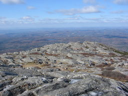 Rocky plateau on summit of Mount Monadnock
Country United States State New Hampshire Region Cheshire County Municipality Jaffrey / Dublin Range Central New England upland Elevation 3,165 ft (965 m) Prominence 2,150 ft (655 m) Coordinates 42°51′39″N 72°6′29″W / 42.86083°N 72.10806°W Biome northern hardwood forest,
boreal forestGeology Littleton formation
schist/ quartzitePeriod 400 million years Ascended by Captain Samuel Willard
(first recorded)- date 1725 Easiest route White Arrow Trail
2.3 mi (3.7 km)Listing #33 New England Fifty Finest Website: Mount Monadnock State Park [1][2] Mount Monadnock, or Grand Monadnock, is the most prominent New England mountain peak south of the White Mountains and east of the Massachusetts Berkshires, and is the highest point in Cheshire County, New Hampshire. It has long been known as one of the most frequently climbed mountains in the world.[3]
At 3,165 feet (965 m), Mount Monadnock is nearly 1,000 feet (300 m) higher than any mountain peak within 30 miles (48 km) and rises 2,000 feet (600 m) above the surrounding landscape. Mount Monadnock, 62 miles (100 km) northwest of Boston and 38 miles (61 km) southwest of Concord, is located within the towns of Jaffrey and Dublin, New Hampshire.[4]
The term "monadnock" has come to be used by American geologists to describe any isolated mountain formed from the exposure of a harder rock as a result of the erosion of a softer rock that once surrounded it (a landform termed inselberg elsewhere in the world).
Monadnock's bare, isolated, and rocky summit provides expansive views. A number of hiking trails ascend the mountain, including the 110-mile (180 km) Metacomet-Monadnock Trail and the 50-mile (80 km) Monadnock-Sunapee Greenway.[4]
It remains clear largely because of fires set by early settlers. The first major fire, set in 1800 to clear the lower slopes for pasture, swept through the stands of virgin red spruce on the summit and flanks of the mountain. Further fires and hurricane damage left the forests a tangle of fallen timber. Between 1810 and 1820, local farmers, who believed that wolves were denning in the blowdowns, set fire to the mountain again. The conflagration raged for weeks, destroying the topsoil and denuding the mountain above 2,000 feet (610 m).[5]
Contents
Name
The word "monadnock" is an Abenaki-derived word used to describe a mountain. Loosely translated it means "mountain that stands alone",[6] although the exact meaning of the word (what kind of mountain) is uncertain. The term was adopted by early settlers of southern New Hampshire and later by American geologists as an alternative term for an inselberg or isolated mountain. Mount Monadnock is often called Grand Monadnock, to differentiate it from other Vermont and New Hampshire peaks with "Monadnock" in their names.[5]
History
The transcendentalists
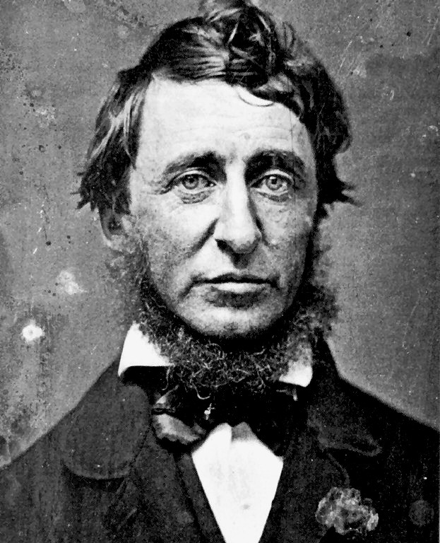
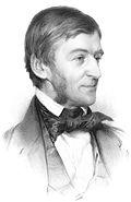 Ralph Waldo Emerson
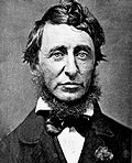 Henry David Thoreau
Both Ralph Waldo Emerson and Henry David Thoreau visited the mountain and wrote fondly of it. Emerson was a frequent visitor, and made the mountain the subject of "Monadnoc"[7], one of his most famous poems. Thoreau visited the mountain four times between 1844 and 1860 and spent a great deal of time observing and cataloging natural phenomenon. He is regarded as having written one of the first serious naturalist inventories of the mountain. A bog near the summit of Mount Monadnock and a rocky lookout off the Cliff Walk trail are named after him; another lookout is named after Emerson.[5]
The Halfway House and other structures
In 1858, Moses Cudworth of Rindge, New Hampshire opened The Half Way House hotel on the south side of the mountain, roughly halfway from the base to the summit. The "Toll Road" was built to service it. By that time the popularity of the mountain was booming, and it was not long before Cudworth enlarged the hotel to accommodate 100 guests. On busy summer days, the stables at the Halfway House held as many as 75 horses. The Halfway House became public property when hundreds of residents of the nearby towns formed a coalition to buy the Toll Road and hotel and prevent a radio tower from being constructed on the summit. After the hotel burned down in 1954, a concession stand operated at the site until 1969 when it and the toll road were both closed to public vehicles. Moses Spring, with its source in a hole drilled through a rock behind the site, is one of the few remaining artifacts of the hotel years.[5]
A small firewarden's hut was located on the summit of Mount Monadnock and operated from 1911 to 1948, when it was decommissioned with the advent of modern means of detecting forest fires. The hut remained as a snack bar and hiker's shelter until 1969 and was removed in 1972. A small cabin, located farther down the mountain, served as the fire lookout's residence. It, too, is gone.[5]
A private dwelling, 100 feet (30 m) south of the site of the former Halfway House, is the last remaining inholding on the mountain above 1,000 feet (300 m).
Hiking history
The earliest recorded ascent of Mount Monadnock took place in 1725 by Captain Samuel Willard and fourteen rangers under his command who camped at the top and used the summit as a lookout while patrolling for Native Americans. Before the practice came to be frowned upon, many early hikers carved their names in the summit; the earliest such engraving reads "S. Dakin, 1801" and is attributed to a local town clerk.[5]
Notable "power hiking" records associated with the mountain include that of Garry Harrington who hiked to the summit sixteen times in a twenty-four hour period and Larry Davis, who claimed to have hiked to the summit daily for 2,850 consecutive days (7.8 years).[8][9]
Mount Monadnock is often promoted as the most hiked mountain in the United States as well as the second most hiked mountain in the world, with 125,000 hikers yearly,[5] behind Mount Fuji in Japan, with about 200,000 yearly hikers. Bus routes that head part way up Mount Fuji opened in 1990, however, even from that base, each person who reaches the summit of Mount Fuji has climbed about 5,000 feet (1,500 m), more than twice the ascent of Mount Monadnock.[10] Neither mountain comes close in popularity to Tai Shan in China, with more than 2 million visitors a year.[11]
Biogeography, ecology, and geology
Due to fires in the early 19th century which burned a majority of the top 300 feet (90 m) around the summit, there is little soil cover on the peak and surroundings upland. Although the mountain has recovered to the degree that its landscape appears natural, Mount Monadnock is an example of a mountain which has an artificial tree line, occurring well below the climatic tree line of similar mountains in the region.[12]
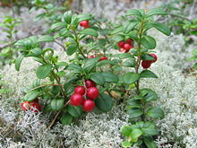
From the base to the summit, floral species diminish with increasingly shallow soil levels. The summit is home to many different specialized sub-alpine species which can retain moisture for long periods of time. Alpine and sub-alpine species include mountain ash, cotton grass, sheep laurel, mountain sandwort, and the mountain cranberry. Krummholz, trees stunted by harsh weather, are found on Mount Monadnock, as are several alpine bogs. Lower elevations on Mount Monadnock are clad in northern hardwood forest species; middle elevations support stands of red spruce. Before the fires, Mount Monadnock was totally covered in a red spruce forest. Since the summit has been barren of soil cover, red spruce have been slowly ascending back towards the top in a process known as ecological succession.[5]
The mountain is largely composed of highly metamorphosed 400-million-year-old schist and quartzite rock primarily associated with the Devonian Littleton Formation, a stratum that extends south into Massachusetts and north into the White Mountains.[13] At lower elevations on the mountain, and stratigraphically below the Littleton Formation, the bedrock is from the Silurian period, consisting of Rangeley Formation schists, Perry Mountain Formation quartzites, the Francestown Formation granulite, and the Warner Formation granulite. Structurally, the mountain is part of an overturned syncline – called a fold nappe – that was caused by the compressional forces of the Acadian orogeny. Dramatic small to medium-scale metamorphic folds are visible on many of the rock faces of the mountain, including the famous Billings Fold (a recumbent syncline found about 450 feet (140 m) west of the summit), shown in the 1942 edition of Marland P. Billings' Structural Geology.[14] In addition to impressive folds, the Devonian Littleton Formation also shows large pseudomorphs of sillimanite after andalusite. These sillimanite crystals, normally needle thin, occur as 4-inch (102 mm) long "turkey tracks" on Mount Monadnock and were formed during prograde metamorphism.[5]
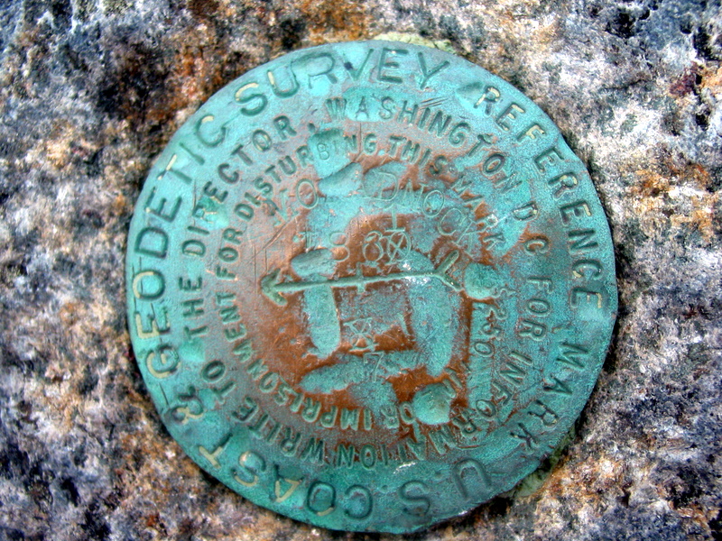
 USGS benchmark on the summit
Hydrology
Mount Monadnock lies on the divide between the Connecticut River and Merrimack River watersheds. The northern slopes of the mountain drain to Howe Reservoir, then via Minnewawa Brook to the Ashuelot River, the Connecticut River, and ultimately Long Island Sound. Gleason Brook and Mountain Brook flow off the western slopes, then via Shaker Brook to the South Branch of the Ashuelot River. The southwestern slopes of the mountain drain to Fassett Brook, then Quarry Brook, before reaching the South Branch of the Ashuelot.
To the southeast of the mountain, Mead Brook and Stony Brook flow to Mountain Brook, a tributary of the Contoocook River, which flows to the Merrimack River and ultimately the Gulf of Maine. The eastern slopes of the mountain drain to Thorndike Pond, the outlet of which (Stanley Brook) flows northeast to Nubanusit Brook, then into the Contoocook and the Merrimack.[15]
Recreation
Mount Monadnock is open to hiking, backpacking, picnicking, and snowshoeing. Backcountry skiing is possible on some of the lower trails. A seasonal campground on the southeast side of the mountain is maintained by the state of New Hampshire, however, camping is not allowed anywhere else on the mountain. A per-person fee is charged (in season) to park at the Old Toll Road and State Park Headquarters trailheads. There are no roads to the summit, and the Old Toll Road, which leads to the Halfway House site, is closed to vehicles. ATVs are not allowed on the mountain.[16] Good views of the mountain can be had from a number of regional roads and highways, especially from New Hampshire Route 124.
Trails
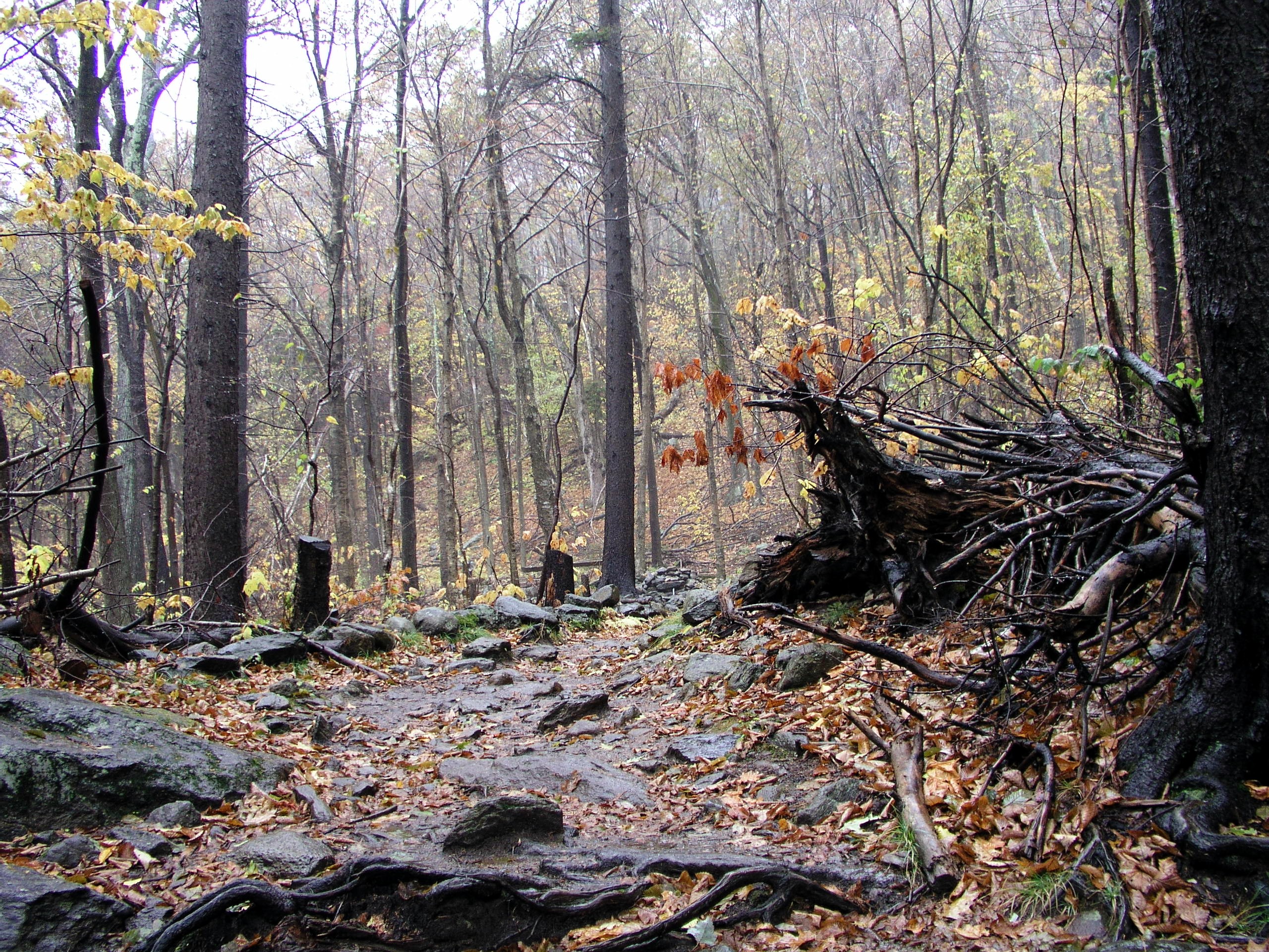
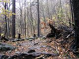 Near the head of the White Dot trail.
Mount Monadnock is criss-crossed by many miles of well-maintained hiking trails. The most popular trails are the White Dot Trail, 2.2 miles (3.5 km), the shortest but steepest ascent, accessible from the Monadnock State Park headquarters and campground on the southeast side of the mountain; and the White Arrow Trail, 2.3 miles (3.7 km) to summit, considered the easiest ascent, via the Old Toll Road (Halfway House) trailhead on the south side of the mountain. Other major trails include:
- The Marlboro Trail, on the west side of the mountain, 2.2 miles (3.5 km) to summit
- The Dublin Path, also part of the Monadnock-Sunapee Greenway, on the north side 2.4 miles (3.9 km) to summit
- The Pumpelly Trail, on the northeast side, the longest ascent, 4.4 miles (7.1 km) to summit
- Access from the east side of the mountain is provided by the Birchtoft Trail (Gilson Pond trailhead) and several connecting trails to the summit.
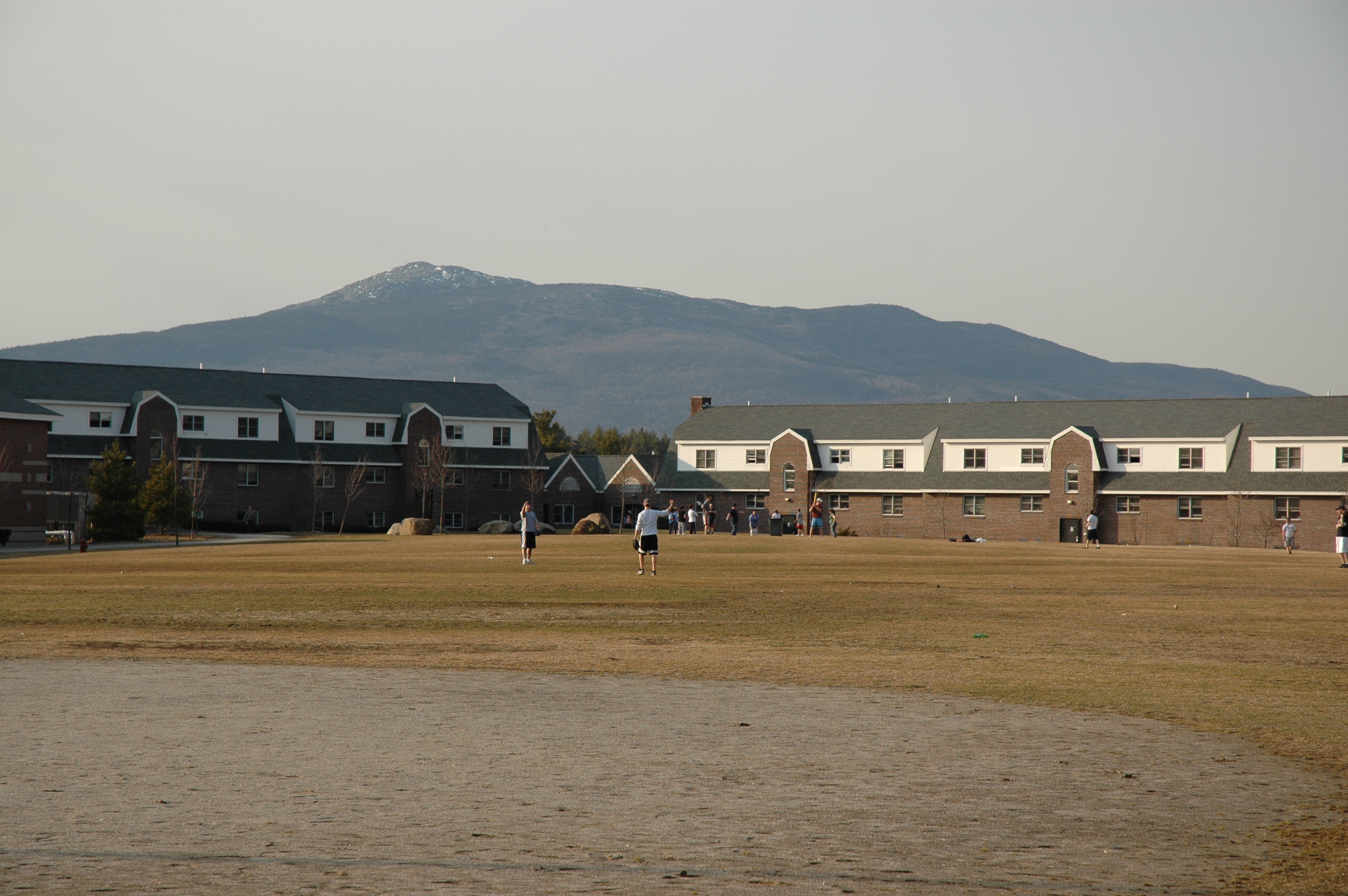
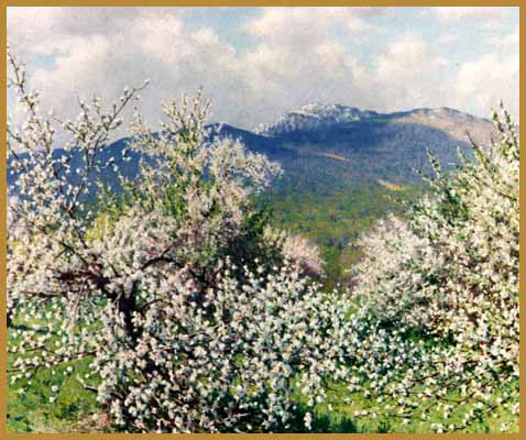
 Mount Monadnock from Franklin Pierce University
Other important trails include the White Cross Trail, an alternative parallel to the White Dot Trail, and the Cliff Walk, a scenic detour that shadows a ledge to the east of the White Arrow Trail.[5] The 110 mile (180 km) Metacomet-Monadnock Trail ascends the mountain from the southwest; however, there is no trailhead where that trail crosses Route 124 at the foot of the mountain, and the highway there is marked with "no parking" signs.[17]
Mount Monadnock is the northern terminus of the Metacomet-Monadnock Trail, a long-distance hiking trail stretching south through Massachusetts to the Connecticut border.[18] The mountain is also the southern terminus of the Monadnock-Sunapee Greenway, a 50-mile (80-km) highland trail connecting Mount Monadnock and Mount Sunapee.[5] A third long distance trail project, the Wantastiquet-Monadnock Greenway, aims at linking Mount Monadnock with Pisgah State Park and Wantastiquet Mountain, a prominent peak in Hinsdale, New Hampshire, overlooking the town of Brattleboro, Vermont and the Connecticut River.[19]
Hiking the mountain
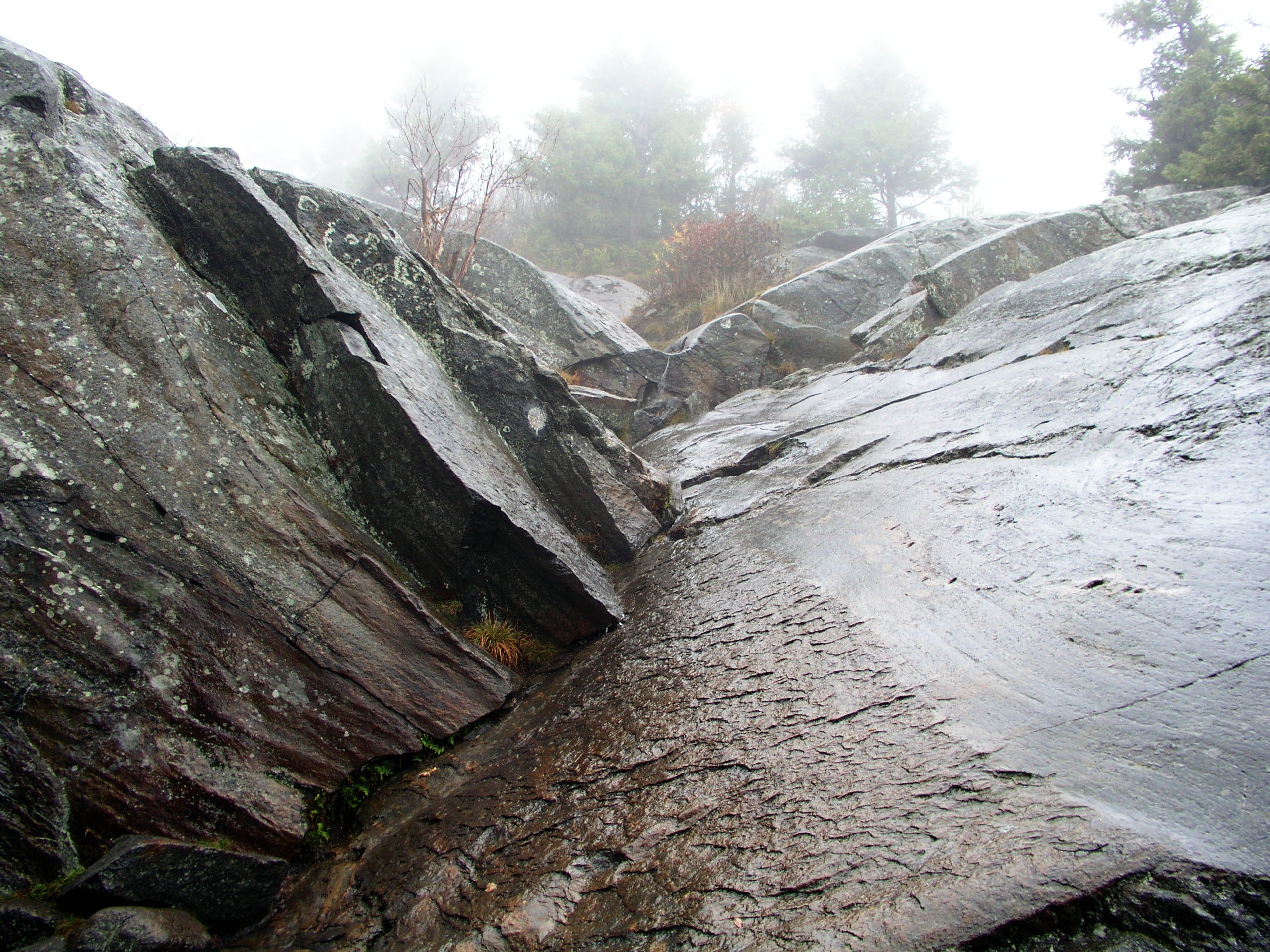
 One mile away from the summit on the White Dot trail.
 A small stream during a rainy day on the White Dot trail.
The four hour round trip to the summit and back via one of the shorter trails is considered moderately challenging for the average hiker but requires no technical skills during the late spring to early fall season. Wind and weather on the exposed, rocky summit is usually harsher than below, year round; winter storms and summer thunderstorms can be life-threatening. Winter snow and ice can linger on the trails well into May, making hiking hazardous or impossible without special equipment. The compacting of snow due to winter recreation on the more frequently used trails tends to lengthen the time it takes for the snow and ice to melt off. Stabilizers, crampons, ice axes, ski poles, and snowshoes may be helpful or necessary for winter and early spring ascents depending on ice and snow cover. Fall hiking generally requires warmer clothing, an awareness of weather conditions, and earlier ascent times. As there are few reliable water sources on the mountain and little shelter from the sun above 2,000 feet (610 m), dehydration and heat stroke are potential hiking hazards. Poison ivy does not grow on Mount Monadnock, and venomous snakes do not inhabit it. The mountain and surrounding area are black bear habitat, although problem encounters with bears are rare.[5][20]
Advice on hiking can be solicited in-season (Memorial Day through Columbus Day and select off-season weekends) at the park headquarters on the southeast side of the mountain. Trail descriptions and maps of Mount Monadnock are published by a variety of commercial and non-commercial sources. The Society for the Protection of New Hampshire Forests prints a complete guidebook with maps, trail descriptions, history, geology, ecology, and other trivia on the mountain.[5]
 A 360° view from the top of Mount Monadnock.
Conservation
Most of the mountain has been protected and is not subject to development. The Society for the Protection of New Hampshire Forests is the major landowner, holding over 4,000 acres (16 km2) in its Monadnock Reservation.[21][22] Lands on Monadnock are leased to the state for management purposes. The state and the town of Jaffrey also own portions of the mountain.[23]
In 2000, the Metacomet-Monadnock Trail was included in a study by the National Park Service for possible inclusion in a new National Scenic Trail, now tentatively called the New England National Scenic Trail, which would also include the Mattabesett and Metacomet trails in Connecticut, giving it some of the status accorded to the Appalachian Trail. However, there seems to be some uncertainty whether or not the New Hampshire section of the Metacomet-Monadnock Trial will be included in the final NST designation.[24]
Artistic tributes
Beside Emerson and Thoreau, other artists and writers have been inspired by Mount Monadnock, including:
- William Preston Phelps (1848–1917), artist, was known as "The Painter of Mount Monadnock"
- Numerous other American artists have painted Mount Monadnock, including Abbott Thayer, Rockwell Kent and Richard Whitney.
- The American composer Alan Hovhaness (1911–2000), who climbed Mount Monadnock several times during his youth, composed a symphonic fantasy entitled Monadnock, Op. 2, around 1935.
- Early 20th century horror fiction writer H.P. Lovecraft wrote a poem about the mountain entitled To Templeton and Mount Monadnock[25]
- Pulitzer Prize-winning poet Galway Kinnell wrote about the mountain in his poem Flower Herding on Mount Monadnock.[26]
- Part of the yearly Mount Monadnock Celebration of Dance takes place on the summit of Mount Monadnock at the autumn equinox.
Other nearby peaks named Monadnock
- Pack Monadnock and North Pack Monadnock are two peaks in the Wapack Range, 11 miles (18 km) to the east across the Contoocook River valley from Mount Monadnock, in Greenfield and Peterborough, New Hampshire. Pack is a Native American word for "little."
- Little Monadnock Mountain is a peak located 7 miles (11 km) southwest of Mount Monadnock in Troy, New Hampshire. Like Mount Monadnock, it is crossed by the Metacomet-Monadnock Trail.
- Monadnock Mountain is the name of a mountain in the Northeast Kingdom of Vermont.
See also
References
- ^ Summit elevation between 960 and 966 m.
- ^ Key col elevation between 1,000 and 1,020 ft (310 m)
- ^ NH Division of Parks & Recreation: Monadnock State Park
- ^ a b DeLorme Topo USA 6.0. (2006). Mapping software. Yarmouth, Maine:DeLorme.
- ^ a b c d e f g h i j k l m Baldwin, Henry I. (1989). Monadnock Guide 4th edition. Concord, New Hampshire:Society for the Protection of New Hampshire Forests.
- ^ "Devonian Period." New Hampshire Geology Home Page. Web. 23 Jan. 2011. <http://www.nhgeology.org/devonian.htm>.
- ^ "Monadnoc"
- ^ Mount Monadnock.com Retrieved December 14, 2007
- ^ American Profile.com Retrieved December 14, 2007
- ^ Japan Guide.com. Retrieved December 15, 2007
- ^ see page 17 of this UNESCO report: http://whc.unesco.org/archive/periodicreporting/apa/cycle01/section2/437.pdf
- ^ Baldwin, Henry I. The Induced Timberline of Mount Monadnock, N. H. Bulletin of the Torrey Botanical Club, Vol. 104, No. 4, pp. 324–333.
- ^ Raymo, Chet and Maureen E. Written in Stone: A Geologic History of the Northeastern United States. Globe Pequot, Chester, Connecticut, 1989.
- ^ Thompson, Peter J., "Geology of Mount Monadnock, New Hampshire", in West, David P. and Bailey, Richard H., eds., Guidebook for geological field trips in New England, Geological Society of America, United States, 2001
- ^ Monadnock Mountain, New Hampshire, 7.5-minute topographic map series (1984). Washington: U.S. Geological Survey
- ^ Monadnock State Park New Hampshire Department of Conservation and Recreation. Retrieved December 10, 2007.
- ^ The Metacomet-Monadnock Trail Guide (1999). 9th edition. Amher4st, Massachusetts: Appalachian Mountain Club.
- ^ Henry Baldwin's Monadnock Guide (see ref.#3) incorrectly states that the Metacomet-Monadnock Trail runs from Mount Monadnock to Meriden, Connecticut, confusing it with the Metacomet Trail.
- ^ Chesterfield Outdoors.com Retrieved December 12, 2007.
- ^ Southern New Hampshire Trail Guide Appalachian Mountain Club, Boston, 1995.
- ^ Society for the Protection of New Hampshire Forests. Retrieved June 22, 2011.
- ^ New Hampshire Division of Parks and Recreation. Retrieved June 22, 2011.
- ^ GRANIT Data Mapper University of New Hampshire. Retrieved February 18, 2008.
- ^ MMM National Scenic Trail. National Park Service. Retrieved December 12, 2007.
- ^ Monadnock.com. Retrieved December 15, 2007.
- ^ Norton Anthology of Modern Poetry 2nd edition, (1988). New York: Norton.
External links
- NH Division of Parks & Recreation: Monadnock State Park
- Mount Monadnock State Park Trail Map
- Monadnock Conservancy
- Society for the Protection of New Hampshire Forests
- U.S. Geological Survey Geographic Names Information System: Monadnock Mountain
- U.S. Congress New England National Scenic Trail Designation Act
- Antioch University New England's Monadnock Ecological Research and Education Project
- History, photos, trails and points of interest on the mountain.
Trails
Categories:- Mountains of New Hampshire
- Landforms of Cheshire County, New Hampshire
- National Natural Landmarks in New Hampshire
- Monadnocks


Wikimedia Foundation. 2010.