- National Register of Historic Places listings in Washington County, Missouri
-
This is a list of properties and historic districts in Washington County, Missouri, that are listed on the National Register of Historic Places. .
Contents: Counties in Missouri A–B · C · D–I · J–K · L–N · O–St. · St. Louis · Ste.–Z -
- This National Park Service list is complete through NPS recent listings posted November 10, 2011.[1]
Current listings
Landmark name Image Date listed Location City or Town Summary 1 Caledonia Historic District October 27, 1986 Roughly bounded by Patrick, College, and Alexander Sts., and MO 21
37°45′48″N 90°46′18″W / 37.76333°N 90.77167°WCaledonia 2 Cresswell Petroglyph Archeological Site 
February 12, 1971 Address restricted Fertile 3 George Cresswell Furnace May 23, 1988 MO F
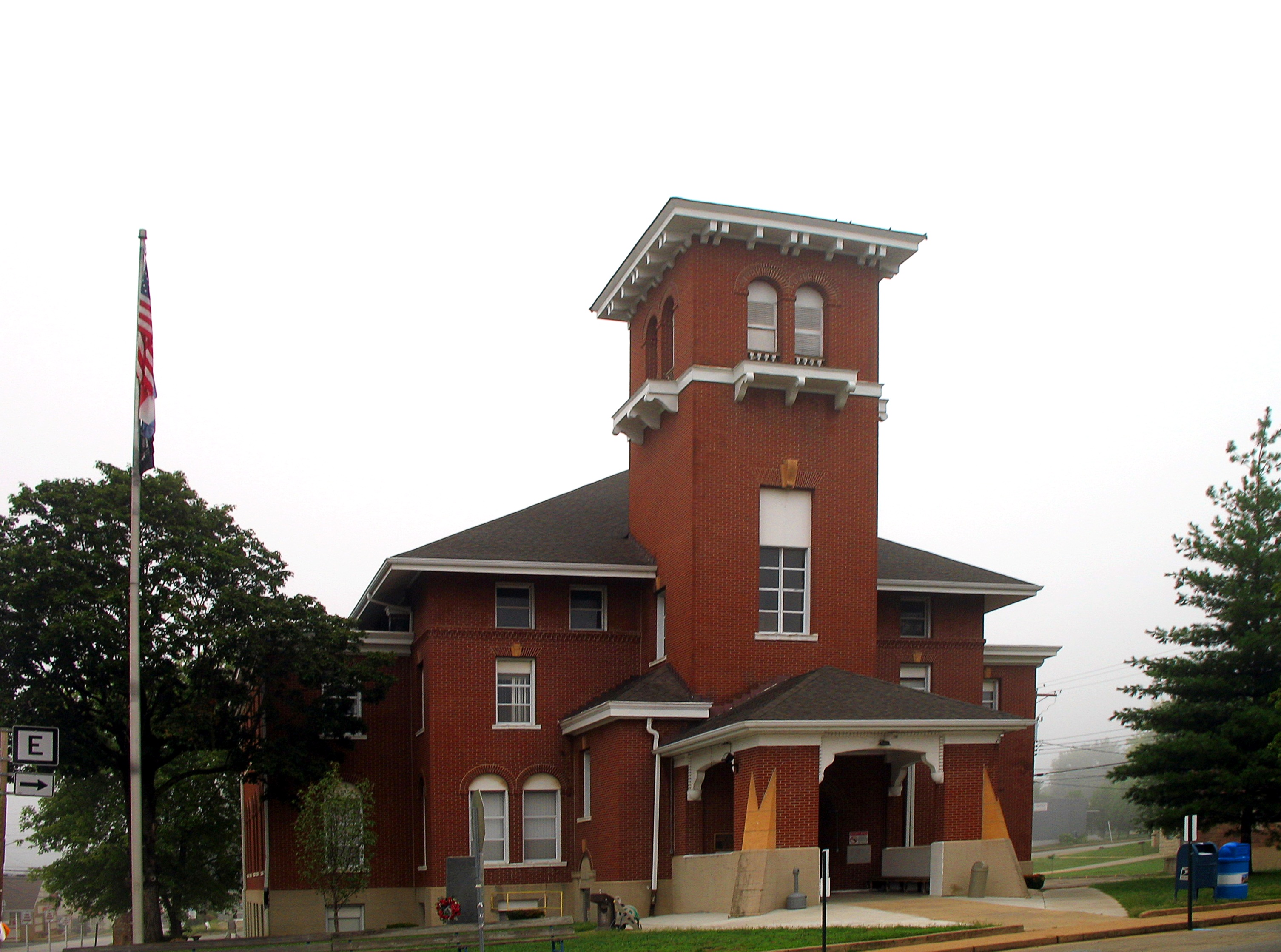
38°2′27″N 90°50′20″W / 38.04083°N 90.83889°WPotosi 4 Land Archeological Site May 5, 1972 Address restricted Caledonia 5 Lost Creek Pictograph Archeological Site January 25, 1971 Address restricted Caledonia 6 Palmer Historic Mining District November 29, 2010 Address restricted Potosi vicinity 7 Harrison Queen House June 27, 2002 Hwy C, 1.3 mi. W of MO 21
37°46′48″N 90°47′55″W / 37.78°N 90.79861°WCaledonia 8 Susan Cave (23WA190) July 8, 1989 Address restricted Shirley 9 Washington County Courthouse 
October 25, 2011 102 N. Missouri St.
37°56′12″N 90°47′17″W / 37.93667°N 90.78806°WPotosi 10 Washington State Park CCC Historic District March 4, 1985 Roughly bounded by MO 102 and MO 104
38°5′1″N 90°41′13″W / 38.08361°N 90.68694°WPotosi 11 Washington State Park Petroglyph Archeological Site April 3, 1970 Address restricted Fertile References
- ^ "National Register of Historic Places: Weekly List Actions". National Park Service, United States Department of the Interior. Retrieved on November 10, 2011.
Municipalities and communities of Washington County, Missouri Cities 
Villages Townships Belgrade | Belleview | Breton | Concord | Harmony | Johnson | Kingston | Liberty | Richwoods | Union | Walton
Unincorporated
communitiesU.S. National Register of Historic Places Topics Lists by states Alabama • Alaska • Arizona • Arkansas • California • Colorado • Connecticut • Delaware • Florida • Georgia • Hawaii • Idaho • Illinois • Indiana • Iowa • Kansas • Kentucky • Louisiana • Maine • Maryland • Massachusetts • Michigan • Minnesota • Mississippi • Missouri • Montana • Nebraska • Nevada • New Hampshire • New Jersey • New Mexico • New York • North Carolina • North Dakota • Ohio • Oklahoma • Oregon • Pennsylvania • Rhode Island • South Carolina • South Dakota • Tennessee • Texas • Utah • Vermont • Virginia • Washington • West Virginia • Wisconsin • WyomingLists by territories Lists by associated states Other Categories:- Washington County, Missouri
- National Register of Historic Places in Missouri
-

Wikimedia Foundation. 2010.