- Irondale, Missouri
Infobox Settlement
official_name = Irondale, Missouri
settlement_type =City
nickname =
motto =
imagesize =
image_caption =
image_
imagesize =
image_caption =
image_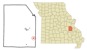
mapsize = 250px
map_caption = Location of Irondale, Missouri
mapsize1 =
map_caption1 =subdivision_type = Country
subdivision_name =United States
subdivision_type1 = State
subdivision_name1 =Missouri
subdivision_type2 = County
subdivision_name2 = Washington
government_footnotes =
government_type =
leader_title =
leader_name =
leader_title1 =
leader_name1 =
established_title =
established_date =unit_pref = Imperial
area_footnotes =area_magnitude =
area_total_km2 = 1.5
area_land_km2 = 1.4
area_water_km2 = 0.0
area_total_sq_mi = 0.6
area_land_sq_mi = 0.5
area_water_sq_mi = 0.0population_as_of = 2000
population_footnotes =
population_total = 437
population_density_km2 = 310.3
population_density_sq_mi = 803.8timezone = Central (CST)
utc_offset = -6
timezone_DST = CDT
utc_offset_DST = -5
elevation_footnotes =
elevation_m = 246
elevation_ft = 807
latd = 37 |latm = 50 |lats = 7 |latNS = N
longd = 90 |longm = 40 |longs = 21 |longEW = Wpostal_code_type =
ZIP code
postal_code = 63648
area_code = 573
blank_name = FIPS code
blank_info = 29-35396GR|2
blank1_name = GNIS feature ID
blank1_info = 0736310GR|3
website =
footnotes =Irondale is a city in Washington County,
Missouri ,United States . The population was 437 at the 2000 census. It is 8 Miles Northeast ofBelgrade, Missouri Geography
Irondale is located at coor dms|37|50|7|N|90|40|21|W|city (37.835204, -90.672505).GR|1
According to the
United States Census Bureau , the city has a total area of 0.6square mile s (1.5km² ), of which, 0.5 square miles (1.4 km²) of it is land and 0.04 square miles (0.1 km²) of it (3.57%) is water.Demographics
As of the
census GR|2 of 2000, there were 437 people, 169 households, and 117 families residing in the city. Thepopulation density was 803.8 people per square mile (312.5/km²). There were 198 housing units at an average density of 364.2/sq mi (141.6/km²). The racial makeup of the city was 97.71% White, 0.23% Native American, 0.46% Asian, and 1.60% from two or more races. Hispanic or Latino of any race were 0.92% of the population.There were 169 households out of which 34.3% had children under the age of 18 living with them, 55.0% were married couples living together, 11.2% had a female householder with no husband present, and 30.2% were non-families. 29.0% of all households were made up of individuals and 11.2% had someone living alone who was 65 years of age or older. The average household size was 2.59 and the average family size was 3.19.
In the city the population was spread out with 28.4% under the age of 18, 10.5% from 18 to 24, 27.0% from 25 to 44, 23.1% from 45 to 64, and 11.0% who were 65 years of age or older. The median age was 34 years. For every 100 females there were 97.7 males. For every 100 females age 18 and over, there were 104.6 males.
The median income for a household in the city was $26,250, and the median income for a family was $30,156. Males had a median income of $25,833 versus $15,909 for females. The
per capita income for the city was $11,819. About 19.5% of families and 23.3% of the population were below thepoverty line , including 44.4% of those under age 18 and 8.5% of those age 65 or over.History
Irondale was founded in 1807 and incorporated as a city in 1908. The town briefly changed its name to Savoy in 1906 to solve the problem of mail getting mixed up with the nearby towns of Ironton and Iron Mountain. The next year the citizens decided to change the name back to Irondale.
Camp Irondale
Irondale once had a Boy Scout camp, called Irondale Scout Reservation. It was opened in 1920, closed and was replaced by the
S-F Scout Ranch in August 1965.Recent Events
In February 2006, the mayor of Irondale, Jennifer Hamelback, was caught by the sheriff's deputies, who were investigating another person who lived there. They found evidence of Ms. Hamelback & the other occupant possessing
methamphetamine . She was arrested. [http://www.mappsd.org/News%20-%20Snapshot14.htm 1]Famous Irondales
*
Thomas Wesley Benoist (1874-1917), aviator, aerospace engineer, founder of the first airline in the USA
*TheIron Mountain Baby , William Moses Gould Helms, subject offolksong , was discovered where the railroad trestle crosses Big River in August, 1902.References
External links
Wikimedia Foundation. 2010.