- National Register of Historic Places listings in Marinette County, Wisconsin
-
Buildings, sites, districts, and objects in Marinette County listed on the National Register of Historic Places
-
- This National Park Service list is complete through NPS recent listings posted November 10, 2011.[1]
This document is intended to provide a comprehensive listing of entries in the National Register of Historic Places that are located in Marinette County, Wisconsin. The locations of National Register properties, the latitude and longitude coordinates of which are included below, may be seen in a Google map.[2]
[3] Landmark name [4] Image Date listed Location City or town Summary 1 Amberg Town Hall 
March 20, 1981 One third mile off U.S. 141 on County V.
45°30′09″N 87°59′40″W / 45.5025°N 87.994444°WAmberg 2 Bijou Theatre Building March 11, 1993 1722-1726 Main St.
45°05′58″N 87°37′47″W / 45.099444°N 87.629722°WMarinette 3 Chautauqua Grounds Site 
April 29, 1997 Address Restricted Marinette 4 Dunlap Square Building 
February 24, 1992 1821 Hall St.
45°05′58″N 87°37′55″W / 45.099444°N 87.631944°WMarinette 5 Independent Order of Odd Fellows-Lodge No. 189 Building January 7, 1999 1335 Main St.
45°05′42″N 87°37′18″W / 45.095°N 87.621667°WMarinette 6 Lena Road School 
April 26, 2002 N2155 US 141
45°02′19″N 88°02′42″W / 45.038611°N 88.045°WPound Listed as the Kena Road School 7 Lauerman Brothers Department Store February 24, 1992 1701-1721 Dunlap Sq.
45°05′58″N 87°37′51″W / 45.099444°N 87.630833°WMarinette 8 F.J. Lauerman House August 14, 1979 383 State St.
45°06′00″N 87°38′21″W / 45.1°N 87.639167°WMarinette 9 Milwaukee Road Depot January 12, 2005 650 Hattie St.
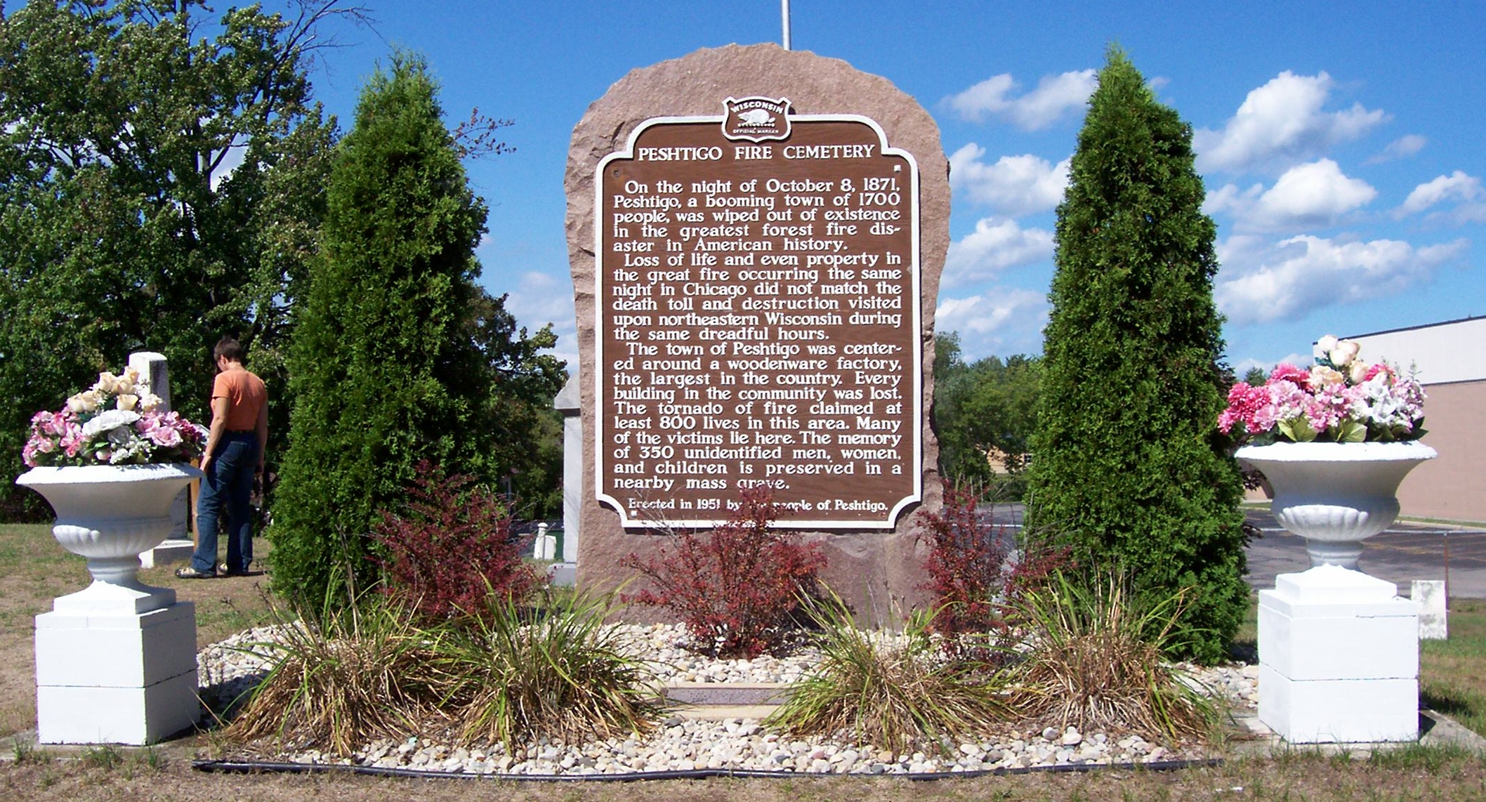
45°05′55″N 87°38′17″W / 45.098611°N 87.638056°WMarinette 10 Peshtigo Fire Cemetery 
October 15, 1970 Oconto Ave. between Peck and Ellis Aves.
45°03′23″N 87°45′15″W / 45.056389°N 87.754167°WPeshtigo 11 Peshtigo Reef Light May 2, 2007 Offshore in lower Green Bay, approx. 3.3 mi (5.3 km). SE of Peshtigo Point
44°57′31″N 87°34′48″W / 44.958611°N 87.58°WPeshtigo Township ARLHS USA 951 References
- ^ "National Register of Historic Places: Weekly List Actions". National Park Service, United States Department of the Interior. Retrieved on November 10, 2011.
- ^ The latitude and longitude information provided is primarily from the National Register Information System, and has been found to be fairly accurate for about 99% of listings. For 1%, the location info may be way off. We seek to correct the coordinate information wherever it is found to be erroneous. Please leave a note in the Discussion page for this article if you believe any specific location is incorrect.
- ^ Numbers represent an ordering by significant words. Various colorings, defined here, differentiate National Historic Landmark sites and National Register of Historic Places Districts from other NRHP buildings, structures, sites or objects.
- ^ "National Register Information System". National Register of Historic Places. National Park Service. . http://nrhp.focus.nps.gov/natreg/docs/All_Data.html.
Municipalities and communities of Marinette County, Wisconsin Cities 
Villages Towns Amberg | Athelstane | Beaver | Beecher | Dunbar | Goodman | Grover | Lake | Middle Inlet | Niagara | Pembine | Peshtigo | Porterfield | Pound | Silver Cliff | Stephenson | Wagner | Wausaukee
CDPs Amberg | Dunbar | Goodman | Pembine
Unincorporated
communitiesAthelstane | Bagley Junction | Beaver | Beecher | Beecher Lake | Cedarville | County Line‡ | Goll | Harmony | Kremlin | Loomis | May Corner | McAllister | Middle Inlet | Miles | Packard | Porterfield | Rubys Corner | Sweetheart City | Wagner | Walsh | White Pine Haven | Wilcox
Footnotes ‡This populated place also has portions in an adjacent county or counties
U.S. National Register of Historic Places Topics Lists by states Alabama • Alaska • Arizona • Arkansas • California • Colorado • Connecticut • Delaware • Florida • Georgia • Hawaii • Idaho • Illinois • Indiana • Iowa • Kansas • Kentucky • Louisiana • Maine • Maryland • Massachusetts • Michigan • Minnesota • Mississippi • Missouri • Montana • Nebraska • Nevada • New Hampshire • New Jersey • New Mexico • New York • North Carolina • North Dakota • Ohio • Oklahoma • Oregon • Pennsylvania • Rhode Island • South Carolina • South Dakota • Tennessee • Texas • Utah • Vermont • Virginia • Washington • West Virginia • Wisconsin • WyomingLists by territories Lists by associated states Other Categories:- Marinette County, Wisconsin
- Lists of historic places in Wisconsin
-


Wikimedia Foundation. 2010.