- National Register of Historic Places listings in Madison County, Montana
-
 Location of Madison County in Montana
This is a list of the National Register of Historic Places listings in Madison County, Montana. It is intended to be a complete list of the properties and districts on the National Register of Historic Places in Madison County, Montana, United States. The locations of National Register properties and districts for which the latitude and longitude coordinates are included below, may be seen in a Google map.[1]
There are 17 properties and districts listed on the National Register in the county, including 1 National Historic Landmark.
-
- This National Park Service list is complete through NPS recent listings posted November 10, 2011.[2]
Listings county-wide
[3] Landmark name Image Date listed Location City or town Summary 1 Beaverhead Rock-Lewis and Clark Expedition February 11, 1970 About 14 miles northeast of Dillon
45°23′18″N 112°27′29″W / 45.388333°N 112.458056°WDillon 2 Dr. Don L. Byam House March 1, 2002 Main St.
45°18′27″N 111°58′04″W / 45.3075°N 111.967778°WNevada City 3 Christ Episcopal Church and Rectory January 22, 1987 Southwestern corner of the junction of Poppleton and Main Sts.
45°27′13″N 112°11′45″W / 45.453611°N 112.195833°WSheridan 4 Ferris-Hermsmeyer-Fenton January 9, 2008 144 Duncan District Rd. Sheridan 5 Finney House March 1, 2002 Junction of Main and California Sts.
45°18′28″N 111°58′05″W / 45.307778°N 111.968056°WNevada City 6 Hutchins Bridge March 18, 1999 Across the Madison River
44°53′20″N 111°34′47″W / 44.888889°N 111.579722°WCameron 7 Madison County Fairgrounds August 3, 1984 Montana Highway 41
45°32′31″N 112°20′08″W / 45.541944°N 112.335556°WTwin Bridges 8 William O'Brien House October 23, 1986 114 E. Poppleton
45°27′16″N 112°11′40″W / 45.454444°N 112.194444°WSheridan 9 Pony Historic District 
August 4, 1987 Community of Pony, southwest of Harrison
45°39′25″N 111°53′50″W / 45.656944°N 111.897222°WPony 10 Powder House August 3, 1987 ½ mile southeast of Pony on Potosi Rd.
45°39′22″N 111°52′33″W / 45.656111°N 111.875833°WPony 11 Robbers Roost January 1, 1976 5 miles north of Alder at Montana Highway 387A
45°23′33″N 112°08′49″W / 45.3925°N 112.146944°WAlder 12 H.D. Rossiter Building March 7, 1994 115 S. Main St.
45°27′21″N 112°11′46″W / 45.455833°N 112.196111°WSheridan 13 Saint Mary of the Assumption October 24, 1985 Off Montana Highway 287
45°21′15″N 112°06′26″W / 45.354167°N 112.107222°WLaurin 14 Strawberry Mine Historic District August 4, 1987 Roughly bounded by Strawberry Ridge, Pony Rd., and Pony Creek
45°39′50″N 111°56′14″W / 45.663889°N 111.937222°WPony 15 Thexton Ranch May 12, 2006 335 Vaney Rd.
45°16′55″N 111°45′56″W / 45.281944°N 111.765556°WEnnis 16 Union City February 26, 1999 Southeast of Virginia City
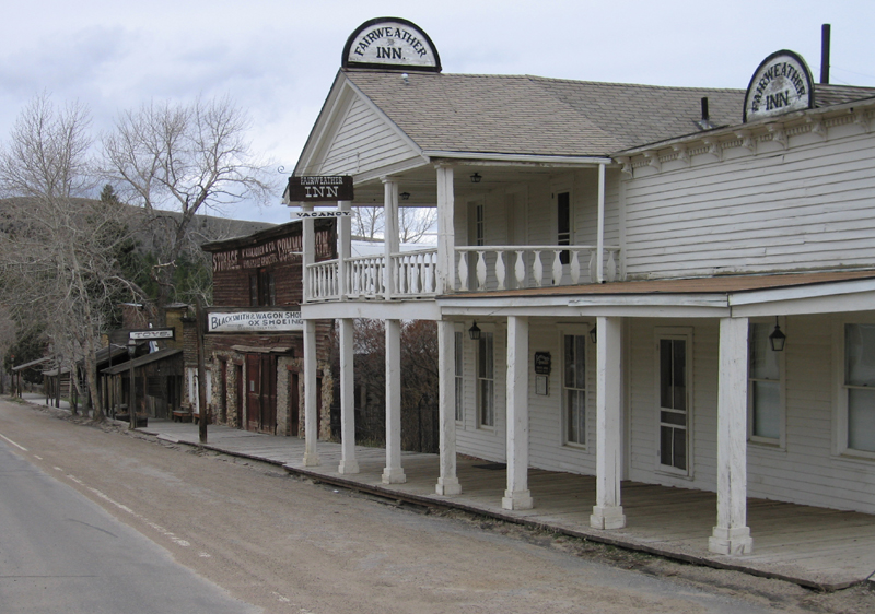
45°12′30″N 111°56′3″W / 45.20833°N 111.93417°W[4]Virginia City An abandoned mining camp[5] 17 Virginia City Historic District 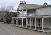
October 15, 1966 Wallace St.
45°17′27″N 111°56′35″W / 45.290833°N 111.943056°WVirginia City See also
- List of National Historic Landmarks in Montana
- National Register of Historic Places listings in Montana
References
- ^ The latitude and longitude information provided in this table was derived originally from the National Register Information System, which has been found to be fairly accurate for about 99% of listings. For about 1% of NRIS original coordinates, experience has shown that one or both coordinates are typos or otherwise extremely far off; some corrections may have been made. A more subtle problem causes many locations to be off by up to 150 yards, depending on location in the country: most NRIS coordinates were derived from tracing out latitude and longitudes off of USGS topographical quadrant maps created under North American Datum of 1927, which differs from the current, highly accurate GPS system used by Google maps. Chicago is about right, but NRIS longitudes in Washington are higher by about 4.5 seconds, and are lower by about 2.0 seconds in Maine. Latitudes differ by about 1.0 second in Florida. Some locations in this table may have been corrected to current GPS standards.
- ^ "National Register of Historic Places: Weekly List Actions". National Park Service, United States Department of the Interior. Retrieved on November 10, 2011.
- ^ Numbers represent an ordering by significant words. Various colorings, defined here, differentiate National Historic Landmark sites and National Register of Historic Places Districts from other NRHP buildings, structures, sites or objects.
- ^ Location derived from its GNIS feature record; the NRIS lists it as "Address Restricted."
- ^ U.S. Geological Survey Geographic Names Information System: Union City (historical)
U.S. National Register of Historic Places Topics Lists by states Alabama • Alaska • Arizona • Arkansas • California • Colorado • Connecticut • Delaware • Florida • Georgia • Hawaii • Idaho • Illinois • Indiana • Iowa • Kansas • Kentucky • Louisiana • Maine • Maryland • Massachusetts • Michigan • Minnesota • Mississippi • Missouri • Montana • Nebraska • Nevada • New Hampshire • New Jersey • New Mexico • New York • North Carolina • North Dakota • Ohio • Oklahoma • Oregon • Pennsylvania • Rhode Island • South Carolina • South Dakota • Tennessee • Texas • Utah • Vermont • Virginia • Washington • West Virginia • Wisconsin • WyomingLists by territories Lists by associated states Other  Category:National Register of Historic Places •
  Portal:National Register of Historic Places
Municipalities and communities of Madison County, Montana County seat: Virginia City Towns 
CDPs Unincorporated
communitiesFootnotes ‡This populated place also has portions in an adjacent county or counties
Categories:- National Register of Historic Places in Montana by county
- Madison County, Montana
-


Wikimedia Foundation. 2010.