- Virginia City, Montana
Infobox Settlement
official_name = Virginia City, Montana
settlement_type =Town
nickname =
motto =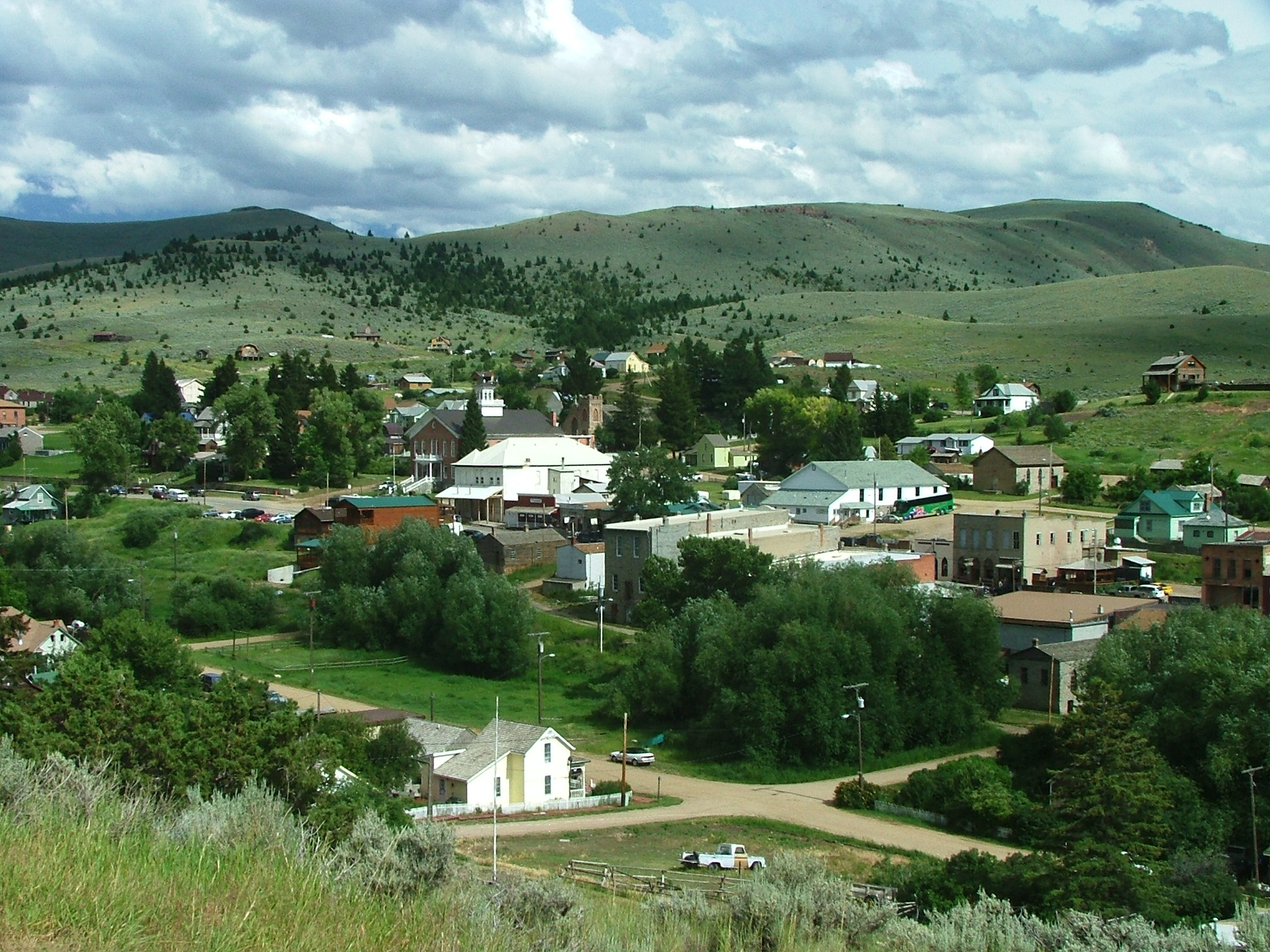
imagesize = 250px
image_caption = Virginia City from a nearby hillside
image_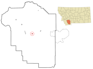
mapsize = 250px
map_caption = Location of Virginia City, Montana
mapsize1 =
map_caption1 =subdivision_type = Country
subdivision_name =United States
subdivision_type1 = State
subdivision_name1 =Montana
subdivision_type2 = County
subdivision_name2 = Madison
government_footnotes =
government_type =
leader_title =
leader_name =
leader_title1 =
leader_name1 =
established_title =
established_date =unit_pref = Imperial
area_footnotes =area_magnitude =
area_total_km2 = 2.4
area_land_km2 = 2.4
area_water_km2 = 0.0
area_total_sq_mi = 0.9
area_land_sq_mi = 0.9
area_water_sq_mi = 0.0population_as_of = 2000
population_footnotes =
population_total = 130
population_density_km2 = 54.2
population_density_sq_mi = 140.4timezone = Mountain (MST)
utc_offset = -7
timezone_DST = MDT
utc_offset_DST = -6
elevation_footnotes =
elevation_m = 1756
elevation_ft = 5761
latd = 45 |latm = 17 |lats = 39 |latNS = N
longd = 111 |longm = 56 |longs = 28 |longEW = Wpostal_code_type =
ZIP code
postal_code = 59755
area_code = 406
blank_name = FIPS code
blank_info = 30-77125
blank1_name = GNIS feature ID
blank1_info = 0778036
website =
footnotes = Infobox_nrhp | name =Virginia City Historic District
nrhp_type = nhld
caption =
location=Virginia City, Montana
lat_degrees = 45
lat_minutes = 17
lat_seconds = 27
lat_direction = N
long_degrees = 111
long_minutes = 56
long_seconds = 35
long_direction = W
locmapin = Montana
area =
built =1863
architect= Unknown
architecture= No Style Listed
designated =July 04 ,1961
added =October 15 ,1966
governing_body = BUREAU OF LAND MANAGEMENT
refnum=66000435cite web|url=http://www.nr.nps.gov/|title=National Register Information System|date=2008-04-15|work=National Register of Historic Places|publisher=National Park Service]Virginia City is a town in and the
county seat of Madison County,Montana ,United States .GR|6 A portion of the town was designated as aNational Historic Landmark District in 1961.cite web|url=http://tps.cr.nps.gov/nhl/detail.cfm?ResourceId=304&ResourceType=District
title=Virginia City Historic District|accessdate=2008-07-15|work=National Historic Landmark summary listing|publisher=National Park Service] The population was 130 at the 2000 census.History
Founding
In 1863, the area was part of the
Dakota Territory until March, when it became part of the newly formedIdaho Territory . On May 26, 1864, the Territory of Montana was formed, with Bannack briefly becoming the territorial capital, Virginia City would quickly take that title from Bannack.In May 1863, a group of prospectors were headed towards the
Yellowstone River and instead came upon a party of theCrow tribe and were forced to return to Bannack.Gold was discovered on the retreat trip when Bill Fairweather stuck a pick near Alder Creek joking he might find something to fund sometobacco .The prospectors could not keep the site a secret. They were followed on their return to the gold bearing site and set up the town in order to formulate rules about individual gold claims. On June 16, 1863 under the name of "Verina" the township was formed a mile south of the gold fields. The name was meant to honor Varina Howell Davis, first and only
First Lady of theConfederate States of America during theAmerican Civil War . Verina, although in Union territory, was founded by men whose loyalties were thoroughly Confederate. Upon registration of the name, aConnecticut judge, G. G. Bissell, objected to their choice and recorded it as Virginia City. (In fullirony , sinceVirginia itself had seceded, only to haveWest Virginia secede from the state and stay in the Union, it seemed an appropriate name for aDixie city inYankee territory.)Within weeks Virginia City was a veritable
boomtown of thousands in the midst of agold rush with no law enforcement whatsoever, except for vigilantism. Most of Montana became under the rule of aVigilance committee which operated on both sides of the law. Their secret motto,3-7-77 is still on the badges, patches, and car door insignia of theMontana Highway Patrol .In 1864, the
Montana Territory was carved out of Idaho Territory. Virginia City, claiming 10,000 citizens, was made the capital of the new territory in 1865. The first public school was built in 1866, but already the most easily accessible gold fromplacer mining had been exploited and development and population in the territory was moving towards Helena.Ghost town
In the 1940s, Charles and Sue Bovey began buying the town, putting much needed maintenance into failing structures. The
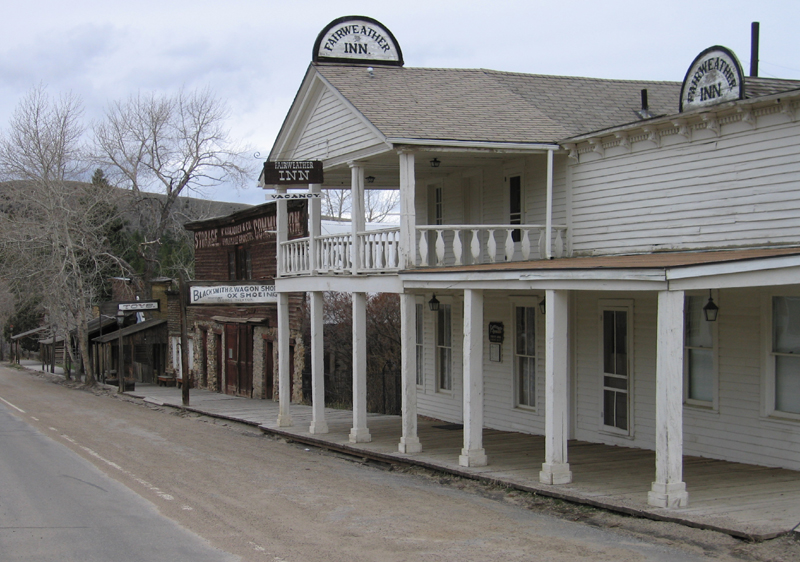
ghost town of Virginia City began to be restored fortourism in the 1950s. Most of the city is now owned by the state government and is aNational Historic Landmark operated as an open air museum. Of the nearly three hundred structures in town, almost half were built prior to 1900. Buildings in their original condition with Old West period displays and information plaques stand next to thoroughly modern diners and other amenities.For Virginia City, the term "ghost town" has a double meaning, as the town is known throughout Montana for being the most
haunted in the state;Fact|date=December 2007 not only that, but the town'sghost s have a reputation for unusually vicious and/or troublesome behavior. Philipsburg, some ways to the northwest, has achieved a similar, albeit lesser, reputation.Notable residents
*
Calamity Jane lived here for some time.
*Joseph Millard , later a United States Senator from Nebraska, lived and opened a bank here.
*Wilbur F. Sanders , United States Senator from Montana, lived here.
*George Laird Shoup ,Governor of Idaho , moved here after the Civil War.
*Sam V. Stewart , Governor and Supreme Court justice of Montana, practiced law here.
*William Boyce Thompson , founder ofNewmont Mining , was born here.Geography
Virginia City is located at coor dms|45|17|39|N|111|56|28|W|city (45.294107, -111.941230)GR|1.
According to the
United States Census Bureau , the town has a total area of 0.9square mile s (2.4km² ), all of it land.Demographics
As of the
census GR|2 of 2000, there were 130 people, 72 households, and 32 families residing in the town. Thepopulation density was 140.4 people per square mile (54.0/km²). There were 122 housing units at an average density of 131.7/sq mi (50.7/km²). The racial makeup of the town was 94.62% White, 2.31% Native American, 0.77% from other races, and 2.31% from two or more races. Hispanic or Latino of any race were 0.77% of the population.There were 72 households out of which 18.1% had children under the age of 18 living with them, 40.3% were married couples living together, 1.4% had a female householder with no husband present, and 54.2% were non-families. 47.2% of all households were made up of individuals and 15.3% had someone living alone who was 65 years of age or older. The average household size was 1.81 and the average family size was 2.52.
In the town the population was spread out with 14.6% under the age of 18, 0.8% from 18 to 24, 23.8% from 25 to 44, 46.9% from 45 to 64, and 13.8% who were 65 years of age or older. The median age was 48 years. For every 100 females there were 106.3 males. For every 100 females age 18 and over, there were 117.6 males.
The median income for a household in the town was $30,000, and the median income for a family was $46,250. Males had a median income of $37,500 versus $19,167 for females. The
per capita income for the town was $19,182. There are 5.7% of the population living below thepoverty line , including those under eighteens and over 64.References
External links
* [http://virginiacitychamber.com/ Virginia City Chamber of Commerce website]

Wikimedia Foundation. 2010.