- Clifton (Ednor, Maryland)
-
Clifton
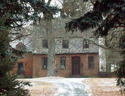 Clifton, January 2011
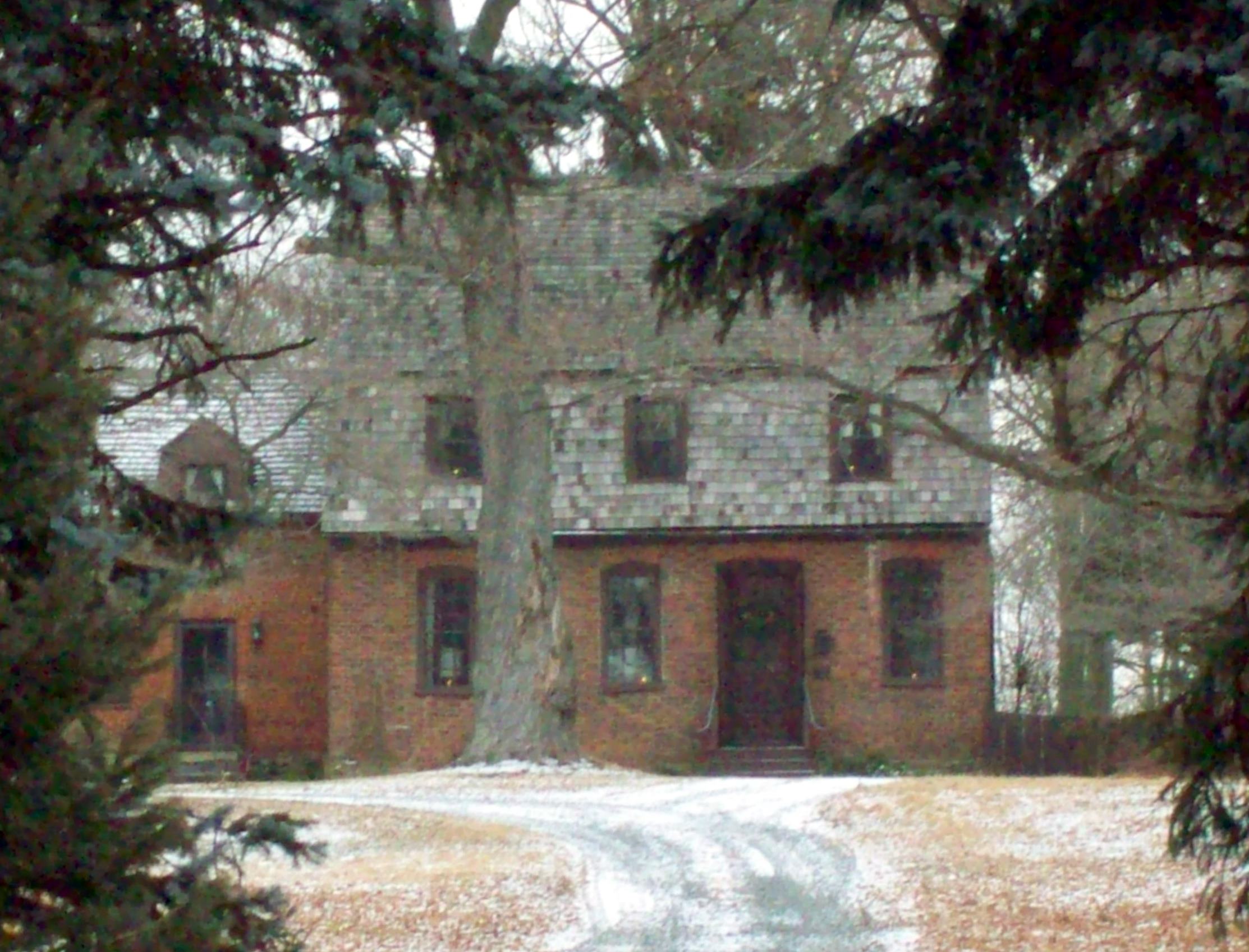

Location: 17107 New Hampshire Ave., Ednor, Maryland Coordinates: 39°8′17″N 76°59′39″W / 39.13806°N 76.99417°WCoordinates: 39°8′17″N 76°59′39″W / 39.13806°N 76.99417°W Built: 1760 Architect: Unknown Architectural style: No Style Listed Governing body: Private NRHP Reference#: 74000959
[1]Added to NRHP: June 25, 1974 Clifton is a historic home located at Ednor, Montgomery County, Maryland, United States. It is a 1 1⁄2-story gambrel-roofed brick structure with a lower north wing, also with a gambrel roof. Outbuildings on the property include a wood-frame shed and a guest house or cottage. It is one of the few extant mid-18th-century buildings in Montgomery County and is associated with the local Quaker community, which by 1753 had been organized into the Sandy Spring Meeting of Friends.[2]
Clifton was listed on the National Register of Historic Places in 1974.[1]
References
- ^ a b "National Register Information System". National Register of Historic Places. National Park Service. 2008-04-15. http://nrhp.focus.nps.gov/natreg/docs/All_Data.html.
- ^ "Clifton". Maryland Historical Trust. http://www.mht.maryland.gov/nr/NRDetail.aspx?HDID=227&COUNTY=Montgomery&FROM=NRCountyList.aspx?COUNTY=Montgomery. Retrieved 2008-10-29.
External links
- Clifton, Montgomery County, Inventory No.: M: 15-41, including photo in 1973, at Maryland Historical Trust website
U.S. National Register of Historic Places in Maryland Lists by county Allegany • Anne Arundel • Baltimore County • Calvert • Caroline • Carroll • Cecil • Charles • Dorchester • Frederick • Garrett • Harford • Howard • Kent • Montgomery • Prince George's • Queen Anne's • Somerset • St. Mary's • Talbot • Washington • Wicomico • Worcester

Lists by city Other lists Keeper of the Register • History of the National Register of Historic Places • Property types • Historic district • Contributing property Categories:- Houses on the National Register of Historic Places in Maryland
- 1760 architecture
- Houses in Montgomery County, Maryland
- Maryland Registered Historic Place stubs


Wikimedia Foundation. 2010.