- Creeslough
-
Creeslough
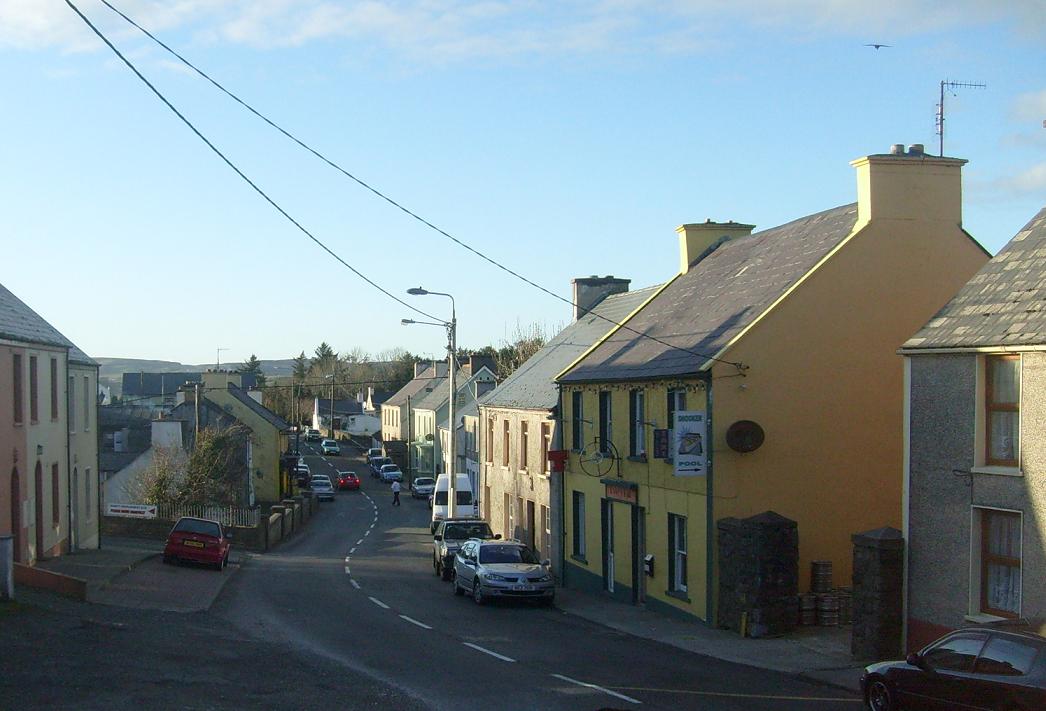
An Craoslach— Town — A view of Creeslough village, taken in 2008. Location in Ireland
 Creeslough
Coordinates: 55°07′20″N 7°54′22″W / 55.122171°N 7.906036°WCoordinates: 55°07′20″N 7°54′22″W / 55.122171°N 7.906036°W Country Ireland Province Ulster County County Donegal Time zone WET (UTC+0) - Summer (DST) IST (WEST) (UTC-1) Irish Grid Reference C055307 Website creeslough.com Creeslough (Irish: An Craoslach, meaning 'The Gorge' or 'Throat Lake' ) is a village in County Donegal, part of the Province of Ulster in Ireland. It lies 12 km south of Dunfanaghy on the N56 road, 54 m above sea level and overlooking an arm of Sheephaven Bay. It is a small village, with the population of the surrounding area engaged mainly in agriculture, mostly livestock rearing, as little of the surrounding land is suitable for tillage.
Contents
Places of interest
Nearby attractions include:
- Doe Castle, a 16th century castle of the MacSuibhne clan, which has been restored during 2002-2005. It is perhaps best known as the place to which Owen Roe O'Neill returned to command the Irish Confederate's Ulster army in 1642 during the Irish Confederate Wars.
- Ards Forest Park, which contains some megalithic tombs, ringforts and a Mass rock. The forest park encompasses a variety of habitats, including sand dunes, tidal salt marsh as well as several small lakes, two of which are vegetation-filled and in the process of becoming bogs.
- Remains of the Owencarrow Viaduct, whose railway line closed in 1941. Scene of the Owencarrow Viaduct Disaster.
- Glenveagh National Park, which was created in 1981 from lands granted to the state by Henry P. McIlhenny, of Philadelphia.
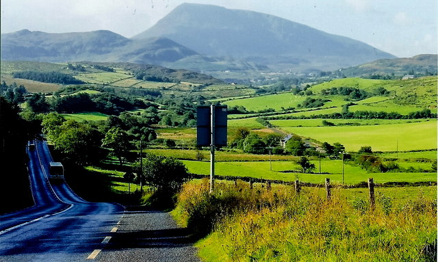
- The surrounding mountainous areas are suitable for hill walking and are notable for their ease of access. Muckish, with its distinctive outline and a number of routes to the summit to choose from, is a popular destination with walkers. The annual Glover Highlander walk (from Muckish to Errigal) starts nearby.[1] There are several marked trails to choose from in Glenveagh National Park, as well as the possibility for off-trail hiking.
Architecture
The Roman Catholic church, St Michael's, is notable for its architecture, being modelled on the nearby table mountain of Muckish. The architect, Liam McCormack, was also responsible for the design of the RIAI Triennial Gold Medal-winning St Aengus' Church, Burt, County Donegal. The church bell was moved from the bell tower associated with (the now demolished) Doe Chapel. The remains of the outer walls of the chapel are situated within the current graveyard at Doe (in the townland of Cashelmore, 3 km north of Creeslough). The bell tower was, however, not demolished.
Transport
Creeslough railway station opened on 9 March 1903, closed for passenger traffic on 3 June 1940, and finally closed altogether on 6 January 1947.[1]
Education

- Creeslough supports two primary schools, Scoil Mhuire (142 pupils, 2011 figures,[2] Roman Catholic) and Creeslough National School (20 pupils, 2011 figures,[3] Church of Ireland).
- Creeslough also contains a National School by the name of Glassan National School, located 5 km to the West of Creeslough village.
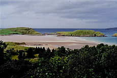 Clonmass Bay at Ards Forest Park, Creeslough.
People
- Bridie Gallagher, acclaimed singer
- Thomas Bartholomew Curran, barrister and Anti-Parnellite
- Kathleen Antonelli, programmer of the first ever computer
In popular culture
In the novel An Answer from Limbo by Brian Moore, the main character, Eileen Tierney was born and reared in Creeslough and it is remembered and described by her with fondness. No News at Throat Lake is a non-fiction book by Lawrence Donegan about working for a bi-weekly newspaper in Creeslough. The area has featured in many Irish folk songs, the most famous being "Cutting the Corn in Creeslough" which has been covered by the likes of Daniel O'Donnell and Creeslough native Bridie Gallagher.
References
- ^ "Creeslough station" (PDF). Railscot - Irish Railways. http://www.railscot.co.uk/Ireland/Irish_railways.pdf. Retrieved 2007-09-23.
External links
Categories:- Untranslated Irish place names
- Towns and villages in County Donegal


Wikimedia Foundation. 2010.