- Arranmore
Infobox Irish Place
name = Arranmore
gaeilge = Árainn Mhór
map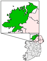
pin coords = left: 27px; top: 53px
north coord = 55.050941 | west coord = 8.235626 | irish grid = B847228
area = | elevation =
province =Ulster
county =County Donegal
rural pop = 528
census yr =
dailconstituency =Donegal South West
stdcode =
web =
|Arranmore Island (official name: Árainn Mhór, meaning "Large Ridge") [ [http://www.commissioner.ie/downloads/An_tOrdu_Logainmneacha_(Ceantair_Ghaeltachta)_2004.pdf Placenames (Ceantair Ghaeltachta) Order 2004] . As to the meaning of the name, see Deirdre and Laurence Flanagan, "Irish Place Names", Gill & Macmillan, 2002.] is the largest inhabited island in
County Donegal , and the second largest in all ofIreland , with a population of 528 in 2006, down from 543 in 2002, and over 600 in 1996. The island is part of the DonegalGaeltacht . It is also known in English as Aran Island. In Irish the island was traditionally called "Árainn" the adjective "mór" (great) was added fairly recently. It was also sometimes called in Irish "Árainn Uí Dhomhnaill" the "Aran of the O Donnells".Location
The island lies 5 km (3 mi) off
Burtonport and is served by twoferry services, a conventional ferry that accommodates up to 128 foot passengers and all sizes of vehicles. This journey takes 25 - 30 minutes. In 2007, a fast ferry service commenced which can cover the run to the island in 5 minutes. Both services run daily all year. The trip to the island affords spectacular views, passing a number of small islands before crossing a stretch of open Atlantic water.Habitation
Most of the population lives along the southern and (comparatively sheltered) eastern coast. It has been settled since pre-Celtic times, and the few remaining signs of early settlement include a
promontory fort to the south of the island and shellmidden s dotted along the beaches. Its position near theAtlantic shipping lanes was exploited, with acoastguard station and alighthouse positioned on the most north-westerly point, and a World War 2 monitoring post set up to look out for U-Boats.The permanent population is 528, but this rises to well over 1,000 during the summer months. A large proportion of the housing stock are holiday homes, with both native islanders and their descendants, as well as non locals being attracted to the beauty of the island.
Infrastructure/Economy
The island was the first offshore island in the
Republic of Ireland to get electricity from theRural Electrification Scheme in 1957, but was amongst the last places in the country to get universally reliable piped water (in the 1980s) and an automatic phone exchange (in the 1990s). It went directly from a manual switchboard to anISDN -enabled system, which had to be upgraded within weeks due to massive demand for consumer phone lines, as the previous exchange had been limited to issuing numbers to business ventures only, and only had 47 internal lines.It relies mostly ontourism for its income (fishing was the island's mainstay up to the 1980s but is no longer a significant industry), as well as the traditional Gaeltacht summer schools. In recent years, a local development co-op has encouraged the development of other industries on the island, such as acall centre and teacher training for Irish teachers. The island's many lakes provide excellent rod fishing opportunities.With no less than six pubs, Arranmore is a pub crawler's dream. Given that there is no permanent
Garda Siochana presence on the island, the pubs are usually lax in adhering to closing times, if at all.Other
The island is home to Ireland's only island-based football team, and formerly Donegal's only non-inshore lifeboat service. The Arranmore station, with its
Severn class lifeboat , remains the best equipped in the county.For a visitor, the island has a character distinct from
Donegal , partly through its separation from the mainland and partly through itsdiaspora outside Ireland. The island, in common with many communities at the edge of Europe, has shed people to many parts of the English-speaking world. These are not lost, however, and many return for the summer school holidays, doubling the resident population. The influx of young people during the summer gives rise to an active youth culture.The result is that a visitor is not conscious of being in the
Gaeltacht and football - soccer - is preferred to GAA sports. The island hosts the Arranmore Challenge, an annual soccer competition every June bank holiday weekend where 16 teams compete over 2 days. The competition has increased in popularity every year since it was introduced in 2001 and hosts teams from all over Ireland and Great Britain.Places and Villages on Arranmore Island
*
Aphort
*Ballintra
*Ballard
*Illion
*Leabgarrow
*Leabrannagh
*Pollawaddy
*Scraigatoke
*Torries ee also
*
Lighthouses in Ireland
*List of RNLI stations
*Ulster Irish External links
* [http://www.arainnmhor.com/ Árainn Mhór Official Website]
* [http://www.arranmoreferry.com/ Árainn Mhór Ferry Service]
* [http://www.arranmorecharters.com/ Fast Ferry Service]References
Wikimedia Foundation. 2010.