- Machaire Rabhartaigh
-
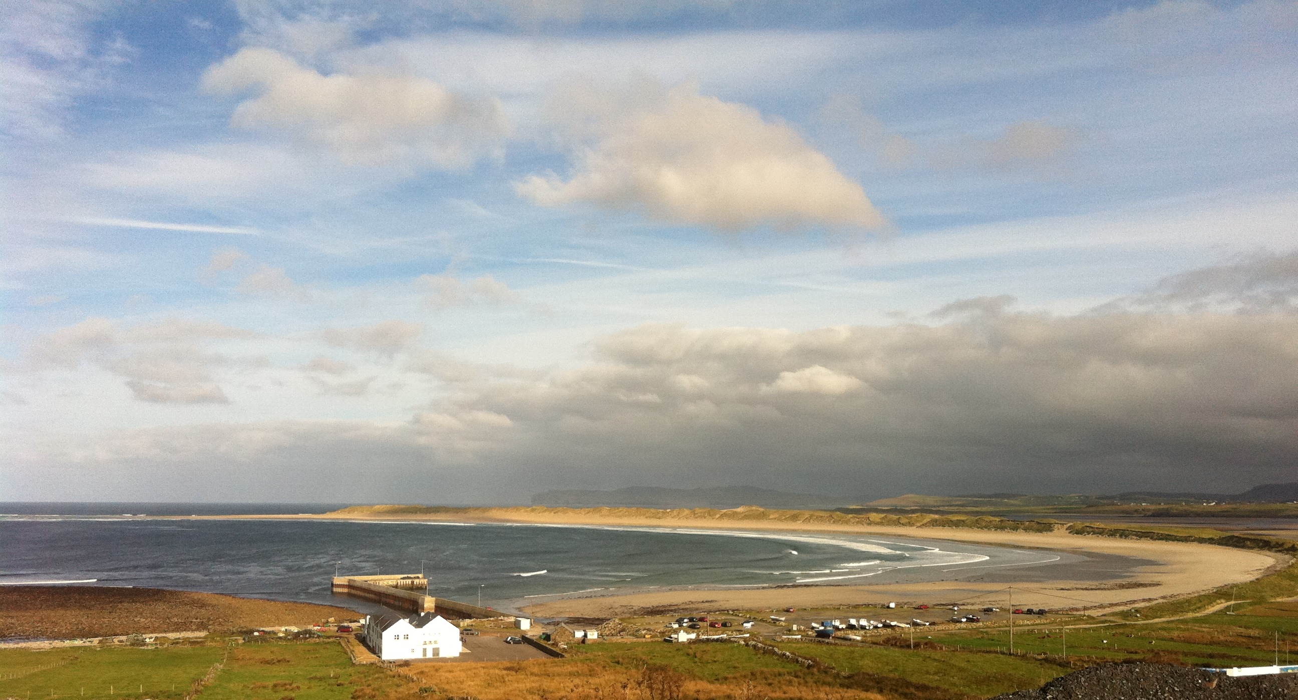
Machaire Rabhartaigh — Village — A view of Machaire Rabhartaigh strand, October 2011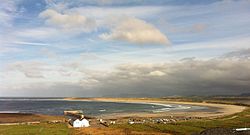 Location in Ireland
 Machaire Rabhartaigh
Coordinates: 55°03′03″N 8°14′08″W / 55.050941°N 8.235626°WCoordinates: 55°03′03″N 8°14′08″W / 55.050941°N 8.235626°W Country Ireland Province Ulster County County Donegal Government - Dáil Éireann Donegal South West Area code(s) 074, +000 353 74 Irish Grid Reference B847228 Machaire Rabhartaigh (formerly anglicized as Magheraroarty), meaning "plain of the high tide",[1] is a Gaeltacht village and townland on the north-west coast of County Donegal, Ireland. It is in the parish of Cloughaneely and its main access road is the R257.
It has been home to a Gael Linn Irish Language Summer School since 1981 which runs three[2] courses for teenagers aged 12–18 every summer and has an intake of about 200[3] students per course.
The village has a port suited for fishing vessels. It is the main ferry port for Tory Island.
It attracts many tourists during the summer and watersports enthusiasts visit the area to windsurf/surf/kitesurf and to go kayaking in the bay. A natural reef exists to the left of the pier which provides excellent surf throughout the year. Anemities include Coll's Bar, a café and Scoil Naomh Dubhthach Mhachaire Rabhartaigh, an Irish-speaking primary school.
References
Categories:- Geography of County Donegal
- Gaeltacht towns and villages
- Gaeltacht places in County Donegal
- County Donegal geography stubs


Wikimedia Foundation. 2010.