- Teelin
Infobox Irish Place
name = Teelin
gaeilge = Teileann
crest
motto =
map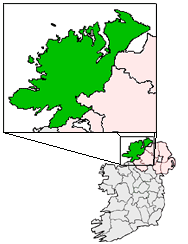
pin coords = left: 15px; top: 100px
north coord = 54.631958 | west coord = 8.645639 | irish grid = G580765
area = | elevation =
province =Ulster
county =County Donegal
town pop = 300
rural pop =
census yr =
web =
|Teelin (official name: Teileann) [ [http://www.commissioner.ie/downloads/An_tOrdu_Logainmneacha_(Ceantair_Ghaeltachta)_2004.pdf Placenames (Ceantair Ghaeltachta) Order 2004] .] is a village in
County Donegal , Ireland. It is located nearSlieve League , at the north-west end ofDonegal Bay . Its population is about 250–300.The village is noted for fishing, scuba diving, and traditional music. It has a fine deep harbour and boat launching facilities with safe mooring. It is still an Irish-speaking community, though this is on the wane.
Teelin was one of the first settlements to appear on maps of Ireland, as it was an important port.
The planning of houses in the area is a good example of the much criticised ribbon development endemic in Ireland with dwellings strung along the main road for several miles with little clustering until recently.
References
External links
* [http://www.donegallibrary.ie/memory/towns/teelin.htm Teileann (Teelin)] at Donegal Places
Wikimedia Foundation. 2010.