- Annagry
Infobox Irish Place
name = Annagry
gaeilge = Anagaire
map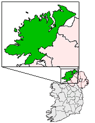
pin coords = left: 39px; top: 49px
north coord = 55.01919| west coord = 8.312101 | irish grid = B808187
area = | elevation = 70m [ [http://www.fallingrain.com/world/EI/6/Annagary.html Maps, Weather, and Airports for Annagary, Ireland ] ]
province =Ulster
county =County Donegal
rural pop =
census yr =
dailconstituency =Donegal South West
stdcode =
web =
|Annagry (official name: Anagaire) [ [http://www.commissioner.ie/downloads/An_tOrdu_Logainmneacha_(Ceantair_Ghaeltachta)_2004.pdf Placenames (Ceantair Ghaeltachta) Order 2004] .] is a village in the
Gaeltacht area ofthe Rosses , Donegal, nearGweedore and with a population of around 249. It has seen large numbers of its parish folk working inScotland ,England andWales and much wider afield including theUSA , Australia andCanada . Anagaire may derive from Áth na gCoire.The village has an Irish speaking college in the summer months where theIrish language can be learnt by young and old alike. It's local GAA club is the Naomh Mhuire Tigers.In the first week of June, the Annual Festival takes place, when those who have left often return to spend some time in Sharkeys Bar, and Caisleáin Óir, (formerly Jack's Bar) and Teach Conal (formerly Duffy's).
The nearby Deeragh hill provides panoramic view of the far off
Mount Errigal , Donegal's highest peak.Annagry is also the closest village to
Donegal Airport , which is located 3 miles away in Carrickfinn.ee also
*List of towns in Ireland
References
Wikimedia Foundation. 2010.