Kerrykeel

Kerrykeel

Infobox Irish Place
name = Kerrykeel
gaeilge = An Cheathrú Chaol
map

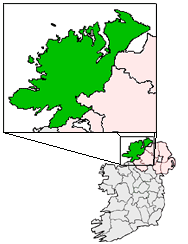
pin coords = left: 91px; top: 34px
north coord = 55.050941 | west coord = 8.235626 | irish grid = B847228
area = | elevation =
province = Ulster
county = County Donegal
town pop = |
census yr =
dailconstituency = Donegal South West
stdcode = 075, +000 353 74
|

Kerrykeel (Irish: "An Cheathrú Chaol", meaning "the narrow quarter") is a small village in County Donegal, Ireland. It lies between Knockalla Mountain, Ranny hill and the scenic Mulroy Bay.

It consists of supermarkets and small pubs, and Kerrykeel Motors and Donegal Creameries Plc.

Notable people

*Billy Gillespie, footballer
*Davitt Walsh, footballer
*John Kerr, ballad singer

References

External Links

* [http://www.rockhill.ie Rock Hill Holiday Park]


Wikimedia Foundation. 2010.

Игры ⚽ Нужна курсовая?

Look at other dictionaries:

  • Керрикил — Деревня Ирландии Керрикил англ. Kerrykeel, ирл. An Cheathr Chaol Страна …   Википедия

  • County Donegal — Contae Dhún na nGall Coontie Dunnygal / Coontie Dinnygal Coat of arms …   Wikipedia

  • Letterkenny — Leitir Ceanainn   Town   …   Wikipedia

  • Clonmany — Cluain Maine   Town   …   Wikipedia

  • Donegal — This article is about the Irish town of Donegal. For the county, see County Donegal. For other uses, see Donegal (disambiguation). Donegal Dún na nGall   Town   …   Wikipedia

  • Dunfanaghy — Dún Fionnachaidh   Village   …   Wikipedia

  • Dungloe — An Clochán Liath   Town   …   Wikipedia

  • Tory Island — Toraigh Tory   Populated place   Toraigh from the mai …   Wikipedia

  • Milford, County Donegal — Millford Baile na nGallóglach   Town   …   Wikipedia

  • Gweedore — Gaoth Dobhair Gweedore   Parish   …   Wikipedia

Share the article and excerpts

Direct link
Do a right-click on the link above
and select “Copy Link”