- Inishtrahull Island
Infobox Irish Place
name = Inishtrahull Island
gaeilge = Inis Trá Tholl | crest
motto =
map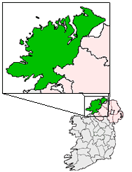
pin coords = left: 121px; top: 0px
north coord = 55.430019
west coord = 7.23381
irish grid = C439548
area =
elevation =
province =Ulster
county =County Donegal
town pop = 0
rural pop =
census yr = 2002
web =
|Inishtrahull Island (Irish: Inis Trá Tholl, meaning "island of the bloody beach") is located approx 10 kilometres (6 miles) north-east of
Malin Head ,Inishowen ,County Donegal . It is the most northerly island ofIreland . The most northerly landfall of Ireland, the Tor Beg rock is located another one kilometer to the North West of Inishtrahull. [cite web | title=Ireland - Geographical facts and figures | work= Travel through the Ireland story...| url=http://www.wesleyjohnston.com/users/ireland/geography/extremities.html | accessdate=2007-09-15] Inishtrahull has an area of 0.34 square kilometres or approximately 80 acres. [ [http://www.ub.ntnu.no/formidl/utgivelser/til_opplysning/to_nr16.pdf Per Ivar Haug, Gazetteer of Ireland, Trondheim University 2007.] ]Geology
The island is formed from a type of the
Gneiss metamorphic rock known as Inishtrahull Gneiss, dated at 1700 million years old. The gneiss is the oldest known rock on the Irish Islands, however studies have shown that the island was originally part of southernGreenland .Roddy Muir , a ScottishGeologist , in the McCallion report, argued for geological links between Greenland,Colonsay ,Islay and Inishtrahull. Muir visited this area and usedPlate tectonics to conclude that Inishtrahull was part of the Southern tip of Greenland c.1800 million years ago. He believes that Inishtrahull,Islay and Colonsay broke off the southern tip of Greenland, Islay and Colonsay moving to the western area of Scotland and Inishtrahull moving 1,300 km (800 mi) to the south east of Greenland off the Donegal Coast.The islanders
The island is now uninhabited but had a resident community until 1929 and a lighthousekeepers until 1987. The evacuation of the community from Inistrahull took place en-bloc in 1929. The matter was raised in a
Dáil debate on illegal fishing in November, 1929 by theTD for the area, Deputy Carney. [ [ http://historical-debates.oireachtas.ie/D/0032/D.0032.192911140028.html 14 November 1929 Dáil Debate] ] The Deputy stated that Inishtrahull was one of the few places in the country where the population had actually increased by almost 100% from 1881 to 1901. He said that the people on the island had a school and a graveyard and earned their livelihood from the fishing industry with very small boats for inshore fishing and that they could line fish and fish with nets during the herring season. Deputy Carney said that ordinarily they were able to make a reasonable living. However, he said that because of illegal fishing by "“Scotch and English trawlers and French fishing smacks”" the islanders had been compelled some weeks earlier to evacuate the island, desert their homes and leave only a lighthousekeeper behind.Responding the Minister for Fisheries, Fionán Lynch TD said that he did not agree that the people had left the island because of illegal fishing and was making enquiries as to their current circumstances. The Minister said that he "“would like to feel that everything was being done to keep them from being a permanent charge on home assistance”." The Minister later sent a Prinicpal Officer from his Department to report on their circumstances. The Minister then reported in the Dáil that "“four of the [six Inistrahull] families derived their livelihood from the Irish Lights boat service to the island, in which they are still able to engage”" and that there was no case state intervention. He also said that his Officer’s report indicated that the resettled Islanders were not in "“poor circumstances”". [ [http://historical-debates.oireachtas.ie/D/0034/D.0034.193004100006.html 10 April 1930 Dáil Debate] ]
Last sight of Ireland
Inishtrahull is home to the most northern Irish lighthouse. The lighthouse was first put into operation in 1813 largely because ships of the British Navy had begun to use
Lough Foyle . Today its light flashes every 30 seconds. [ [http://cil2.adnet.ie/index.php3?LighthouseID=39 Irish Lights Commissioners] ] The ruins of the old lighthouse as well as a new (1956) lighthouse can be found on the island. Automation of the lighthouse was completed in March 1987 and the last three Lighthousekeepers left the station on 30 April 1987. [ [http://cil2.adnet.ie/index.php3?LighthouseID=39 Irish Lights Commissioners] ] Over the centuries, Ireland has been the source of millions of emigrants bound for the “New World” across the Atlantic. For many of those emigrants, especially those who departed fromDerry , Inistrahull and its lighthouse had a special significance. As one emigrant recalled:Attractions
Inishtrahull is well known for its wildlife and is designated a
Nature reserve by the National Parks and Wildlife Service,Department of the Environment, Heritage and Local Government . The islands geographical location and lighthouse attract many unusual birds, as well as a population ofGrey Seal s. The island and its adjacent 90 metre depth tidal sound attract basking sharks and cetaceans in large numbers during the summer months. Many scuba-divers use the Islands Port Mór as a lunch spot while out surveying the hundreds of wrecks off its shores. Access to the island is limited by the dangerous tides and currents aroundMalin Head and the island itself. There are landing restrictions enforced by the National Parks and Wildlife Service and theCommissioners of Irish Lights (present owners of the Island). Particular care is requested by visitors during the breeding bird period of May - July.Name
The name of the island in Irish, "Inis Trá Tholl" meaning "island of the bloody beach" is thought to refer to a bloody episode between some of the islanders and men of Islay (a near-by scottish island) where the men of Islay were tricked and slain while trying to rescue a woman. Verify credibility|date=June 2008
References
- The book of Inishtrahull by Sean Beattie
- Local Island history collection by Des Mills
- [http://www.npws.ie Irish national parks and wildlife service]
- [http://www.cil.ie Irish lights]
- [http://www.nature.ie Wildlife of Ireland (Inistrahull information section]
Wikimedia Foundation. 2010.