Quigley's Point

Quigley's Point

Infobox Irish Place
name = Quigley's Point
gaeilge = Rinn Uí Choigligh
crest

motto =
map

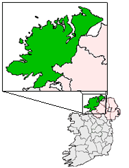
pin coords = left: 120px; top: 39px
north coord = 55.2 | west coord = 6.9833 | irish grid = C648397
area = | elevation = 30 m
province = Ulster
county = County Donegal
town pop = | rural pop =
census yr =
web =

Quigley's Point (Irish:"Rinn Uí Choigligh")) is located on the eastern shores of Inishowen and overlooks the wide expanse of Lough Foyle. To the south is the city of Derry and to the north lie the villages of Moville and Greencastle. A car ferry links Greencastle with Magilligan during the summer.

The village of Quigley's Point is also known as "Carrowkeel" (pronounced "Kerrykeel" locally) as it is marked as such on Irish Ordnance Survey maps. However all local signage and the local post office give the name "Quigley's Point" to the village.

The two pubs in the village are Foody's Lodge and Callaghans (The Cabry House). Foody's Lodge also has a caravan park adjacent to it.

The Presbyterian Church in Ireland has a church and Lecture Hall at Greenbank, near the village. Quigley's Point forms part of the Roman Catholic parish of Iskaheen and Upper Moville, and the nearest Church in the Parish is at Drung, approximately 3 km away towards Moville. The nearest Church of Ireland Church is at Redcastle and there is a Methodist Church in Ireland Church at Whitecastle, approximately 2.5 km from the village just off the road to Moville.

Nearby amenities include an interesting heritage centre at Isle of Doagh which tells the story of the famine years in the area.


Wikimedia Foundation. 2010.

Игры ⚽ Нужна курсовая?

Look at other dictionaries:

  • Quigley's Village — was a long running (1987 to 1999) collection of Christian children s videos designed to teach children sound Biblical values in a fun and exciting way. A combination of live action and puppets, it was very similar in style to Sesame Street but… …   Wikipedia

  • Roger Quigley — Roger Patrick Martin Quigley is a singer/songwriter and one half of the indie pop duo known as The Montgolfier Brothers.He has released multiple recordings, including two LPs mdash; 1969 Until God Knows When , and Quigley s Point . The latter… …   Wikipedia

  • Archbishop Quigley Preparatory Seminary — Infobox nrhp | name =Quigley Preparatory Seminary nrhp type = caption = location= Chicago, Illinois lat degrees = 41 lat minutes = 53 lat seconds = 52 lat direction = N long degrees = 87 long minutes = 37 long seconds = 33 long direction = W… …   Wikipedia

  • Куиглис-Пойнт — Деревня Ирландии Куиглис Пойнт англ. Quigley s Point, ирл. Rinn Uí Choigligh Страна …   Википедия

  • Muff, County Donegal — Muff Magh   Town   Main Street Muff …   Wikipedia

  • Coastal landforms of Ireland — Ireland is an island surrounded by water,[1] with a 7,500 kilometre coastline.[2] This list catalogues about 400 of the coastal landforms of the island including bays, estuaries, harbours, headlands, and many others.[3][4][5] Most offshore… …   Wikipedia

  • Tory Island — Toraigh Tory   Populated place   Toraigh from the mai …   Wikipedia

  • Dunkineely — Dún Cionnaola   Town   …   Wikipedia

  • County Donegal — Contae Dhún na nGall Coontie Dunnygal / Coontie Dinnygal Coat of arms …   Wikipedia

  • Letterkenny — Leitir Ceanainn   Town   …   Wikipedia

Share the article and excerpts

Direct link
Do a right-click on the link above
and select “Copy Link”