- Castlefin
Infobox Irish Place|thumb|left|name = Castlefin
gaeilge = Caisleán na Finne
crest
motto =
map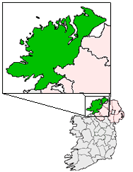
pin coords = left: 94px; top: 73px
north coord =
west coord =
province =Ulster
county =County Donegal
NI district =
Dail Constituency =Donegal South West
EU constituency =
stdcode =
posttown = Castlefin
postcode =
population = 810
census yr = 2006
web =Castlefin ( _ga. Caisleán na Finne), (sometimes spelt Castlefinn) is a
market town in the Finn Valley ofCounty Donegal , Ireland an Ulster county within the Republic of Ireland. The town has a population of 810 (2006) and is located betweenBallybofey andLifford . TheRiver Finn flows by the town. The town is located in along the main N15 national primary road, which runs fromBundoran toLifford . The town lies 6 miles fromLifford and 8 miles from the twin towns ofBallybofey /Stranorlar . It has close links to the twin towns ofBallybofey /Stranorlar ,Letterkenny and has strong links with West Tyrone inNorthern Ireland , especially with the towns ofStrabane andCastlederg .Amenities
The main social outlet in the town is a pub called McBrides, at the foot of the Long Brae beside the main road between
Lifford andBallybofey . Other pubs in the town include Tinneys, skins and The Diamond Bar.The main two housing estates in the town are called the Emmett Park, Sessaigh Park, Caislean Court, Hillhead and Grahamsland - these were built in the 1960s.The town centre is located around the Diamond area, which is where 3 routes merge. This area has a number of functions, mainly retail/commercial. The Diamond is an attractive area, with landscaped seating and planting areas. This area also has a number of buildings that are included on the Record of Protected Structures.
The town has a number of functions including retail, commercial, education, religious, economic, agricultural, social and recreational. However, the majority of functions are limited in scope due to the deficiency in population to support a number of large-scale services.
Castlefinn serves as the focus of primary education for the surrounding rural areas. The National School has a large catchment area and currently has 225 pupils attending. This provides employment for 11 full time teachers and a number of associated job opportunities. The town has a play school for pre-school age children.
The town centre is the focus of a wide range of functions and activities. The town offers the basic essential retail outlets including grocery stores, petrol station, Post office, estate agency, butchers, take-aways, public houses, hairdressers and a florist. The town also has a recycling facility that is located on the Castlederg road beside the bridge.
History
Castlefinn is in the parish of Donaghmore, barony of
Raphoe , 4.5 miles from Lifford. It's name translates from the castle on the banks of the river finn, the stones from the castle were used in the construction of the bridge that still stands today, and at the close of Elizabeth I’s reign it belonged to Sir Neill Garbh O’Donnell. It is situated on the river Finn, which is navigable to theRiver Foyle for vessels of 14 tons’ burden, is on the road fromStrabane toStranorlar and in 1837 consisted of a single street, with a Roman Catholic Chapel. [cite web | title= Castlefinn - Lewis's Topographical Dictionary of Ireland, 1837 | work=From Ireland | url=http://www.from-ireland.net/lewis/don/castlefinn.htm | accessdate=2007-09-16]Industry
There used to be a clothing factory in the town which made shirts and other items, but like so much of the
textile industry inDonegal , this is long since gone.chools
St Mary's National School, Castlefin
Scoil Naisiunta Domhnach Mor, Liscooley, Castlefin
St. Safan's, Scoil Naisiunta Naomh Samhthann, Drumdoit, CastlefinTransport
Castlefinn railway station opened on
7 September 1863 , but finally closed on1 January 1960 . [cite web | title=Castlefinn station | work=Railscot - Irish Railways | url=http://www.railscot.co.uk/Ireland/Irish_railways.pdf | accessdate=2007-09-16|format=PDF]References
ee also
*
List of towns in the Republic of Ireland External links
* [http://www.castlefinonline.com/ Castlefin Online]
* [http://www.fiacharts.com/ Fiach Arts]
*Castlefin is at coordinates coord|54.8030|-7.5966|type:city|display=inline,title
* [http://www.donegalcoco.ie/services/informationpoints/planning/lapcastlefin.htm Donegal County Council - Castlefinn Local Area Plan]
Wikimedia Foundation. 2010.