Carrigans

Carrigans

Infobox Irish Place
name = Carrigans
gaeilge = An Carraigín
crest

motto =
map

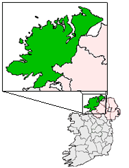
pin coords = left: 106px; top: 57px
north coord = 54.835599
west coord = 7.477913
irish grid =
area =
elevation =
province = Ulster
county = County Donegal
dailconstituency = Donegal North East
stdcode =
town pop =
rural pop =
census yr = 2006
web = www.stjohnstonandcarrigans.com
|

Carrigans (Irish: "An Carraigín") is a village in the Laggan Valley of east County Donegal, part of the Province of Ulster in Ireland. The village is located only a short distance from the River Foyle.

External links

* [http://www.stjohnstonandcarrigans.com Official site]


Wikimedia Foundation. 2010.

Игры ⚽ Нужен реферат?

Look at other dictionaries:

  • Карриганс — Деревня Ирландии Карриганс англ. Carrigans, ирл. An Carraigín Страна …   Википедия

  • County Donegal — Contae Dhún na nGall Coontie Dunnygal / Coontie Dinnygal Coat of arms …   Wikipedia

  • Letterkenny — Leitir Ceanainn   Town   …   Wikipedia

  • Clonmany — Cluain Maine   Town   …   Wikipedia

  • Donegal — This article is about the Irish town of Donegal. For the county, see County Donegal. For other uses, see Donegal (disambiguation). Donegal Dún na nGall   Town   …   Wikipedia

  • Dunfanaghy — Dún Fionnachaidh   Village   …   Wikipedia

  • River Foyle — The River Foyle (derive|Irish|An Feabhail|estuary of the lip) is a river in west Ulster in the northwest of Ireland, which flows from the confluence of the rivers Finn and Mourne at the towns of Lifford in County Donegal, Republic of Ireland, and …   Wikipedia

  • Dungloe — An Clochán Liath   Town   …   Wikipedia

  • Magherafelt — Coordinates: 54°45′N 6°37′W / 54.75°N 6.61°W / 54.75; 6.61 …   Wikipedia

  • Tory Island — Toraigh Tory   Populated place   Toraigh from the mai …   Wikipedia

Share the article and excerpts

Direct link
Do a right-click on the link above
and select “Copy Link”